Category:Ford and Stoke Prior
Jump to navigation
Jump to search
civil parish in Herefordshire, England | |||||
| Upload media | |||||
| Instance of | |||||
|---|---|---|---|---|---|
| Location | Herefordshire, West Midlands, England | ||||
 | |||||

Ford and Stoke Prior is a civil parish in Herefordshire, England, and south-east from the town of Leominster. The parish includes the hamlet of Ford and the village of Stoke Prior.
Subcategories
This category has the following 2 subcategories, out of 2 total.
F
S
Media in category "Ford and Stoke Prior"
The following 173 files are in this category, out of 173 total.
-
 A field of dandelions - geograph.org.uk - 4497877.jpg 800 × 531; 185 KB
-
 A peek into Fairmile Coppice - geograph.org.uk - 955360.jpg 640 × 480; 133 KB
-
 A springtime verge - geograph.org.uk - 4496332.jpg 800 × 531; 190 KB
-
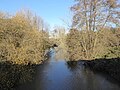 A swollen River Lugg - geograph.org.uk - 5208475.jpg 800 × 600; 170 KB
-
 A wet field corner - geograph.org.uk - 3275907.jpg 640 × 480; 267 KB
-
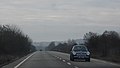 A49, Leominster Bypass - geograph.org.uk - 2284833.jpg 640 × 365; 23 KB
-
 Across the stubble - geograph.org.uk - 866090.jpg 640 × 480; 86 KB
-
 Apple orchard - geograph.org.uk - 4496330.jpg 1,024 × 680; 387 KB
-
 Arable field at Humber - geograph.org.uk - 5209242.jpg 1,024 × 576; 178 KB
-
 Arable land near Risbury - geograph.org.uk - 4498705.jpg 800 × 531; 155 KB
-
 Barn at Witsets Farm - geograph.org.uk - 5395097.jpg 640 × 461; 52 KB
-
 Bridleway to Briarymere - geograph.org.uk - 4289445.jpg 800 × 451; 177 KB
-
 Bridleway to Risbury - geograph.org.uk - 4498690.jpg 800 × 531; 155 KB
-
 Brierymere - geograph.org.uk - 5006815.jpg 640 × 360; 111 KB
-
 Ceiling at St. John of Jerusalem's Church (Chancel ^ Ford) - geograph.org.uk - 5955382.jpg 3,648 × 2,736; 1.47 MB
-
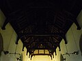 Ceiling at St. Luke's Church (Nave ^ Stoke Prior) - geograph.org.uk - 5955727.jpg 3,648 × 2,736; 1.86 MB
-
 Chopper over the fields - geograph.org.uk - 997166.jpg 640 × 480; 49 KB
-
 Churchyard at St. Luke's Church (Stoke Prior) - geograph.org.uk - 5955493.jpg 3,648 × 2,736; 4.3 MB
-
 Clock on St. Luke's Church (Bell Tower ^ Stoke Prior) - geograph.org.uk - 5955478.jpg 2,048 × 1,360; 996 KB
-
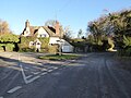
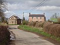
 Cottage and lane - geograph.org.uk - 4301928.jpg 800 × 451; 189 KB
-
 Cottage by Risbury Bridge - geograph.org.uk - 4289404.jpg 800 × 451; 186 KB
-
 Cottage in Stoke Prior - geograph.org.uk - 5207889.jpg 800 × 600; 145 KB
-
 Cow parsley and oil seed rape - geograph.org.uk - 4498696.jpg 800 × 531; 195 KB
-
 Derelict Machinery by Grove Golf ^ Bowl (Ford) - geograph.org.uk - 5955431.jpg 3,648 × 2,736; 5.02 MB
-
 Derelict site at Ford Bridge - geograph.org.uk - 1023362.jpg 640 × 480; 98 KB
-
 Disused Railway Bridge (Stoke Prior) - geograph.org.uk - 5955461.jpg 3,648 × 2,736; 4.77 MB
-
 Diverging lane and bridleway - geograph.org.uk - 4289431.jpg 800 × 451; 184 KB
-
 End of the road - Wickton Court - geograph.org.uk - 997150.jpg 640 × 480; 96 KB
-
 Farmland at Hollywall, near Risbury - geograph.org.uk - 5614537.jpg 1,024 × 680; 293 KB
-
 Farmland at Risbury - geograph.org.uk - 5614532.jpg 1,024 × 680; 326 KB
-
 Farmland near Steen's Bridge - geograph.org.uk - 5208574.jpg 1,024 × 768; 297 KB
-
 Farmland near Summerhill - geograph.org.uk - 5208582.jpg 800 × 600; 178 KB
-
 Fenced in path - geograph.org.uk - 5006830.jpg 640 × 360; 136 KB
-
 Field access, Wickton - geograph.org.uk - 5006827.jpg 640 × 360; 133 KB
-
 Field at Stoke Prior - geograph.org.uk - 5207874.jpg 800 × 600; 149 KB
-
 Ford Abbey junction, A4103 - geograph.org.uk - 955344.jpg 640 × 480; 76 KB
-
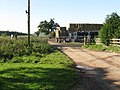
 Ford Farm (Ford) - geograph.org.uk - 5954800.jpg 3,648 × 2,736; 4.67 MB
-
 Ford Farm (Ford) - geograph.org.uk - 5955434.jpg 3,648 × 2,736; 4.67 MB
-
 Ford Farm ^ The River Lugg (Ford) - geograph.org.uk - 5955408.jpg 3,648 × 2,736; 4.15 MB
-
 Geese on the Humber Brook, Risbury - geograph.org.uk - 280995.jpg 640 × 427; 314 KB
-
 Green lane to Briarymere - geograph.org.uk - 4289410.jpg 800 × 451; 205 KB
-
 Grove Golf and Bowl - geograph.org.uk - 1988844.jpg 4,000 × 3,000; 2.4 MB
-
 Grove Golf ^ Bowl (Ford) - geograph.org.uk - 5955424.jpg 3,648 × 2,736; 3.9 MB
-
 Grove Golf ^ Bowl (Ford) - geograph.org.uk - 5955427.jpg 3,648 × 2,736; 4.48 MB
-
 Harvested field, Humber - geograph.org.uk - 6003387.jpg 1,024 × 683; 419 KB
-
 Herefordshire farmland - geograph.org.uk - 5208578.jpg 800 × 600; 153 KB
-
 Hillside above the Humber Brook - geograph.org.uk - 5006842.jpg 640 × 427; 171 KB
-
 Hollywall Croft - geograph.org.uk - 281233.jpg 640 × 427; 334 KB
-
 Hollywall Croft - geograph.org.uk - 5614543.jpg 1,024 × 680; 348 KB
-
 Hollywall Farm - geograph.org.uk - 281023.jpg 640 × 427; 317 KB
-
-
 Humber Lane - geograph.org.uk - 997142.jpg 480 × 640; 94 KB
-
 Humber Marsh - geograph.org.uk - 914395.jpg 640 × 480; 96 KB
-
 Humber Marsh - geograph.org.uk - 914396.jpg 640 × 480; 114 KB
-
 Humber Marsh - geograph.org.uk - 914397.jpg 640 × 480; 107 KB
-
 Lane To The Witsetts - geograph.org.uk - 1235164.jpg 640 × 480; 160 KB
-
 Lane to Wickton - geograph.org.uk - 4301924.jpg 800 × 451; 201 KB
-
 Leominster Golf Course - geograph.org.uk - 3001894.jpg 2,592 × 1,944; 1.76 MB
-
 Lugg Valley Pastures - geograph.org.uk - 1023359.jpg 640 × 480; 67 KB
-
 Maize field near The Leasowe - geograph.org.uk - 955359.jpg 640 × 480; 76 KB
-
 Mature orchard at Stoke Prior - geograph.org.uk - 5207871.jpg 800 × 600; 195 KB
-
-
 Memorial obelisk, Stoke Prior churchyard - geograph.org.uk - 5209235.jpg 576 × 1,024; 242 KB
-

-

-

-
 Memorials inside St. Luke's Church (Nave ^ Stoke Prior) - geograph.org.uk - 5955519.jpg 3,648 × 2,736; 2.72 MB
-
 Mud - geograph.org.uk - 3275902.jpg 640 × 480; 308 KB
-
 Naked polytunnels off Wickton Court Lane - geograph.org.uk - 997145.jpg 640 × 480; 125 KB
-
 New Housing Development (Stoke Prior) - geograph.org.uk - 5955813.jpg 2,048 × 1,536; 1.64 MB
-
 New Housing Development (Stoke Prior) - geograph.org.uk - 5955814.jpg 2,048 × 1,536; 1.46 MB
-
 Old orchard land near Stoke Prior - geograph.org.uk - 4301929.jpg 800 × 451; 172 KB
-
 Old railway bridge - geograph.org.uk - 5208517.jpg 800 × 600; 195 KB
-
 Orchard, Risbury - geograph.org.uk - 5006835.jpg 640 × 360; 176 KB
-
 Orchard, Risbury - geograph.org.uk - 5006841.jpg 640 × 360; 149 KB
-
 Ordnance Survey Cut Mark - geograph.org.uk - 5312208.jpg 640 × 388; 75 KB
-
 Pasture beside the Lugg - geograph.org.uk - 2012532.jpg 640 × 480; 134 KB
-
 Pasture land east of Stoke Prior - geograph.org.uk - 4301927.jpg 800 × 451; 184 KB
-
 Path to St. John of Jerusalem's Church (Ford) - geograph.org.uk - 5955416.jpg 3,648 × 2,736; 4.8 MB
-
 River Lugg - geograph.org.uk - 2012539.jpg 640 × 480; 104 KB
-
 River Lugg - geograph.org.uk - 641539.jpg 640 × 480; 58 KB
-
 River Lugg at Ford Bridge, 1 - geograph.org.uk - 4301948.jpg 800 × 602; 235 KB
-
 Road approaching Humber Bridge - geograph.org.uk - 4497870.jpg 1,024 × 680; 332 KB
-
 Road from Wickton - geograph.org.uk - 5006816.jpg 640 × 360; 150 KB
-
 Road from Wickton - geograph.org.uk - 5006831.jpg 640 × 360; 112 KB
-
 Road junction in Stoke Prior - geograph.org.uk - 5207881.jpg 800 × 600; 117 KB
-
 Road passing Leominster Golf Club - geograph.org.uk - 5208463.jpg 1,024 × 768; 298 KB
-
 Road to Humber - geograph.org.uk - 4497874.jpg 531 × 800; 138 KB
-
 Road to Lower Wickton - geograph.org.uk - 4498698.jpg 531 × 800; 144 KB
-
 Road to Stoke Prior from Ford Bridge - geograph.org.uk - 525036.jpg 640 × 440; 356 KB
-

-
 Row of birches - geograph.org.uk - 4301940.jpg 800 × 451; 191 KB
-
 Rural junction - geograph.org.uk - 955365.jpg 640 × 480; 58 KB
-
 Sheep by St. John of Jerusalem's Church (Ford) - geograph.org.uk - 5955009.jpg 3,648 × 2,736; 4.69 MB
-
 Sheep grazing on Lugg meadows - geograph.org.uk - 5208539.jpg 1,024 × 768; 337 KB
-
 Sign at St. John of Jerusalem's Church (Ford) - geograph.org.uk - 5955414.jpg 3,648 × 2,736; 4.71 MB
-
 Sign at St. Luke's Church (Stoke Prior) - geograph.org.uk - 5955472.jpg 3,648 × 2,736; 4.38 MB
-
 Sign inside St. Luke's Church (Nave ^ Stoke Prior) - geograph.org.uk - 5955517.jpg 3,648 × 2,736; 2.71 MB
-
 St. John of Jerusalem's Church (Chancel ^ Ford) - geograph.org.uk - 5955395.jpg 3,648 × 2,736; 2.07 MB
-
 St. John of Jerusalem's Church (Font ^ Ford) - geograph.org.uk - 5955043.jpg 3,648 × 2,736; 1.94 MB
-
 St. John of Jerusalem's Church (Ford) - geograph.org.uk - 5954998.jpg 3,648 × 2,736; 4.44 MB
-
 St. John of Jerusalem's Church (Ford) - geograph.org.uk - 5955023.jpg 1,920 × 1,080; 562 KB
-
 St. John of Jerusalem's Church (Ford) - geograph.org.uk - 5955412.jpg 3,648 × 2,736; 4.41 MB
-
 St. John of Jerusalem's Church (Ford) - geograph.org.uk - 5955418.jpg 3,648 × 2,736; 4.63 MB
-
 St. John of Jerusalem's Church (Ford) - geograph.org.uk - 5955440.jpg 3,648 × 2,736; 4.69 MB
-
 St. John of Jerusalem's Church (Ford) - geograph.org.uk - 5955447.jpg 3,648 × 2,736; 4.84 MB
-
 St. John of Jerusalem's Church (Nave ^ Ford) - geograph.org.uk - 5955369.jpg 3,648 × 2,736; 2.03 MB
-
 St. John of Jerusalem's Church (Pulpit ^ Ford) - geograph.org.uk - 5955098.jpg 3,648 × 2,736; 1.9 MB
-
 St. John of Jerusalem's Church (War Memorial ^ Ford) - geograph.org.uk - 5955080.jpg 3,648 × 2,736; 2.59 MB
-
 St. John of Jerusalem's Church (War Memorial ^ Ford) - geograph.org.uk - 5955387.jpg 3,648 × 2,736; 2.31 MB
-
 St. Luke's Church (Bell Tower ^ Stoke Prior) - geograph.org.uk - 5955499.jpg 3,648 × 2,736; 3.57 MB
-
 St. Luke's Church (Bell Tower ^ Stoke Prior) - geograph.org.uk - 5955735.jpg 3,648 × 2,736; 3.02 MB
-
 St. Luke's Church (Bell Tower ^ Stoke Prior) - geograph.org.uk - 5955751.jpg 3,648 × 2,736; 4.16 MB
-
 St. Luke's Church (Bell Tower ^ Stoke Prior) - geograph.org.uk - 5955755.jpg 3,648 × 2,736; 3.26 MB
-
 St. Luke's Church (Chancel ^ Stoke Prior) - geograph.org.uk - 5955591.jpg 3,648 × 2,736; 2.26 MB
-
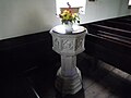
 St. Luke's Church (Font ^ Stoke Prior) - geograph.org.uk - 5955584.jpg 3,648 × 2,736; 3.28 MB
-
 St. Luke's Church (Lectern ^ Stoke Prior) - geograph.org.uk - 5955710.jpg 3,648 × 2,736; 2.86 MB
-
 St. Luke's Church (Nave ^ Stoke Prior) - geograph.org.uk - 5955717.jpg 3,648 × 2,736; 2.97 MB
-
 St. Luke's Church (Organ ^ Stoke Prior) - geograph.org.uk - 5955525.jpg 3,648 × 2,736; 2.36 MB
-
 St. Luke's Church (Pulpit ^ Stoke Prior) - geograph.org.uk - 5955641.jpg 3,648 × 2,736; 2.57 MB
-
 St. Luke's Church (Stoke Prior) - geograph.org.uk - 5955487.jpg 3,648 × 2,736; 4.72 MB
-
 St. Luke's Church (Stoke Prior) - geograph.org.uk - 5955489.jpg 3,648 × 2,736; 3.92 MB
-
 St. Luke's Church (Stoke Prior) - geograph.org.uk - 5955490.jpg 2,736 × 3,648; 3.63 MB
-
 St. Luke's Church (Stoke Prior) - geograph.org.uk - 5955505.jpg 1,920 × 1,080; 720 KB
-
 St. Luke's Church (Stoke Prior) - geograph.org.uk - 5955752.jpg 3,648 × 2,736; 4.37 MB
-
 St. Luke's Church (Stoke Prior) - geograph.org.uk - 5955757.jpg 3,648 × 2,736; 4.57 MB
-
 St. Luke's Church (Stoke Prior) - geograph.org.uk - 5955760.jpg 3,648 × 2,736; 4.37 MB
-
 Steen's Bridge telephone exchange - geograph.org.uk - 6158744.jpg 1,920 × 1,280; 984 KB
-
 Stoke Prior church - geograph.org.uk - 5207890.jpg 800 × 600; 130 KB
-
 Stoke Prior church - geograph.org.uk - 5209218.jpg 600 × 800; 108 KB
-
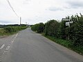
 Stoke Prior road - geograph.org.uk - 4301495.jpg 800 × 451; 177 KB
-
 Stoke Prior road - geograph.org.uk - 4301499.jpg 800 × 451; 171 KB
-
 Stone farm - geograph.org.uk - 4301937.jpg 800 × 450; 212 KB
-
 The A44 near Steen's Bridge - geograph.org.uk - 6168890.jpg 1,839 × 1,225; 1.27 MB
-
-
 The Drum crossroads, A4103 - geograph.org.uk - 955334.jpg 640 × 480; 74 KB
-
 The east window, Stoke Prior church - geograph.org.uk - 5209222.jpg 600 × 800; 161 KB
-
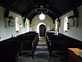
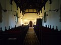
 The interior of Stoke Prior church - geograph.org.uk - 5209219.jpg 600 × 800; 96 KB
-
-
 The Lugg at Ford Bridge - geograph.org.uk - 3888937.jpg 3,456 × 2,592; 2.93 MB
-
 The pulpit in Stoke Prior church - geograph.org.uk - 5209224.jpg 600 × 800; 69 KB
-
 The River Lugg (Ford) - geograph.org.uk - 5955006.jpg 3,648 × 2,736; 4.81 MB
-
 The route of a former Roman Road - geograph.org.uk - 5208548.jpg 800 × 600; 92 KB
-
 The tower of Stoke Prior church - geograph.org.uk - 5209215.jpg 600 × 800; 145 KB
-
 The Village of Stoke Prior - geograph.org.uk - 5955764.jpg 3,648 × 2,736; 4.21 MB
-
 Tight bend on the A44 - geograph.org.uk - 2670961.jpg 640 × 480; 44 KB
-
 Victorian House (Stoke Prior) - geograph.org.uk - 5955809.jpg 2,048 × 1,536; 1.62 MB
-
 View to flood Lugg meadows - geograph.org.uk - 5207867.jpg 1,024 × 768; 251 KB
-
 View to Humber church - geograph.org.uk - 4497882.jpg 800 × 531; 142 KB
-
 Wickton Court Lane - geograph.org.uk - 997147.jpg 640 × 480; 81 KB
-
 Wickton Lane - geograph.org.uk - 4301926.jpg 800 × 451; 202 KB
-

-
-
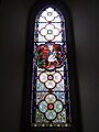
 Window inside St. Luke's Church (Chancel ^ Stoke Prior) - geograph.org.uk - 5955606.jpg 2,048 × 2,730; 2.82 MB
-
 Window inside St. Luke's Church (Chancel ^ Stoke Prior) - geograph.org.uk - 5955677.jpg 2,736 × 3,648; 4.37 MB
-
 Window inside St. Luke's Church (Chancel ^ Stoke Prior) - geograph.org.uk - 5955682.jpg 2,048 × 4,096; 3.52 MB
-
 Window inside St. Luke's Church (Chancel ^ Stoke Prior) - geograph.org.uk - 5955698.jpg 2,736 × 3,648; 3.29 MB
-
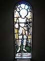
 Window inside St. Luke's Church (Nave ^ Stoke Prior) - geograph.org.uk - 5955602.jpg 1,280 × 1,920; 1.41 MB
-
 Witsets Farm - geograph.org.uk - 5395093.jpg 640 × 473; 48 KB
-
 Young cereal crop at Wickton - geograph.org.uk - 4301923.jpg 800 × 451; 185 KB
-
 Fairmile Coppice - geograph.org.uk - 188256.jpg 640 × 479; 79 KB
-
 Hill Top Farm - geograph.org.uk - 146702.jpg 640 × 480; 82 KB
-
 Holly on Bridleway - geograph.org.uk - 281051.jpg 640 × 427; 353 KB
-
 Misunderstanding All You See - geograph.org.uk - 280735.jpg 640 × 377; 268 KB
-
 Moss Covered Stumps - geograph.org.uk - 281276.jpg 427 × 640; 378 KB
-
 New Crop - geograph.org.uk - 281044.jpg 640 × 427; 309 KB
-
 Old Mill Pond^ at Cobb's Castle - geograph.org.uk - 281037.jpg 640 × 427; 222 KB
-
 Standing Stubble near Wickton Court - geograph.org.uk - 202497.jpg 640 × 480; 55 KB
-
 Stoke Prior - Old Railway Bridge - geograph.org.uk - 168213.jpg 640 × 480; 144 KB
-
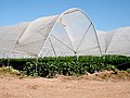 Strawberries under Polytunnels - geograph.org.uk - 202479.jpg 640 × 480; 65 KB
-
 Track,The Witsetts. - geograph.org.uk - 146687.jpg 640 × 480; 161 KB
-
 Twin Trees - geograph.org.uk - 147147.jpg 640 × 480; 98 KB
-
 Witsets - geograph.org.uk - 146695.jpg 640 × 480; 76 KB


_-_geograph.org.uk_-_5955382.jpg)
_-_geograph.org.uk_-_5955727.jpg)

_-_geograph.org.uk_-_5955493.jpg)
_-_geograph.org.uk_-_5955478.jpg)


_-_geograph.org.uk_-_5955431.jpg)

_-_geograph.org.uk_-_5955461.jpg)


_-_geograph.org.uk_-_5954800.jpg)
_-_geograph.org.uk_-_5955434.jpg)
_-_geograph.org.uk_-_5955408.jpg)


_-_geograph.org.uk_-_5955424.jpg)
_-_geograph.org.uk_-_5955427.jpg)


_-_geograph.org.uk_-_5955177.jpg)

_-_geograph.org.uk_-_5955743.jpg)
_-_geograph.org.uk_-_5955731.jpg)
_-_geograph.org.uk_-_5955732.jpg)
_-_geograph.org.uk_-_5955519.jpg)


_-_geograph.org.uk_-_5955813.jpg)
_-_geograph.org.uk_-_5955814.jpg)


_-_geograph.org.uk_-_5955416.jpg)


_-_geograph.org.uk_-_5955009.jpg)

_-_geograph.org.uk_-_5955414.jpg)
_-_geograph.org.uk_-_5955472.jpg)
_-_geograph.org.uk_-_5955517.jpg)
_-_geograph.org.uk_-_5955395.jpg)
_-_geograph.org.uk_-_5955043.jpg)
_-_geograph.org.uk_-_5954998.jpg)
_-_geograph.org.uk_-_5955023.jpg)
_-_geograph.org.uk_-_5955412.jpg)
_-_geograph.org.uk_-_5955418.jpg)
_-_geograph.org.uk_-_5955440.jpg)
_-_geograph.org.uk_-_5955447.jpg)
_-_geograph.org.uk_-_5955369.jpg)
_-_geograph.org.uk_-_5955098.jpg)
_-_geograph.org.uk_-_5955080.jpg)
_-_geograph.org.uk_-_5955387.jpg)
_-_geograph.org.uk_-_5955499.jpg)
_-_geograph.org.uk_-_5955735.jpg)
_-_geograph.org.uk_-_5955751.jpg)
_-_geograph.org.uk_-_5955755.jpg)
_-_geograph.org.uk_-_5955591.jpg)
_-_geograph.org.uk_-_5955584.jpg)
_-_geograph.org.uk_-_5955710.jpg)
_-_geograph.org.uk_-_5955717.jpg)
_-_geograph.org.uk_-_5955525.jpg)
_-_geograph.org.uk_-_5955641.jpg)
_-_geograph.org.uk_-_5955487.jpg)
_-_geograph.org.uk_-_5955489.jpg)
_-_geograph.org.uk_-_5955490.jpg)
_-_geograph.org.uk_-_5955505.jpg)
_-_geograph.org.uk_-_5955752.jpg)
_-_geograph.org.uk_-_5955757.jpg)
_-_geograph.org.uk_-_5955760.jpg)


_-_geograph.org.uk_-_5955006.jpg)


_-_geograph.org.uk_-_5955809.jpg)


_-_geograph.org.uk_-_5955375.jpg)
_-_geograph.org.uk_-_5955378.jpg)
_-_geograph.org.uk_-_5955606.jpg)
_-_geograph.org.uk_-_5955677.jpg)
_-_geograph.org.uk_-_5955682.jpg)
_-_geograph.org.uk_-_5955698.jpg)
_-_geograph.org.uk_-_5955602.jpg)


