Category:Ford, West Sussex
Jump to navigation
Jump to search
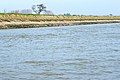
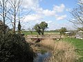
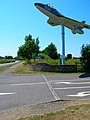
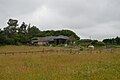
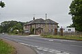
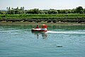
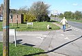
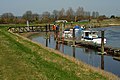
English: Ford is a village and civil parish in the Arun District of West Sussex, England. It is located 3 km (two miles) to the south-west of Arundel. The civil parish, roughly triangular in shape, covers an area of and has a population of 1358 according to the 2001 census.
village and civil parish in West Sussex, UK  | |||||
| Upload media | |||||
| Instance of | |||||
|---|---|---|---|---|---|
| Location | Arun, West Sussex, South East England, England | ||||
| Area |
| ||||
| Said to be the same as | Ford (Wikimedia duplicated page, civil parish) | ||||
 | |||||
Subcategories
This category has the following 5 subcategories, out of 5 total.
F
- Ford railway bridge (14 F)
Media in category "Ford, West Sussex"
The following 200 files are in this category, out of 320 total.
(previous page) (next page)-
 'Sarah Louise' on the River Arun - geograph.org.uk - 5698213.jpg 640 × 428; 101 KB
-
 'Sarah Louise' on the River Arun - geograph.org.uk - 5698219.jpg 640 × 428; 103 KB
-

-
 A line of openwater swimmers - geograph.org.uk - 5619172.jpg 640 × 426; 69 KB
-

-
 Access to Mill Studio - geograph.org.uk - 5614188.jpg 640 × 426; 77 KB
-
 Altar ^ East window - geograph.org.uk - 5614415.jpg 640 × 425; 42 KB
-
 Arriving at Ford, Sussex - geograph.org.uk - 2873152.jpg 3,627 × 2,351; 7.73 MB
-
 Arun journey - geograph.org.uk - 803013.jpg 637 × 425; 56 KB
-
 Arun journey - geograph.org.uk - 803015.jpg 637 × 425; 66 KB
-
 Arun journey - geograph.org.uk - 803023.jpg 637 × 425; 65 KB
-
 Arun railway bridge, Ford - geograph.org.uk - 5695476.jpg 640 × 428; 80 KB
-
 Autumn approaching Ford Prison - geograph.org.uk - 1561280.jpg 640 × 480; 99 KB
-
 Autumn leaves at HM Prison Ford - geograph.org.uk - 1561245.jpg 640 × 480; 128 KB
-
 Barrier by Ford Rd - geograph.org.uk - 5614175.jpg 640 × 346; 42 KB
-

-
 Binsted Brook - geograph.org.uk - 2127527.jpg 480 × 640; 67 KB
-
 Binsted Brook - geograph.org.uk - 2128961.jpg 480 × 640; 112 KB
-
 Boat yard by the Ship and Anchor at Ford - geograph.org.uk - 3378938.jpg 4,320 × 3,240; 4.79 MB
-
-

-
 Car park at St Andrew's, Ford - geograph.org.uk - 1242848.jpg 640 × 463; 77 KB
-
 Chapel, HMP Ford - geograph.org.uk - 5608062.jpg 640 × 426; 41 KB
-
 Church Farm, Ford - geograph.org.uk - 1242852.jpg 640 × 480; 76 KB
-
 Church Lane - geograph.org.uk - 5608071.jpg 640 × 426; 73 KB
-
 Church Lane - geograph.org.uk - 5608078.jpg 640 × 426; 99 KB
-
 Church Lane - geograph.org.uk - 5608079.jpg 640 × 426; 69 KB
-
 Church of St Andrew - geograph.org.uk - 5614405.jpg 640 × 426; 67 KB
-
 Church of St Andrew - geograph.org.uk - 5614407.jpg 426 × 640; 60 KB
-
 Church of St Andrew - geograph.org.uk - 5614421.jpg 426 × 640; 58 KB
-
 Church of St Andrew - geograph.org.uk - 5614423.jpg 426 × 640; 47 KB
-
 Church of St Andrew - geograph.org.uk - 5619158.jpg 640 × 426; 73 KB
-
 Church of St Andrew Ford - geograph.org.uk - 3375904.jpg 4,320 × 3,240; 4.71 MB
-
 Close up shot of Brook Barn Farm - geograph.org.uk - 3378148.jpg 4,320 × 3,240; 4.74 MB
-
 Converted barn - geograph.org.uk - 5614197.jpg 640 × 426; 74 KB
-
 Cottages by footpath close to Ford Lane - geograph.org.uk - 3960474.jpg 800 × 600; 158 KB
-

-
 Cow Park Meadow - geograph.org.uk - 2127572.jpg 640 × 480; 81 KB
-
 C^S, Ford - geograph.org.uk - 5614199.jpg 640 × 426; 72 KB
-
 Dead buzzard on the line at Ford - geograph.org.uk - 2936321.jpg 1,200 × 1,600; 417 KB
-
 Decoy Wood in winter - geograph.org.uk - 4760806.jpg 640 × 342; 29 KB
-
 Derelict mobile crane at the rear of the Ship and Anchor - geograph.org.uk - 3378186.jpg 4,320 × 3,240; 4.96 MB
-
 Drainage ditch - geograph.org.uk - 3377109.jpg 4,320 × 3,240; 4.58 MB
-
 Drainage Ditch near Ford - geograph.org.uk - 733817.jpg 640 × 479; 119 KB
-
 Drainage Ditch, River Arun, Sussex - geograph.org.uk - 2876765.jpg 3,581 × 2,383; 7.56 MB
-
 Dull day on the river Arun - geograph.org.uk - 3193008.jpg 2,256 × 1,496; 808 KB
-
 East along the South Coast line to Ford Station - geograph.org.uk - 3377100.jpg 4,320 × 3,240; 4.97 MB
-
 East window, Church of St Andrew - geograph.org.uk - 5614412.jpg 640 × 426; 32 KB
-
 Eastern end of Ford Lane - geograph.org.uk - 1242911.jpg 640 × 480; 71 KB
-
 Entrance to Ford Airfield - geograph.org.uk - 194956.jpg 479 × 640; 136 KB
-
 Entrance to the Victorian Business Centre off Ford Lane - geograph.org.uk - 3375909.jpg 4,320 × 3,240; 5.14 MB
-

-
 Falconers Meadow - geograph.org.uk - 2127579.jpg 640 × 480; 90 KB
-
 Farm at Ford - geograph.org.uk - 5619163.jpg 640 × 426; 56 KB
-
 Farmland east of Ford Station - geograph.org.uk - 2604747.jpg 640 × 430; 67 KB
-
 Farmland near Ford - geograph.org.uk - 5614434.jpg 640 × 426; 70 KB
-
 Field east of Ford Road - geograph.org.uk - 1559837.jpg 640 × 480; 72 KB
-
 Five Acre Brook (1) - geograph.org.uk - 2126593.jpg 640 × 480; 78 KB
-
 Five Acre Brook (2) - geograph.org.uk - 2126699.jpg 640 × 480; 70 KB
-
 Flat land by Ford Rd - geograph.org.uk - 5614179.jpg 640 × 426; 47 KB
-
 Floodplain of the River Arun - geograph.org.uk - 5614424.jpg 640 × 425; 66 KB
-
 Floodplain of the River Arun - geograph.org.uk - 5614432.jpg 640 × 426; 65 KB
-
 Floodplain, River Arun - geograph.org.uk - 5619154.jpg 640 × 426; 61 KB
-
 Floodplain, River Arun - geograph.org.uk - 5619178.jpg 640 × 426; 49 KB
-
 Font, Church of St Andrew - geograph.org.uk - 5614410.jpg 640 × 426; 53 KB
-
 Footbridge north of Wicks Farm - geograph.org.uk - 5542784.jpg 640 × 428; 191 KB
-
 Footbridge over drainage channel - geograph.org.uk - 3959565.jpg 800 × 600; 250 KB
-

-
 Footpath 175 on former taxiway - geograph.org.uk - 1900305.jpg 2,048 × 1,536; 639 KB
-
 Footpath along the River Arun - geograph.org.uk - 5619167.jpg 640 × 426; 64 KB
-
 Footpath along the River Arun - geograph.org.uk - 5619184.jpg 640 × 426; 47 KB
-
 Footpath along the River Arun - geograph.org.uk - 5619207.jpg 640 × 426; 62 KB
-
 Footpath approaches Long Barn - geograph.org.uk - 3959559.jpg 800 × 600; 145 KB
-

-
 Footpath on bank of River Arun (4) - geograph.org.uk - 1988245.jpg 2,048 × 1,536; 663 KB
-
 Footpath to Ford - geograph.org.uk - 1906817.jpg 2,048 × 1,536; 706 KB
-
 Footpath to Goose Green - geograph.org.uk - 5542809.jpg 640 × 428; 152 KB
-
 Footpath to Wicks Farm - geograph.org.uk - 1906852.jpg 2,048 × 1,536; 707 KB
-
 Footpath to Yapton from junction - geograph.org.uk - 3960478.jpg 800 × 600; 210 KB
-
 Ford Airfield Industrial Estate - geograph.org.uk - 2779726.jpg 640 × 428; 83 KB
-
 Ford Barn Conversion - geograph.org.uk - 32965.jpg 640 × 480; 75 KB
-
 Ford Brook - geograph.org.uk - 2126727.jpg 640 × 480; 95 KB
-
 Ford Canal Basin - geograph.org.uk - 733765.jpg 479 × 640; 75 KB
-
 Ford church - geograph.org.uk - 5696112.jpg 640 × 428; 122 KB
-
 Ford Church, Sussex - geograph.org.uk - 3252983.jpg 4,000 × 2,653; 7.3 MB
-
 Ford Church, Sussex - geograph.org.uk - 3252985.jpg 4,000 × 2,666; 7.07 MB
-
 Ford Church, Sussex - geograph.org.uk - 3252986.jpg 4,000 × 2,666; 6.59 MB
-
 Ford Church, Sussex - geograph.org.uk - 3252987.jpg 4,000 × 2,514; 6.45 MB
-
 Ford Church, Sussex - geograph.org.uk - 3252991.jpg 4,000 × 2,666; 5.72 MB
-
 Ford Crossing - geograph.org.uk - 32968.jpg 640 × 480; 71 KB
-
 Ford Lane - geograph.org.uk - 1243263.jpg 640 × 480; 100 KB
-
 Ford Lane - geograph.org.uk - 2127587.jpg 640 × 468; 106 KB
-
 Ford Lane - geograph.org.uk - 5614194.jpg 640 × 426; 82 KB
-
 Ford Lane - geograph.org.uk - 5614392.jpg 640 × 426; 72 KB
-
 Ford Lane Business Park - geograph.org.uk - 2127600.jpg 640 × 480; 81 KB
-
 Ford Lane Business Park - geograph.org.uk - 2127609.jpg 640 × 480; 63 KB
-
 Ford Lane Business Park - geograph.org.uk - 3375914.jpg 4,320 × 3,240; 4.77 MB
-
 Ford Lane Industrial Estate - geograph.org.uk - 3100342.jpg 3,264 × 2,448; 4.35 MB
-
 Ford Lock One - geograph.org.uk - 1295976.jpg 640 × 424; 133 KB
-
 Ford Marina entrance off Ford Road - geograph.org.uk - 3100333.jpg 3,264 × 2,448; 4.78 MB
-
 Ford Marina on the River Arun - geograph.org.uk - 3740140.jpg 3,072 × 2,048; 956 KB
-
 Ford Prison Farm - geograph.org.uk - 5608075.jpg 640 × 426; 77 KB
-
 Ford Prison Farm - geograph.org.uk - 5608076.jpg 640 × 426; 71 KB
-
 Ford Prison Shop - geograph.org.uk - 5608072.jpg 640 × 426; 75 KB
-
 Ford Prison.jpg 720 × 539; 59 KB
-
 Ford Quay - geograph.org.uk - 2126743.jpg 640 × 478; 114 KB
-
 Ford Rail Bridge - geograph.org.uk - 1296191.jpg 640 × 424; 95 KB
-
 Ford railway station, Sussex - geograph.org.uk - 3760967.jpg 1,024 × 768; 225 KB
-
 Ford railway station, Sussex - geograph.org.uk - 4263047.jpg 1,024 × 768; 169 KB
-
 Ford station underpass - geograph.org.uk - 6195964.jpg 1,024 × 769; 334 KB
-
 Ford, UK - panoramio.jpg 855 × 1,196; 275 KB
-

-
 Gate to Newhouse Farm - geograph.org.uk - 5614201.jpg 640 × 426; 90 KB
-
 Gaugemaster Way - geograph.org.uk - 1559721.jpg 640 × 480; 44 KB
-
 Gaugemaster Way by Ford Station - geograph.org.uk - 3100313.jpg 3,264 × 2,448; 3.22 MB
-
 GR Postbox - geograph.org.uk - 5614202.jpg 426 × 640; 117 KB
-
 Graves, Church of St Andrew - geograph.org.uk - 5614400.jpg 640 × 426; 107 KB
-
 Graves, Church of St Andrew - geograph.org.uk - 5614419.jpg 640 × 426; 105 KB
-
 Graveyard at the Church of St Andrew Ford - geograph.org.uk - 3378955.jpg 4,320 × 3,240; 5.13 MB
-
 HMP Ford - geograph.org.uk - 5608051.jpg 640 × 425; 68 KB
-
 HMP Ford - geograph.org.uk - 5608064.jpg 640 × 426; 48 KB
-
 HMP Ford - geograph.org.uk - 5608066.jpg 640 × 426; 58 KB
-
 HMP Ford - geograph.org.uk - 5608067.jpg 640 × 426; 50 KB
-
 HMP Ford - geograph.org.uk - 5608068.jpg 640 × 426; 68 KB
-
 HMP Ford - geograph.org.uk - 5608070.jpg 640 × 426; 48 KB
-
 HMP Ford - geograph.org.uk - 5608122.jpg 640 × 426; 91 KB
-
 House at the parish boundary - geograph.org.uk - 2779711.jpg 640 × 428; 85 KB
-
 House near Ford Church - geograph.org.uk - 5614395.jpg 640 × 426; 52 KB
-
 House near Ford Church - geograph.org.uk - 5614435.jpg 640 × 426; 49 KB
-
 Houseboats, Ford - geograph.org.uk - 5696104.jpg 640 × 428; 136 KB
-
 Houses on Station Rd - geograph.org.uk - 5614393.jpg 640 × 426; 53 KB
-
 Hovercraft on the River Arun - geograph.org.uk - 5698377.jpg 640 × 428; 119 KB
-
 Imperium House, Ford Lane - geograph.org.uk - 2127631.jpg 640 × 480; 71 KB
-
 Industrial units on the former Ford Airfield - geograph.org.uk - 3101679.jpg 3,264 × 2,448; 3.49 MB
-
 Inlet off the River Arun - geograph.org.uk - 3378951.jpg 4,320 × 3,240; 4.71 MB
-

-
 Junction of Ford Road and Hunterford - geograph.org.uk - 1561217.jpg 640 × 480; 81 KB
-

-
-

-
 Land drainage sluice, River Arun - geograph.org.uk - 5698393.jpg 640 × 428; 130 KB
-
 Large barn in large field - geograph.org.uk - 4392878.jpg 800 × 533; 87 KB
-
 Level Crossing at Ford - geograph.org.uk - 1907541.jpg 640 × 480; 88 KB
-
 Level crossing at Ford station - geograph.org.uk - 1907499.jpg 640 × 480; 85 KB
-
 Level crossing at Ford station - geograph.org.uk - 1907504.jpg 640 × 480; 67 KB
-
 Level Crossing at Ford, Sussex - geograph.org.uk - 2873144.jpg 3,306 × 2,200; 7.65 MB
-
 Level Crossing on Ford Road - geograph.org.uk - 3521549.jpg 640 × 422; 48 KB
-
 Littlehampton train beyond the Arun - geograph.org.uk - 5698059.jpg 640 × 428; 88 KB
-
 Lock Cottage - geograph.org.uk - 2127548.jpg 640 × 480; 75 KB
-
 Lock Cottage, Ford - geograph.org.uk - 5698042.jpg 640 × 428; 114 KB
-
 Locks Cottage, Ford - geograph.org.uk - 733735.jpg 640 × 479; 124 KB
-

-

-

-

-
 Looking east along railway from footpath - geograph.org.uk - 3959560.jpg 600 × 800; 135 KB
-

-

-

-
 Looking into Ford Lane from the east - geograph.org.uk - 4392665.jpg 800 × 533; 120 KB
-
 Looking north on Ford Road - geograph.org.uk - 4392842.jpg 800 × 533; 109 KB
-
 Looking north on Station Road - geograph.org.uk - 4392648.jpg 800 × 533; 139 KB
-

-
 Looking south on Ford Road - geograph.org.uk - 4392771.jpg 800 × 533; 98 KB
-
 Looking south over the Arun - geograph.org.uk - 4753017.jpg 1,024 × 768; 138 KB
-

-

-
 Looking west along Ford Lane - geograph.org.uk - 3960472.jpg 800 × 600; 132 KB
-
 Lorries turning into Ford Lane - geograph.org.uk - 1245984.jpg 640 × 480; 85 KB
-
 Lower Barn Field - geograph.org.uk - 2127590.jpg 640 × 480; 126 KB
-
 Marina by the River Arun - geograph.org.uk - 5619151.jpg 640 × 426; 46 KB
-
 Memorial to RNAS Ford - geograph.org.uk - 5608080.jpg 640 × 426; 98 KB
-
 Memorial to RNAS Ford - geograph.org.uk - 5614177.jpg 426 × 640; 38 KB
-
 Millennium sign at HM Prison Ford - geograph.org.uk - 1561249.jpg 640 × 480; 50 KB
-
 Mirror Mirror - geograph.org.uk - 733715.jpg 479 × 640; 156 KB
-
 Moored at a marina on the River Arun - geograph.org.uk - 5619147.jpg 640 × 426; 90 KB
-
 Moored on the River Arun - geograph.org.uk - 5614449.jpg 640 × 426; 40 KB
-
 Moorings at Ford, Sussex - geograph.org.uk - 2873131.jpg 3,398 × 2,261; 7.69 MB
-
 Nelson Row - geograph.org.uk - 1875504.jpg 640 × 428; 90 KB
-
 Nelsons Row, Ford - geograph.org.uk - 733861.jpg 640 × 466; 97 KB
-
 Newhouse Farm - geograph.org.uk - 5614195.jpg 640 × 426; 68 KB
-
 No way today - geograph.org.uk - 4753042.jpg 800 × 600; 148 KB
-
 On the old airfield - geograph.org.uk - 2779739.jpg 640 × 428; 72 KB
-
 Openwater swimmers - geograph.org.uk - 5619179.jpg 640 × 426; 50 KB
-
 Openwater swimmers - geograph.org.uk - 5619182.jpg 640 × 425; 66 KB
-
 Openwater swimmers - geograph.org.uk - 5619188.jpg 640 × 426; 44 KB
-
 Openwater swimmers - geograph.org.uk - 5619195.jpg 640 × 426; 30 KB
-
 Outfall on River Arun - geograph.org.uk - 5698634.jpg 640 × 428; 112 KB
-

-
 Path away from river bank, Clymping - geograph.org.uk - 5698623.jpg 640 × 428; 214 KB
-

-

-
 Path through churchyard - geograph.org.uk - 4392656.jpg 800 × 533; 163 KB
-
 Path through crops to Ford Lane - geograph.org.uk - 3959550.jpg 800 × 600; 118 KB
-
 Path through Wicks Farm to Ford Lane - geograph.org.uk - 3960471.jpg 800 × 600; 146 KB
-
 Path to Ford Church - geograph.org.uk - 1988023.jpg 2,048 × 1,536; 670 KB
-
 Peregrine House on Ford Lane - geograph.org.uk - 3959552.jpg 800 × 600; 128 KB
-
 Phone box in front of Gaugemaster - geograph.org.uk - 1559996.jpg 640 × 480; 63 KB
-
 Pillbox in trees - geograph.org.uk - 5614451.jpg 640 × 426; 46 KB
-
 Plane on a pole - geograph.org.uk - 5619194.jpg 640 × 425; 53 KB


_-_geograph.org.uk_-_2126593.jpg)
_-_geograph.org.uk_-_2126699.jpg)


_-_geograph.org.uk_-_1988245.jpg)


_-_geograph.org.uk_-_1561286.jpg)


