Category:Footpaths in Royal Tunbridge Wells
Jump to navigation
Jump to search
Subcategories
This category has the following 4 subcategories, out of 4 total.
Media in category "Footpaths in Royal Tunbridge Wells"
The following 200 files are in this category, out of 232 total.
(previous page) (next page)-
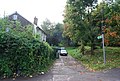
 A small walkway off All Saints Rd. - geograph.org.uk - 1047049.jpg 640 × 430; 99 KB
-

-
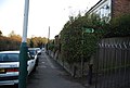
 Barriers on a footpath off Dowding Way - geograph.org.uk - 2119158.jpg 640 × 430; 151 KB
-
 Bridge under the Spa Valley Railway - geograph.org.uk - 4062528.jpg 4,000 × 3,000; 4.45 MB
-
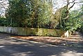
 Calverley Park - geograph.org.uk - 2934384.jpg 640 × 430; 56 KB
-
 Calverley Park - geograph.org.uk - 2934387.jpg 640 × 430; 86 KB
-
 Calverley Park - geograph.org.uk - 3259460.jpg 640 × 430; 78 KB
-
 Calverley Park - geograph.org.uk - 3259471.jpg 640 × 430; 87 KB
-
 Calverley Park - geograph.org.uk - 3628251.jpg 640 × 430; 92 KB
-
 Calverley Park - geograph.org.uk - 3884026.jpg 640 × 430; 105 KB
-
 Calverley Park - geograph.org.uk - 3997228.jpg 640 × 430; 97 KB
-
 Calverley Park - geograph.org.uk - 3999744.jpg 2,009 × 1,340; 853 KB
-
 Calverley Park - geograph.org.uk - 4439269.jpg 640 × 426; 90 KB
-
 Calverley Park - geograph.org.uk - 4852997.jpg 640 × 426; 85 KB
-
 Cut through from Gorse Rd to Pembury Rd - geograph.org.uk - 1173634.jpg 640 × 430; 136 KB
-

-
 Dunorlan Park - geograph.org.uk - 2506703.jpg 640 × 430; 90 KB
-
 Dunorlan Park - geograph.org.uk - 2506740.jpg 640 × 430; 105 KB
-
 End of the path, Farmcombe rd - geograph.org.uk - 1174706.jpg 640 × 430; 131 KB
-
 Footbridge on footpath through gasworks - geograph.org.uk - 2764801.jpg 640 × 480; 157 KB
-
 Footpath above Happy Valley - geograph.org.uk - 2717007.jpg 640 × 430; 131 KB
-

-
 Footpath across Rusthall Common - geograph.org.uk - 1103802.jpg 640 × 430; 136 KB
-
 Footpath across Rusthall Common - geograph.org.uk - 1548107.jpg 640 × 430; 188 KB
-

-
 Footpath across Rusthall Common. - geograph.org.uk - 1047606.jpg 640 × 430; 122 KB
-
 Footpath across the common - geograph.org.uk - 1088069.jpg 640 × 430; 134 KB
-
 Footpath across the Common - geograph.org.uk - 1609155.jpg 640 × 430; 180 KB
-
 Footpath across the Common - geograph.org.uk - 1609195.jpg 640 × 430; 195 KB
-
 Footpath across the common - geograph.org.uk - 2226881.jpg 640 × 430; 193 KB
-
 Footpath across the Common - geograph.org.uk - 4641752.jpg 640 × 426; 116 KB
-
 Footpath across the Common - geograph.org.uk - 4641755.jpg 640 × 426; 117 KB
-
 Footpath across the Common - geograph.org.uk - 4641773.jpg 640 × 426; 120 KB
-

-

-
 Footpath across Tunbridge Wells Common - geograph.org.uk - 1517384.jpg 640 × 430; 164 KB
-
 Footpath across Tunbridge Wells Common - geograph.org.uk - 1517436.jpg 640 × 430; 196 KB
-
 Footpath across Tunbridge Wells Common - geograph.org.uk - 1517543.jpg 640 × 430; 190 KB
-
 Footpath across Tunbridge Wells Common - geograph.org.uk - 1609153.jpg 640 × 430; 192 KB
-
 Footpath across Tunbridge Wells Common - geograph.org.uk - 1961131.jpg 640 × 430; 166 KB
-
 Footpath across Tunbridge Wells Common - geograph.org.uk - 1961142.jpg 640 × 430; 147 KB
-
 Footpath across Tunbridge Wells Common - geograph.org.uk - 3025930.jpg 640 × 430; 122 KB
-
 Footpath across Tunbridge Wells Common - geograph.org.uk - 799789.jpg 640 × 480; 127 KB
-

-
 Footpath along Langton Rd - geograph.org.uk - 1548118.jpg 640 × 430; 172 KB
-

-

-

-
 Footpath at the entrance to Nevill Park - geograph.org.uk - 1517341.jpg 640 × 430; 172 KB
-
 Footpath at the entrance to Nevill Park - geograph.org.uk - 1517349.jpg 640 × 430; 202 KB
-
 Footpath beside Coniston Avenue - geograph.org.uk - 1731878.jpg 2,304 × 3,072; 3.18 MB
-

-

-
 Footpath by High Brooms Gas holder - geograph.org.uk - 2119004.jpg 640 × 372; 95 KB
-

-
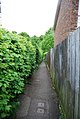
 Footpath covered in leaves - geograph.org.uk - 1047287.jpg 640 × 430; 143 KB
-
 Footpath crosses A26 London Road - geograph.org.uk - 1731780.jpg 3,072 × 2,304; 2.11 MB
-
 Footpath cut through sandstone, Rusthall - geograph.org.uk - 1047613.jpg 640 × 430; 135 KB
-
 Footpath from High Rocks Lane - geograph.org.uk - 3787451.jpg 4,000 × 3,000; 4.19 MB
-
 Footpath from Rusthall - geograph.org.uk - 1516319.jpg 640 × 430; 198 KB
-

-
 Footpath heading south - geograph.org.uk - 2750657.jpg 640 × 430; 124 KB
-
 Footpath heading south - geograph.org.uk - 2752373.jpg 640 × 430; 95 KB
-
 Footpath in Friezland Wood - geograph.org.uk - 1736833.jpg 2,304 × 3,072; 2.64 MB
-

-
 Footpath junction near Hurst Wood - geograph.org.uk - 1731912.jpg 3,072 × 2,304; 2.89 MB
-
 Footpath junction on Cabbage Stalk Lane - geograph.org.uk - 1736897.jpg 3,072 × 2,304; 2.52 MB
-
 Footpath leads off Delves Avenue - geograph.org.uk - 1224798.jpg 640 × 430; 125 KB
-
 Footpath leads off St Michaels Rd - geograph.org.uk - 1117624.jpg 640 × 430; 79 KB
-
 Footpath near Connaught Park - geograph.org.uk - 1303145.jpg 640 × 430; 104 KB
-
 Footpath near Reynolds Lane - geograph.org.uk - 2710800.jpg 640 × 430; 148 KB
-

-
 Footpath off Broadwater Down - geograph.org.uk - 4337792.jpg 640 × 430; 107 KB
-
 Footpath off Broomhill Rd - geograph.org.uk - 5108533.jpg 640 × 426; 108 KB
-
 Footpath off Cavendish Dr. (2) - geograph.org.uk - 1224942.jpg 430 × 640; 90 KB
-
 Footpath off Cavendish Dr. - geograph.org.uk - 1224938.jpg 640 × 430; 66 KB
-
 Footpath off Cornford Lane - geograph.org.uk - 4166431.jpg 640 × 430; 138 KB
-
 Footpath off Dowding Way - geograph.org.uk - 2103323.jpg 640 × 430; 155 KB
-
 Footpath off Eridge Rd - geograph.org.uk - 4846861.jpg 640 × 426; 97 KB
-
 Footpath off Forest Rd - geograph.org.uk - 1174760.jpg 640 × 430; 81 KB
-
 Footpath off High Rocks Lane - geograph.org.uk - 3787452.jpg 4,000 × 3,000; 4.07 MB
-
 Footpath off Lakeman Way - geograph.org.uk - 3684069.jpg 640 × 430; 95 KB
-
 Footpath off Liptraps Lane - geograph.org.uk - 4318474.jpg 640 × 430; 110 KB
-
 Footpath off Newland Rd - geograph.org.uk - 3984159.jpg 640 × 430; 71 KB
-
 Footpath off North Farm Rd - geograph.org.uk - 1927403.jpg 640 × 430; 156 KB
-
 Footpath off North Farm Rd - geograph.org.uk - 2101025.jpg 640 × 430; 208 KB
-
 Footpath off North Farm Rd - geograph.org.uk - 2101036.jpg 640 × 430; 171 KB
-
 Footpath off North Farm Rd - geograph.org.uk - 2989379.jpg 640 × 459; 106 KB
-
 Footpath off North Farm Rd - geograph.org.uk - 3510026.jpg 640 × 430; 64 KB
-
 Footpath off North Farm Rd - geograph.org.uk - 3615002.jpg 430 × 640; 68 KB
-
 Footpath off North Farm Rd - geograph.org.uk - 5179422.jpg 640 × 426; 86 KB
-
 Footpath off Pembury Rd to Squirrel Way - geograph.org.uk - 1173685.jpg 640 × 430; 114 KB
-
 Footpath off Reynolds Lane - geograph.org.uk - 5108824.jpg 640 × 426; 113 KB
-
 Footpath off Rodmell Rd - geograph.org.uk - 1174978.jpg 640 × 430; 117 KB
-
 Footpath off Sandhurst Park - geograph.org.uk - 1303136.jpg 430 × 640; 73 KB
-
 Footpath off Sandhurst Rd - geograph.org.uk - 3684052.jpg 640 × 430; 104 KB
-
 Footpath off St Michael's Rd - geograph.org.uk - 2239970.jpg 640 × 375; 96 KB
-
 Footpath off St Michael's Rd - geograph.org.uk - 4672188.jpg 640 × 426; 99 KB
-
 Footpath off Warwick Park (2) - geograph.org.uk - 1271944.jpg 640 × 430; 127 KB
-
 Footpath off Warwick Park - geograph.org.uk - 1174862.jpg 640 × 430; 89 KB
-
 Footpath off Warwick Park - geograph.org.uk - 1271938.jpg 640 × 430; 129 KB
-
 Footpath off Woodside Rd - geograph.org.uk - 1516323.jpg 640 × 430; 148 KB
-
 Footpath on the common - geograph.org.uk - 3345501.jpg 640 × 430; 152 KB
-
 Footpath on the common - geograph.org.uk - 3361759.jpg 640 × 426; 120 KB
-
 Footpath on the Common - geograph.org.uk - 803873.jpg 640 × 480; 105 KB
-
 Footpath on the edge of High Wood - geograph.org.uk - 4190916.jpg 640 × 430; 137 KB
-
 Footpath on Tunbridge Well Common - geograph.org.uk - 2122899.jpg 640 × 430; 191 KB
-
 Footpath on Tunbridge Well Common - geograph.org.uk - 2122907.jpg 640 × 430; 174 KB
-
 Footpath past Oak Rd Recreation Area - geograph.org.uk - 2872743.jpg 640 × 430; 106 KB
-

-
 Footpath signposted off langton Rd - geograph.org.uk - 1609086.jpg 640 × 508; 134 KB
-
 Footpath through Still Green - geograph.org.uk - 1731920.jpg 3,072 × 2,304; 2.35 MB
-

-

-
 Footpath through the woods - geograph.org.uk - 2867539.jpg 640 × 430; 129 KB
-
 Footpath to Brook Rd - geograph.org.uk - 4158099.jpg 640 × 430; 92 KB
-
 Footpath to Cunningham Rd - geograph.org.uk - 2989390.jpg 640 × 430; 67 KB
-
 Footpath to Cunningham Rd - geograph.org.uk - 3684073.jpg 640 × 430; 81 KB
-

-
 Footpath to Hilbert Woods - geograph.org.uk - 3892498.jpg 640 × 430; 94 KB
-
 Footpath to Hilbert Woods - geograph.org.uk - 3892500.jpg 640 × 430; 129 KB
-
 Footpath to Liptrap Lane - geograph.org.uk - 4158104.jpg 640 × 430; 132 KB
-
 Footpath to Liptrap Lane - geograph.org.uk - 4158113.jpg 640 × 430; 108 KB
-
 Footpath to Mereworth Close - geograph.org.uk - 3904458.jpg 640 × 430; 68 KB
-
 Footpath to Merrion Close - geograph.org.uk - 4285358.jpg 640 × 430; 96 KB
-
 Footpath to Newland Rd - geograph.org.uk - 3902601.jpg 640 × 430; 108 KB
-

-
 Footpath to Rusthall - geograph.org.uk - 1516310.jpg 640 × 430; 161 KB
-
 Footpath to Sandhurst Rd - geograph.org.uk - 2112028.jpg 640 × 430; 146 KB
-
 Footpath to Smockham Farm - geograph.org.uk - 2310327.jpg 640 × 430; 124 KB
-
 Footpath to Smockham Farm - geograph.org.uk - 3697315.jpg 640 × 430; 150 KB
-
 Footpath to Smockham Farm - geograph.org.uk - 5108782.jpg 640 × 426; 109 KB
-
 Footpath to St John's Primary School - geograph.org.uk - 2086378.jpg 640 × 430; 140 KB
-
 Footpath to St Michael's Rd - geograph.org.uk - 2086369.jpg 640 × 430; 148 KB
-
 Footpath to St Michael's Rd - geograph.org.uk - 2086384.jpg 640 × 430; 162 KB
-
 Footpath to St Michael's Rd - geograph.org.uk - 2086386.jpg 640 × 430; 170 KB
-
 Footpath to St Michael's Rd - geograph.org.uk - 2086387.jpg 640 × 430; 125 KB
-
 Footpath to St Michael's Rd - geograph.org.uk - 2756538.jpg 640 × 430; 97 KB
-
 Footpath to St Michael's Rd - geograph.org.uk - 3615041.jpg 640 × 430; 99 KB
-
 Footpath to St Michael's Rd - geograph.org.uk - 4413336.jpg 640 × 426; 108 KB
-
 Footpath to St Michael's Rd - geograph.org.uk - 4756628.jpg 640 × 426; 107 KB
-
 Footpath to Tedder Rd - geograph.org.uk - 3904428.jpg 640 × 430; 54 KB
-
 Footpath to the High St - geograph.org.uk - 3361774.jpg 640 × 426; 108 KB
-
 Footpath to The Midway - geograph.org.uk - 3787447.jpg 4,000 × 3,000; 4.07 MB
-
 Footpath to The Midway - geograph.org.uk - 3787449.jpg 3,000 × 4,000; 4.35 MB
-
 Footpath west of Smockham Farm - geograph.org.uk - 1958686.jpg 640 × 430; 201 KB
-
 Footpath west of Smockham Farm - geograph.org.uk - 2713012.jpg 640 × 430; 132 KB
-
 Footpath west of St Paul's Church - geograph.org.uk - 1958930.jpg 640 × 430; 189 KB
-
 Footpath, Camden Park - geograph.org.uk - 4848896.jpg 640 × 426; 122 KB
-
 Footpath, Happy Valley - geograph.org.uk - 5122933.jpg 640 × 426; 113 KB
-
 Footpath, Happy Valley - geograph.org.uk - 5128217.jpg 640 × 426; 119 KB
-
 Footpath, Happy Valley - geograph.org.uk - 5567135.jpg 640 × 426; 115 KB
-
 Footpath, High Brooms (2) - geograph.org.uk - 1185362.jpg 640 × 430; 93 KB
-
 Footpath, High Brooms - geograph.org.uk - 1185361.jpg 640 × 430; 81 KB
-
 Footpath, High Wood - geograph.org.uk - 4190960.jpg 640 × 430; 152 KB
-
 Footpath, Hurst Wood - geograph.org.uk - 1958712.jpg 640 × 430; 192 KB
-
 Footpath, Hurst Wood - geograph.org.uk - 2713032.jpg 640 × 430; 144 KB
-
 Footpath, Hurst Wood - geograph.org.uk - 4042121.jpg 640 × 430; 130 KB
-
 Footpath, North Farm - geograph.org.uk - 4311559.jpg 640 × 430; 131 KB
-
 Footpath, Robingate Wood - geograph.org.uk - 2867513.jpg 640 × 430; 114 KB
-
 Footpath, Rusthall Common - geograph.org.uk - 5122649.jpg 640 × 426; 119 KB
-
 Footpath, Tunbridge Wells Common - geograph.org.uk - 2122908.jpg 640 × 430; 194 KB
-
 Footpath, Tunbridge Wells Common - geograph.org.uk - 2122922.jpg 640 × 430; 179 KB
-
 Footpath, Tunbridge Wells Common - geograph.org.uk - 2635830.jpg 640 × 430; 88 KB
-
 Footpath, Tunbridge Wells Common - geograph.org.uk - 2719968.jpg 640 × 430; 118 KB
-
 Footpath, Tunbridge Wells Common - geograph.org.uk - 2721474.jpg 640 × 430; 99 KB
-
 Footpath, Tunbridge Wells Common - geograph.org.uk - 2721479.jpg 640 × 430; 79 KB
-
 Footpath, Tunbridge Wells Common - geograph.org.uk - 2721510.jpg 640 × 430; 139 KB
-
 Footpath, Tunbridge Wells Common - geograph.org.uk - 3364476.jpg 640 × 426; 113 KB
-
 Footpath, Tunbridge Wells Common - geograph.org.uk - 3390578.jpg 640 × 426; 120 KB
-
 Footpath, Tunbridge Wells Common - geograph.org.uk - 3390607.jpg 640 × 426; 110 KB
-
 Footpath, Tunbridge Wells Common - geograph.org.uk - 5136582.jpg 640 × 426; 119 KB
-
 Footpath, Upper Cumberland Walk - geograph.org.uk - 1070580.jpg 640 × 430; 121 KB
-
 Formal garden, Dunorlan Park - geograph.org.uk - 2506735.jpg 640 × 430; 95 KB
-
 Gate at the entrance to Hurst Wood - geograph.org.uk - 767449.jpg 640 × 430; 120 KB
-
 Gate by New England Cottage - geograph.org.uk - 4549919.jpg 640 × 426; 116 KB
-
 Gate by New England Cottage - geograph.org.uk - 4671732.jpg 640 × 426; 123 KB
-
 Gate on path - geograph.org.uk - 3984167.jpg 640 × 430; 112 KB
-
 Gate, footpath to Speldhurst Rd - geograph.org.uk - 2750659.jpg 640 × 430; 141 KB
-
 Gate, Permissive path off Newlands Road - geograph.org.uk - 2125191.jpg 640 × 430; 196 KB
-
 Gated Path - geograph.org.uk - 3358781.jpg 640 × 426; 114 KB
-

-
 Happy Valley, Rusthall Common - geograph.org.uk - 3024554.jpg 4,000 × 3,000; 3.98 MB
-
 Narrow footpath - geograph.org.uk - 4311555.jpg 640 × 430; 139 KB
-
 Narrow footpath, North Farm - geograph.org.uk - 4311556.jpg 640 × 430; 143 KB
-
 Path across Rusthall Common. - geograph.org.uk - 1047604.jpg 640 × 430; 110 KB
-
 Path across Tunbridge Wells Common - geograph.org.uk - 1609206.jpg 640 × 430; 195 KB
-

-
 Path in St John's Recreation Ground - geograph.org.uk - 1670294.jpg 640 × 430; 183 KB
-
 Path into Friezland Wood - geograph.org.uk - 4063819.jpg 4,000 × 3,000; 4.18 MB
-

-
 Path off Newlands Rd - geograph.org.uk - 3358780.jpg 640 × 426; 94 KB
-

-
 Path off Upper Grosvenor Rd - geograph.org.uk - 3991261.jpg 640 × 430; 104 KB
-

-
 Path on Tunbridge Wells Common - geograph.org.uk - 3010588.jpg 4,000 × 3,000; 4.23 MB
-
 Path through Calverley Grounds - geograph.org.uk - 1117562.jpg 640 × 430; 72 KB
-
 Path through Calverley Park - geograph.org.uk - 2134790.jpg 640 × 430; 144 KB
-
 Path through Dunorlan Park - geograph.org.uk - 1780327.jpg 640 × 430; 144 KB
-
 Path to St Michael's Rd - geograph.org.uk - 4054790.jpg 640 × 430; 98 KB


_-_geograph.org.uk_-_1177415.jpg)


_-_geograph.org.uk_-_1224942.jpg)


_-_geograph.org.uk_-_1271944.jpg)


_-_geograph.org.uk_-_1185362.jpg)


