Category:Footbridges in Suffolk
Jump to navigation
Jump to search
Subcategories
This category has the following 5 subcategories, out of 5 total.
- Stepping stones in Suffolk (1 F)
J
- Jubilee Bridge, Lowestoft (7 F)
P
S
- Sir Bobby Robson Bridge (27 F)
Media in category "Footbridges in Suffolk"
The following 145 files are in this category, out of 145 total.
-
 2 bridges, Bungay.jpg 1,219 × 1,444; 913 KB
-
 A 15th century bridge at Moulton - geograph.org.uk - 532133.jpg 640 × 402; 74 KB
-
 A footbridge for a footpath - geograph.org.uk - 342619.jpg 640 × 480; 96 KB
-
-

-
 Baylham Footbridge Photo.jpg 480 × 640; 131 KB
-
 Bury St Edmunds - panoramio (15).jpg 2,816 × 2,112; 3.17 MB
-
 Crossing the railway - geograph.org.uk - 875643.jpg 480 × 640; 96 KB
-
 Crossing the stream - geograph.org.uk - 979166.jpg 640 × 477; 99 KB
-
 Foot and cycle bridge over the A12 - geograph.org.uk - 1339938.jpg 640 × 480; 86 KB
-
 Footbridge - geograph.org.uk - 1112182.jpg 640 × 480; 63 KB
-
 Footbridge - geograph.org.uk - 1159962.jpg 640 × 480; 137 KB
-
 Footbridge - geograph.org.uk - 1226254.jpg 480 × 640; 158 KB
-
 Footbridge - geograph.org.uk - 1260382.jpg 640 × 480; 157 KB
-
 Footbridge - geograph.org.uk - 1498270.jpg 480 × 640; 157 KB
-
 Footbridge - geograph.org.uk - 1509481.jpg 480 × 640; 151 KB
-
 Footbridge - geograph.org.uk - 1530341.jpg 480 × 640; 126 KB
-
 Footbridge - geograph.org.uk - 1573278.jpg 640 × 480; 98 KB
-
 Footbridge - geograph.org.uk - 1578574.jpg 640 × 480; 140 KB
-
 Footbridge - geograph.org.uk - 1582716.jpg 480 × 640; 144 KB
-
 Footbridge - geograph.org.uk - 1741268.jpg 1,200 × 1,600; 930 KB
-
 Footbridge - geograph.org.uk - 1770820.jpg 1,600 × 1,200; 804 KB
-
 Footbridge - geograph.org.uk - 1771649.jpg 1,200 × 1,600; 799 KB
-
 Footbridge - geograph.org.uk - 2721742.jpg 768 × 1,024; 357 KB
-
 Footbridge - geograph.org.uk - 925837.jpg 640 × 480; 121 KB
-
 Footbridge across flooded gravel pits - geograph.org.uk - 1464350.jpg 640 × 480; 138 KB
-
 Footbridge across The Cut - geograph.org.uk - 1587533.jpg 640 × 427; 96 KB
-
 Footbridge across the River Blyth - geograph.org.uk - 1073454.jpg 427 × 640; 106 KB
-
 Footbridge across the River Kennett - geograph.org.uk - 1207484.jpg 640 × 427; 81 KB
-
 Footbridge and footpath junction - geograph.org.uk - 1266872.jpg 640 × 440; 101 KB
-
 Footbridge and Ford - geograph.org.uk - 1078748.jpg 640 × 480; 119 KB
-
 Footbridge and path - geograph.org.uk - 832019.jpg 480 × 640; 121 KB
-
 Footbridge and path to Boyton Hall farm - geograph.org.uk - 1161982.jpg 640 × 480; 126 KB
-
 Footbridge and path to Ryece Hall - geograph.org.uk - 1624944.jpg 427 × 640; 116 KB
-

-
 Footbridge and path towards Ringshall - geograph.org.uk - 968293.jpg 640 × 412; 88 KB
-

-
 Footbridge And Tree - geograph.org.uk - 1770776.jpg 1,200 × 1,600; 486 KB
-
 Footbridge and view to Grove Farm - geograph.org.uk - 1144678.jpg 640 × 507; 105 KB
-
 Footbridge at Beyton Green - geograph.org.uk - 1596134.jpg 640 × 427; 95 KB
-
 Footbridge at Brandon - geograph.org.uk - 1025838.jpg 640 × 427; 154 KB
-
 Footbridge at Rattlesden - geograph.org.uk - 1478354.jpg 640 × 427; 113 KB
-
 Footbridge at Wash Lane Ford - geograph.org.uk - 4984793.jpg 2,304 × 3,072; 4.06 MB
-
 Footbridge at Woodbridge Station - geograph.org.uk - 4639869.jpg 2,784 × 1,568; 2.09 MB
-

-

-
 Footbridge in Nowton Park - geograph.org.uk - 730477.jpg 427 × 640; 122 KB
-
 Footbridge into Blyth Meadow - geograph.org.uk - 1779301.jpg 2,304 × 3,072; 1.67 MB
-
 Footbridge leading to picnic area - geograph.org.uk - 1464347.jpg 640 × 480; 148 KB
-
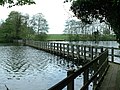
 Footbridge near Broad Water - geograph.org.uk - 1129632.jpg 427 × 640; 115 KB
-

-
 Footbridge near Snape Maltings - geograph.org.uk - 16693.jpg 640 × 480; 50 KB
-
-
 Footbridge near the Fairy Lake - geograph.org.uk - 1628813.jpg 427 × 640; 128 KB
-
 Footbridge of the footpath to Hoxne Road, Denham Green - geograph.org.uk - 2705134.jpg 3,072 × 2,304; 1.37 MB
-
 Footbridge On Spring Meadow - geograph.org.uk - 1260530.jpg 640 × 480; 127 KB
-
 Footbridge on the footpath Hubbard's Hill to the Mounts - geograph.org.uk - 1384779.jpg 3,072 × 2,304; 1.68 MB
-
 Footbridge on the footpath Hubbard's Hill to the Mounts - geograph.org.uk - 1384808.jpg 3,072 × 2,304; 1.66 MB
-
 Footbridge on the Gipping path - geograph.org.uk - 1779052.jpg 768 × 1,024; 546 KB
-

-
 Footbridge over drain - geograph.org.uk - 671917.jpg 480 × 640; 92 KB
-
 Footbridge over drain at The Carr - geograph.org.uk - 925298.jpg 640 × 427; 129 KB
-
 Footbridge Over Lark Rise - geograph.org.uk - 1105521.jpg 480 × 640; 151 KB
-
 Footbridge over River Lark - geograph.org.uk - 641315.jpg 640 × 427; 104 KB
-
 Footbridge over the A11 - geograph.org.uk - 1639555.jpg 640 × 480; 140 KB
-
 Footbridge over the A14 - geograph.org.uk - 1227527.jpg 640 × 480; 77 KB
-
 Footbridge over the A14 - geograph.org.uk - 1312381.jpg 640 × 480; 92 KB
-
 Footbridge over the Black Bourn - geograph.org.uk - 1596259.jpg 427 × 640; 116 KB
-
 Footbridge over the ford, Marlesford - geograph.org.uk - 1182481.jpg 3,072 × 2,304; 1.66 MB
-
 Footbridge over the railway - geograph.org.uk - 1315585.jpg 640 × 480; 57 KB
-
 Footbridge over the railway - geograph.org.uk - 901108.jpg 427 × 640; 121 KB
-
 Footbridge over the River Alde - geograph.org.uk - 1050101.jpg 3,072 × 2,304; 1.63 MB
-

-
 Footbridge over the River Lark - geograph.org.uk - 1302608.jpg 480 × 640; 94 KB
-
 Footbridge over the River Stour - geograph.org.uk - 624123.jpg 640 × 480; 103 KB
-
 Footbridge over the River Waveney - geograph.org.uk - 1462474.jpg 640 × 480; 163 KB
-
 Footbridge over the Stour - geograph.org.uk - 859121.jpg 640 × 427; 83 KB
-
 Footbridge to St Catherine, Pettaugh - geograph.org.uk - 1346671.jpg 3,072 × 2,304; 1.47 MB
-
 Footbridge to the Haberden - geograph.org.uk - 775151.jpg 640 × 427; 123 KB
-
 Footbridge volunteers.jpg 3,915 × 3,009; 2.07 MB
-
 Footbridge, ditch and open fields - geograph.org.uk - 1474328.jpg 640 × 459; 101 KB
-
 Footbridge, Knodishall Common - geograph.org.uk - 462999.jpg 640 × 480; 121 KB
-
 Footbridge, St Helens, Thetford Forest - geograph.org.uk - 302549.jpg 640 × 427; 244 KB
-
 Footpath 10 over New Reach Closed - geograph.org.uk - 1779129.jpg 3,072 × 2,304; 1.66 MB
-
 Footpath 14, off Hubbard's Hill - geograph.org.uk - 1384762.jpg 3,072 × 2,304; 1.56 MB
-
 Footpath Bridge - geograph.org.uk - 1153902.jpg 480 × 640; 107 KB
-
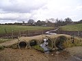
 Ford at Grundisburgh - geograph.org.uk - 814128.jpg 640 × 480; 136 KB
-
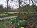
 Ickworth Park -Suffolk, England-17April2006 (3).jpg 1,600 × 1,200; 518 KB
-
 Mendham Marshes - geograph.org.uk - 550614.jpg 640 × 480; 99 KB
-
 New footbridge - geograph.org.uk - 992503.jpg 640 × 480; 121 KB
-
 Old Trackbed - geograph.org.uk - 2316090.jpg 1,600 × 1,200; 775 KB
-
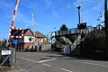
 Overlooking Woodbridge station - geograph.org.uk - 3203501.jpg 1,024 × 768; 120 KB
-
 Railway Footbridge - geograph.org.uk - 273041.jpg 640 × 480; 106 KB
-
 River Alde at Badingham - geograph.org.uk - 1064473.jpg 3,072 × 2,304; 1.51 MB
-
 River Blyth Gauging Station - geograph.org.uk - 1139217.jpg 3,072 × 2,304; 1.48 MB
-
 River Kennett at Dalham - geograph.org.uk - 42924.jpg 640 × 427; 133 KB
-
 River Waveney, Redgrave Fen.jpg 2,034 × 1,310; 949 KB
-
 Sleeper bridge - geograph.org.uk - 697713.jpg 480 × 640; 91 KB
-
 Small footbridge - geograph.org.uk - 979696.jpg 640 × 480; 119 KB
-
 Small footbridge - geograph.org.uk - 979705.jpg 480 × 640; 140 KB
-
 Small Footbridge in Nowton Park (1) - geograph.org.uk - 731300.jpg 480 × 640; 120 KB
-
 Small Footbridge in Nowton Park (2) - geograph.org.uk - 731304.jpg 640 × 480; 112 KB
-
 Small Footbridge in Nowton Park (3) - geograph.org.uk - 731309.jpg 640 × 480; 146 KB
-
 Small footbridge, North Meadow Common - geograph.org.uk - 785544.jpg 640 × 480; 139 KB
-
 Trimley station in 2012 - level crossing.jpg 1,024 × 683; 326 KB
-
 A footbridge over the River Stour - geograph.org.uk - 961200.jpg 640 × 426; 63 KB
-

-
 Chad Brook Footbridge - geograph.org.uk - 296262.jpg 640 × 480; 78 KB
-
 Double plank footbridge - geograph.org.uk - 766202.jpg 640 × 480; 139 KB
-

-
 Footbridge - geograph.org.uk - 1413944.jpg 480 × 640; 128 KB
-
 Footbridge - geograph.org.uk - 291658.jpg 640 × 480; 165 KB
-
 Footbridge across A14 - geograph.org.uk - 320451.jpg 640 × 427; 76 KB
-
 Footbridge across the River Gipping - geograph.org.uk - 757343.jpg 640 × 427; 133 KB
-
 Footbridge And Field Boundary - geograph.org.uk - 537430.jpg 480 × 640; 141 KB
-

-

-
 Footbridge at Ampton Water - geograph.org.uk - 200733.jpg 640 × 427; 119 KB
-
 Footbridge beside lane - geograph.org.uk - 1424311.jpg 640 × 480; 119 KB
-
 Footbridge by Pond Hall Farm - geograph.org.uk - 719812.jpg 640 × 480; 73 KB
-
 Footbridge near Hempnalls Hall - geograph.org.uk - 388545.jpg 427 × 640; 162 KB
-
 Footbridge near Kedington - geograph.org.uk - 508298.jpg 640 × 427; 104 KB
-
 Footbridge near Offton - geograph.org.uk - 592995.jpg 640 × 427; 153 KB
-
 Footbridge near path junction. - geograph.org.uk - 596119.jpg 459 × 640; 105 KB
-
 Footbridge onto Godfrey's Common - geograph.org.uk - 222783.jpg 480 × 640; 157 KB
-
 Footbridge over Ampton Water - geograph.org.uk - 729047.jpg 640 × 480; 119 KB
-
 Footbridge over Chad Brook - geograph.org.uk - 296260.jpg 640 × 480; 79 KB
-
 Footbridge over Deben - geograph.org.uk - 378928.jpg 640 × 480; 116 KB
-

-
 Footbridge over Fynn - geograph.org.uk - 380118.jpg 640 × 480; 100 KB
-

-
 Footbridge over Hundred River, Aldringham - geograph.org.uk - 357449.jpg 640 × 426; 195 KB
-
 Footbridge over River Dove - geograph.org.uk - 712951.jpg 427 × 640; 122 KB
-
 Footbridge over River Gipping - geograph.org.uk - 757308.jpg 640 × 427; 139 KB
-
 Footbridge over stream - geograph.org.uk - 194027.jpg 640 × 480; 137 KB
-
 Footbridge Over The Lark - geograph.org.uk - 1433479.jpg 640 × 480; 152 KB
-
 Footbridge over the River Brett - geograph.org.uk - 628151.jpg 640 × 480; 97 KB
-
 Footbridge over the Waveney - geograph.org.uk - 772203.jpg 427 × 640; 145 KB
-
 Footbridge to River Alde - geograph.org.uk - 664871.jpg 427 × 640; 54 KB
-
 Footbridge, Black Heath Forest - geograph.org.uk - 229426.jpg 640 × 480; 115 KB
-
 Footpath bridge - geograph.org.uk - 771428.jpg 480 × 640; 113 KB
-
 Footpath through the trees. - geograph.org.uk - 247738.jpg 640 × 480; 145 KB
-
 New Footbridge - geograph.org.uk - 283692.jpg 640 × 480; 73 KB
-
 New footbridge over the A14 - geograph.org.uk - 283687.jpg 640 × 480; 70 KB
-
 Out of the shadows into the sun - geograph.org.uk - 605767.jpg 480 × 640; 203 KB


.jpg)


.jpg)


_-_geograph.org.uk_-_731300.jpg)
_-_geograph.org.uk_-_731304.jpg)
_-_geograph.org.uk_-_731309.jpg)


