Category:Footbridges in Dorset
Jump to navigation
Jump to search
Subcategories
This category has the following 6 subcategories, out of 6 total.
Media in category "Footbridges in Dorset"
The following 200 files are in this category, out of 337 total.
(previous page) (next page)-
 "Stile" onto footbridge over Key Brook - geograph.org.uk - 5123628.jpg 3,072 × 2,048; 1.31 MB
-

-
 A footbridge in Cerne Abbas - geograph.org.uk - 855577.jpg 640 × 480; 170 KB
-
 A31 footbridge north of Hatch Hole - geograph.org.uk - 3499084.jpg 3,648 × 2,736; 1.8 MB
-
 A31 footbridge north of Stapehill Farm - geograph.org.uk - 3499015.jpg 3,648 × 2,736; 2.07 MB
-
 Alderholt, footbridge - geograph.org.uk - 1245538.jpg 640 × 480; 155 KB
-
 Alderney, footbridge at Bourne Bottom - geograph.org.uk - 1712028.jpg 640 × 480; 127 KB
-
 Alderney, track across Bourne Bottom - geograph.org.uk - 1712088.jpg 640 × 480; 79 KB
-
 Alley Bridge, Charminster - geograph.org.uk - 629390.jpg 640 × 480; 140 KB
-
 Ameysford, footbridge - geograph.org.uk - 2296300.jpg 1,024 × 768; 384 KB
-
 Ancient stone bridge - geograph.org.uk - 390479.jpg 640 × 480; 58 KB
-
 Ancient stone bridge - geograph.org.uk - 390482.jpg 640 × 480; 58 KB
-
 Any disagreements^ - geograph.org.uk - 763078.jpg 640 × 430; 111 KB
-
 Ashley Heath, footbridge - geograph.org.uk - 2964863.jpg 1,024 × 768; 189 KB
-
 Asker Footbridge at New Zealand Farm - geograph.org.uk - 3365090.jpg 3,888 × 2,592; 3.89 MB
-
 Asker Meadows footbridge and path improvements - geograph.org.uk - 3357738.jpg 3,888 × 2,592; 5 MB
-
 Asker Millstream footbridge - geograph.org.uk - 3532945.jpg 2,592 × 3,888; 5.27 MB
-
 Beaminster, footbridge over the Brit - geograph.org.uk - 922615.jpg 427 × 640; 266 KB
-
 Beaminster, ford footbridge - geograph.org.uk - 1383396.jpg 480 × 640; 79 KB
-
 Beaminster, ford in Woodswater Lane - geograph.org.uk - 1383391.jpg 640 × 480; 84 KB
-

-

-
 Benchmark on footbridge over River Birt - geograph.org.uk - 2085606.jpg 768 × 1,024; 336 KB
-
 Bere Regis, bridge - geograph.org.uk - 1268342.jpg 640 × 480; 135 KB
-
 Berwick, footbridge - geograph.org.uk - 2563170.jpg 1,024 × 768; 347 KB
-
 Beware - oncoming trick cyclists^ - geograph.org.uk - 1557350.jpg 640 × 427; 96 KB
-

-
 Blue Bridge - geograph.org.uk - 1557193.jpg 640 × 427; 78 KB
-
 Blue Bridge - geograph.org.uk - 1557210.jpg 640 × 427; 95 KB
-
 Boscombe - Chine Gardens footbridge - geograph.org.uk - 4199399.jpg 1,600 × 1,196; 830 KB
-
 Boscombe Chine Gardens, land-train stop - geograph.org.uk - 646446.jpg 640 × 480; 106 KB
-

-
 Bourne Bottom, footbridge - geograph.org.uk - 4059420.jpg 1,024 × 768; 303 KB
-
 Bournemouth , Boundary Road - geograph.org.uk - 1744827.jpg 3,264 × 2,448; 3.88 MB
-
 Bournemouth , Boundary Road and Footbridge - geograph.org.uk - 1744849.jpg 3,264 × 2,448; 3.77 MB
-
 Bournemouth , Boundary Road and Footbridge - geograph.org.uk - 1745444.jpg 3,264 × 2,448; 3.91 MB
-
 Bournemouth , Stour Valley Local Nature Reserve - geograph.org.uk - 1704345.jpg 3,264 × 2,448; 3.88 MB
-
 Bridge cables and clamp - geograph.org.uk - 4372244.jpg 853 × 1,280; 376 KB
-
-
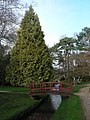
 Bournemouth Gardens, red bridge reflected - geograph.org.uk - 670345.jpg 640 × 480; 102 KB
-
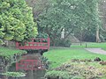
 Bournemouth Gardens, red footbridge - geograph.org.uk - 669499.jpg 640 × 480; 106 KB
-

-

-
 Bournemouth Park stream - geograph.org.uk - 783527.jpg 593 × 640; 112 KB
-

-

-
 Bradford Peverell, ford ^ footbridge - geograph.org.uk - 4749981.jpg 1,024 × 768; 265 KB
-

-
 Bridge Across River Frome at Cruxton - geograph.org.uk - 437750.jpg 640 × 477; 97 KB
-
 Bridge over Mill Stream - geograph.org.uk - 1556106.jpg 640 × 427; 110 KB
-
 Bridge over stream - geograph.org.uk - 764735.jpg 640 × 430; 121 KB
-
 Bridge over the Lodden - geograph.org.uk - 5070072.jpg 2,048 × 3,072; 1.55 MB
-
 Bridge over the Mill Stream, Dorchester - geograph.org.uk - 809783.jpg 480 × 640; 125 KB
-
 Bridge, Nature Reserve, Upton Heath - geograph.org.uk - 1233842.jpg 640 × 480; 81 KB
-
 Bridport, footbridge - geograph.org.uk - 3666099.jpg 1,024 × 768; 191 KB
-
 Bus Stop and Footbridge at St Leonards - geograph.org.uk - 1993997.jpg 640 × 427; 147 KB
-
 By Christchurch Harbour - geograph.org.uk - 1775662.jpg 1,024 × 683; 352 KB
-
 Canford Heath, footbridge - geograph.org.uk - 2385819.jpg 1,024 × 749; 339 KB
-
 Castleman Trailway in Ferndown Forest - geograph.org.uk - 1750169.jpg 800 × 600; 226 KB
-
 Chetnole, footbridge over Wriggle River - geograph.org.uk - 3001441.jpg 640 × 427; 498 KB
-
 Coast path towards Cuddle - geograph.org.uk - 1634130.jpg 480 × 640; 130 KB
-
 Colber footbridge - geograph.org.uk - 2795242.jpg 2,048 × 1,536; 2.27 MB
-
 Concrete footbridge - geograph.org.uk - 1870613.jpg 683 × 1,024; 249 KB
-

-
 Corfe Mullen, footbridge - geograph.org.uk - 2763447.jpg 1,024 × 768; 242 KB
-
 Coy Pond Gardens, cycle-footbridge - geograph.org.uk - 658897.jpg 640 × 480; 108 KB
-

-
 Cranborne, footbridges - geograph.org.uk - 1330811.jpg 640 × 480; 106 KB
-
 Cruxton, bridge over the River Frome - geograph.org.uk - 935853.jpg 480 × 640; 85 KB
-
 Ditch footbridge - geograph.org.uk - 3497004.jpg 1,659 × 2,495; 1.63 MB
-
 Dorchester , The A35 and Bridge - geograph.org.uk - 1517828.jpg 640 × 461; 92 KB
-
 East Stoke, footbridge - geograph.org.uk - 5114275.jpg 1,024 × 749; 258 KB
-
 Eye Bridge - geograph.org.uk - 1052654.jpg 640 × 480; 105 KB
-
 Eype Mouth - geograph.org.uk - 1231912.jpg 640 × 428; 97 KB
-
 Eype, Eype's Mouth - geograph.org.uk - 505256.jpg 640 × 498; 87 KB
-
 Fiddleford, footbridge - geograph.org.uk - 2642926.jpg 1,024 × 768; 319 KB
-

-

-
 Footbridge - geograph.org.uk - 2712472.jpg 3,264 × 2,448; 5.58 MB
-
 Footbridge - geograph.org.uk - 2905797.jpg 640 × 430; 110 KB
-
 Footbridge - Lower Gardens - geograph.org.uk - 4924726.jpg 640 × 480; 87 KB
-
 Footbridge across small stream - geograph.org.uk - 4561345.jpg 640 × 426; 97 KB
-
 Footbridge across the Corfe River - geograph.org.uk - 769226.jpg 480 × 640; 140 KB
-
 Footbridge across the river Piddle - geograph.org.uk - 3032667.jpg 2,048 × 1,536; 3.07 MB
-
 Footbridge alongside Canford Bridge - geograph.org.uk - 1555229.jpg 571 × 640; 111 KB
-
 Footbridge and Christchurch Harbour - geograph.org.uk - 1775737.jpg 1,024 × 683; 336 KB
-

-
 Footbridge and footpath, West Bexington - geograph.org.uk - 5009302.jpg 1,024 × 768; 249 KB
-

-
 Footbridge and Stile near Knighton - geograph.org.uk - 2292322.jpg 640 × 480; 161 KB
-
 Footbridge at Eype Mouth - geograph.org.uk - 2835261.jpg 640 × 430; 53 KB
-
 Footbridge at Keynston Mill - geograph.org.uk - 3239728.jpg 640 × 480; 135 KB
-
 Footbridge at Stanpit Marsh - geograph.org.uk - 2263767.jpg 640 × 396; 421 KB
-
 Footbridge at West Bay - geograph.org.uk - 4308072.jpg 640 × 428; 83 KB
-
 Footbridge by the Stour - geograph.org.uk - 1438163.jpg 640 × 455; 163 KB
-
 Footbridge by the weir on river Stour - geograph.org.uk - 2792249.jpg 681 × 1,024; 317 KB
-
 Footbridge from the Red Lion to Waitrose - geograph.org.uk - 1636348.jpg 640 × 480; 130 KB
-
 Footbridge In Holt Wood - geograph.org.uk - 2797009.jpg 800 × 600; 237 KB
-
 Footbridge in Hurn Forest - geograph.org.uk - 1727044.jpg 640 × 480; 121 KB
-
 Footbridge in Little Giant Wood - geograph.org.uk - 5070774.jpg 480 × 640; 111 KB
-
 Footbridge in St Leonards - geograph.org.uk - 1737510.jpg 640 × 480; 148 KB
-
 Footbridge into Littlesea Holiday Park - geograph.org.uk - 1713516.jpg 640 × 480; 161 KB
-
 Footbridge leaving Bournemouth - geograph.org.uk - 4242670.jpg 640 × 268; 27 KB
-
 Footbridge near Chilcombe - geograph.org.uk - 2803123.jpg 640 × 430; 123 KB
-
 Footbridge near Corfe Castle - geograph.org.uk - 1524228.jpg 640 × 455; 102 KB
-
 Footbridge near East End - geograph.org.uk - 1228272.jpg 640 × 480; 125 KB
-
 Footbridge near Gore Farm - geograph.org.uk - 5126316.jpg 3,072 × 2,048; 1.38 MB
-
 Footbridge near Keynston Mill - geograph.org.uk - 1275835.jpg 640 × 480; 94 KB
-
 Footbridge near Margaret Marsh - geograph.org.uk - 5123488.jpg 2,048 × 3,072; 1.24 MB
-
 Footbridge on coastal path - geograph.org.uk - 3420400.jpg 640 × 480; 123 KB
-
 Footbridge on coastal path - geograph.org.uk - 4383211.jpg 640 × 480; 113 KB
-
 Footbridge on coastal path - geograph.org.uk - 4389825.jpg 640 × 480; 148 KB
-
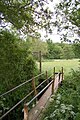
 Footbridge on footpath - geograph.org.uk - 528088.jpg 493 × 623; 129 KB
-
 Footbridge on path from Stanbridge to River Allen - geograph.org.uk - 2833048.jpg 1,600 × 1,200; 950 KB
-

-
 Footbridge on the Coast Path - geograph.org.uk - 2413694.jpg 1,024 × 768; 267 KB
-

-

-

-
 Footbridge over a small stream - geograph.org.uk - 2896158.jpg 640 × 430; 119 KB
-
 Footbridge over A30, by-passing Sherborne - geograph.org.uk - 4831395.jpg 1,600 × 1,279; 260 KB
-
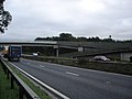 Footbridge over A31 - geograph.org.uk - 267623.jpg 640 × 480; 72 KB
-
 Footbridge over A31 - geograph.org.uk - 3014941.jpg 800 × 600; 329 KB
-
 Footbridge over A31 - geograph.org.uk - 3207714.jpg 640 × 428; 81 KB
-
 Footbridge over A338 - geograph.org.uk - 1546836.jpg 640 × 480; 90 KB
-
 Footbridge over A35 Dorchester bypass - geograph.org.uk - 3014284.jpg 800 × 600; 306 KB
-
 Footbridge over A350, Blandford Forum by-pass - geograph.org.uk - 4834405.jpg 1,600 × 1,196; 210 KB
-
-
 Footbridge over Boundary Road - geograph.org.uk - 4901643.jpg 1,280 × 853; 497 KB
-
 Footbridge over Fordington Mill Stream - geograph.org.uk - 1207671.jpg 640 × 428; 125 KB
-
 Footbridge over Garden - geograph.org.uk - 1275819.jpg 640 × 480; 113 KB
-
 Footbridge over Keu Brook - geograph.org.uk - 5123546.jpg 2,900 × 1,945; 1.07 MB
-

-
 Footbridge over Millstream - geograph.org.uk - 1438153.jpg 640 × 455; 129 KB
-
 Footbridge over Moors River - geograph.org.uk - 2418608.jpg 800 × 600; 229 KB
-
 Footbridge over Ridge Water on Monarch's Way - geograph.org.uk - 4390965.jpg 1,024 × 768; 601 KB
-
 Footbridge over river - geograph.org.uk - 1275831.jpg 640 × 480; 107 KB
-

-
 Footbridge over River Char, Charmouth - geograph.org.uk - 3824062.jpg 1,536 × 1,153; 1.15 MB
-
 Footbridge over River Stour - geograph.org.uk - 1568628.jpg 640 × 480; 121 KB
-

-

-

-
 Footbridge over the A31 - geograph.org.uk - 2838473.jpg 640 × 430; 39 KB
-
 Footbridge over the A31 - geograph.org.uk - 2844097.jpg 640 × 338; 36 KB
-
 Footbridge over the A31 - geograph.org.uk - 2844109.jpg 640 × 430; 37 KB
-
 Footbridge over the A31 - geograph.org.uk - 3649082.jpg 640 × 430; 53 KB
-
 Footbridge over the A338 - geograph.org.uk - 3571311.jpg 3,648 × 2,736; 4.1 MB
-
 Footbridge over the A338 - geograph.org.uk - 3676302.jpg 640 × 430; 36 KB
-
 Footbridge over the A338 - geograph.org.uk - 3676413.jpg 640 × 430; 36 KB
-
 Footbridge over the A35 - geograph.org.uk - 2847723.jpg 640 × 430; 32 KB
-
 Footbridge over the A35 at Upton - geograph.org.uk - 3276137.jpg 640 × 480; 398 KB
-
 Footbridge over the A350 - geograph.org.uk - 3635091.jpg 640 × 430; 48 KB
-
 Footbridge over the A354 - geograph.org.uk - 3666096.jpg 640 × 430; 45 KB
-
 Footbridge over the Eastbound A35 - geograph.org.uk - 3276983.jpg 640 × 480; 357 KB
-
 Footbridge over the Frome - geograph.org.uk - 402274.jpg 640 × 480; 140 KB
-
 Footbridge over the Frome - geograph.org.uk - 554819.jpg 640 × 480; 181 KB
-
 Footbridge over the Mangerton River - geograph.org.uk - 2894732.jpg 640 × 430; 100 KB
-
 Footbridge over the River Allen - geograph.org.uk - 2833060.jpg 1,600 × 1,200; 776 KB
-
 Footbridge over the River Asker - geograph.org.uk - 2879363.jpg 640 × 430; 110 KB
-
 Footbridge over the River Avon millstream - geograph.org.uk - 4377972.jpg 1,500 × 999; 265 KB
-
 Footbridge over the River Brit - geograph.org.uk - 2991242.jpg 640 × 430; 69 KB
-
 Footbridge over the River Char - geograph.org.uk - 2907201.jpg 1,024 × 768; 187 KB
-
 Footbridge over the River Char - geograph.org.uk - 3108857.jpg 1,024 × 768; 230 KB
-
 Footbridge over the River Char - geograph.org.uk - 4095938.jpg 5,336 × 3,545; 2.62 MB
-
 Footbridge over the River Char - geograph.org.uk - 4676134.jpg 640 × 480; 175 KB
-
 Footbridge over the River Char - geograph.org.uk - 4945782.jpg 800 × 600; 115 KB
-
 Footbridge over the River Char, Charmouth - geograph.org.uk - 712516.jpg 640 × 484; 207 KB
-
 Footbridge over the River Frome - geograph.org.uk - 1357257.jpg 640 × 480; 55 KB
-

-
 Footbridge over the River Simene - geograph.org.uk - 2873860.jpg 640 × 430; 90 KB
-
 Footbridge over the River Stour - geograph.org.uk - 1145358.jpg 480 × 640; 140 KB
-
 Footbridge over the river Stour - geograph.org.uk - 2795232.jpg 1,600 × 1,200; 1.92 MB
-
 Footbridge over the river Stour - geograph.org.uk - 2795240.jpg 2,048 × 1,536; 2.82 MB
-
 Footbridge over the River Stour - geograph.org.uk - 79913.jpg 400 × 533; 123 KB
-
-

-
 Footbridge over the River Winniford - geograph.org.uk - 2848420.jpg 640 × 430; 81 KB
-

-

-
 Footbridge over the Stour - geograph.org.uk - 1546611.jpg 480 × 640; 110 KB
-

-

-
 Footbridge over Westhay Water - geograph.org.uk - 2891573.jpg 1,024 × 768; 185 KB
-
 Footbridge over Westhay Water - geograph.org.uk - 2891575.jpg 768 × 1,024; 163 KB
-
 Footbridge over Westhay Water - geograph.org.uk - 4848493.jpg 640 × 468; 72 KB
-

-
 Footbridge to Town Mill, Lyme Regis - geograph.org.uk - 5009813.jpg 1,200 × 1,600; 831 KB
-

-
 Footbridge west of Toller Porcorum - geograph.org.uk - 5056711.jpg 480 × 640; 137 KB
-
 Footbridge with graffiti over Boundary Road - geograph.org.uk - 4901648.jpg 1,280 × 853; 289 KB
-
 Footbridge, A31 - geograph.org.uk - 2838500.jpg 640 × 394; 33 KB
-
 Footbridge, A31, St Ives - geograph.org.uk - 2838463.jpg 640 × 420; 46 KB
-
 Footbridge, A35 - geograph.org.uk - 2851353.jpg 640 × 430; 42 KB
-
 Footbridge, A35 - geograph.org.uk - 4242661.jpg 640 × 333; 48 KB
-

-
 Footbridge, Blandford Forum, Dorset - geograph.org.uk - 2921940.jpg 1,024 × 768; 265 KB
-
 Footbridge, Blandford Forum, Dorset - geograph.org.uk - 2921955.jpg 768 × 1,024; 301 KB
-
 Footbridge, Christchurch Harbour - geograph.org.uk - 1775679.jpg 683 × 1,024; 250 KB
-
 Footbridge, Cowgrove - geograph.org.uk - 1438132.jpg 640 × 455; 143 KB


_-_geograph.org.uk_-_2467137.jpg)


