Category:Fog in West Yorkshire
Jump to navigation
Jump to search
Subcategories
This category has only the following subcategory.
Q
Media in category "Fog in West Yorkshire"
The following 16 files are in this category, out of 16 total.
-
 Albion Road - viewed from Edge Lane - geograph.org.uk - 4567794.jpg 640 × 413; 51 KB
-
 All Hallows Churchyard, Kirkburton - geograph.org.uk - 379522.jpg 640 × 480; 52 KB
-
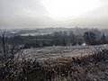
 Bower Hill Plantation, West Bretton - geograph.org.uk - 110005.jpg 640 × 480; 97 KB
-

-
 Freezing fog - geograph.org.uk - 5655615.jpg 4,608 × 3,456; 2.01 MB
-
 Frosty, Foggy Ferry Fryston from Fairburn - geograph.org.uk - 5655626.jpg 4,608 × 3,456; 3.07 MB
-
 Heath Hill Road south of Mount Tabor - geograph.org.uk - 2221745.jpg 640 × 480; 33 KB
-
 High Royds - geograph.org.uk - 1047053.jpg 640 × 428; 32 KB
-
 Mist in the valley 1 (3068423945).jpg 2,516 × 1,866; 4.92 MB
-
 Mist in the Valley 2 (3068337617).jpg 2,534 × 1,434; 3.05 MB
-
 Mist in the Valley 3 (3068334499).jpg 2,519 × 1,507; 3.08 MB
-
 Misty crossroads on Nudge Hill - geograph.org.uk - 69062.jpg 640 × 480; 42 KB
-
 Santander building, Bradford - geograph.org.uk - 5256580.jpg 640 × 458; 47 KB
-

-
 Thomson B.757 G-BYAY (8539213981).jpg 3,888 × 2,592; 2.77 MB
-
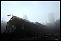
 Tower, spires, chimneys (6341651520).jpg 4,000 × 2,667; 5.55 MB


.jpg)
.jpg)
.jpg)


.jpg)
.jpg)