Category:Fluvial erosion in Scotland
Jump to navigation
Jump to search
Constituent countries of the United Kingdom: England · Scotland · Wales – British Crown dependencies: Isle of Man
Subcategories
This category has the following 11 subcategories, out of 11 total.
Media in category "Fluvial erosion in Scotland"
The following 18 files are in this category, out of 18 total.
-
 Abhainn Shira - Erosion of River Bank - geograph.org.uk - 2042577.jpg 1,499 × 842; 1.51 MB
-
 Bank of the River Add - geograph.org.uk - 305757.jpg 430 × 640; 98 KB
-
 Dry burn on the upper reaches of Canisp - geograph.org.uk - 1330527.jpg 640 × 480; 120 KB
-
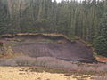 Erosion - geograph.org.uk - 109145.jpg 640 × 480; 97 KB
-
 Falls of Dochart, Killin 04.jpg 2,816 × 2,112; 1.47 MB
-
 Falls of Dochart, Killin 11.jpg 2,816 × 2,112; 1.46 MB
-
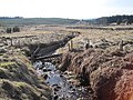
 Flash flood damage, Glen Ogle. - geograph.org.uk - 108490.jpg 480 × 640; 113 KB
-
 River Avon, Linlithgow - geograph.org.uk - 1134077.jpg 640 × 480; 100 KB
-
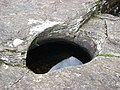
 Spar Cave - geograph.org.uk - 264216.jpg 640 × 480; 73 KB
-

-
 The Dry Burn near Wainhope - geograph.org.uk - 1754866.jpg 600 × 450; 337 KB
-
 The Duneaton Water - geograph.org.uk - 1455413.jpg 640 × 427; 125 KB
-
 The Medwin Water - geograph.org.uk - 556623.jpg 640 × 480; 120 KB
-

-

-
 River Isla at Crathies - geograph.org.uk - 651233.jpg 640 × 417; 98 KB
-
 South Medwin - geograph.org.uk - 121080.jpg 640 × 480; 133 KB
-
 The Douglas Water - geograph.org.uk - 170016.jpg 640 × 480; 112 KB


