Category:Floods in Florida
Jump to navigation
Jump to search
States of the United States: Alabama · Alaska · Arizona · Arkansas · California · Colorado · Connecticut · Delaware · Florida · Georgia · Hawaii · Idaho · Illinois · Indiana · Iowa · Kansas · Kentucky · Louisiana · Maine · Maryland · Massachusetts · Michigan · Minnesota · Mississippi · Missouri · Montana · Nebraska · Nevada · New Hampshire · New Jersey · New Mexico · New York · North Carolina · North Dakota · Ohio · Oklahoma · Oregon · Pennsylvania · Rhode Island · South Carolina · South Dakota · Tennessee · Texas · Utah · Vermont · Virginia · Washington · West Virginia · Wisconsin · Wyoming – Washington, D.C.
Subcategories
This category has the following 3 subcategories, out of 3 total.
F
- Flooded roads in Florida (18 F)
- 2023 Fort Lauderdale floods (3 F)
Media in category "Floods in Florida"
The following 42 files are in this category, out of 42 total.
-
 05-04 FloodOchlockonee.jpg 1,000 × 689; 160 KB
-
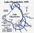
 1928 Okeechobee Flood.png 855 × 819; 172 KB
-
 1928 Okeechobee Flood.svg 802 × 768; 10.36 MB
-
 2023 florida floods.jpg 1,840 × 1,931; 556 KB
-
 Alberto-flooding.jpg 585 × 302; 75 KB
-
 Brickell flooding August 1, 2017.jpg 4,032 × 3,024; 2.71 MB
-

-
 CR419 South - When Flooded Turn Around Sign (43910400674).jpg 2,400 × 1,600; 1.38 MB
-
 Docks Under Water 2016 (10) (29526950325).jpg 3,088 × 2,056; 2.87 MB
-
 Docks Under Water 2016 (11) (29417700362).jpg 3,088 × 2,056; 2.72 MB
-
 Docks Under Water 2016 (12) (29492330016).jpg 3,088 × 2,056; 2.84 MB
-
 Docks Under Water 2016 (13) (29526946645).jpg 3,088 × 2,056; 2.48 MB
-
 Docks Under Water 2016 (14) (28901541644).jpg 3,088 × 2,056; 2.62 MB
-
 Docks Under Water 2016 (15) (29526944005).jpg 3,088 × 2,056; 2.75 MB
-
 Docks Under Water 2016 (16) (29526941855).jpg 3,088 × 2,056; 3.31 MB
-
 Docks under water 2016 (7) (29417706132).jpg 3,088 × 2,056; 2.77 MB
-
 Docks under water 2016 (8) (28901551484).jpg 3,088 × 2,056; 2.92 MB
-
 Docks under water 2016 (9) (29417702862).jpg 3,088 × 2,056; 2.53 MB
-
 FEMA - 574 - Photograph by Kevin Galvin taken on 10-07-2000 in Florida.jpg 3,224 × 2,167; 1.29 MB
-
 Flickr - DVIDSHUB - National Guardsmen Evacuate Florida Residents in Wake of Fay.jpg 1,689 × 1,113; 390 KB
-
 Flood - Stuart Florida, October 1995.jpg 4,178 × 2,713; 5.8 MB
-
 Flood Levels, Manatee Springs State Park.JPG 5,184 × 3,456; 10.43 MB
-
 Flood Markers in Aripeka.jpg 1,818 × 1,228; 795 KB
-
 Flood102405.JPG 1,600 × 1,200; 1,012 KB
-
 Gabrielle damage (2001).jpg 640 × 480; 68 KB
-
 Idalia storm surge Bayshore Blvd Tampa.jpg 5,568 × 3,712; 13.39 MB
-
 Irma flooding in Ortega (Jacksonville).jpg 1,280 × 960; 753 KB
-
 Lake Iamonia Flooding April 2009.jpg 1,092 × 800; 91 KB
-
 Las Olas Blvd flooded at high tide. - panoramio.jpg 3,264 × 2,448; 2.08 MB
-
 Leslie Flooding.jpg 400 × 300; 34 KB
-

-
 Manatee Springs State Park Florida flood levels01.jpg 2,448 × 3,264; 3.46 MB
-

-
 OchlockoneeRiver1975.jpg 1,796 × 1,153; 1.47 MB
-
 Potential Tropical Cyclone Ten rainfall totals in Florida.jpg 484 × 387; 41 KB
-
 Rain Flood in Key West Florida November 1980.jpg 1,831 × 1,240; 1.14 MB
-
 Sarasota - My Home after 8 Inches of Rain (1995).jpg 1,000 × 643; 372 KB
-
 Standing water on US Sugar Corporation fields following 1947 hurricane.jpg 5,992 × 4,816; 11.79 MB
-
 The first band of Hurricane Idalia as it reached Hudson Beach, Florida.png 3,796 × 2,847; 10.59 MB
-

-
 Wakulla River Lower Bridge flooding 2019-03-22.jpg 1,200 × 900; 442 KB
-
 Wall Street, Key West Florida - July 1975 Flood.jpg 4,836 × 3,209; 10.46 MB


.jpg)
_(29526950325).jpg)
_(29417700362).jpg)
_(29492330016).jpg)
_(29526946645).jpg)
_(28901541644).jpg)
_(29526944005).jpg)
_(29526941855).jpg)
_(29417706132).jpg)
_(28901551484).jpg)
_(29417702862).jpg)


.jpg)

.jpg)


.jpg)


.jpg)


