Category:Flood damage in the United States
Jump to navigation
Jump to search
Countries of the Americas: Argentina · Brazil · Canada · Costa Rica · El Salvador · Haiti · Mexico · Peru · United States of America
Subcategories
This category has the following 9 subcategories, out of 9 total.
A
- Flood damage in Alaska (5 F)
F
- Flood damage in Montana (1 F)
G
- 1936 Guadalupe River flood (12 F)
- 1972 Guadalupe River flood (24 F)
H
J
- Johnstown flood of 1977 (23 F)
W
Media in category "Flood damage in the United States"
The following 200 files are in this category, out of 214 total.
(previous page) (next page)-
 100501-N-0000X-004 (4582011594).jpg 1,766 × 978; 516 KB
-
 160926-Z-OB216-281 (30080961026).jpg 5,184 × 3,456; 6.21 MB
-
 170927-Z-CD688-257 (23527444578).jpg 4,713 × 3,366; 1.34 MB
-
 1889 Johnstown flood - panoramio.jpg 1,950 × 1,083; 569 KB
-
1938 flood at Atwood.webm 1 min 24 s, 640 × 428; 10.95 MB
-
1938 flood at Olive.webm 56 s, 640 × 428; 7.39 MB
-
 1940 Flood Cullowhee1.jpg 500 × 337; 42 KB
-
 2013 Colorado floods search and rescue operations in Jamestown, Colorado.jpg 3,648 × 2,736; 2.63 MB
-
 2020 Hermiston flood damage.jpeg 4,032 × 3,024; 4.11 MB
-
 2020 Walla Walla River flood.jpeg 4,032 × 3,024; 2.82 MB
-

-

-

-

-

-

-
 4 July 2002 Floods - Blue Hole Park, Georgetown, TX.JPG 2,160 × 1,440; 943 KB
-
Aerial views of 140-ton lattice boom crane removing flood debris from Poso Creek, Wasco, California, USA.webm 8 min 42 s, 3,840 × 2,160; 1.02 GB
-
 After the Flood at Johnstown -- Main Street.jpg 869 × 637; 197 KB
-
 Aftermath of 1913 flood.jpg 748 × 454; 60 KB
-
 AFTERMATH OF FLOODING NEAR LAKE MICHIGAN IN ZION - NARA - 547081.jpg 3,000 × 2,023; 801 KB
-
 AFTERMATH OF FLOODING OF LAKE MICHIGAN IN ZION - NARA - 547030.jpg 2,036 × 3,000; 832 KB
-
 AFTERMATH OF SEVERE STORM IN ZION - NARA - 547036.jpg 3,000 × 2,012; 1.07 MB
-
 AFTERMATH OF SEVERE STORM IN ZION-BIRD PERCHED ON STREWN GARBAGE - NARA - 547039.jpg 3,000 × 2,028; 792 KB
-

-
 Allisonia section of the trail (8435887042).jpg 4,288 × 3,216; 3.51 MB
-
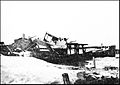
 Austin Dam - Flood wreck LOC 2163737374.jpg 1,024 × 745; 184 KB
-
 Austin Dam Disaster - RR Bridge, Costello LOC 2163738680.jpg 1,024 × 744; 196 KB
-
 B139 St smashed house Sandy jeh.jpg 3,000 × 2,500; 1.31 MB
-
 B204 wrecked beach house Sandy jeh.jpg 3,600 × 2,500; 1.49 MB
-
 B217 beach houses shoved off piers Sandy jeh.jpg 3,000 × 2,400; 1.22 MB
-
 B219 beach house atilt Sandy jeh.jpg 2,400 × 2,000; 1.01 MB
-
 Baby Strapped to Back (16988998062).jpg 3,269 × 2,090; 788 KB
-
 Baseball diamond after Hurricane Irene flooding, Grahamsville, NY.jpg 4,188 × 2,532; 3.34 MB
-
 BinghamtonTSLee2011.jpg 1,024 × 768; 144 KB
-
 Bread Line (16802893570).jpg 3,295 × 2,099; 1.27 MB
-
 Bread Line (16964464656).jpg 3,279 × 2,065; 1.7 MB
-
 C. & O. railroad yard damaged by flood - NARA - 279796.jpg 3,000 × 1,780; 1.1 MB
-
 CA-84 Woodside April 2023 002.jpg 5,464 × 3,640; 11.52 MB
-

-
 Culverts at Carbon.jpg 1,707 × 1,280; 2.43 MB
-
 Damage from Hurricane Irene flooding to Butternut Drive, New Windsor, NY.jpg 3,764 × 2,812; 7.7 MB
-
 Deep gorge created in road after Hurricane Irene flooding, Oliverea, NY.jpg 3,652 × 2,588; 7.67 MB
-
 Deer Hill Trail National Public Lands Day 2017 (23819304718).jpg 6,719 × 4,484; 18.68 MB
-
 Deer Hill Trail National Public Lands Day 2017 (36962138174).jpg 7,360 × 4,912; 15.5 MB
-
 Destroyed fishing pier on Boyer Chute.jpg 2,816 × 2,112; 1.41 MB
-
 Dyer-lond-road-damage-tn2.jpg 3,840 × 2,131; 3.24 MB
-
 Dyer-long-road-damage-tn1.jpg 3,903 × 2,859; 3.67 MB
-
 Dyer-long-road-damage-tn3.jpg 3,753 × 2,010; 2.43 MB
-
 Eroded bluff threatening house on Butternut Drive, New Windsor, NY.jpg 4,048 × 2,900; 7.28 MB
-
 FEMA - 21493 - Photograph by Bob McMillan taken on 05-09-2002 in West Virginia.jpg 1,818 × 1,228; 452 KB
-
 FEMA - 32705 - USGS surveying flood damage in Ohio for future flood maps.jpg 3,000 × 1,955; 1.35 MB
-
 FEMA - 36406 - Sinkhole caused by flooding being repaired in Iowa.jpg 4,000 × 2,667; 3.31 MB
-
 Fishing in a soybean field.jpg 6,016 × 4,000; 6.51 MB
-
 Flood at Cedar Falls, Washington, 1915 (WASTATE 616).jpeg 768 × 481; 74 KB
-
 Flood Damage (Southern Indiana).jpg 3,872 × 2,592; 2.9 MB
-
 FLOOD DAMAGE - NARA - 544580.jpg 3,000 × 2,021; 1,022 KB
-
 Flood damage ditch siltation.jpg 3,000 × 1,969; 405 KB
-

-
 Flood scenes, Dayton, Ohio? LCCN2016864653.jpg 1,024 × 753; 162 KB
-
 Flood scenes, Dayton, Ohio? LCCN2016864653.tif 10,153 × 7,463; 144.54 MB
-
 FLOOD-DAMAGED HOUSEBOAT - NARA - 544445.jpg 2,021 × 3,000; 1,004 KB
-
-

-
 Flooded pumpkin patch.jpg 1,170 × 820; 1.35 MB
-
-

-

-
-
 Floods in Grant County (5727397054).jpg 640 × 480; 75 KB
-
 Forge Hill Road bridge washout after Hurricane Irene, New Windsor, NY.jpg 4,288 × 3,216; 7.52 MB
-
 Galveston - 1900 wreckage.jpg 1,200 × 799; 333 KB
-
 GaysMillsFloodDamage2010.jpg 934 × 630; 229 KB
-

-
 Great blue heron flying over soybeans.jpg 6,016 × 4,000; 6.47 MB
-
 Greeley, CO, September 19, 2013 (12441526333).jpg 800 × 520; 154 KB
-
-
 House turned over by flood - NARA - 279814.jpg 1,757 × 3,000; 1.14 MB
-
 Hurricane Ivan Damage in Gulf Breeze, FL 2.jpg 3,894 × 2,592; 3.66 MB
-
 Hurricane Ivan Damage in Gulf Breeze, FL.jpg 2,592 × 3,894; 2.65 MB
-

-
 Interpretive display and waterline.jpg 2,816 × 2,112; 2.18 MB
-
 Jamestown, CO, November 19, 2013 (12441388785).jpg 4,608 × 3,456; 5.21 MB
-
 Jamestown, CO, November 19, 2013 (12441526943).jpg 4,608 × 3,456; 5.65 MB
-

-
 Jamestown, Colorado Cut Off by 2013 Colorado Floods.jpg 3,000 × 2,000; 5.33 MB
-

-
 June 2010 Arkansas floods - 4.jpg 640 × 480; 140 KB
-
 Klamath Septic Leach Field.JPG 1,216 × 912; 306 KB
-
 Lisle flood.jpg 1,341 × 942; 744 KB
-
 Looking at the Aftermath of the Kansas City Flood - 1951 (FDA 090) (8250647260).jpg 7,168 × 4,720; 12.64 MB
-
 Lynn Township flood-damaged cornfield.jpg 6,016 × 4,000; 6.26 MB
-

-

-

-
 Metropolitan Transportation Authority (New York)- IMG-20110831-00102 (6100921706).jpg 2,048 × 1,536; 1.12 MB
-
 Metropolitan Transportation Authority (New York)- IMG-20110831-00104 (6100388249).jpg 2,048 × 1,536; 1.05 MB
-

-
 Mill Creek bridge damage.jpeg 4,032 × 3,024; 4.35 MB
-
 N Austin Ave Bridge at 15-foot flood stage.JPG 2,160 × 1,440; 650 KB
-
 Nashville flooded yard.jpg 599 × 800; 136 KB
-
 Near Elysian Park, CO, November 19, 2013 (12441389515).jpg 4,608 × 3,456; 4.97 MB
-
 Near Lyons, CO, October 31, 2013 (12441386635).jpg 4,608 × 3,456; 5.14 MB
-

-
 Nebraska Task Force 1 Conducts Search and Rescue Operations.jpg 3,648 × 2,736; 3.35 MB
-

-
 Oregon 202 at mile point 5.5 (3191769293).jpg 640 × 480; 261 KB
-
 Oregon 202 at mile point 5.5 (3192616602).jpg 640 × 480; 235 KB
-
 Oregon 22 at mile point 11 (3192614460).jpg 2,816 × 2,112; 4.38 MB
-
 Oregon 22 at mile point 11 (3192616420).jpg 2,816 × 2,112; 5.08 MB
-
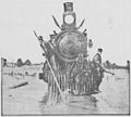 Partially-submerged locomotive (Akron, 1904).jpg 1,296 × 1,168; 812 KB
-
 Pavement washed off Peekamoose Road after Hurricane Irene, Sundown, NY.jpg 3,932 × 2,400; 3.6 MB
-
 Peekamoose Valley Wild Forest after Hurricane Irene floods, Sundown, NY.jpg 3,584 × 2,796; 4.08 MB
-
 Pennsylvania - Susquehanna River - NARA - 68148535.jpg 6,923 × 5,485; 17.94 MB
-
 Pennsylvania National Guard (37587475852).jpg 2,100 × 1,500; 1.29 MB
-
 Pippin-road-flood-damage-tn1.jpg 3,840 × 2,160; 3.62 MB
-
 Pippin-road-flood-damage-tn2.jpg 3,840 × 2,160; 3.17 MB
-
 PJ Line bet. Sloatsburg and Suffern (6093811271).jpg 3,008 × 2,000; 3.29 MB
-
 Ponchatoula Creek north from LA 1064.JPG 2,981 × 2,212; 2.01 MB
-
 Pontoon Bridge (16989453791).jpg 3,215 × 2,063; 835 KB
-
 Pontoon Bridge Wrecked (16989462761).jpg 3,232 × 2,070; 1.17 MB
-
 Port Jervis Line bet. Sloatsburg and Harriman (6094348128).jpg 3,008 × 2,000; 3.08 MB
-
 Port Jervis Line tracks damaged by flooding, Sloatsburg, NY.jpg 3,828 × 3,024; 8.94 MB
-
 Port Jervis washout (6095270252).jpg 3,008 × 2,000; 2.9 MB
-
 PortJervisWashoutIrene.jpg 3,008 × 2,000; 2.89 MB
-
 Post-Irene Moodna Creek panorama from Forge Hill Road bridge, New Windsor, NY.jpg 4,224 × 1,584; 4.89 MB
-
 PR 141017 AerialNelson 161.jpg 3,000 × 1,900; 6.35 MB
-
 PR DR4339.jpg 2,400 × 1,602; 5.87 MB
-
 PR141017GuajatacaDam154.jpg 3,000 × 1,900; 6.25 MB
-
 PSM V73 D187 Ruins of a brick house caused by the freshet of may 21 1901.png 1,666 × 1,292; 714 KB
-
 PSM V86 D562 Vicinity of seabright new jersey.jpg 1,149 × 1,675; 189 KB
-
 PSM V86 D563 Ruins of octagon hotel seabright.jpg 1,580 × 994; 322 KB
-
 PSM V86 D564 Houses being undermined from rear.jpg 1,552 × 1,076; 145 KB
-
 PSM V86 D565 Undermining of sandbar causing collapse of house.jpg 1,584 × 1,105; 308 KB
-
 PSM V86 D566 House undermined by waves.jpg 1,590 × 1,078; 291 KB
-
 PSM V86 D568 Breaching of bulkhead and beginning of undermining.jpg 1,578 × 1,188; 297 KB
-
 PSM V86 D568 First stage of wave attack on protected house.jpg 1,584 × 1,103; 241 KB
-
 PSM V86 D569 Last stage of wave attack on house.jpg 1,588 × 1,122; 177 KB
-
 PSM V86 D569 Sandy foundation removed by wave erosion.jpg 1,587 × 1,065; 274 KB
-
 Ramapo-20110831-00082 (6100372595).jpg 2,048 × 1,536; 1.15 MB
-
 Ramapo-20110831-00093 (6099963331).jpg 2,048 × 1,536; 909 KB
-
 Ramapo-20110831-00095 (6100920348).jpg 2,048 × 1,536; 1.11 MB
-
 Ramapo-20110831-00096 (6100374485).jpg 2,048 × 1,536; 1.17 MB
-
 Ramapo-20110831-00103 (6100935354).jpg 2,048 × 1,536; 1.08 MB
-
 Raritan River Flood, New Brunswick, NJ.JPG 5,184 × 3,456; 4.25 MB
-
 Reis jam 02 1904.jpg 912 × 621; 385 KB
-

-
 Repairs to Catskill Mountain Railroad folowing Hurricane Irene.jpg 3,824 × 2,608; 7 MB
-
 Results of the 1904 Cleveland flood.jpg 1,372 × 1,700; 1.55 MB
-

-
-
 Road damaged by flood.jpg 435 × 580; 70 KB
-
 Rondout Creek after Hurricane Irene.jpg 3,006 × 3,414; 2.78 MB
-

-
 Runaway Pond Glover VT.JPG 4,000 × 2,248; 2.05 MB
-
 Sacramento River broken levee.jpg 1,051 × 1,500; 716 KB
-
 Sandy Damage Bay Bkwy 2 jeh.JPG 3,600 × 2,400; 1.4 MB
-
 Sandy Damage Bay Bkwy 3 jeh.JPG 3,600 × 3,000; 1.99 MB
-
 Sanlando Springs after Hurricane Frances 2004.jpg 9,542 × 6,420; 58.4 MB
-
 Sargent bridge remains from N bank 1.jpg 1,709 × 1,548; 1.18 MB
-
 Schultz Pass Road (9358367133).jpg 4,608 × 3,456; 6.33 MB
-
 Schultz Pass Road (9361150558).jpg 4,608 × 3,456; 6.22 MB
-
 Seattle - flood damage at 4th Avenue S. & Barton Street, 1943.jpg 1,200 × 922; 436 KB
-

-

-
 Skykomish River flood, Index, 1917 (PICKETT 907).jpeg 768 × 553; 62 KB
-
 SmashedOnPleasureStreet1.jpg 2,592 × 1,567; 1.33 MB
-
 Storm damage clean-up at White River NFH (6148364801).jpg 5,616 × 3,744; 6.11 MB
-
 Storm damage relief at White River NFH (6148352295).jpg 5,616 × 3,744; 6.29 MB
-
 Storm damage relief at White River NFH (6148354777).jpg 5,616 × 3,744; 8.06 MB
-
 Storm damage relief at White River NFH (6148367325).jpg 5,616 × 3,744; 7.17 MB
-
 Storm damage relief at White River NFH (6148375737).jpg 5,616 × 3,744; 6.81 MB
-
 Storm damage relief at White River NFH (6148381715).jpg 5,616 × 3,744; 7.64 MB
-
 Storm damage relief at White River NFH (6148383897).jpg 5,616 × 3,744; 7.55 MB
-
 Storm damage relief at White River NFH (6148409405).jpg 5,616 × 3,744; 5.79 MB
-
 Storm damage relief at White River NFH (6148424443).jpg 5,616 × 3,744; 6.41 MB
-
 Storm damage relief at White River NFH (6148426737).jpg 5,616 × 3,744; 7.07 MB
-
 Storm damage relief at White River NFH (6148430961).jpg 5,616 × 3,744; 7.25 MB
-
 Storm damage relief at White River NFH (6148436483).jpg 5,616 × 3,744; 8.93 MB
-
 Storm damage relief at White River NFH (6148441471).jpg 5,616 × 3,744; 8.49 MB
-
 Storm damage relief at White River NFH (6148444267).jpg 5,616 × 3,744; 8.55 MB
-
 Storm damage relief at White River NFH (6148908702).jpg 5,616 × 3,744; 8.09 MB
-
 Storm damage relief at White River NFH (6148920984).jpg 5,616 × 3,744; 7.57 MB
-
 Storm damage relief at White River NFH (6148924044).jpg 5,616 × 3,744; 7.55 MB
-
 Storm damage relief at White River NFH (6148930098).jpg 5,616 × 3,744; 9.05 MB
-
 Storm damage relief at White River NFH (6148943822).jpg 5,616 × 3,744; 9.83 MB
-
 Storm damage relief at White River NFH (6148947776).jpg 5,616 × 3,744; 12.65 MB
-
 Storm damage relief at White River NFH (6148950598).jpg 5,616 × 3,744; 8.44 MB
-
 Storm damage relief at White River NFH (6148957990).jpg 5,616 × 3,744; 12.32 MB
-
 Storm damage relief at White River NFH (6148973186).jpg 5,616 × 3,744; 8.87 MB
-
 Storm damage relief at White River NFH (6148979338).jpg 5,616 × 3,744; 6.38 MB
-
 Storm damage relief at White River NFH (6148996190).jpg 5,616 × 3,744; 4.92 MB
-
 Storm damage relief at White River NFH (6148998684).jpg 5,616 × 3,744; 7.81 MB
-
 Storm damage relief at White River NFH (6149000742).jpg 5,616 × 3,744; 6.23 MB
-

-
 Superstorm Sandy Pasanella Exterior.jpg 3,264 × 2,448; 1.48 MB
-
 Superstorm Sandy Pasanella Interior.jpg 3,264 × 2,448; 1.55 MB
-
 Texas - Freeport - NARA - 68149317 (page 1).jpg 6,923 × 5,485; 15.53 MB
-
 Texas - Freeport - NARA - 68149320 (page 1).jpg 6,923 × 5,485; 15.85 MB
-
 The street railway review (1891) (14573744038).jpg 2,134 × 804; 172 KB
.jpg)
.jpg)
.jpg)


_just_east_of_New_York_State_Route_43_and_New_York_State_Route_66_in_Sand_Lake,_Rensselaer_County,_New_York.jpg)
_just_east_of_New_York_State_Route_43_and_New_York_State_Route_66_in_Sand_Lake,_Rensselaer_County,_New_York.jpg)
_just_east_of_New_York_State_Route_43_and_New_York_State_Route_66_in_Sand_Lake,_Rensselaer_County,_New_York.jpg)
_just_east_of_New_York_State_Route_43_and_New_York_State_Route_66_in_Sand_Lake,_Rensselaer_County,_New_York.jpg)
_just_east_of_New_York_State_Route_43_and_New_York_State_Route_66_in_Sand_Lake,_Rensselaer_County,_New_York.jpg)
_in_Sand_Lake,_Rensselaer_County,_New_York.jpg)


.jpg)


.jpg)


.jpg)
.jpg)


.jpeg)


.jpg)
.jpg)


.jpeg)
.jpg)


.jpeg)


.jpg)
.jpeg)

.jpeg)
.jpeg)
.jpeg)

.jpg)


.jpg)


.jpg)
.jpg)
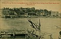
_which_are_being_provided_by_the_Red_Cross._The_town_was_devastated_by_floo_-_DPLA_-_968bccd3f8fd97d59e322894be8ecbd0.jpg)

.jpg)


_(8250647260).jpg)


.jpg)
.jpg)


.jpg)
.jpg)
.jpg)
.jpg)
.jpg)


.jpg)


.jpg)

.jpg)
.jpg)
.jpg)

.jpg)


.jpg)
.jpg)
.jpg)
.jpg)
.jpg)


.jpg)


.jpg)


.jpg)
.jpg)

.jpeg)
.jpeg)
.jpeg)

.jpg)
.jpg)
.jpg)
.jpg)
.jpg)
.jpg)
.jpg)
.jpg)
.jpg)
.jpg)
.jpg)
.jpg)
.jpg)
.jpg)
.jpg)
.jpg)
.jpg)
.jpg)
.jpg)
.jpg)
.jpg)
.jpg)
.jpg)
.jpg)
.jpg)
.jpg)
.jpg)
.jpg)


.jpg)
.jpg)
-_IMG-20110831-00102_(6100921706).jpg)
-_IMG-20110831-00104_(6100388249).jpg)
_(14573744038).jpg)