Category:Fliegerhorst Goslar
Jump to navigation
Jump to search
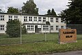
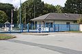
Deutsch: Das Gelände des zivilen Flughafens und späteren Fliegerhorstes Goslar liegt am nördlichen Stadtrand der niedersächsischen Stadt Goslar.
| Object location | | View all coordinates using: OpenStreetMap |
|---|
former military airbase in Germany  | |||||
| Upload media | |||||
| Instance of | |||||
|---|---|---|---|---|---|
| Location | Q107791060, Goslar, Lower Saxony, Germany | ||||
| Inception |
| ||||
| End time |
| ||||
 | |||||
Media in category "Fliegerhorst Goslar"
The following 10 files are in this category, out of 10 total.
-
 02.1-Frühere Flugleitung, Fliegerhorst Goslar, 20-08-2013.jpg 4,272 × 2,848; 5.58 MB
-
 06.1-Hauptwache, Fliegerhorst Goslar, 20-08-2013.jpg 4,272 × 2,848; 5.95 MB
-
 13.1-Alte Wache, Fliegerhorst Goslar, 20-08-2013.jpg 4,272 × 2,848; 7.71 MB
-
 46.1-Offizierskasino, 23-11-2016.jpg 4,272 × 2,848; 4.67 MB
-
 Fliegerhorst Goslar (Juli 2018) 01.jpg 3,264 × 2,448; 2.9 MB
-
 Fliegerhorst Goslar (Juli 2018) 02.jpg 1,236 × 1,460; 563 KB
-
 Fliegerhorst Goslar (Juli 2018) 03.jpg 3,263 × 1,641; 1.68 MB
-
 Fliegerhorst Goslar (Juli 2018) 04.jpg 3,263 × 1,361; 1.17 MB
-
 Goslar (Fliegerhorst) Walter-Krämer-Straße.jpeg 2,521 × 1,145; 803 KB
-
 Verkehrslandeplatz Goslar (Nachrichten für Luftfahrer 1927).jpg 393 × 268; 81 KB


_01.jpg)
_02.jpg)
_03.jpg)
_04.jpg)
_Walter-Kr%C3%A4mer-Stra%C3%9Fe.jpeg)
.jpg)