Category:Fisherwick
Jump to navigation
Jump to search
English: Fisherwick is a civil parish in Lichfield District, Staffordshire, England. Located about east of the City of Lichfield, the parish does not include a village, just a scattered collection of farms and houses. The ancient settlement, dating back to the 12th century, and the manor of Fisherwick Park no longer exist.
hamlet and civil parish in Staffordshire, England  | |||||
| Upload media | |||||
| Instance of | |||||
|---|---|---|---|---|---|
| Location | Lichfield, Staffordshire, West Midlands, England | ||||
 | |||||
Media in category "Fisherwick"
The following 83 files are in this category, out of 83 total.
-
 "4 tracking" - rail engineering works - geograph.org.uk - 298357.jpg 640 × 480; 95 KB
-
 A field next to the River Tame - geograph.org.uk - 2109450.jpg 480 × 640; 88 KB
-
 A line of trees - geograph.org.uk - 4894862.jpg 587 × 640; 70 KB
-
 A small field of maize - geograph.org.uk - 2830042.jpg 640 × 430; 52 KB
-
 A snowy rural landscape near Comberford - geograph.org.uk - 2221538.jpg 640 × 430; 108 KB
-
 Arable land, Comberford - geograph.org.uk - 3657883.jpg 640 × 430; 39 KB
-
 Beech and Pine in Hopwas wood - geograph.org.uk - 2123104.jpg 426 × 640; 163 KB
-
 Birmingham and Fazeley Canal - geograph.org.uk - 6132911.jpg 640 × 480; 44 KB
-

-

-

-
 Canal and road in Hademore - geograph.org.uk - 4707264.jpg 800 × 534; 115 KB
-
 Canal south-east of Whittington in Staffordshire - geograph.org.uk - 5703409.jpg 1,280 × 960; 1.35 MB
-
 Canal south-east of Whittington in Staffordshire - geograph.org.uk - 5703416.jpg 1,280 × 867; 1.29 MB
-
 Canal south-east of Whittington in Staffordshire - geograph.org.uk - 6249605.jpg 1,280 × 960; 1.55 MB
-
 Cottages east of Whittington in Staffordshire - geograph.org.uk - 6249610.jpg 1,440 × 960; 1.4 MB
-
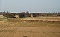
 Crop field near Hademore - geograph.org.uk - 5334110.jpg 640 × 423; 55 KB
-
 Crops and farmland near Hademore - geograph.org.uk - 2221534.jpg 640 × 347; 60 KB
-
 Entrance to Fisherwick Lakes - geograph.org.uk - 2632181.jpg 640 × 428; 113 KB
-
 Entrance to Hademore Farm, Hademore - geograph.org.uk - 2507395.jpg 640 × 428; 61 KB
-
 Fallow field - geograph.org.uk - 3850826.jpg 640 × 430; 53 KB
-
 Farmland by the WCML - geograph.org.uk - 3733982.jpg 640 × 430; 31 KB
-
 Farmland by the West Coast Main Line - geograph.org.uk - 3850822.jpg 640 × 430; 55 KB
-
 Farmland in the Tame Valley - geograph.org.uk - 4844572.jpg 640 × 426; 43 KB
-
 Farmland near Comberford - geograph.org.uk - 2221536.jpg 640 × 430; 101 KB
-
 Farmland near Comberford - geograph.org.uk - 2830054.jpg 640 × 430; 33 KB
-
 Farmland near Hademore - geograph.org.uk - 2830038.jpg 640 × 430; 30 KB
-
 Farmland near Hademore - geograph.org.uk - 3850829.jpg 640 × 430; 48 KB
-
 Farmland near Hademore - geograph.org.uk - 3850840.jpg 640 × 430; 47 KB
-
 Farmland, Comberford - geograph.org.uk - 4894867.jpg 640 × 426; 37 KB
-
 Farmland, Comberford - geograph.org.uk - 4894868.jpg 640 × 426; 38 KB
-
 Fields near Comberford - geograph.org.uk - 5334103.jpg 640 × 337; 39 KB
-
 Fields near Hademore - geograph.org.uk - 5334106.jpg 640 × 301; 41 KB
-
 Fisherwick Road to Copes Lodge - geograph.org.uk - 2507411.jpg 640 × 428; 76 KB
-
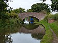
 Hademore Farm Bridge - geograph.org.uk - 4707272.jpg 800 × 600; 148 KB
-
 Hademore House Bridge - geograph.org.uk - 4707269.jpg 800 × 584; 198 KB
-
 Haystack, Fisherwick - geograph.org.uk - 4894864.jpg 640 × 372; 31 KB
-
 House along Fisherwick Road - geograph.org.uk - 4707258.jpg 800 × 634; 173 KB
-
 In the Tame Valley - geograph.org.uk - 3657879.jpg 640 × 420; 40 KB
-
 In the Tame Valley - geograph.org.uk - 4335264.jpg 640 × 430; 41 KB
-
 Industry near Whittington Bridge - geograph.org.uk - 4369665.jpg 640 × 341; 28 KB
-
 Isolated tree - geograph.org.uk - 4369664.jpg 640 × 343; 33 KB
-
 Large snow covered field near Hademore - geograph.org.uk - 2221533.jpg 640 × 430; 106 KB
-
 Level Crossing, Hademore - geograph.org.uk - 266192.jpg 640 × 480; 87 KB
-
 Localised flooding by the River Tame - geograph.org.uk - 4756883.jpg 640 × 426; 47 KB
-
 Minor road, Stubby Leas - geograph.org.uk - 5335579.jpg 640 × 480; 100 KB
-

-

-
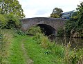
 Old Bridge - geograph.org.uk - 433003.jpg 640 × 480; 109 KB
-
 Paddocks - geograph.org.uk - 4756882.jpg 640 × 426; 43 KB
-
 Paddocks - geograph.org.uk - 4844577.jpg 640 × 426; 49 KB
-
 Pillbox and Virgin Train - geograph.org.uk - 4031960.jpg 1,280 × 849; 250 KB
-
 Pillbox near Hopwas Hays Wood - geograph.org.uk - 4031964.jpg 1,280 × 847; 334 KB
-
 Red field, Comberford - geograph.org.uk - 3657885.jpg 640 × 402; 41 KB
-
 River Tame - geograph.org.uk - 2221542.jpg 640 × 334; 68 KB
-
 River Tame - geograph.org.uk - 3850812.jpg 640 × 430; 62 KB
-
 River Tame - geograph.org.uk - 4370707.jpg 640 × 283; 18 KB
-
 River Tame near Hopwas - geograph.org.uk - 4031969.jpg 1,280 × 960; 250 KB
-
 River Tame, Elford Bridge - geograph.org.uk - 5335574.jpg 640 × 480; 42 KB
-
 Rural landscape near Comberford - geograph.org.uk - 2830049.jpg 640 × 430; 38 KB
-
 Shallow valley - geograph.org.uk - 4335267.jpg 640 × 430; 54 KB
-
 Small stream - geograph.org.uk - 4894870.jpg 640 × 426; 44 KB
-
 Staffordshire farmland south-east of Whittington - geograph.org.uk - 5703403.jpg 1,280 × 845; 1.15 MB
-
 Staffordshire farmland south-east of Whittington - geograph.org.uk - 5703408.jpg 1,280 × 960; 1.32 MB
-
 Stubble field, Stubby Leas - geograph.org.uk - 5335576.jpg 640 × 480; 113 KB
-
 Tamhorn Farm Bridge north of Hopwas in Staffordshire - geograph.org.uk - 6249592.jpg 1,440 × 960; 1.71 MB
-
 Tamhorn Farm Bridge north of Hopwas in Staffordshire - geograph.org.uk - 6249595.jpg 1,440 × 960; 1.94 MB
-
 Tamhorn Farm Bridge.jpg 800 × 593; 151 KB
-
 Tamhorn House - geograph.org.uk - 4844575.jpg 640 × 426; 66 KB
-
 Tamhorn House Bridge.jpg 800 × 622; 184 KB
-
 Tamhorn Park Bridge - geograph.org.uk - 4707299.jpg 800 × 608; 241 KB
-
 Tamhorn Park Bridge north of Hopwas in Staffordshire - geograph.org.uk - 6249527.jpg 1,440 × 1,080; 2.52 MB
-
 Tamhorn Park Bridge north of Hopwas in Staffordshire - geograph.org.uk - 6249531.jpg 1,280 × 960; 1.79 MB
-
 Tamhorn Park Farm - geograph.org.uk - 4369660.jpg 640 × 430; 57 KB
-
-
 Trees on the banks of the River Tame - geograph.org.uk - 2830059.jpg 640 × 430; 43 KB
-

-

-
 View to Wind turbine - geograph.org.uk - 5358566.jpg 640 × 507; 49 KB
-

-

-
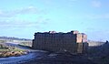
 Fisherwick Park Farm - geograph.org.uk - 266206.jpg 640 × 480; 80 KB
-
 Stubby Lea Farm - geograph.org.uk - 266193.jpg 640 × 480; 91 KB


