Category:Fingerpost, St Helens
Jump to navigation
Jump to search
| Object location | | View all coordinates using: OpenStreetMap |
|---|
A district of St Helens, Merseyside
Subcategories
This category has the following 3 subcategories, out of 3 total.
Media in category "Fingerpost, St Helens"
The following 5 files are in this category, out of 5 total.
-
 Fingerpost Shops - geograph.org.uk - 603625.jpg 640 × 480; 59 KB
-
 Higher Parr Street, Fingerpost.jpg 5,075 × 2,800; 14.41 MB
-
 RCCG Saints Church, Fingerpost.jpg 4,793 × 3,202; 22.8 MB
-
 Thrifty's, Fingerpost.jpg 4,594 × 3,377; 19.5 MB
-
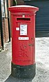 Post box at Higher Parr Street Post Office, St Helens.jpg 2,967 × 4,984; 13.32 MB


