Category:Finger Hill
Jump to navigation
Jump to search
Highest hill of Peng Chau, in Hong Kong  | |||||
| Upload media | |||||
| Instance of | |||||
|---|---|---|---|---|---|
| Location |
| ||||
| Elevation above sea level |
| ||||
 | |||||
English: Finger Hill
中文:手指山
Subcategories
This category has the following 2 subcategories, out of 2 total.
V
- Views from Finger Hill (3 F)
Media in category "Finger Hill"
The following 13 files are in this category, out of 13 total.
-
 Finger Hill from trail, Peng Chau, Hong Kong.jpg 2,592 × 1,938; 3.52 MB
-
 Finger Hill from Wing Tung Street, Peng Chau, Hong Kong.jpg 4,288 × 2,484; 1.6 MB
-
 Finger Hill Peng Chau Island Hong Kong - panoramio.jpg 2,400 × 1,800; 3.39 MB
-
 Finger Hill sign, Peng Chau.jpg 4,032 × 3,024; 3.95 MB
-
 FingerHill.jpg 1,550 × 871; 2.62 MB
-
 HK FingerHill TrigonometricalStation.jpg 2,848 × 2,136; 1.62 MB
-
 HK PengChauTungWanBeach.JPG 2,848 × 2,136; 1.34 MB
-
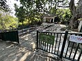 Peng Chau Finger Hill Sitting-out Area 2023.jpg 4,032 × 3,024; 2.89 MB
-
 Trigonometrical station, Finger Hill.jpg 3,024 × 4,032; 5.8 MB
-
 View (east) from east Peng Chau.jpg 4,032 × 3,024; 6.33 MB
-
 View (north) from east Peng Chau.jpg 4,032 × 3,024; 6.72 MB
-
 View (north-east) from east Peng Chau.jpg 4,032 × 3,024; 6.33 MB
-
 View south down Wing Tung Street towards Finger Hill, Peng Chau, Hong Kong.jpg 4,288 × 3,216; 6.96 MB


_from_east_Peng_Chau.jpg)
_from_east_Peng_Chau.jpg)
_from_east_Peng_Chau.jpg)
