Category:Film locations of Metro-Land (1973)
Jump to navigation
Jump to search
Subcategories
This category has the following 20 subcategories, out of 20 total.
B
G
H
I
- Interior of Grim's Dyke (11 F)
M
- Marlborough Road tube station (14 F)
O
- The Orchard, Chorleywood (1 F)
P
Q
- Quainton Road railway station (45 F)
S
W
- Watkin's Tower (14 F)
Media in category "Film locations of Metro-Land (1973)"
The following 43 files are in this category, out of 43 total.
-
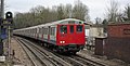
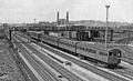
 A60 Stock at Pinner 1.jpg 3,648 × 2,736; 4.35 MB
-
 A62 Stock 5163 at Chorleywood cropped.jpg 3,322 × 2,136; 7.06 MB
-
 A62 Stock 5163 at Chorleywood.jpg 4,200 × 2,136; 5.67 MB
-
 Blenhiem Road, St John's Wood - geograph.org.uk - 546335.jpg 640 × 480; 116 KB
-
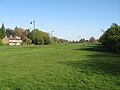
 Chorleywood Common - geograph.org.uk - 3308977.jpg 640 × 430; 54 KB
-
 Chorleywood Common - geograph.org.uk - 3418560.jpg 640 × 430; 47 KB
-
 Chorleywood Common Cricket Ground - geograph.org.uk - 1592089.jpg 640 × 480; 76 KB
-
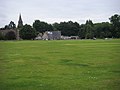 Chorleywood Common Cricket Ground - geograph.org.uk - 951159.jpg 640 × 480; 58 KB
-
 Clifton Hill (3) - geograph.org.uk - 770025.jpg 640 × 480; 110 KB
-
 Croxley Green from by the Orchard.jpg 3,041 × 2,274; 1.23 MB
-
 Gilbert's lake.jpg 2,600 × 1,950; 1.29 MB
-
 Glen Chess, Loudwater - geograph.org.uk - 131591.jpg 640 × 480; 293 KB
-

-
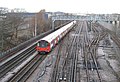
 London Underground lines from the Chiltern Main Line - DSCF0489.JPG 4,000 × 3,000; 2.98 MB
-
 Loudwater, Troutstream Way - geograph.org.uk - 605478.jpg 640 × 480; 119 KB
-

-

-
 Metropolitan Line railway near Chorleywood - geograph.org.uk - 95884.jpg 640 × 480; 163 KB
-
 Neasden Lane - geograph.org.uk - 309270.jpg 640 × 480; 76 KB
-
 Neasden Lane, London - geograph.org.uk - 1250257.jpg 640 × 480; 66 KB
-
 Neasden LT Depot A Stock (1).jpg 1,600 × 835; 1.37 MB
-
 Neasden metropolitan line station geograph-2384536-by-Ben-Brooksbank.jpg 2,394 × 1,447; 993 KB
-
 Neasden Parade (geograph 2554769).jpg 1,600 × 1,200; 812 KB
-
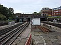
 Neasden, London Underground trackwork - geograph.org.uk - 725911.jpg 640 × 438; 95 KB
-
 Pinner - High Street - geograph.org.uk - 81890.jpg 640 × 480; 139 KB
-
 Pinner Fair (geograph 3406556).jpg 2,592 × 1,728; 1.17 MB
-
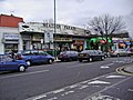
 Pinner shopping centre - geograph.org.uk - 92855.jpg 500 × 375; 69 KB
-
 Postcard British Empire Exhibition 1924 23.jpg 844 × 539; 338 KB
-
 Rail lines from Dudden Hill Lane - geograph.org.uk - 574791.jpg 640 × 480; 123 KB
-
-
 Railway trackbed near Shipton Lee - geograph.org.uk - 379579.jpg 640 × 480; 161 KB
-
 Railway trackbed near Shipton Lee 3 - geograph.org.uk - 934929.jpg 640 × 480; 113 KB
-
 River Chess - geograph.org.uk - 766560.jpg 640 × 480; 74 KB
-
 River Chess, near Sarratt Bottom - geograph.org.uk - 67260.jpg 640 × 425; 98 KB
-
 River Chess, near Valley Farm - geograph.org.uk - 67267.jpg 640 × 425; 127 KB
-
 St johns wood 1.jpg 1,280 × 1,247; 1.48 MB
-
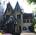
 The Castle - geograph.org.uk - 530405.jpg 640 × 480; 80 KB
-
 The Green, Croxley Green, early spring.jpg 3,072 × 2,304; 1.86 MB
-
 THOMAS HOOD - 28 Finchley Road St John's Wood London NW8 6ES.jpg 1,500 × 2,000; 711 KB
-
 West Harrow, Drury Road - geograph.org.uk - 77446.jpg 640 × 480; 109 KB
-
 West Harrow, Wilson Gardens - geograph.org.uk - 760149.jpg 640 × 480; 107 KB
-
-
 White Castle Mansions, Buck Lane, Kingsbury.JPG 4,000 × 3,000; 3.31 MB


_-_geograph.org.uk_-_770025.jpg)


.jpg)

.jpg)


.jpg)


