Category:Fields in Skelton CP
Jump to navigation
Jump to search
English: Fields in Skelton civil parish, York.
Media in category "Fields in Skelton CP"
The following 27 files are in this category, out of 27 total.
-
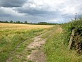
 Across a field of barley - geograph.org.uk - 902700.jpg 640 × 478; 271 KB
-
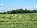
 Barley off Corban Lane - geograph.org.uk - 906113.jpg 640 × 478; 231 KB
-
 Bridleway along ditch - geograph.org.uk - 902697.jpg 640 × 478; 273 KB
-
 Bridleway to Home Farm - geograph.org.uk - 902475.jpg 640 × 478; 263 KB
-
 Bridleway to Moor Lane - geograph.org.uk - 902696.jpg 640 × 478; 290 KB
-
 Cattle off Corban Lane - geograph.org.uk - 906115.jpg 640 × 478; 226 KB
-
 Crossing a ditch - geograph.org.uk - 902698.jpg 640 × 478; 288 KB
-
 Farmland near Park Farm - geograph.org.uk - 2487746.jpg 1,600 × 1,200; 498 KB
-
 Farmland near to St Catherines, Skelton - geograph.org.uk - 2136775.jpg 800 × 600; 341 KB
-
 Farmland off Corban Lane - geograph.org.uk - 2487774.jpg 1,600 × 1,200; 578 KB
-
 Farmland off Moorlands Lane - geograph.org.uk - 2487745.jpg 1,600 × 1,200; 281 KB
-
 Farmland, Glebe Farm - geograph.org.uk - 2487754.jpg 1,600 × 1,200; 529 KB
-
 Field Boundary - geograph.org.uk - 105262.jpg 640 × 479; 39 KB
-
 Field of Barley along bridleway - geograph.org.uk - 902477.jpg 640 × 478; 343 KB
-
 Field off Stripe Lane - geograph.org.uk - 5118505.jpg 1,024 × 683; 426 KB
-
 Flat farmland near Rawcliffe - geograph.org.uk - 3234184.jpg 3,872 × 2,592; 5.38 MB
-
 From the bridleway next to Moor Lane - geograph.org.uk - 902462.jpg 640 × 478; 269 KB
-
 Hall Moor - geograph.org.uk - 4979669.jpg 2,592 × 1,936; 1.76 MB
-
 Hedgerow along Moor Lane - geograph.org.uk - 902422.jpg 640 × 478; 288 KB
-
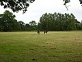 Horses at St Catherines - geograph.org.uk - 902431.jpg 640 × 478; 272 KB
-
 Land behind Fairfields - geograph.org.uk - 3930722.jpg 640 × 427; 80 KB
-
 Partially flooded field, west of North Hall Moor - geograph.org.uk - 4918999.jpg 1,024 × 768; 124 KB
-
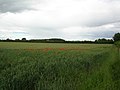 Poppies off Corban Lane - geograph.org.uk - 906117.jpg 640 × 478; 229 KB
-
 Towards Moor Lane - geograph.org.uk - 902470.jpg 640 × 478; 267 KB
-
 Trees on the boundary - geograph.org.uk - 902467.jpg 640 × 478; 237 KB
-
 Waterlogged field, north side of Corban Lane - geograph.org.uk - 4918997.jpg 1,024 × 768; 135 KB
-
 Wet farmland near Rawcliffe - geograph.org.uk - 3234202.jpg 3,872 × 2,592; 5.63 MB


