Category:Fields in Saxby All Saints
Jump to navigation
Jump to search
Subcategories
This category has only the following subcategory.
S
Media in category "Fields in Saxby All Saints"
The following 98 files are in this category, out of 98 total.
-
 Anglian Water Reservoir - geograph.org.uk - 194368.jpg 640 × 480; 130 KB
-
 Appleby Old River Ancholme (Drain) - geograph.org.uk - 172878.jpg 640 × 426; 97 KB
-
 Autumnal Tree, Saxby All Saints.jpg 2,729 × 2,000; 3.52 MB
-
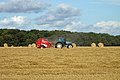 Baler operating near Pikendale Plantation - geograph.org.uk - 542422.jpg 640 × 426; 116 KB
-
 Barley Field on Saxby Wold - geograph.org.uk - 1308607.jpg 640 × 480; 85 KB
-
 Crop Spraying near Saxby All Saints - geograph.org.uk - 1762793.jpg 1,000 × 633; 591 KB
-
 Crop Spraying on Saxby Carrs - geograph.org.uk - 1803674.jpg 1,000 × 932; 912 KB
-
 Cultivating near Saxby All Saints - geograph.org.uk - 1462358.jpg 640 × 425; 68 KB
-
 Cultivating on Saxby Wold - geograph.org.uk - 1240120.jpg 640 × 480; 331 KB
-
 Cultivating on Saxby Wold - geograph.org.uk - 1240144.jpg 640 × 396; 235 KB
-
 Drilling on Saxby Wolds 1.jpg 2,640 × 1,760; 3.63 MB
-
 Drilling on Saxby Wolds 2.jpg 2,640 × 1,760; 4.34 MB
-
 Early morning on Saxby Wold - geograph.org.uk - 1274972.jpg 640 × 427; 63 KB
-
 Easter on Middlegate Lane - geograph.org.uk - 737402.jpg 640 × 427; 77 KB
-
 Farm Track off North Carr Lane - geograph.org.uk - 966851.jpg 640 × 425; 87 KB
-
 Field Drain with Bullrushes - geograph.org.uk - 269093.jpg 640 × 426; 145 KB
-
 Field of White Flax near Saxby All Saints.jpg 1,200 × 1,093; 1.59 MB
-

-
 Fox Covert - geograph.org.uk - 269112.jpg 640 × 426; 138 KB
-
 Fox Covert Plantation - geograph.org.uk - 1353059.jpg 640 × 480; 83 KB
-
-
 Gorse Covert - geograph.org.uk - 470423.jpg 640 × 426; 109 KB
-
 Harvesting on Saxby Carrs - geograph.org.uk - 963888.jpg 640 × 351; 72 KB
-
 Harvesting on Saxby Carrs - geograph.org.uk - 963898.jpg 640 × 425; 69 KB
-
 Harvesting on Saxby Carrs - geograph.org.uk - 963907.jpg 640 × 425; 66 KB
-
 Harvesting on Saxby Carrs - geograph.org.uk - 963914.jpg 640 × 425; 95 KB
-
 Horkstow Carrs - geograph.org.uk - 224486.jpg 640 × 480; 95 KB
-
 Land Drain - geograph.org.uk - 270069.jpg 640 × 426; 127 KB
-
 Land Drain near Saxby Bridge - geograph.org.uk - 962758.jpg 427 × 640; 74 KB
-
 Lifting Potatoes near Saxby All Saints - geograph.org.uk - 1537027.jpg 640 × 480; 297 KB
-
 Lifting Potatoes near Saxby All Saints - geograph.org.uk - 1537041.jpg 640 × 480; 274 KB
-
 Lifting Potatoes near Saxby All Saints - geograph.org.uk - 1537057.jpg 640 × 480; 263 KB
-

-
 Looking towards Bonby - geograph.org.uk - 1762778.jpg 640 × 480; 236 KB
-
 Looking towards Fox Covert Plantation - geograph.org.uk - 1557906.jpg 640 × 464; 337 KB
-
 Looking towards Horkstow - geograph.org.uk - 966837.jpg 640 × 480; 91 KB
-
 Looking towards Pikendale Plantation - geograph.org.uk - 1058309.jpg 640 × 516; 105 KB
-
 Looking towards the Ancholme - geograph.org.uk - 168575.jpg 640 × 480; 90 KB
-
 Looking towards the Ancholme - geograph.org.uk - 516723.jpg 640 × 426; 115 KB
-
 Looking towards Willow Plantation - geograph.org.uk - 172820.jpg 640 × 426; 89 KB
-
 Looking WNW from Saxby Bridge - geograph.org.uk - 681691.jpg 640 × 517; 100 KB
-
 Massey Ferguson tractor pulling Cambridge rollers, North Lincolnshire.jpg 3,539 × 2,343; 3.79 MB
-
 Middlegate in November - geograph.org.uk - 1059217.jpg 640 × 480; 68 KB
-
 Middlegate near Saxby All Saints - geograph.org.uk - 1258589.jpg 640 × 480; 86 KB
-
 Mowing the Middlegate Verge - geograph.org.uk - 2050777.jpg 1,000 × 753; 597 KB
-
 Near Saxby All Saints - geograph.org.uk - 1565353.jpg 640 × 426; 343 KB
-
 Near Saxby Bridge - geograph.org.uk - 963926.jpg 640 × 425; 93 KB
-
 Near Spot Height 93m - geograph.org.uk - 393268.jpg 640 × 426; 116 KB
-
 Near Spot Height 99m - geograph.org.uk - 304067.jpg 480 × 640; 113 KB
-
 New River Ancholme - Footpath - geograph.org.uk - 681679.jpg 640 × 427; 100 KB
-
 New River Ancholme - geograph.org.uk - 738747.jpg 640 × 418; 61 KB
-
 New Years Day 2007 on the Middlegate Road - geograph.org.uk - 304059.jpg 640 × 474; 148 KB
-
 North Carr Lane - geograph.org.uk - 269043.jpg 640 × 480; 100 KB
-
 North Carr Lane - geograph.org.uk - 269066.jpg 640 × 426; 132 KB
-
 North Carr Lane - geograph.org.uk - 270105.jpg 425 × 640; 138 KB
-
 North Carr Lane - geograph.org.uk - 681672.jpg 640 × 427; 127 KB
-
 On Saxby Wolds - geograph.org.uk - 195111.jpg 640 × 480; 124 KB
-
 On Saxby Wolds - geograph.org.uk - 671555.jpg 640 × 480; 147 KB
-
 Ploughing near Saxby All Saints - geograph.org.uk - 2679628.jpg 1,280 × 960; 1.24 MB
-
 Ploughing on Saxby Wolds - geograph.org.uk - 2112841.jpg 1,280 × 1,046; 1 MB
-
 Ridged Field - geograph.org.uk - 411689.jpg 640 × 480; 91 KB
-
 Rural Prospect near Bonby - geograph.org.uk - 1437042.jpg 640 × 425; 80 KB
-
 Saxby All Saints Carrs - geograph.org.uk - 224447.jpg 640 × 480; 75 KB
-
 Saxby All Saints Carrs - geograph.org.uk - 494279.jpg 640 × 480; 150 KB
-
 Saxby All Saints Carrs - geograph.org.uk - 495065.jpg 640 × 480; 169 KB
-
 Saxby All Saints Carrs - geograph.org.uk - 738756.jpg 640 × 427; 125 KB
-
 Saxby Carrs - geograph.org.uk - 50786.jpg 640 × 426; 94 KB
-
 Saxby Carrs - geograph.org.uk - 50787.jpg 640 × 426; 72 KB
-
 Saxby Wold - geograph.org.uk - 1565367.jpg 426 × 640; 405 KB
-
 Saxby Wolds - Fox Covert Plantation - geograph.org.uk - 75331.jpg 640 × 426; 152 KB
-
 Saxby Wolds - geograph.org.uk - 1258558.jpg 640 × 480; 81 KB
-
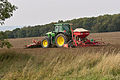
 Seed Drilling on Saxby Wolds - geograph.org.uk - 2635638.jpg 1,280 × 1,280; 1.6 MB
-
 South of North Carr Lane - geograph.org.uk - 966828.jpg 640 × 480; 143 KB
-
 South Plantation - geograph.org.uk - 494362.jpg 640 × 480; 160 KB
-

-
 The Ancholme Valley - geograph.org.uk - 640824.jpg 640 × 480; 43 KB
-
 The Banks of the Ancholme - geograph.org.uk - 962778.jpg 640 × 427; 84 KB
-
 The New River Ancholme - geograph.org.uk - 962738.jpg 640 × 427; 61 KB
-
 The Old Saxby - Barton Road - geograph.org.uk - 410416.jpg 640 × 426; 92 KB
-
 The Road down to Saxby All Saints - geograph.org.uk - 936535.jpg 640 × 425; 75 KB
-
 The Road to Saxby All Saints - geograph.org.uk - 994246.jpg 640 × 480; 97 KB
-
 The Road to Saxby Bridge - geograph.org.uk - 172696.jpg 640 × 440; 101 KB
-
 The Saxby to Barton Road - geograph.org.uk - 304587.jpg 640 × 427; 76 KB
-
 The Saxby to Barton Road - geograph.org.uk - 304593.jpg 640 × 380; 85 KB
-
 The Track to Grange Farm - geograph.org.uk - 959344.jpg 640 × 480; 85 KB
-
 The Track to Saxby Wolds Reservoir. - geograph.org.uk - 1058321.jpg 640 × 425; 94 KB
-
 The Track to Saxby Wolds Reservoir. - geograph.org.uk - 946136.jpg 640 × 481; 86 KB
-
 Track on Saxby Wolds - geograph.org.uk - 716920.jpg 640 × 480; 99 KB
-
 Track on Saxby Wolds - geograph.org.uk - 716929.jpg 640 × 494; 78 KB
-
 Track to the Reservoir - geograph.org.uk - 411777.jpg 480 × 640; 127 KB
-
 Track towards Pickendale Plantation - geograph.org.uk - 1532088.jpg 640 × 426; 314 KB
-
 Track towards the River Ancholme - geograph.org.uk - 1526086.jpg 640 × 441; 86 KB
-
 Waterlogged Field on North Carr Lane - geograph.org.uk - 964146.jpg 640 × 425; 92 KB
-
 West of Saxby All Saints Bridge - geograph.org.uk - 742110.jpg 640 × 462; 76 KB
-
 Wet January Afternoon on the Wolds - geograph.org.uk - 1117553.jpg 637 × 390; 269 KB
-
 White Flax - geograph.org.uk - 2576170.jpg 960 × 1,280; 1.68 MB
-
 White Flax awaiting Harvest - geograph.org.uk - 2576151.jpg 1,280 × 960; 1.36 MB
-
 Winter Wheat on Saxby Wold - geograph.org.uk - 1739620.jpg 1,000 × 750; 978 KB

_-_geograph.org.uk_-_172878.jpg)


