Category:Ferdenrothorn
Jump to navigation
Jump to search
| Object location | | View all coordinates using: OpenStreetMap |
|---|
mountain in Switzerland  | |||||
| Upload media | |||||
| Instance of | |||||
|---|---|---|---|---|---|
| Location | |||||
| Mountain range |
| ||||
| Topographic prominence |
| ||||
| Elevation above sea level |
| ||||
| Parent peak | |||||
 | |||||
Media in category "Ferdenrothorn"
The following 13 files are in this category, out of 13 total.
-
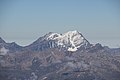 Balmhorn (15237432216).jpg 5,184 × 3,456; 4.87 MB
-
 Balmhorn from Ferdenrothorn.jpg 2,592 × 1,944; 1.19 MB
-
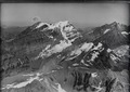 ETH-BIB-Balmhorn, Altels, Doldenhorn v. S. aus 4000 m-Inlandflüge-LBS MH01-004316.tif 6,372 × 4,498; 82.15 MB
-
 ETH-BIB-Lötschental-LBS H1-018899 (cropped).tif 2,783 × 2,086; 5.57 MB
-
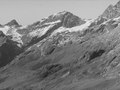
 ETH-BIB-Rinderhorn, Ferdenrothorn, von der Gemmi aus 4000 m-Inlandflüge-LBS MH01-000453.tif 6,611 × 4,626; 87.67 MB
-
 Ferdenrothorn (3.180 m ü.d.M.) mit Lötschenpass - panoramio.jpg 3,872 × 2,592; 3.69 MB
-
 Ferdenrothorn mit Lötschenpass 180°-Panorama - panoramio.jpg 12,649 × 2,279; 18.35 MB
-
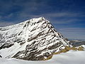
 Ferdenrothorn NE.jpg 4,000 × 3,000; 8.26 MB
-
 Ferdenrothorn pass 2019.jpg 3,024 × 4,032; 2.39 MB
-
 Ferdenrothorn.jpg 4,000 × 3,000; 9.53 MB
-
 Loetschental-2007.jpg 1,200 × 800; 270 KB
-
 Lötschengletscher.jpg 3,200 × 2,400; 5.19 MB
-
 Rinderhorn from Ferdenrothorn.jpg 2,592 × 1,944; 966 KB
.jpg)

_mit_L%C3%B6tschenpass_-_panoramio.jpg)


