Category:Fences in County Donegal
Jump to navigation
Jump to search
Media in category "Fences in County Donegal"
The following 26 files are in this category, out of 26 total.
-
 Aghaveagh Townland - geograph.org.uk - 1749304.jpg 640 × 480; 50 KB
-
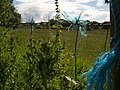 Blue Rope Fence - geograph.org.uk - 861623.jpg 640 × 480; 102 KB
-
 Carrowmeanagh Townland - geograph.org.uk - 1348185.jpg 640 × 479; 76 KB
-
 Carrowmeanagh Townland - geograph.org.uk - 1348190.jpg 640 × 479; 77 KB
-
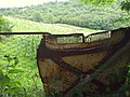
 Cashelard Townland - geograph.org.uk - 884725.jpg 640 × 479; 69 KB
-
 Cloghanmore Townland - geograph.org.uk - 1771183.jpg 640 × 480; 65 KB
-
 Cloghanmore Townland - geograph.org.uk - 1771191.jpg 640 × 480; 62 KB
-
 Clogher South - geograph.org.uk - 1771120.jpg 640 × 480; 66 KB
-
 Coolnasillagh Townland - geograph.org.uk - 1340995.jpg 640 × 479; 71 KB
-
 County Donegal - Malin Beg Signal Tower - 20200817171434.jpg 6,000 × 4,000; 1.79 MB
-
 Crocknageeha Townland - geograph.org.uk - 1348046.jpg 640 × 479; 79 KB
-
 Crocknageeha Townland - geograph.org.uk - 1348157.jpg 640 × 479; 83 KB
-
 Fence - geograph.org.uk - 495640.jpg 640 × 427; 90 KB
-
 Gate to Meadow, Tullywee - geograph.org.uk - 911005.jpg 640 × 480; 105 KB
-
 House for sale - geograph.org.uk - 1032583.jpg 640 × 480; 68 KB
-
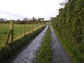 Lane at Mullafin - geograph.org.uk - 1017822.jpg 640 × 479; 61 KB
-
 Looped root of hawthorn and sheds - geograph.org.uk - 893721.jpg 640 × 480; 103 KB
-

-

-

-
 Magheravail Townland - geograph.org.uk - 1771685.jpg 640 × 480; 48 KB
-
 Middle Town - geograph.org.uk - 1806343.jpg 640 × 480; 58 KB
-
 Plaque, Termon National School - geograph.org.uk - 1805742.jpg 640 × 480; 54 KB
-
 Pumping Station at Listallaghan - geograph.org.uk - 1349274.jpg 640 × 479; 93 KB
-
 Roshin, gar do Na Cealla Beaga - geograph.org.uk - 1317379.jpg 640 × 376; 83 KB
-
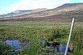 View to Binbane, Blue Stacks - geograph.org.uk - 974272.jpg 640 × 427; 93 KB


