Category:Feltwell
Jump to navigation
Jump to search
English: Feltwell is a village 10 miles west of Thetford, Norfolk, England, and is in the borough of King's Lynn and West Norfolk.
village in the borough of King's Lynn and West Norfolk  | |||||
| Upload media | |||||
| Instance of | |||||
|---|---|---|---|---|---|
| Location | King's Lynn and West Norfolk, Norfolk, East of England, England | ||||
| Area |
| ||||
| Said to be the same as | Feltwell (Wikimedia duplicated page, civil parish) | ||||
 | |||||
Subcategories
This category has the following 7 subcategories, out of 7 total.
Media in category "Feltwell"
The following 200 files are in this category, out of 323 total.
(previous page) (next page)-

-
 Alley - geograph.org.uk - 855832.jpg 463 × 640; 109 KB
-
 Allotments north of Feltwell - geograph.org.uk - 1439412.jpg 640 × 427; 80 KB
-
 Allotments, Hythe Lane, Feltwell - geograph.org.uk - 463970.jpg 640 × 480; 90 KB
-
 Anchor Drove - geograph.org.uk - 4573977.jpg 640 × 480; 55 KB
-
 Anchor Drove - geograph.org.uk - 4573981.jpg 640 × 480; 58 KB
-
 Anchor Drove - geograph.org.uk - 4622187.jpg 640 × 480; 65 KB
-
 Anchor Drove - geograph.org.uk - 4622195.jpg 640 × 480; 60 KB
-
 Anchor Drove approaching Stokes Farm - geograph.org.uk - 4622190.jpg 640 × 480; 67 KB
-
 Anchor End Farm - geograph.org.uk - 2858235.jpg 1,600 × 1,200; 768 KB
-
 Ancient stone of Feltwell - geograph.org.uk - 2769881.jpg 1,600 × 1,200; 1.2 MB
-
 Arable crop on RAF Methwold airfield site - geograph.org.uk - 5406980.jpg 1,600 × 1,200; 402 KB
-
 Bank of the Cut-off Channel - geograph.org.uk - 1439353.jpg 640 × 427; 100 KB
-
 Barley field by Hythe Road - geograph.org.uk - 5407792.jpg 1,600 × 1,200; 445 KB
-
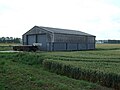
 Barn off Shrub Drove - geograph.org.uk - 2932030.jpg 1,600 × 1,200; 570 KB
-
 Barn on Feltwell Anchor - geograph.org.uk - 2931814.jpg 1,600 × 1,200; 653 KB
-
 Barn, Middle Farm - geograph.org.uk - 2931911.jpg 1,600 × 1,200; 655 KB
-
 Bell Street, Feltwell - geograph.org.uk - 2769901.jpg 1,600 × 1,200; 524 KB
-
 Birch Farm - geograph.org.uk - 2766679.jpg 1,600 × 1,200; 1.11 MB
-
 Bird Brand factory - geograph.org.uk - 2769865.jpg 1,600 × 1,200; 607 KB
-
 Black Drain off Shrub Drove - geograph.org.uk - 2936137.jpg 1,600 × 1,200; 568 KB
-
 Black Drain, Feltwell Anchor - geograph.org.uk - 2931842.jpg 1,600 × 1,200; 679 KB
-
 Black Drove - geograph.org.uk - 2763885.jpg 1,600 × 1,200; 793 KB
-
 Black Drove from Cross Bank Farm - geograph.org.uk - 2763888.jpg 1,600 × 1,200; 732 KB
-
 Black Drove towards Poppylot Farm - geograph.org.uk - 2762719.jpg 1,600 × 1,200; 753 KB
-
 Bridge - geograph.org.uk - 5289913.jpg 768 × 1,024; 177 KB
-
 Bridge over Cut Off Channel - geograph.org.uk - 570206.jpg 640 × 480; 64 KB
-
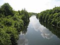
 Bridge over Little Ouse River - geograph.org.uk - 2936578.jpg 1,600 × 1,200; 614 KB
-
 Bridge Over Little Ouse River at Little Ouse - geograph.org.uk - 4207021.jpg 4,000 × 3,000; 3.25 MB
-
 Bridleway across Feltwell Anchor - geograph.org.uk - 2858292.jpg 1,600 × 1,200; 847 KB
-
 Bridleway across Feltwell Anchor - geograph.org.uk - 2931706.jpg 1,600 × 1,200; 1.04 MB
-
 Bridleway across Feltwell Anchor - geograph.org.uk - 2931732.jpg 1,600 × 1,200; 1.02 MB
-
 Bridleway across Feltwell Common - geograph.org.uk - 2766860.jpg 1,600 × 1,200; 812 KB
-
 Bridleway along Little Ouse - geograph.org.uk - 2936401.jpg 1,600 × 1,200; 681 KB
-
 Bridleway away from Little Ouse - geograph.org.uk - 2858278.jpg 1,600 × 1,200; 899 KB
-
 Bridleway, Brandon Bank - geograph.org.uk - 4622184.jpg 640 × 480; 70 KB
-
 Bridleway, Feltwell Anchor - geograph.org.uk - 4575927.jpg 1,600 × 1,200; 919 KB
-
 Bridleway, Feltwell Anchor - geograph.org.uk - 4575937.jpg 1,600 × 1,200; 791 KB
-
 Conservation walks, off Southery Road - geograph.org.uk - 2766571.jpg 1,197 × 1,600; 549 KB
-
 Corkway Drove - geograph.org.uk - 2931797.jpg 1,600 × 1,200; 872 KB
-
 Corkway Drove - geograph.org.uk - 2931864.jpg 1,600 × 1,200; 739 KB
-
 Corkway Drove - geograph.org.uk - 5406866.jpg 1,600 × 1,200; 326 KB
-
 Corkway Drove - geograph.org.uk - 5406872.jpg 1,600 × 1,200; 341 KB
-
 Corkway Drove - geograph.org.uk - 5407434.jpg 1,600 × 1,200; 332 KB
-
 Corkway Drove - geograph.org.uk - 5407779.jpg 1,600 × 1,200; 429 KB
-
 Corkway Drove over the Cut-off Channel - geograph.org.uk - 5407776.jpg 1,600 × 1,200; 458 KB
-
 Corkway Drove past Middle Farm - geograph.org.uk - 2931880.jpg 1,600 × 1,200; 605 KB
-
 Cottages on Feltham Common - geograph.org.uk - 3500288.jpg 4,320 × 3,240; 2.85 MB
-
 Countryside Stewardship area - geograph.org.uk - 2766613.jpg 1,600 × 1,200; 693 KB
-
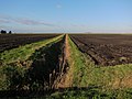
 Crop field beside drain - geograph.org.uk - 4622198.jpg 640 × 480; 77 KB
-
 Crop field near Cross Bank Farm - geograph.org.uk - 4573985.jpg 640 × 480; 88 KB
-
 Crop field near Cross Bank Farm - geograph.org.uk - 4622548.jpg 640 × 480; 76 KB
-
 Crop field near Manorfen Farm - geograph.org.uk - 4622543.jpg 640 × 480; 95 KB
-
 Crop field near Stokes Farm - geograph.org.uk - 4622194.jpg 640 × 480; 87 KB
-
 Crop field off Anchor Drove - geograph.org.uk - 4573974.jpg 640 × 480; 73 KB
-
 Cross Bank Farm - geograph.org.uk - 4573989.jpg 640 × 480; 68 KB
-
 Cross Hill ancient stone plinth - geograph.org.uk - 2769884.jpg 1,182 × 1,600; 818 KB
-
 Cross Hill, Feltwell - geograph.org.uk - 2769877.jpg 1,600 × 1,200; 760 KB
-

-
 Cut-off Channel - geograph.org.uk - 2769851.jpg 1,600 × 1,200; 647 KB
-
 Cut-off Channel - geograph.org.uk - 2770895.jpg 1,600 × 1,200; 482 KB
-
 Cut-Off Channel - geograph.org.uk - 416568.jpg 640 × 427; 56 KB
-
 Cut-off Channel - geograph.org.uk - 5407775.jpg 1,600 × 1,200; 401 KB
-
 Cut-off Channel - geograph.org.uk - 5407777.jpg 1,600 × 1,284; 357 KB
-

-
 Cut-off Channel near Feltwell - geograph.org.uk - 1438917.jpg 427 × 640; 89 KB
-
 Cut-off Channel near Feltwell - geograph.org.uk - 463966.jpg 640 × 480; 66 KB
-
 Cut-Off Channel near Whiteplot Farm - geograph.org.uk - 416560.jpg 640 × 411; 56 KB
-
 Cut-off Channel, near Feltwell - geograph.org.uk - 1439366.jpg 640 × 427; 122 KB
-
 Cut-off Channel, near Feltwell - geograph.org.uk - 463969.jpg 640 × 480; 60 KB
-
 Cut-off Channel, north of Feltwell - geograph.org.uk - 1439405.jpg 640 × 427; 106 KB
-
 December colours, Methwold - geograph.org.uk - 2726477.jpg 536 × 640; 316 KB
-
 December sunshine, Feltwell - geograph.org.uk - 2726463.jpg 640 × 480; 320 KB
-
 Ditch across Feltwell Anchor - geograph.org.uk - 2931765.jpg 1,600 × 1,200; 833 KB
-
 Ditch across Methwold Fens - geograph.org.uk - 2762715.jpg 1,600 × 1,200; 765 KB
-
 Ditch off Black Drove - geograph.org.uk - 2763877.jpg 1,600 × 1,200; 764 KB
-
 Ditch off Fodderfen Drove - geograph.org.uk - 2931929.jpg 1,600 × 1,200; 684 KB
-
 Ditch, Feltwell Anchor - geograph.org.uk - 4575933.jpg 1,600 × 1,200; 888 KB
-
 Drain beside Smith's Drove - geograph.org.uk - 4573967.jpg 640 × 480; 76 KB
-
 Drain clearing beside Corkway Drove - geograph.org.uk - 4622537.jpg 640 × 480; 59 KB
-

-
 East Hall - geograph.org.uk - 2766879.jpg 1,600 × 1,200; 749 KB
-
 Easthall Farm - geograph.org.uk - 2766887.jpg 1,600 × 1,200; 603 KB
-
 Easthall Farm - geograph.org.uk - 2766893.jpg 1,600 × 1,200; 667 KB
-
 Environment Agency gateway - geograph.org.uk - 1439312.jpg 640 × 427; 115 KB
-
 Farm building off Anchor Drove - geograph.org.uk - 4573979.jpg 640 × 480; 66 KB
-
 Farm building off Corkway Drove - geograph.org.uk - 4573984.jpg 640 × 480; 57 KB
-
 Farm building off Smith's Drove - geograph.org.uk - 4573969.jpg 640 × 480; 74 KB
-
 Farm buildings by Old Methwold Road - geograph.org.uk - 5407785.jpg 1,600 × 1,200; 305 KB
-
 Farm buildings, Manorfen Farm - geograph.org.uk - 4622539.jpg 640 × 480; 67 KB
-
 Farm buildings, Stokes Farm - geograph.org.uk - 4622191.jpg 640 × 480; 89 KB
-
 Farm on Anchor Drove - geograph.org.uk - 4573971.jpg 640 × 480; 70 KB
-
 Farm scale lawn mower - geograph.org.uk - 2931919.jpg 1,600 × 1,200; 562 KB
-

-
 Farm track off Hythe Road - geograph.org.uk - 2770954.jpg 1,600 × 1,200; 576 KB
-
 Farmland near Feltwell - geograph.org.uk - 2725392.jpg 640 × 480; 111 KB
-
 Farmland north of Feltwell - geograph.org.uk - 1439399.jpg 640 × 427; 93 KB
-
 Feltwell Anchor - geograph.org.uk - 2858285.jpg 1,600 × 1,200; 815 KB
-
 Feltwell Anchor - geograph.org.uk - 2936338.jpg 1,600 × 1,200; 754 KB
-
 Feltwell Anchor - geograph.org.uk - 2936381.jpg 1,600 × 1,200; 595 KB
-
 Feltwell Common - geograph.org.uk - 2766845.jpg 1,600 × 1,200; 835 KB
-
 Feltwell Golf Club Clubhouse - geograph.org.uk - 481285.jpg 400 × 270; 24 KB
-

-

-
 Field by Hythe Road - geograph.org.uk - 5407787.jpg 1,600 × 1,200; 545 KB
-
 Field by Old Methwold Road - geograph.org.uk - 5406915.jpg 1,600 × 1,200; 394 KB
-
 Field by the Little Ouse - geograph.org.uk - 4575962.jpg 1,600 × 1,200; 820 KB
-
 Field drain, Feltwell Anchor - geograph.org.uk - 2931750.jpg 1,200 × 1,600; 921 KB
-
 Fields by Little Ouse - geograph.org.uk - 2858126.jpg 1,600 × 1,200; 523 KB
-
 Fields off Corkway Drove - geograph.org.uk - 5406870.jpg 1,600 × 1,200; 420 KB
-
 Fields off Old Methwold Road - geograph.org.uk - 5406919.jpg 1,600 × 1,200; 344 KB
-
 Fields on Feltwell Common - geograph.org.uk - 5406868.jpg 1,600 × 1,200; 482 KB
-
 Flytip beside the track, Feltwell - geograph.org.uk - 2726458.jpg 640 × 480; 251 KB
-
 Forest Road Scene - geograph.org.uk - 5499394.jpg 1,024 × 768; 260 KB
-
 Forest track - geograph.org.uk - 2790795.jpg 1,600 × 1,200; 878 KB
-
 Forget-me-nots beside the path - geograph.org.uk - 1881046.jpg 480 × 640; 136 KB
-
 Former entrance to airbase - geograph.org.uk - 1439324.jpg 640 × 427; 99 KB
-

-
 Former RAF Methwold - geograph.org.uk - 5408275.jpg 1,600 × 1,200; 348 KB
-
 Game rearing area - geograph.org.uk - 2858287.jpg 1,600 × 1,200; 850 KB
-
 George VI postbox - geograph.org.uk - 1880994.jpg 314 × 640; 94 KB
-
 Grazing near Iron Bridge Farm - geograph.org.uk - 4622182.jpg 640 × 480; 83 KB
-
 Grazing, Brandon Bank - geograph.org.uk - 4573965.jpg 640 × 480; 73 KB
-
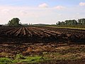
 Harvested turf field - geograph.org.uk - 2931967.jpg 1,600 × 1,200; 601 KB
-
 Harvested wheat field near Hockwold - geograph.org.uk - 1438907.jpg 640 × 427; 62 KB
-
 Haythill Lane - geograph.org.uk - 2769903.jpg 1,600 × 1,200; 617 KB
-
 Hereward Way, Feltwell - geograph.org.uk - 2769867.jpg 1,600 × 1,200; 604 KB
-
 High Street, Feltwell - geograph.org.uk - 5602087.jpg 640 × 360; 41 KB
-
 High Street, Feltwell - geograph.org.uk - 5602089.jpg 640 × 360; 51 KB
-
 High Street, Feltwell, Norfolk - geograph.org.uk - 855824.jpg 640 × 482; 109 KB
-
 Horse field by Lodge Road - geograph.org.uk - 4250280.jpg 1,600 × 1,200; 781 KB
-
 Horse paddocks by Old Methwold Road - geograph.org.uk - 5406932.jpg 1,600 × 1,200; 488 KB
-
 House of crates - geograph.org.uk - 2766650.jpg 1,600 × 1,200; 733 KB
-
 House of crates - geograph.org.uk - 2766666.jpg 1,600 × 1,200; 898 KB
-
 Hythe Road - geograph.org.uk - 2769905.jpg 1,600 × 1,200; 429 KB
-
 Hythe Road - geograph.org.uk - 2770933.jpg 1,600 × 1,200; 600 KB
-
 Hythe Road - geograph.org.uk - 5407794.jpg 1,600 × 1,200; 446 KB
-
 Hythe Road looking north - geograph.org.uk - 564659.jpg 640 × 480; 159 KB
-
 Hythe Road, Feltwell - geograph.org.uk - 1881222.jpg 640 × 480; 113 KB
-
-
 Jubilee Farm, Southery Road - geograph.org.uk - 2766674.jpg 1,600 × 1,200; 881 KB
-
 Jubilee Farm, Southery Road - geograph.org.uk - 3500300.jpg 4,320 × 3,240; 2.91 MB
-
 Kettle Lane - geograph.org.uk - 2770876.jpg 1,600 × 1,200; 763 KB
-
 Landfill site near The Oakery, Feltwell - geograph.org.uk - 2725394.jpg 640 × 480; 199 KB
-
 Landfill site near The Oakery, Feltwell - geograph.org.uk - 2725395.jpg 640 × 480; 141 KB
-
 Larmen's Drain - geograph.org.uk - 2763909.jpg 1,600 × 1,200; 864 KB
-
 Little Oulsham Drove - geograph.org.uk - 2766689.jpg 1,600 × 1,200; 529 KB
-
 Little Oulsham Drove - geograph.org.uk - 2766839.jpg 1,600 × 1,200; 549 KB
-
 Little Oulsham Drove - geograph.org.uk - 2770830.jpg 1,600 × 1,200; 641 KB
-
 Little Oulsham Drove - geograph.org.uk - 2770871.jpg 1,600 × 1,200; 900 KB
-
 Little Oulsham Drove - geograph.org.uk - 2770900.jpg 1,600 × 1,200; 563 KB
-
 Little Oulsham Drove bridge - geograph.org.uk - 2770857.jpg 1,600 × 1,200; 864 KB
-
 Little Ouse Bridge - geograph.org.uk - 1415842.jpg 640 × 480; 87 KB
-
 Little Ouse Ordnance Survey Trig Pillar - geograph.org.uk - 3846990.jpg 768 × 1,024; 368 KB
-
 Little Ouse River - geograph.org.uk - 2858149.jpg 1,600 × 1,200; 765 KB
-
 Little Ouse River - geograph.org.uk - 2858271.jpg 1,600 × 1,200; 790 KB
-
 Little Ouse River - geograph.org.uk - 2936411.jpg 1,600 × 1,200; 713 KB
-
 Little Ouse River - geograph.org.uk - 2936594.jpg 1,600 × 1,200; 687 KB
-

-
 Lodge Road, Feltwell - geograph.org.uk - 2766905.jpg 1,600 × 1,200; 698 KB
-

-
 Looking South from St Mary's tower - geograph.org.uk - 481247.jpg 640 × 480; 77 KB
-

-
 Looking South West from St Mary's Tower - geograph.org.uk - 481252.jpg 640 × 480; 110 KB
-
 Lowest trig point in UK - geograph.org.uk - 2857780.jpg 1,600 × 1,200; 1.16 MB
-
 Lowest trig point in UK - geograph.org.uk - 2857789.jpg 1,600 × 1,200; 641 KB
-
 Maize crop by Tennis Drove - geograph.org.uk - 5406985.jpg 1,600 × 1,200; 676 KB
-

-
 Middle Farm - geograph.org.uk - 2931892.jpg 1,600 × 1,200; 690 KB
-
 Minor road from Denton Lodge - geograph.org.uk - 4250335.jpg 1,600 × 1,200; 1,005 KB
-
 Minor road near Manorfen Farm - geograph.org.uk - 4622544.jpg 640 × 480; 63 KB
-
 Molehill Drove - geograph.org.uk - 2770841.jpg 1,600 × 1,200; 585 KB
-
 Moorings on Little Ouse River - geograph.org.uk - 2858217.jpg 1,600 × 1,200; 709 KB
-
 More Straight Road - geograph.org.uk - 1415857.jpg 640 × 480; 57 KB
-
 Munson's Lane, Feltwell - geograph.org.uk - 5407783.jpg 1,600 × 1,200; 397 KB
-
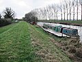 Narrowboat on the Little Ouse - geograph.org.uk - 4575954.jpg 1,600 × 1,200; 996 KB
-
 New buildings at Middle Farm - geograph.org.uk - 2931901.jpg 1,600 × 1,200; 649 KB
-
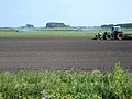
 New furrows - geograph.org.uk - 576477.jpg 640 × 480; 162 KB
-
 New trees by the reservoir - geograph.org.uk - 2931826.jpg 1,600 × 1,200; 712 KB
-

-
 Oilseed rape crop off Anchor Drove - geograph.org.uk - 4573975.jpg 640 × 480; 103 KB
-
 Oilseed rape crop off Anchor Drove - geograph.org.uk - 4573982.jpg 640 × 480; 78 KB
-
 Old Boundary Stone - geograph.org.uk - 5499382.jpg 1,024 × 768; 378 KB
-
 Old Boundary Stone - geograph.org.uk - 5499390.jpg 1,024 × 768; 433 KB
-
 Old buildings by Orchard House - geograph.org.uk - 2858266.jpg 1,600 × 1,200; 843 KB
-
 Old Methwold Road - geograph.org.uk - 5406917.jpg 1,600 × 1,200; 308 KB
-
 On the east bank of the Little Ouse - geograph.org.uk - 4203616.jpg 1,500 × 952; 1.44 MB
-
 Opposite St Mary, Feltwell, Norfolk - geograph.org.uk - 855817.jpg 640 × 480; 61 KB
-
 Ordnance Survey Flush Bracket (10784) - geograph.org.uk - 4209356.jpg 480 × 640; 122 KB
-
 Ordnance Survey Flush Bracket 10784 - geograph.org.uk - 4273478.jpg 4,000 × 3,000; 4.67 MB
-

-
 Outdoor pigs - geograph.org.uk - 5407313.jpg 1,600 × 1,221; 500 KB
-
 Outdoor reared pigs - geograph.org.uk - 5407327.jpg 1,600 × 1,200; 532 KB
-
 Pace garage, Feltwell - geograph.org.uk - 2769873.jpg 1,600 × 1,200; 453 KB
-
 Partly harvested field - geograph.org.uk - 1439403.jpg 427 × 640; 95 KB
-
 Partly harvested wheat field - geograph.org.uk - 1439328.jpg 640 × 427; 90 KB
-
 Patched up hedge off Shrub Drove - geograph.org.uk - 2936125.jpg 1,600 × 1,200; 708 KB
-
 Path from the churchyard - geograph.org.uk - 1881028.jpg 480 × 640; 152 KB
-

-
 Pig houses at Breckland Farm, Feltwell - geograph.org.uk - 2726464.jpg 640 × 480; 212 KB


_at_RAF_Feltwell,_aerial_2017_-_geograph.org.uk_-_5536799.jpg)
_at_RAF_Feltwell,_aerial_2017_-_geograph.org.uk_-_5536853.jpg)


_-_geograph.org.uk_-_4209356.jpg)


