Category:Felpham
Jump to navigation
Jump to search
English: Felpham (sometimes pronounced locally as Felf-fm) is a village and civil parish in the Arun District of West Sussex, England. It is part of the Bognor Regis conurbation but remains administratively separate.
village in the United Kingdom  | |||||
| Upload media | |||||
| Instance of | |||||
|---|---|---|---|---|---|
| Location | Arun, West Sussex, South East England, England | ||||
| Area |
| ||||
| official website | |||||
 | |||||
Subcategories
This category has the following 6 subcategories, out of 6 total.
- Pubs in Felpham (10 F)
B
- Blake's Cottage, Felpham (4 F)
Media in category "Felpham"
The following 200 files are in this category, out of 246 total.
(previous page) (next page)-
 60 bus in West Street - geograph.org.uk - 1681028.jpg 480 × 640; 44 KB
-
 700 bus near Hardy Close - geograph.org.uk - 845817.jpg 640 × 480; 59 KB
-
 700 bus turning into Flansham Park - geograph.org.uk - 845719.jpg 640 × 480; 88 KB
-
 A259 - geograph.org.uk - 4559280.jpg 640 × 426; 92 KB
-
 A259 entering Felpham - geograph.org.uk - 3624928.jpg 3,264 × 2,448; 3.82 MB
-
 A259 enters Felpham - geograph.org.uk - 2666195.jpg 640 × 428; 89 KB
-
 A259 Felpham Way - geograph.org.uk - 2666210.jpg 640 × 428; 66 KB
-
 A259, eastbound - geograph.org.uk - 4742580.jpg 640 × 426; 58 KB
-
 A259, Felpham - geograph.org.uk - 4742582.jpg 640 × 352; 56 KB
-
 Air Quality Monitor - geograph.org.uk - 4730541.jpg 640 × 426; 101 KB
-
 Aldingbourne Rife - geograph.org.uk - 2902096.jpg 2,048 × 1,536; 658 KB
-
 Aldingbourne Rife - geograph.org.uk - 3259659.jpg 1,920 × 1,080; 927 KB
-
 Aldingbourne Rife and sluice - geograph.org.uk - 3518558.jpg 640 × 427; 106 KB
-
 Aldingbourne Rife Valley - geograph.org.uk - 4730553.jpg 640 × 426; 46 KB
-
 Along the northern part of Findon Drive - geograph.org.uk - 4394023.jpg 800 × 533; 126 KB
-

-
 Barnham Rife - geograph.org.uk - 75848.jpg 640 × 480; 79 KB
-
 Barrier on Worms Lane - geograph.org.uk - 3624897.jpg 3,264 × 2,448; 4.88 MB
-
 Beach access from Davenport Road - geograph.org.uk - 3518790.jpg 640 × 427; 78 KB
-
 Beach Huts - Felpham - geograph.org.uk - 1943102.jpg 4,000 × 2,664; 2.37 MB
-
 Beach huts 94 - 118, Felpham - geograph.org.uk - 3712160.jpg 640 × 480; 131 KB
-
 Beach huts and seats, Felpham, West Sussex - geograph.org.uk - 4897043.jpg 1,600 × 1,200; 336 KB
-
 Beach huts at Felpham - geograph.org.uk - 1985833.jpg 1,600 × 1,200; 363 KB
-
 Beach huts by Felpham seafront - geograph.org.uk - 90191.jpg 640 × 480; 143 KB
-
 Beach huts on Felpham Greensward - geograph.org.uk - 2213456.jpg 640 × 480; 65 KB
-
 Beach huts on Felpham Greensward - geograph.org.uk - 2677147.jpg 480 × 640; 76 KB
-
 Beach Huts, Felpham, West Sussex - geograph.org.uk - 4896775.jpg 1,600 × 1,200; 364 KB
-
 Beaches at Bognor - geograph.org.uk - 1985804.jpg 1,600 × 1,200; 522 KB
-
 Beyond Butlins, Bognor Regis - geograph.org.uk - 4896764.jpg 1,600 × 1,200; 266 KB
-
 Blakes Mead a new housing estate south of Flansham - geograph.org.uk - 3626596.jpg 3,264 × 2,448; 3.19 MB
-
 Bognor from the East - geograph.org.uk - 4897051.jpg 1,600 × 1,161; 231 KB
-
 Bognor Regis (East) - geograph.org.uk - 4907305.jpg 1,600 × 1,200; 521 KB
-
 Bognor Regis , Coastline Scenery - geograph.org.uk - 3128411.jpg 3,264 × 2,448; 3.42 MB
-
 Bognor regis crop.jpg 646 × 456; 48 KB
-
 Bracing day by Felpham beach - geograph.org.uk - 3518835.jpg 640 × 427; 60 KB
-
 Bridleway leaves footpath on sea front - geograph.org.uk - 4394312.jpg 800 × 533; 111 KB
-
 Bungalow in Flansham Park - geograph.org.uk - 845732.jpg 640 × 480; 76 KB
-
 Bus stop A259 Flansham Lane - geograph.org.uk - 2842069.jpg 2,048 × 1,536; 666 KB
-
 Bus stop in Flansham Park - geograph.org.uk - 2898339.jpg 2,048 × 1,536; 660 KB
-
 Butlins Holiday Camp Bognor Regis - geograph.org.uk - 3627351.jpg 3,264 × 2,448; 3.56 MB
-
 Canning Road, Felpham - geograph.org.uk - 655695.jpg 640 × 480; 306 KB
-

-
 Church House, 94 Felpham Road, Felpham (NHLE Code 1293528) (May 2011).jpg 2,400 × 1,600; 2.07 MB
-
 Coastal Protection - geograph.org.uk - 4768650.jpg 640 × 480; 72 KB
-
 Coastal View of Felpham - geograph.org.uk - 5719652.jpg 5,472 × 3,648; 7.3 MB
-
 Conifers and willows on Andrew Avenue Felpham - geograph.org.uk - 3626662.jpg 3,264 × 2,448; 3.42 MB
-
 Contrasting ideas of the seaside - geograph.org.uk - 4907294.jpg 1,600 × 1,200; 472 KB
-
-
 Crossing, A259 - geograph.org.uk - 4742577.jpg 640 × 426; 59 KB
-
 Disused airfield, near Bognor Regis - geograph.org.uk - 138642.jpg 640 × 479; 71 KB
-
 East end of Overdown Road - geograph.org.uk - 4394402.jpg 800 × 533; 105 KB
-
 Eastern offshoot of Findon Drive - geograph.org.uk - 4394034.jpg 800 × 533; 101 KB
-
 Eddie's Bigger Little Shop - geograph.org.uk - 4318784.jpg 4,320 × 3,240; 4.86 MB
-
 Eleanor Gardens, Felpham - geograph.org.uk - 2449931.jpg 640 × 480; 49 KB
-
 End of Fourth Avenue - geograph.org.uk - 4318789.jpg 4,320 × 3,240; 4.18 MB
-

-
 Entrance to Summerley Private Estate via Limmer Lane - geograph.org.uk - 2900033.jpg 2,048 × 1,536; 651 KB
-
 Estate agents in Felpham Road - geograph.org.uk - 4870866.jpg 640 × 480; 100 KB
-

-
 Felpham Beach - geograph.org.uk - 1010740.jpg 640 × 480; 150 KB
-
 Felpham Beach - geograph.org.uk - 195042.jpg 640 × 530; 71 KB
-
 Felpham Beach looking towards Middleton - geograph.org.uk - 4907280.jpg 1,600 × 1,200; 479 KB
-
 Felpham Beach towards Bognor - geograph.org.uk - 4907284.jpg 1,600 × 1,200; 494 KB
-
 Felpham Bikes on the A259 - geograph.org.uk - 850114.jpg 640 × 480; 65 KB
-
 Felpham Community College - geograph.org.uk - 4730564.jpg 640 × 426; 88 KB
-
 Felpham Greensward - geograph.org.uk - 2213436.jpg 640 × 480; 71 KB
-
 Felpham Greensward - geograph.org.uk - 2213443.jpg 640 × 480; 70 KB
-
 Felpham Leisure Centre - geograph.org.uk - 3626759.jpg 3,264 × 2,448; 3.99 MB
-
 Felpham Leisure Centre - geograph.org.uk - 4559274.jpg 640 × 426; 76 KB
-
 Felpham Leisure Centre - geograph.org.uk - 4730556.jpg 640 × 426; 102 KB
-
 Felpham Leisure Centre - geograph.org.uk - 4730559.jpg 640 × 426; 62 KB
-
 Felpham Post Office - geograph.org.uk - 81571.jpg 640 × 480; 147 KB
-
 Felpham Sailing Club - Felpham - geograph.org.uk - 1943031.jpg 4,000 × 2,664; 2.54 MB
-
 Felpham seafront - geograph.org.uk - 2213461.jpg 640 × 480; 67 KB
-
 Felpham seafront looking east - geograph.org.uk - 81822.jpg 640 × 480; 137 KB
-

-

-
 FelphamA259.jpg 1,024 × 683; 129 KB
-
 Findon Drive - geograph.org.uk - 845960.jpg 640 × 480; 78 KB
-
 Flansham Lane - geograph.org.uk - 4742592.jpg 640 × 426; 42 KB
-
 Flansham Lane - geograph.org.uk - 4742593.jpg 640 × 396; 38 KB
-
 Flansham Lane - geograph.org.uk - 4742595.jpg 640 × 414; 60 KB
-
 Flansham Lane - geograph.org.uk - 4742596.jpg 640 × 390; 52 KB
-
 Flansham Lane - geograph.org.uk - 4742599.jpg 640 × 401; 65 KB
-
 Flansham Lane, Felpham - geograph.org.uk - 2666204.jpg 640 × 428; 66 KB
-
 Flansham Park Health Centre - geograph.org.uk - 845830.jpg 640 × 480; 59 KB
-
 Flood gate on First Avenue - geograph.org.uk - 3518809.jpg 640 × 427; 63 KB
-

-
 Florance Findlay Memorial Playroom - geograph.org.uk - 655708.jpg 640 × 480; 95 KB
-
 Footpath 2988-1 on bridge - geograph.org.uk - 2899697.jpg 2,048 × 1,536; 704 KB
-
 Footpath 3047 adjacent to Allotments - geograph.org.uk - 2902068.jpg 2,048 × 1,536; 670 KB
-
 Footpath 3048 adjacent to drain - geograph.org.uk - 2901822.jpg 2,048 × 1,536; 673 KB
-
 Footpath Junction - geograph.org.uk - 2899714.jpg 2,048 × 1,536; 693 KB
-
 Footpath leading off Crossbush Road - geograph.org.uk - 2679200.jpg 640 × 480; 83 KB
-

-

-
 Footpath to New Barn Lane - geograph.org.uk - 2898358.jpg 2,048 × 1,536; 698 KB
-
 Footpath to New Barn Lane - geograph.org.uk - 2899930.jpg 2,048 × 1,536; 696 KB
-
 Footpath to new housing - geograph.org.uk - 4593154.jpg 4,608 × 3,456; 4.33 MB
-
 Garden sculpture on housing estate - geograph.org.uk - 4394106.jpg 800 × 533; 150 KB
-
 Groyne, Felpham - geograph.org.uk - 3712142.jpg 640 × 428; 107 KB
-
 Groynes in front of the beach huts - geograph.org.uk - 3518602.jpg 640 × 427; 52 KB
-

-
 Hayley's Corner - geograph.org.uk - 4318777.jpg 4,320 × 3,240; 5.93 MB
-
 Henfield Way - geograph.org.uk - 845800.jpg 640 × 480; 59 KB
-

-

-
 Houses on Felpham seafront - geograph.org.uk - 1985814.jpg 1,600 × 1,200; 309 KB
-
 Houses on the sea front - geograph.org.uk - 3518776.jpg 640 × 427; 68 KB
-

-
 King George's Field Felpham - geograph.org.uk - 2679206.jpg 640 × 480; 64 KB
-
 Large rocks by the sea - geograph.org.uk - 2079952.jpg 640 × 480; 53 KB
-
 Leaving Felpham Leisure Centre - geograph.org.uk - 4742573.jpg 640 × 426; 64 KB
-
 Leverton Avenue Felpham - geograph.org.uk - 3626650.jpg 3,264 × 2,448; 4.1 MB
-

-
 Limmer Lane Felpham - geograph.org.uk - 3626745.jpg 3,264 × 2,448; 3.85 MB
-
 Long hedge in Flansham Park - geograph.org.uk - 845736.jpg 640 × 480; 68 KB
-

-
 Looking east along Overdown Road - geograph.org.uk - 4394399.jpg 800 × 497; 119 KB
-
 Looking into Overdown Road from the east - geograph.org.uk - 4394406.jpg 800 × 533; 109 KB
-
 Looking north on Ley Road - geograph.org.uk - 4394397.jpg 800 × 533; 122 KB
-
 Looking north on Summerley Lane - geograph.org.uk - 4394375.jpg 800 × 533; 90 KB
-

-

-
 Looking southwards on Flansham Park - geograph.org.uk - 4394049.jpg 800 × 533; 139 KB
-
-
 Looking westwards on Flansham Park - geograph.org.uk - 4394044.jpg 800 × 533; 102 KB
-
 Lush oundabout in Felpham - geograph.org.uk - 850013.jpg 640 × 480; 71 KB
-
 Mid section of Crossbush Road - geograph.org.uk - 849957.jpg 640 × 480; 70 KB
-
 Mid section of Flansham Park - geograph.org.uk - 845787.jpg 640 × 480; 61 KB
-

-

-
 Milestones, Felpham Road - geograph.org.uk - 4870124.jpg 640 × 480; 47 KB
-
 Mini roundabout in Felpham - geograph.org.uk - 2213307.jpg 640 × 480; 57 KB
-
 More beach huts, Felpham, West Sussex - geograph.org.uk - 4897037.jpg 1,600 × 1,200; 391 KB
-
 New housing - geograph.org.uk - 4593165.jpg 4,608 × 3,456; 3.5 MB
-

-
 Outfall pipe at Hannah's Groyne - geograph.org.uk - 4394259.jpg 800 × 533; 147 KB
-

-
 Path at Felpham - geograph.org.uk - 2213311.jpg 640 × 480; 81 KB
-
 Path between Felpham and Middleton - geograph.org.uk - 1985824.jpg 1,600 × 1,200; 392 KB
-

-
 Path by the sea - geograph.org.uk - 4394252.jpg 800 × 533; 140 KB
-
 Path in Felpham - geograph.org.uk - 2213330.jpg 640 × 480; 79 KB
-
 Path near Housing Development - geograph.org.uk - 2899746.jpg 2,048 × 1,536; 702 KB
-
 Path to North Bersted - geograph.org.uk - 3518572.jpg 427 × 640; 96 KB
-
 Pathway on estate - geograph.org.uk - 4394008.jpg 800 × 533; 121 KB
-
 Pedestrian crossing in Felpham Way - geograph.org.uk - 2679233.jpg 640 × 480; 60 KB
-
 Pedestrian crossing, A259 - geograph.org.uk - 2666223.jpg 640 × 428; 69 KB
-

-

-
 Pond in Flansham - geograph.org.uk - 4593171.jpg 4,608 × 3,456; 4.08 MB
-
 Post box PO22 43 (14001376894).jpg 3,456 × 4,608; 6.7 MB
-
 Public footpath 3585 off the A259 at Felpham - geograph.org.uk - 3626636.jpg 3,264 × 2,448; 3.25 MB
-
-
 Recreation ground at Felpham - geograph.org.uk - 850043.jpg 640 × 480; 76 KB
-

-
 Richmond Hyundai at Felpham - geograph.org.uk - 850077.jpg 640 × 480; 81 KB
-
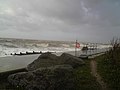 Rough Seas Storm Force Winds - panoramio.jpg 2,592 × 1,944; 877 KB
-
 Rough Seas Stormy weather - panoramio.jpg 2,592 × 1,944; 869 KB
-

-
 Route to Flansham - geograph.org.uk - 2899944.jpg 2,048 × 1,536; 693 KB
-
 Safety Fencing - geograph.org.uk - 2899876.jpg 2,048 × 1,536; 683 KB
-
 Safety first - geograph.org.uk - 4593161.jpg 4,608 × 3,456; 4.57 MB
-

-

-
 Scouts Hall, Vicarage Lane, Felpham - geograph.org.uk - 252985.jpg 640 × 480; 132 KB
-
 Sea front and Art Deco House - geograph.org.uk - 3518801.jpg 640 × 427; 60 KB
-

-
-
 Seaside Holiday Home - geograph.org.uk - 5719644.jpg 4,494 × 2,994; 2.59 MB
-
 Selsey Bill from above Bognor Regis - geograph.org.uk - 4509932.jpg 3,264 × 2,448; 3.45 MB
-
 Sheepwash Barn - geograph.org.uk - 4394098.jpg 800 × 533; 150 KB
-

-

-
 Short Twitten - geograph.org.uk - 2899676.jpg 1,536 × 2,048; 650 KB
-
 Signpost -Bognor - geograph.org.uk - 1943094.jpg 640 × 427; 25 KB
-
 St Mary, Felpham, memorial (3) - geograph.org.uk - 4870821.jpg 640 × 480; 64 KB
-
 Star 1 in Flansham Park - geograph.org.uk - 845741.jpg 640 × 480; 64 KB
-
 Steps down onto Felpham beach - geograph.org.uk - 849908.jpg 480 × 640; 96 KB
-
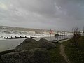
 Storm Force Winds Making Waves - panoramio (1).jpg 2,592 × 1,944; 920 KB
-
 Storm Force Winds Making Waves - panoramio.jpg 2,592 × 1,944; 926 KB
-

-
 Summerley Private Estate - geograph.org.uk - 3829344.jpg 2,048 × 1,536; 702 KB
-
 Telecom mast - geograph.org.uk - 4742588.jpg 640 × 426; 46 KB
-
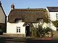 Thatched Cottage, Felpham Way, Felpham - geograph.org.uk - 83220.jpg 640 × 480; 143 KB
-
 The A259 - geograph.org.uk - 4742575.jpg 640 × 426; 62 KB
-
 The Beach at Felpham - geograph.org.uk - 5719650.jpg 5,472 × 3,648; 3.89 MB
-
 The Beachcroft Hotel, Felpham - geograph.org.uk - 2070088.jpg 640 × 480; 86 KB
-

-
 The eastern end of Pulborough Way - geograph.org.uk - 4394052.jpg 800 × 533; 120 KB
-
-
 The Lobster Pot Cafe, Felpham - geograph.org.uk - 2070131.jpg 640 × 480; 91 KB
-
 The Loop - geograph.org.uk - 4394306.jpg 800 × 533; 111 KB
-
 The north eastern end of Findon Drive - geograph.org.uk - 4394029.jpg 800 × 533; 100 KB
-
 The north west end of Findon Drive - geograph.org.uk - 4394020.jpg 800 × 533; 105 KB
-
 The northern end of Uppark Way - geograph.org.uk - 4394001.jpg 800 × 533; 112 KB
-

-

-
 There's a long way to go yet^ - geograph.org.uk - 4392926.jpg 800 × 533; 81 KB


_-_geograph.org.uk_-_4907305.jpg)


_(May_2011).jpg)


.jpg)


_-_geograph.org.uk_-_4870821.jpg)


.jpg)


