Category:Feckenham
Jump to navigation
Jump to search
village and civil parish in the Borough of Redditch in Worcestershire, England  | |||||
| Upload media | |||||
| Instance of | |||||
|---|---|---|---|---|---|
| Location | Redditch, Worcestershire, West Midlands, England | ||||
| Said to be the same as | Feckenham (Wikimedia duplicated page, civil parish) | ||||
 | |||||
Subcategories
This category has the following 2 subcategories, out of 2 total.
J
N
Media in category "Feckenham"
The following 200 files are in this category, out of 276 total.
(previous page) (next page)-
 17 Astwood Lane, Feckenham with scarecrow - geograph.org.uk - 5139092.jpg 1,600 × 1,200; 427 KB
-
 A modern roundhouse - geograph.org.uk - 5139294.jpg 1,600 × 1,200; 706 KB
-
 Access road, Bradley Green - geograph.org.uk - 1889671.jpg 640 × 480; 81 KB
-
 Approaching Mill Lane - geograph.org.uk - 4933079.jpg 480 × 640; 125 KB
-
 Astwood Lane - geograph.org.uk - 6191187.jpg 800 × 600; 148 KB
-

-
 Astwood Lane Feckenham - geograph.org.uk - 4110941.jpg 640 × 480; 77 KB
-
 B4090 Approaching Feckenham - geograph.org.uk - 3655620.jpg 640 × 441; 49 KB
-
 B4090 Milestone - geograph.org.uk - 3655628.jpg 640 × 366; 90 KB
-
 Barn and kennels, Moors Lane, Feckenham - geograph.org.uk - 5611017.jpg 1,600 × 1,200; 470 KB
-
 Bean Hall Mill - geograph.org.uk - 6244832.jpg 640 × 480; 151 KB
-
 Beehives at Feckenham - geograph.org.uk - 4961697.jpg 1,600 × 1,200; 661 KB
-
 Berrow Hill trig point - geograph.org.uk - 5616558.jpg 1,600 × 1,200; 665 KB
-
 Berrow Hill, south of the actual hill - geograph.org.uk - 5616521.jpg 1,600 × 1,200; 314 KB
-
 Beside Bow Brook - geograph.org.uk - 4933094.jpg 480 × 640; 136 KB
-
 Beside Bow Brook - geograph.org.uk - 4933098.jpg 640 × 480; 129 KB
-
 Beside Bow Brook - geograph.org.uk - 4933099.jpg 480 × 640; 117 KB
-
 Beside Bow Brook - geograph.org.uk - 4933105.jpg 480 × 640; 82 KB
-

-
 Blown away - geograph.org.uk - 4933111.jpg 480 × 640; 40 KB
-
 Bow Brook - geograph.org.uk - 4933091.jpg 480 × 640; 118 KB
-
 Bow Brook - geograph.org.uk - 4933092.jpg 640 × 480; 124 KB
-
 Bow Brook and Brook House, Feckenham - geograph.org.uk - 4456950.jpg 640 × 480; 94 KB
-
 Bow Brook at Feckenham - geograph.org.uk - 4961589.jpg 1,600 × 1,200; 659 KB
-
 Bow Brook below the footbridge, Feckenham - geograph.org.uk - 4961647.jpg 1,600 × 1,200; 690 KB
-

-
 Bow Brook looking north, Feckenham, Worcs - geograph.org.uk - 3542060.jpg 1,024 × 661; 280 KB
-
 Bow Brook looking south, Feckenham, Worcs - geograph.org.uk - 3542076.jpg 683 × 1,024; 231 KB
-
 Bradley Court - geograph.org.uk - 1869430.jpg 640 × 480; 79 KB
-
 Brandon Brook - geograph.org.uk - 4933134.jpg 640 × 480; 109 KB
-
 Brickhouse Farm, Ham Green - geograph.org.uk - 2307633.jpg 1,024 × 680; 193 KB
-
 Bridge over stream by Mill Lane, Feckenham - geograph.org.uk - 2538523.jpg 1,024 × 760; 240 KB
-
 Bridleway from Moreton Underhill - geograph.org.uk - 138775.jpg 640 × 480; 260 KB
-
 Bridleway near Beanhall Mill Farm - geograph.org.uk - 2467195.jpg 1,024 × 680; 273 KB
-
 Bridleway off Bentley Lane - geograph.org.uk - 5355030.jpg 800 × 450; 86 KB
-
 Bridleway on Cruise Hill - geograph.org.uk - 2306253.jpg 1,024 × 680; 205 KB
-

-
 Brookside Farm - geograph.org.uk - 2307652.jpg 1,024 × 680; 172 KB
-
 Brookside Farm - geograph.org.uk - 3774266.jpg 640 × 480; 59 KB
-
 Burial Lane, Feckenham - geograph.org.uk - 4936295.jpg 480 × 640; 109 KB
-
 Burial Lane, Feckenham - geograph.org.uk - 4936297.jpg 640 × 480; 80 KB
-
 Burial Lane, Feckenham - geograph.org.uk - 4936298.jpg 480 × 640; 83 KB
-
 Burial Lane, Feckenham - geograph.org.uk - 4936301.jpg 480 × 640; 97 KB
-

-
 Callow Hill Lane Near Callow Hill - geograph.org.uk - 5671282.jpg 640 × 480; 115 KB
-
 Callow Hill Lane Near Love Lyne - geograph.org.uk - 5671285.jpg 640 × 492; 93 KB
-
 Callow Hill Lane Redditch - geograph.org.uk - 5671274.jpg 640 × 458; 115 KB
-
 Callow Hill Lane Redditch Near Parklands - geograph.org.uk - 5671278.jpg 640 × 480; 116 KB
-
 Callow Hill.jpg 640 × 480; 265 KB
-
 Cattle grid, Lower Berrow Farm - geograph.org.uk - 2304884.jpg 1,024 × 680; 186 KB
-

-
 Coarse vegetation between Bow Brook and nature reserve - geograph.org.uk - 5616123.jpg 1,600 × 1,200; 667 KB
-
 Cottage on Littleworth Lane - geograph.org.uk - 5616569.jpg 1,600 × 1,200; 402 KB
-
 Cricket pitch roller, Feckenham - geograph.org.uk - 4457039.jpg 640 × 480; 105 KB
-
 Abandoned church, Cruise Hill - geograph.org.uk - 173591.jpg 640 × 480; 371 KB
-
 Curved - geograph.org.uk - 4933101.jpg 640 × 480; 80 KB
-
 Deer near Bradley Green - geograph.org.uk - 6244810.jpg 597 × 640; 118 KB
-
 Derelict wind pump - geograph.org.uk - 5616517.jpg 1,172 × 1,600; 331 KB
-
 Droitwich Road (B4090), Feckenham - geograph.org.uk - 2532229.jpg 1,024 × 754; 166 KB
-
 Droitwich Road (B4090), looking west, Feckenham - geograph.org.uk - 2532247.jpg 1,024 × 718; 147 KB
-
 Droitwich Road, Feckenham - geograph.org.uk - 6191158.jpg 800 × 600; 217 KB
-
 Electricity Sub Station - geograph.org.uk - 7621.jpg 640 × 480; 82 KB
-
 Elizabeth II postbox on High Street, Feckenham - geograph.org.uk - 6192049.jpg 3,872 × 4,152; 4.72 MB
-
 Entrance to Lower Berrow Farm - geograph.org.uk - 2306220.jpg 1,024 × 680; 181 KB
-
 Ewes and lambs - geograph.org.uk - 2306210.jpg 1,024 × 680; 167 KB
-
 Far Away Cottage, Berrowhill Lane - geograph.org.uk - 5616572.jpg 1,600 × 1,200; 438 KB
-
 Farm building at Ham Green - geograph.org.uk - 2304894.jpg 1,024 × 680; 186 KB
-
 Farm on Berrowhill Lane, Feckenham - geograph.org.uk - 5616538.jpg 1,600 × 1,155; 245 KB
-
 Farmland beside Blaze Lane - geograph.org.uk - 2473316.jpg 1,024 × 680; 173 KB
-
 Farmland near Bradley Green - geograph.org.uk - 2467173.jpg 1,024 × 680; 216 KB
-
 Farmland near Bradley Green - geograph.org.uk - 2467185.jpg 1,024 × 680; 196 KB
-
 Farmland near Crumpfield - geograph.org.uk - 2306294.jpg 1,024 × 680; 189 KB
-
 Feckenham Church from Bow Brook - geograph.org.uk - 4961683.jpg 1,600 × 1,200; 514 KB
-
 Feckenham Cricket Club - geograph.org.uk - 4936315.jpg 640 × 480; 47 KB
-
 Feckenham Cricket Club - the scorebox - geograph.org.uk - 2538462.jpg 776 × 1,024; 267 KB
-

-

-
 Feckenham Cricket Club Pavilion - geograph.org.uk - 2537448.jpg 1,024 × 756; 201 KB
-

-
 Feckenham Droitwich Road - geograph.org.uk - 3754759.jpg 640 × 444; 52 KB
-
 Feckenham Ebenezer Chapel - geograph.org.uk - 4936318.jpg 480 × 640; 69 KB
-
 Feckenham First School with scarecrow - geograph.org.uk - 5139287.jpg 1,600 × 1,200; 530 KB
-
 Feckenham Football Club ground - geograph.org.uk - 2538497.jpg 1,024 × 713; 129 KB
-
 Feckenham High Street - geograph.org.uk - 3728794.jpg 1,024 × 768; 135 KB
-
 Feckenham High Street.jpg 640 × 480; 122 KB
-
 Feckenham Manor House (geograph 3728788).jpg 1,024 × 768; 175 KB
-
 Feckenham Parish Church - geograph.org.uk - 4936322.jpg 480 × 640; 57 KB
-
 Feckenham public car park - geograph.org.uk - 4932975.jpg 480 × 640; 77 KB
-
 Feckenham village hall - geograph.org.uk - 3258357.jpg 640 × 480; 67 KB
-
 Feckenham Village Hall - geograph.org.uk - 6191164.jpg 800 × 623; 152 KB
-
 Feckenham Village Hall, High Street, Feckenham - geograph.org.uk - 2534466.jpg 1,024 × 764; 213 KB
-
 Feckenham Wylde Moor Nature reserve - geograph.org.uk - 169740.jpg 640 × 480; 259 KB
-
 Feckenham, Brook House - geograph.org.uk - 3728785.jpg 1,024 × 768; 206 KB
-
 Feckenham, brook ^ weir - geograph.org.uk - 3728784.jpg 1,024 × 768; 288 KB
-
 Feckenham, village shop - geograph.org.uk - 3728792.jpg 1,024 × 768; 120 KB
-
 Field beside Bentley Lane - geograph.org.uk - 5355043.jpg 1,024 × 768; 311 KB
-

-
 Field roll - geograph.org.uk - 2306216.jpg 1,024 × 680; 172 KB
-
 Foot path emerges onto Droitwich Road, Feckenham - geograph.org.uk - 4961712.jpg 1,600 × 1,200; 739 KB
-
 Footbridge across Bow Brook, Feckenham - geograph.org.uk - 4961599.jpg 1,600 × 1,200; 650 KB
-
 Footpath and gate near Bradley Green - geograph.org.uk - 6244817.jpg 640 × 480; 103 KB
-
 Footpath by the side of Bow Brook, Feckenham - geograph.org.uk - 4961662.jpg 1,600 × 1,200; 709 KB
-
 Footpath to Feckenham Church - geograph.org.uk - 5139099.jpg 1,600 × 1,200; 821 KB
-
 Forest Cottage, High Street, Feckenham - geograph.org.uk - 4961389.jpg 1,600 × 1,200; 362 KB
-
 Former chapel - geograph.org.uk - 2306259.jpg 680 × 1,024; 308 KB
-
 Former water mill, Feckenham - geograph.org.uk - 4456997.jpg 640 × 480; 156 KB
-
 Friendly horses next to a footpath - geograph.org.uk - 5616110.jpg 1,600 × 1,037; 294 KB
-
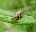 Froghopper. Alder spittlebug. (Aphrophora alni). - Flickr - gailhampshire.jpg 1,398 × 1,242; 132 KB
-
 Grassland near Feckenham - geograph.org.uk - 6191143.jpg 800 × 600; 147 KB
-
 Grassland off Astwood Lane - geograph.org.uk - 6191185.jpg 800 × 600; 79 KB
-
 Green lane and bridleway - geograph.org.uk - 2467393.jpg 1,024 × 680; 258 KB
-
 Ham Green Hamgreen Lane - geograph.org.uk - 5658892.jpg 640 × 480; 101 KB
-
-

-

-
 High Street, Feckenham - geograph.org.uk - 2535325.jpg 1,024 × 755; 213 KB
-
 Horse riders exit speed limit - geograph.org.uk - 5147135.jpg 1,600 × 1,200; 624 KB
-
 House at junction of High Street and Turton Gardens - geograph.org.uk - 4961282.jpg 1,600 × 1,200; 622 KB
-
 House beside Bow Brook - geograph.org.uk - 4933107.jpg 640 × 480; 64 KB
-
 House in Feckenham - geograph.org.uk - 4933065.jpg 640 × 480; 59 KB
-
 House in Feckenham - geograph.org.uk - 4933067.jpg 640 × 480; 60 KB
-
 House in Feckenham - geograph.org.uk - 4933068.jpg 640 × 480; 77 KB
-
 House in Feckenham - geograph.org.uk - 4933069.jpg 640 × 480; 72 KB
-
 House on Droitwich Road, Feckenham - geograph.org.uk - 6191151.jpg 800 × 533; 107 KB
-
 House on Littleworth Lane - geograph.org.uk - 5616567.jpg 1,600 × 1,200; 654 KB
-
 Houses on Astwood Lane, Feckenham - geograph.org.uk - 6191178.jpg 800 × 491; 88 KB
-
 Hover Fly. Volucella pelucens - Flickr - gailhampshire.jpg 2,520 × 2,112; 364 KB
-
 Kennels on Moors Lane, Feckenham - geograph.org.uk - 5611312.jpg 1,600 × 1,200; 396 KB
-
 Leaving Bean Hall Mill - geograph.org.uk - 4935088.jpg 480 × 640; 71 KB
-
 Leaving Bean Hall Mill - geograph.org.uk - 4935091.jpg 480 × 640; 105 KB
-
 Leaving Feckenham - geograph.org.uk - 4933077.jpg 640 × 480; 58 KB
-
 Leaving Feckenham - geograph.org.uk - 4936279.jpg 480 × 640; 88 KB
-
 Leaving Mill Lane - geograph.org.uk - 4933082.jpg 640 × 480; 107 KB
-
 Leaving Noah's Green - geograph.org.uk - 4933108.jpg 480 × 640; 104 KB
-
 Lister roller at Feckenham Cricket Club - geograph.org.uk - 2537411.jpg 1,024 × 773; 224 KB
-
 Llama - geograph.org.uk - 173544.jpg 639 × 480; 268 KB
-
 Looking down on Berrow Hill - geograph.org.uk - 5616535.jpg 1,600 × 1,200; 347 KB
-
 Lower Berrow Farm - geograph.org.uk - 2306211.jpg 1,024 × 680; 215 KB
-
 Mill Lane looking towards the village, Feckenham - geograph.org.uk - 2538576.jpg 1,024 × 768; 338 KB
-
 Mill Lane, Feckenham - geograph.org.uk - 2536530.jpg 750 × 1,024; 214 KB
-
 Mill Lane, Feckenham - geograph.org.uk - 4936310.jpg 480 × 640; 97 KB
-
 Near Dunstable Court - geograph.org.uk - 4935119.jpg 480 × 640; 115 KB
-
 Norgrove Court - geograph.org.uk - 2306301.jpg 1,024 × 680; 189 KB
-
 Norgrove Lane Elcock's Brook (2) - geograph.org.uk - 5671300.jpg 640 × 480; 107 KB
-
 Norgrove Lane Elcock's Brook - geograph.org.uk - 5671295.jpg 640 × 453; 108 KB
-

-

-

-
 Norgrove Lane Near Norgrove Court (2) - geograph.org.uk - 5671321.jpg 640 × 480; 103 KB
-
 Norgrove Lane Near Norgrove Court - geograph.org.uk - 5671319.jpg 640 × 493; 151 KB
-
 Old AA sign on Feckenham Village Hall - geograph.org.uk - 6191167.jpg 800 × 789; 193 KB
-
 Old houses in Droitwich Road (B4090), Feckenham - geograph.org.uk - 2532219.jpg 1,024 × 704; 161 KB
-

-
 Old Milestone by the B4090, west of Feckenham (geograph 6382017).jpg 3,024 × 4,032; 3.45 MB
-

-
 Orchard House, Berrowhill Lane, Feckenham - geograph.org.uk - 5616548.jpg 1,600 × 1,200; 204 KB
-
 P1220324 - Flickr - gailhampshire.jpg 1,236 × 1,164; 129 KB
-
 P1220400 - Flickr - gailhampshire.jpg 1,080 × 876; 91 KB
-
 P1220404 - Flickr - gailhampshire.jpg 1,744 × 2,082; 201 KB
-
 P1220407 - Flickr - gailhampshire.jpg 1,878 × 3,276; 534 KB
-
 Path across fields, Feckenham - geograph.org.uk - 4961564.jpg 1,600 × 1,223; 540 KB
-
 Path from Bow Brook, Feckenham - geograph.org.uk - 4961629.jpg 1,600 × 1,200; 725 KB
-
 Path leaving Feckenham - geograph.org.uk - 4935109.jpg 480 × 640; 93 KB
-
 Path leaving Feckenham - geograph.org.uk - 4935112.jpg 640 × 480; 94 KB
-
 Path leaving Feckenham - geograph.org.uk - 4935114.jpg 480 × 640; 88 KB
-
 Path leaving Feckenham - geograph.org.uk - 4935116.jpg 480 × 640; 74 KB
-
 Pond near Merry Oak Farm - geograph.org.uk - 4935103.jpg 640 × 480; 116 KB
-
 Pond near The Dingle - geograph.org.uk - 4933087.jpg 640 × 480; 123 KB
-
 Pool near public bridleway, near Feckenham - geograph.org.uk - 2538666.jpg 1,024 × 761; 331 KB
-
 Poplars Lane (Feckenham end) - geograph.org.uk - 5147126.jpg 1,600 × 1,200; 862 KB
-
 Poser Cables Crossing Norgrove Lane - geograph.org.uk - 5671450.jpg 640 × 480; 125 KB
-

-
 Recently Renovated (18385970119).jpg 5,456 × 3,632; 15.36 MB
-
 Road to Andy's Barn Farm - geograph.org.uk - 5611301.jpg 1,600 × 1,192; 371 KB
-
 Road to Berrow Hill Farm - geograph.org.uk - 6191147.jpg 800 × 600; 175 KB
-
 Road to Elcock's Brook - geograph.org.uk - 2306273.jpg 680 × 1,024; 210 KB
-
 Road to Mouch Farm, Feckenham - geograph.org.uk - 5611306.jpg 1,600 × 1,200; 753 KB
-
 Rock Hall Farm, Feckenham - geograph.org.uk - 2467376.jpg 1,024 × 680; 214 KB
-
 Rock Hill Farm, Feckenham, Worcestershire - geograph.org.uk - 5147144.jpg 1,600 × 1,200; 441 KB
-
 Rose ^ Crown (1), 48 High Street, Feckenham - geograph.org.uk - 2534341.jpg 1,024 × 738; 159 KB
-

-
 Salt Way (B4090) towards Feckenham - geograph.org.uk - 6191148.jpg 800 × 592; 126 KB
-
 Salt Way, Feckenham - geograph.org.uk - 6057307.jpg 1,920 × 1,280; 1.12 MB
-
 Scarecrow at Feckenham First School - geograph.org.uk - 5139289.jpg 1,200 × 1,600; 542 KB
-
 Scarecrow on house on High Street Feckenham - geograph.org.uk - 5147154.jpg 1,600 × 1,200; 628 KB
-

-
 Sign for the Forest at Feckenham - geograph.org.uk - 6191163.jpg 586 × 800; 56 KB
-
 Sign for the Rose ^ Crown, Feckenham - geograph.org.uk - 6191174.jpg 614 × 800; 79 KB
-
 Sillins Lane Near Silcot Farm - geograph.org.uk - 5671293.jpg 640 × 445; 67 KB
-
 Silver Jubilee village noticeboard, Feckenham - geograph.org.uk - 2535313.jpg 1,024 × 765; 243 KB
-
 Sledding Feb 2007 - geograph.org.uk - 392434.jpg 640 × 481; 138 KB
-
 Start of a footpath in Feckenham - geograph.org.uk - 4933073.jpg 640 × 480; 68 KB
-
 Start of a footpath in Feckenham - geograph.org.uk - 4933076.jpg 640 × 480; 81 KB
-
 Stoners Farm, Berrowhill Lane - geograph.org.uk - 5616555.jpg 1,600 × 1,185; 177 KB
-
 Stream adjacent to Mill Lane, Feckenham - geograph.org.uk - 2538538.jpg 768 × 1,024; 364 KB
-
 Swansbrook Lane - geograph.org.uk - 3774259.jpg 640 × 480; 93 KB
-
 Swansbrook Lane, Feckenham - geograph.org.uk - 6191176.jpg 800 × 600; 167 KB
-
 Swansbrook Lane, Feckenham, Worcestershire - geograph.org.uk - 5139298.jpg 1,600 × 1,200; 671 KB
-
 The B4090 road through Feckenham, Worcs - geograph.org.uk - 3538182.jpg 1,024 × 671; 224 KB
-
 The Brook Inn, Elcock's Brook - geograph.org.uk - 2306282.jpg 1,024 × 680; 187 KB


,_Feckenham_-_geograph.org.uk_-_2532229.jpg)
,_looking_west,_Feckenham_-_geograph.org.uk_-_2532247.jpg)


.jpg)


._-_Flickr_-_gailhampshire.jpg)


,_Feckenham_-_geograph.org.uk_-_2534415.jpg)


_-_geograph.org.uk_-_5671300.jpg)


_-_geograph.org.uk_-_5671321.jpg)


,_Feckenham_-_geograph.org.uk_-_2532219.jpg)
.jpg)
.jpg)


_-_geograph.org.uk_-_5147126.jpg)


.jpg)


,_48_High_Street,_Feckenham_-_geograph.org.uk_-_2534341.jpg)
_-_sign,_48_High_Street,_Feckenham_-_geograph.org.uk_-_2534377.jpg)
_towards_Feckenham_-_geograph.org.uk_-_6191148.jpg)


