Category:Fawfieldhead
Jump to navigation
Jump to search
English: Fawfieldhead is a civil parish in Staffordshire, England. It is situated north-east of Leek and south of Buxton, in the Peak District National Park.
Español: Fawfieldhead es una parroquia civil del distrito de Staffordshire Moorlands, en el condado de Staffordshire (Inglaterra).
Polski: Fawfieldhead – osada i civil parish w Anglii, w Staffordshire, w dystrykcie Staffordshire Moorlands. W 2011 civil parish liczyła 289 mieszkańców.

village and civil parish in Staffordshire, England, UK  | |||||
| Upload media | |||||
| Instance of | |||||
|---|---|---|---|---|---|
| Location | Staffordshire Moorlands, Staffordshire, West Midlands, England | ||||
 | |||||
Subcategories
This category has the following 2 subcategories, out of 2 total.
L
- Leek Home Guard War Memorial (1 F)
R
- St John's church, Reapsmoor (4 F)
Media in category "Fawfieldhead"
The following 200 files are in this category, out of 220 total.
(previous page) (next page)-
 A difficulty with a stile - geograph.org.uk - 1858671.jpg 480 × 640; 118 KB
-
 A snowy Hulme End - geograph.org.uk - 2241084.jpg 2,500 × 1,662; 3.11 MB
-
-

-
 A View of Longnor - geograph.org.uk - 4427699.jpg 4,912 × 3,264; 6.38 MB
-
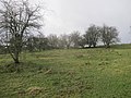
 A view of Top House Farm, Staffordshire - geograph.org.uk - 6324086.jpg 5,150 × 3,758; 5.3 MB
-

-
 Across a meadow towards Oakenclough - geograph.org.uk - 1974385.jpg 640 × 480; 56 KB
-
 An attempt to block a footpath - geograph.org.uk - 2093270.jpg 640 × 480; 88 KB
-
 Another view of a farm ruin at Cuckoostones - geograph.org.uk - 6324064.jpg 4,624 × 3,312; 3.83 MB
-
 Another view of Big Fernyford Farm - geograph.org.uk - 6324082.jpg 3,619 × 4,759; 5.35 MB
-
 Approaching crossroads above Noon Sun Farm - geograph.org.uk - 6324306.jpg 5,184 × 3,888; 5.27 MB
-
 Approaching the triangulation pillar at Merryton Low - geograph.org.uk - 6324318.jpg 3,649 × 4,996; 4.22 MB
-
 Arch of roadbridge over the Blake Brook - geograph.org.uk - 3803880.jpg 2,346 × 3,128; 2.68 MB
-
 At Ludburn Farm - geograph.org.uk - 4513245.jpg 5,053 × 3,651; 5.37 MB
-
 At Shining Ford - geograph.org.uk - 4513207.jpg 4,979 × 3,600; 4.74 MB
-
 At the entrance to Hayes Gate Farm - geograph.org.uk - 5855667.jpg 1,469 × 1,102; 691 KB
-
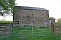 Barn at Fawfieldhead - geograph.org.uk - 168571.jpg 640 × 427; 142 KB
-
 Barn at Fawfieldhead, detail - geograph.org.uk - 1974326.jpg 480 × 640; 129 KB
-
 Barn at Heath Hillock - geograph.org.uk - 6324083.jpg 5,051 × 3,677; 4.94 MB
-
 Barn beside the track to Lower Fleetgreen - geograph.org.uk - 3803889.jpg 3,648 × 2,736; 2.67 MB
-
 Barn by Swallow Moss Plantation - geograph.org.uk - 6324077.jpg 4,911 × 3,503; 4.52 MB
-
 Barn near Field House Farm, Reaps Moor - geograph.org.uk - 4943597.jpg 3,809 × 5,079; 4.51 MB
-
 Barn on grazing land below Lower Fleetgreen - geograph.org.uk - 3803884.jpg 3,648 × 2,736; 2.44 MB
-
 Bend in Road - geograph.org.uk - 2934283.jpg 640 × 427; 239 KB
-
 Big Fernyford Farm - geograph.org.uk - 6324081.jpg 3,887 × 5,020; 5.64 MB
-
 Blake Brook by the footbridge - geograph.org.uk - 4022879.jpg 768 × 1,024; 240 KB
-
 Blake Mere - geograph.org.uk - 3824814.jpg 3,648 × 2,736; 2.25 MB
-
 Boarsgrove - geograph.org.uk - 5072378.jpg 5,113 × 3,001; 1.81 MB
-
 Boundary Stone - geograph.org.uk - 4247279.jpg 480 × 640; 94 KB
-
 Bowl barrow 170m north of The Low.jpg 3,456 × 2,304; 2.75 MB
-
 Bridge Over the River Manifold - geograph.org.uk - 6188454.jpg 4,032 × 3,024; 3.42 MB
-
 Bridging the river (1) - geograph.org.uk - 5849212.jpg 4,320 × 3,240; 3.68 MB
-
 Bridging the river (2) - geograph.org.uk - 5849213.jpg 4,320 × 3,240; 3.57 MB
-
 Brownspit Farm - geograph.org.uk - 1738822.jpg 640 × 426; 67 KB
-

-
 Calf and barn north of The Low - geograph.org.uk - 4513253.jpg 3,516 × 4,896; 4.71 MB
-

-
 Concession path avoiding coal yard - geograph.org.uk - 1974354.jpg 640 × 480; 53 KB
-

-
 Dairy cows near Rewlach - geograph.org.uk - 1311378.jpg 640 × 427; 64 KB
-
 Derelict barn at The Bent, Fawfieldhead - geograph.org.uk - 4513238.jpg 5,115 × 3,747; 5.38 MB
-
 Dukes Drive from Middle Mills (road) - geograph.org.uk - 4889350.jpg 1,200 × 822; 332 KB
-

-
 Entrance gate to Slack Farm - geograph.org.uk - 1974339.jpg 640 × 480; 61 KB
-
 Farm at Round Knowl - geograph.org.uk - 2093249.jpg 640 × 480; 51 KB
-
 Farm at School Clough - geograph.org.uk - 4427702.jpg 4,912 × 3,264; 4.38 MB
-
 Farm buildings at Lower Wigginstall - geograph.org.uk - 1858680.jpg 800 × 600; 148 KB
-
 Farm pond at Lower Swallow Moss - geograph.org.uk - 6324069.jpg 5,007 × 3,567; 4.47 MB
-
 Farm ruin at Cuckoostones - geograph.org.uk - 4943592.jpg 5,033 × 3,775; 4.08 MB
-
 Farm track to Lower Fleetgreen - geograph.org.uk - 3803894.jpg 3,648 × 2,736; 3 MB
-
 Farmhouse at Higher Wigginstall - geograph.org.uk - 4943626.jpg 5,055 × 3,791; 4.22 MB
-
 Farmhouses in the Staffordshire Moorlands - geograph.org.uk - 2322625.jpg 3,648 × 2,736; 5.57 MB
-
 Farmland at Reaps Moor - geograph.org.uk - 5491740.jpg 3,264 × 2,448; 3.49 MB
-
 Farmland near Fawfieldhead - geograph.org.uk - 168561.jpg 640 × 427; 109 KB
-
 Farmland near Fawfieldhead - geograph.org.uk - 2906289.jpg 3,648 × 2,736; 4.72 MB
-
 Fence Corner, Merryton Low - geograph.org.uk - 4247710.jpg 640 × 427; 215 KB
-
 Fence Junction - geograph.org.uk - 4247762.jpg 640 × 480; 79 KB
-
 Field Head Cottage - geograph.org.uk - 4943605.jpg 5,078 × 3,783; 4.78 MB
-
 Field near Spout Farm - geograph.org.uk - 2342730.jpg 640 × 427; 233 KB
-
 Fields east of Little Fernyford - geograph.org.uk - 4022898.jpg 1,024 × 442; 98 KB
-
 Fields near The Lane Farm - geograph.org.uk - 3891921.jpg 1,350 × 898; 115 KB
-
 Fields towards Smedley Sytch - geograph.org.uk - 4022920.jpg 1,024 × 768; 171 KB
-
 Footbridge over a small gully - geograph.org.uk - 2322615.jpg 3,648 × 2,736; 6.02 MB
-
 Footbridge over the Manifold - geograph.org.uk - 3430056.jpg 427 × 640; 240 KB
-
 Footpath and view by Little Fernyford - geograph.org.uk - 4022908.jpg 1,024 × 768; 270 KB
-
 Footpath gate to field at Ludburn - geograph.org.uk - 1974292.jpg 640 × 480; 76 KB
-
 Footpath to Brund Mill - geograph.org.uk - 2934284.jpg 427 × 640; 241 KB
-
 Footpath to Lower Fleetgreen and moorland beyond - geograph.org.uk - 4022937.jpg 1,024 × 692; 144 KB
-
 Footpath to the wide valley of Blake Brook - geograph.org.uk - 4022863.jpg 1,024 × 589; 131 KB
-
 Former Chapel, Hulme End - geograph.org.uk - 2934344.jpg 427 × 640; 254 KB
-
 Former engine shed - geograph.org.uk - 5849205.jpg 4,320 × 3,240; 3.22 MB
-
 Former School House - geograph.org.uk - 2906311.jpg 3,648 × 2,736; 4.16 MB
-
 Free range eggs sign and view to Marnshaw Head - geograph.org.uk - 4513201.jpg 4,951 × 3,544; 4.17 MB
-
 Gate and Road Junction - geograph.org.uk - 4247795.jpg 611 × 423; 232 KB
-
 Gate to Big Fernyford Farm - geograph.org.uk - 6324079.jpg 4,892 × 3,640; 4.15 MB
-
 Gateway to Slack Farm - geograph.org.uk - 4427704.jpg 4,912 × 3,264; 5.59 MB
-
 Gently flows the river - geograph.org.uk - 5849214.jpg 4,320 × 3,240; 5.39 MB
-
 Hardings Booth - geograph.org.uk - 3891927.jpg 1,350 × 1,013; 212 KB
-
 Hardings Booth - geograph.org.uk - 5072376.jpg 4,586 × 3,441; 1.54 MB
-
 Hardings Booth seen from The Hills - geograph.org.uk - 4513205.jpg 3,633 × 4,753; 4.18 MB
-
 Hawk's Yard Near Newtown - geograph.org.uk - 944022.jpg 640 × 480; 88 KB
-
 Hawthorn tree and moorland view - geograph.org.uk - 4023083.jpg 1,024 × 768; 221 KB
-
 Hayes - geograph.org.uk - 4022784.jpg 1,024 × 695; 146 KB
-
 Hayeshead - geograph.org.uk - 2342710.jpg 640 × 427; 292 KB
-
 Heading out of Hulme End towards Hayesgate - geograph.org.uk - 5855605.jpg 1,469 × 1,102; 611 KB
-
 Hillside meadows towards the moors - geograph.org.uk - 4022917.jpg 701 × 800; 164 KB
-
 Hollow Farm - geograph.org.uk - 1858688.jpg 640 × 480; 67 KB
-
 Horse rider on a quiet lane at Oxbatch - geograph.org.uk - 6324297.jpg 4,835 × 3,562; 3.52 MB
-
 How now brown cow - geograph.org.uk - 1311372.jpg 640 × 458; 52 KB
-
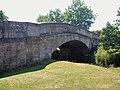
 Hulme End Bridge - geograph.org.uk - 2934347.jpg 640 × 360; 235 KB
-
 Hulme End houses (1) - geograph.org.uk - 5849208.jpg 4,189 × 3,142; 3.23 MB
-
 Hulme End Houses (2) - geograph.org.uk - 5849209.jpg 4,320 × 3,240; 3.64 MB
-
 Hulme End Houses (3) - geograph.org.uk - 5849210.jpg 4,074 × 3,055; 3.13 MB
-
 Hulme End Houses (4) - geograph.org.uk - 5849222.jpg 4,171 × 3,128; 1.97 MB
-
 Junction of roads - geograph.org.uk - 3360729.jpg 4,000 × 3,000; 2.26 MB
-
 Lady Edge - geograph.org.uk - 5083137.jpg 5,032 × 3,274; 1.74 MB
-
 Lambs at Lower Wigginstall - geograph.org.uk - 4944084.jpg 4,595 × 3,774; 4.52 MB
-
 Lane above Little Fernyford - geograph.org.uk - 4022929.jpg 769 × 1,024; 182 KB
-
 Lane Near Newtown - geograph.org.uk - 944015.jpg 640 × 480; 86 KB
-
 Lane up on to moorland - geograph.org.uk - 4022848.jpg 1,024 × 594; 128 KB
-
 Left-hand bend near Hayes Gate Farm - geograph.org.uk - 5855668.jpg 1,469 × 1,102; 575 KB
-
 Little Fernyford - geograph.org.uk - 4022925.jpg 1,024 × 655; 161 KB
-
 Looking east from Middle Mills - geograph.org.uk - 4889360.jpg 1,200 × 799; 379 KB
-
 Looking south towards Warslow - geograph.org.uk - 2322680.jpg 3,648 × 2,736; 4.09 MB
-
 Lum Edge - geograph.org.uk - 2093254.jpg 640 × 480; 34 KB
-
 Manifold Valley Barn - geograph.org.uk - 5849206.jpg 4,320 × 3,240; 3.68 MB
-
 Manifold Valley Visitor Centre - geograph.org.uk - 2834225.jpg 1,024 × 768; 210 KB
-
 Manifold Valley Visitor Centre - geograph.org.uk - 3430052.jpg 640 × 427; 259 KB
-
 Manifold Valley Visitor Centre - geograph.org.uk - 3891968.jpg 1,350 × 898; 166 KB
-
 Manifold Valley Visitor Centre - geograph.org.uk - 4184898.jpg 3,960 × 2,172; 4.16 MB
-
 Manifold Valley Visitor Centre, Hulme End - geograph.org.uk - 4944416.jpg 4,783 × 3,643; 3.38 MB
-
 Manor Farm at Haysgate - geograph.org.uk - 4943630.jpg 4,977 × 3,733; 4.46 MB
-
 Manor Farmhouse - geograph.org.uk - 5855665.jpg 1,469 × 1,102; 581 KB
-
 Memorial plaque and woodland planted by the MOD - geograph.org.uk - 3803900.jpg 3,648 × 2,736; 4.89 MB
-
 Milk churn platform - geograph.org.uk - 2093279.jpg 640 × 480; 72 KB
-
 Millmoor Head at Blackmere Road - geograph.org.uk - 4889339.jpg 1,200 × 799; 310 KB
-
 Mink trap on River Manifold - geograph.org.uk - 1974269.jpg 640 × 480; 125 KB
-
 Misty day at The Low - geograph.org.uk - 1974299.jpg 640 × 480; 69 KB
-
 MOD Property - geograph.org.uk - 2093224.jpg 640 × 480; 65 KB
-
 MOD Property - geograph.org.uk - 2352967.jpg 3,648 × 2,736; 5.83 MB
-
 Moorland farmland, Reaps Moor, Staffordshire - geograph.org.uk - 2322639.jpg 3,648 × 2,736; 5.15 MB
-
 Moorland road across Merryton Low - geograph.org.uk - 3824810.jpg 3,648 × 2,736; 2.05 MB
-
 Morridge - geograph.org.uk - 5075535.jpg 4,830 × 3,102; 1.46 MB
-
 New Road Farm - geograph.org.uk - 1858653.jpg 640 × 480; 50 KB
-
 Nicked and burnt out - geograph.org.uk - 2093105.jpg 640 × 480; 68 KB
-
 North Staffordshire Countryside - geograph.org.uk - 6324088.jpg 4,601 × 3,295; 2.97 MB
-
 Not long down - geograph.org.uk - 2093285.jpg 640 × 480; 95 KB
-
 Old barn near The Slack - geograph.org.uk - 4513212.jpg 5,042 × 3,571; 4.46 MB
-
 Old barn south of Sycamore Farm - geograph.org.uk - 4513224.jpg 3,704 × 4,824; 4.76 MB
-
 Orchids in flower - geograph.org.uk - 4022869.jpg 731 × 1,024; 206 KB
-
 Ordnance Survey Cut Mark - geograph.org.uk - 3362151.jpg 4,000 × 3,000; 4.19 MB
-
 Ordnance Survey Cut Mark - geograph.org.uk - 3362167.jpg 4,000 × 3,000; 4.19 MB
-

-

-
 Permanent Orienteering Marker - geograph.org.uk - 4247274.jpg 480 × 640; 61 KB
-
 Piggenhole Bridge 2.jpg 3,456 × 2,304; 4.05 MB
-
 Piggenhole Bridge.jpg 5,184 × 3,888; 5.74 MB
-
 Rewlach and Marsh House - geograph.org.uk - 1858627.jpg 640 × 480; 73 KB
-
 River Manifold - geograph.org.uk - 3430054.jpg 640 × 427; 269 KB
-
 Riverside B^B Hulme End - geograph.org.uk - 4065054.jpg 480 × 640; 103 KB
-
 Riverside campsite - geograph.org.uk - 5849211.jpg 4,320 × 3,240; 4.05 MB
-
 Road junction at Boarsgrove - geograph.org.uk - 4889324.jpg 1,200 × 799; 240 KB
-
 Road junction at Boarsgrove - geograph.org.uk - 4889326.jpg 1,200 × 799; 269 KB
-
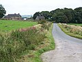
 Road junction near Newtown - geograph.org.uk - 4889317.jpg 1,200 × 826; 485 KB
-
 Road Junction, Fawfieldhead - geograph.org.uk - 4248457.jpg 640 × 427; 246 KB
-
 Road near Hulme House - geograph.org.uk - 2934282.jpg 427 × 640; 273 KB
-
 Road near the Manifold Valley - geograph.org.uk - 3898324.jpg 1,350 × 1,013; 216 KB
-
 Road to Kirkham Yard Farm - geograph.org.uk - 2342719.jpg 427 × 640; 248 KB
-
 Road to Swallow Moss - geograph.org.uk - 2342359.jpg 427 × 640; 294 KB
-
 Roadbridge over the Blake Brook - geograph.org.uk - 3803871.jpg 3,648 × 2,736; 3.19 MB
-
 Royal Mail van at Round Knowl - geograph.org.uk - 6324094.jpg 3,727 × 4,630; 4.6 MB
-
 Ruined barn at Cuckoostones - geograph.org.uk - 2322661.jpg 3,648 × 2,736; 5.26 MB
-
 Ruined Barn, near School Clough - geograph.org.uk - 4248526.jpg 640 × 427; 246 KB
-
 Rusty gate and hawthorn bushes - geograph.org.uk - 1974306.jpg 640 × 480; 69 KB
-
 School Clough - geograph.org.uk - 1974315.jpg 640 × 480; 66 KB
-
 School Clough Barns - geograph.org.uk - 4248460.jpg 640 × 427; 198 KB
-
 Shawfields Farm - geograph.org.uk - 2342355.jpg 640 × 427; 257 KB
-
 Sheep and chickens at New Road Farm - geograph.org.uk - 4943611.jpg 3,687 × 4,776; 4.92 MB
-
 Sheep at the roadside near Upper Hay Corner - geograph.org.uk - 6324459.jpg 3,770 × 5,075; 4.38 MB
-
 Sheep in rough grazing below Halhill Farm - geograph.org.uk - 3799948.jpg 3,648 × 2,736; 2.6 MB
-
 Sheep pastures at New Road Farm - geograph.org.uk - 4944616.jpg 5,184 × 3,888; 6.19 MB
-
 Signpost in Staffordshire - geograph.org.uk - 2093215.jpg 800 × 600; 97 KB
-
 Signpost on the Staffordshire Moors - geograph.org.uk - 6324291.jpg 5,012 × 3,682; 3.78 MB
-
 Slack Farm - geograph.org.uk - 1974347.jpg 640 × 480; 70 KB
-
 Small herd of wild deer on Swallow Moss - geograph.org.uk - 6324073.jpg 4,756 × 3,423; 4.49 MB
-
 Squaddies not welcome on this wall - geograph.org.uk - 2093263.jpg 640 × 480; 88 KB
-
 Staffordshire countryside seen from Merryton Low - geograph.org.uk - 6324577.jpg 4,778 × 3,430; 3.62 MB
-
 Staffordshire hill country - geograph.org.uk - 1858637.jpg 640 × 480; 75 KB
-
 Standing Stone - geograph.org.uk - 4247767.jpg 640 × 480; 92 KB
-

-
 Start of the footpath to Oxbatch - geograph.org.uk - 3824813.jpg 3,648 × 2,736; 2.44 MB
-
 Station building - geograph.org.uk - 5849203.jpg 4,320 × 3,240; 2.9 MB
-
 Station sign - geograph.org.uk - 5849202.jpg 4,081 × 3,060; 3.27 MB
-
 Stile and footbridge - geograph.org.uk - 1757461.jpg 2,048 × 1,536; 649 KB
-
 Stile giving access onto heather moorland - geograph.org.uk - 3803833.jpg 3,648 × 2,736; 3.06 MB
-
 Stile leading up onto heather moorland - geograph.org.uk - 3803823.jpg 3,648 × 2,736; 2.53 MB
-
 Stile on Public Footpath - geograph.org.uk - 4247776.jpg 640 × 480; 62 KB
-
 Stile over Wall, near School Clough - geograph.org.uk - 4248522.jpg 640 × 427; 305 KB
-
 Stiles and small footbridge - geograph.org.uk - 2322602.jpg 3,648 × 2,736; 5.89 MB
-
 Stone barn - geograph.org.uk - 1757463.jpg 2,048 × 1,536; 573 KB
-
 Stone barn at Hulme House - geograph.org.uk - 5855672.jpg 1,402 × 1,052; 632 KB
-
 Stream bed below Halhill Farm - geograph.org.uk - 3799945.jpg 3,648 × 2,736; 3.83 MB
-
 Stream flowing downhill below Halhill Farm - geograph.org.uk - 3799952.jpg 2,346 × 3,128; 2.67 MB
-
 Stream, stile and dry stone walls - geograph.org.uk - 2906299.jpg 3,648 × 2,736; 4.83 MB
-
 Sublime Staffordshire - geograph.org.uk - 5849219.jpg 4,320 × 3,240; 3.44 MB
-
 Sunrise Over the Manifold Valley - geograph.org.uk - 4247701.jpg 640 × 427; 177 KB
-
 T Junction near Brund Mill - geograph.org.uk - 2342795.jpg 427 × 640; 245 KB
-
 The B5053 west of Wigginstall - geograph.org.uk - 4943619.jpg 5,184 × 3,888; 7.33 MB
-

-
 The Cottage - geograph.org.uk - 5075530.jpg 4,275 × 1,668; 1.74 MB
-
 The farmhouse at Ludburn Farm - geograph.org.uk - 4513256.jpg 4,993 × 3,635; 4.31 MB
-
 The Hills - geograph.org.uk - 5075531.jpg 5,184 × 3,456; 1.84 MB
-
 The Lane - geograph.org.uk - 5072377.jpg 5,144 × 3,163; 1.65 MB
-
 The path to Noon Sun - geograph.org.uk - 2113910.jpg 1,200 × 900; 220 KB
-
 The Tea Junction - geograph.org.uk - 5919896.jpg 2,000 × 1,333; 1.92 MB
-
 Track alongside The Hills Wood - geograph.org.uk - 3893052.jpg 1,327 × 1,756; 301 KB
-
 Transition from meadow to moorland - geograph.org.uk - 4022856.jpg 1,024 × 768; 164 KB
-
 Tree and Sky - geograph.org.uk - 4513217.jpg 3,888 × 5,079; 4.73 MB
-
 Triangulation pillar at Merryton Low - geograph.org.uk - 6324387.jpg 5,175 × 3,787; 5.8 MB


_-_geograph.org.uk_-_5849212.jpg)
_-_geograph.org.uk_-_5849213.jpg)


_-_geograph.org.uk_-_4889350.jpg)


_-_geograph.org.uk_-_5849208.jpg)
_-_geograph.org.uk_-_5849209.jpg)
_-_geograph.org.uk_-_5849210.jpg)
_-_geograph.org.uk_-_5849222.jpg)


