Category:Faults in California
Jump to navigation
Jump to search
States of the United States: Alabama · Alaska · Arizona · Arkansas · California · Colorado · Connecticut · Georgia · Hawaii · Idaho · Illinois · Indiana · Kansas · Kentucky · Maine · Massachusetts · Michigan · Minnesota · Missouri · Montana · Nevada · New Hampshire · New Jersey · New Mexico · New York · North Carolina · North Dakota · Ohio · Oklahoma · Oregon · Pennsylvania · South Carolina · South Dakota · Tennessee · Texas · Utah · Vermont · Virginia · Washington · West Virginia · Wisconsin · Wyoming
Puerto Rico
Puerto Rico
Subcategories
This category has the following 30 subcategories, out of 30 total.
*
- Fault scarps in California (2 F)
+
B
- Beaver Street Wall (8 F)
C
- Concord Fault (2 F)
F
H
- Heraldsburg Fault (1 F)
M
O
P
- Pinyon Fault (1 F)
R
S
U
W
- Wilmington Fault (1 F)
Media in category "Faults in California"
The following 64 files are in this category, out of 64 total.
-

-
 After earthquake and fire (1906) (14762796252).jpg 1,956 × 2,368; 1.09 MB
-
 Berkeley stadium fault creep P1320489.jpg 1,920 × 2,560; 1.91 MB
-
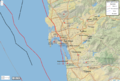
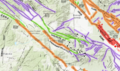
 Borderlands active faults page.jpg 461 × 492; 92 KB
-
 Calcite-chlorite slickenfibres on a small fault slickenside.jpg 3,888 × 2,592; 5.6 MB
-
 California fault parameters sfbay1.png 561 × 635; 35 KB
-
 Cataclasite Matrix in Thin Section.png 3,262 × 1,362; 7.1 MB
-
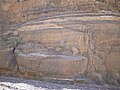
 Cataclastic Flow.jpg 1,966 × 2,034; 9.94 MB
-
 Contorted beds in Hosselkus limestone.jpg 700 × 542; 127 KB
-
 Death Valley - 100 1092 (3262872108).jpg 3,296 × 2,472; 2.48 MB
-
 Death Valley - 100 1093 (3262045465).jpg 3,296 × 2,472; 2.4 MB
-
 Death Valley - Tiny Offset (3262784294).jpg 3,296 × 2,472; 2.48 MB
-
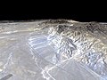
 Death Valley area faults.png 2,483 × 2,235; 4.34 MB
-
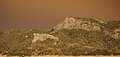
 Deep Springs Valley, California, view from Gilbert Pass (49291311177).jpg 3,648 × 2,432; 6.72 MB
-
 EARTHQUAKE FAULT, INYO NATIONAL FOREST, CA.jpg 3,591 × 5,234; 1.34 MB
-
 Edna Fault.jpg 2,072 × 989; 685 KB
-
-

-

-
-

-
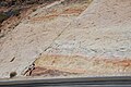
 Fault in Shoshone in California.jpg 2,000 × 3,008; 3.12 MB
-
 Garlock Fault.jpg 600 × 450; 31 KB
-
 Geological Map of the White Ledge Peak Triangle (Carpinteria Zoom).jpg 3,262 × 2,556; 7.67 MB
-
 Geological Map of the White Ledge Peak Triangle.jpg 7,805 × 9,366; 44.08 MB
-
 Hollywood fault.jpg 640 × 640; 228 KB
-
 InglewoodOilField.png 610 × 564; 327 KB
-
 Isabella lake STS51F-42-34.jpg 624 × 639; 68 KB
-
 Jawbone Canyon - 52086703029.jpg 3,000 × 2,247; 5.93 MB
-
 Juan-de-fuca-plate.PNG 536 × 652; 46 KB
-
 Kings Canyon (1509480078).jpg 3,504 × 2,336; 2.58 MB
-
 Laguna Salada fault - USGS map.gif 214 × 218; 17 KB
-
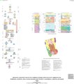
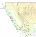
 Main faults of northern and central California.jpg 1,100 × 1,500; 403 KB
-
 Major California faults and ages of volcanics.png 1,202 × 758; 567 KB
-
 Mission peak1.jpg 800 × 600; 141 KB
-
 Normal Fault in Shoshone in California.jpg 3,008 × 2,000; 2.98 MB
-
 Normal Faults in Shoshone in California 2.jpg 3,008 × 2,000; 2.78 MB
-
 NPS devils-postpile-geologic-map.jpg 4,259 × 2,904; 2.91 MB
-
 NPS manzanar-geologic-map.gif 4,273 × 2,872; 932 KB
-
 Pseudotachylyte ladder veins.jpg 3,888 × 2,592; 4.33 MB
-
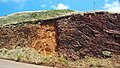
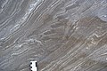
 PSM V86 D254 Folded and faulted strata north of barstow.jpg 1,576 × 913; 237 KB
-
 Pumice roadcut on CA 178 near Shoshone, California.JPG 3,712 × 2,088; 3.83 MB
-
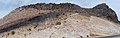
 Rainbow Basin Natural Area - 50702865143.jpg 3,000 × 2,000; 6.99 MB
-
 Road cut fault - Red Rock Canyon.jpg 6,009 × 1,909; 3.97 MB
-
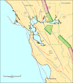
 Rose Canyon Fault.png 1,277 × 861; 1.32 MB
-
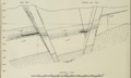 RoundMountainOilFieldGeologicCrossSection.png 992 × 597; 284 KB
-
 San Felipe Fault Zone highlighted.png 1,222 × 728; 1.55 MB
-
 San Gabiel fault.jpg 214 × 218; 61 KB
-
 Schematic structure contour map of the Rincon trend.tiff 1,956 × 916; 262 KB
-
 Sierra Fault Block.gif 1,190 × 408; 103 KB
-
 Sierra Fault Block.png 595 × 204; 21 KB
-
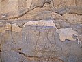
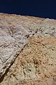
 Small Faults in Sedimentary Rock.jpg 3,872 × 2,592; 4.29 MB
-
 SoCal Faults.svg 675 × 397; 158 KB
-
 Split Cinder Cone.jpg 236 × 148; 16 KB
-
 UCERF-3(2014) factsheet-mar2015-USGS.pdf 1,275 × 1,650, 6 pages; 32.11 MB
-
 UCERF3 figC21.jpg 1,165 × 1,027; 254 KB
-
 USGS - Battle Creek fault.gif 214 × 218; 16 KB
-
 USGS - Raymond fault.gif 214 × 218; 17 KB
-
 USGS - San Cayetano fault.gif 214 × 218; 16 KB
-
 USGS – Green Valley Fault.gif 214 × 218; 16 KB
-
 USGS – San Clemente fault.gif 214 × 221; 17 KB
-
 USGS – White Wolf Fault.gif 214 × 218; 17 KB
-
 Volcanic Tuff and Volcanic Glass and Faults at Shoshone in California.jpg 3,008 × 2,000; 2.7 MB
-
 WilmingtonOilFieldGeologicCrossSection.jpg 5,312 × 2,988; 3.66 MB
_(14766545195).jpg)
_(14762796252).jpg)


.jpg)
.jpg)
.jpg)

.jpg)


_8.jpg)
_4.jpg)
_7.jpg)
_8.jpg)


.jpg)


.jpg)


