Category:Farmhouse (Maggenberg 7, Tafers)
Jump to navigation
Jump to search
| Object location | | View all coordinates using: OpenStreetMap |
|---|
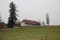
farmhouse in Tafers in the canton of Fribourg, Switzerland  | |||||
| Upload media | |||||
| Instance of | |||||
|---|---|---|---|---|---|
| Part of | |||||
| Location | Tafers, Sense District, Canton of Fribourg, Switzerland | ||||
| Street address |
| ||||
| Heritage designation | |||||
 | |||||
Media in category "Farmhouse (Maggenberg 7, Tafers)"
The following 2 files are in this category, out of 2 total.
-
 Schloss Maggenberg 10 Bauernhaus.jpg 4,752 × 3,168; 2.9 MB
-
 လယ်တဲအိမ်ငယ်.jpg 720 × 540; 119 KB
