Category:Farmhouse, Buckley Homestead
Jump to navigation
Jump to search
The farmhouse was built in 1853 and expanded in 1900 and in 1917.
| Object location | | View all coordinates using: OpenStreetMap |
|---|
Media in category "Farmhouse, Buckley Homestead"
The following 19 files are in this category, out of 19 total.
-
 Back entry 19-10-12 024.jpg 3,072 × 2,595; 1.3 MB
-
 Bath 19-10-12 029.jpg 4,608 × 3,072; 2.58 MB
-
 Bath 19-10-12 030.jpg 3,072 × 4,608; 2.72 MB
-
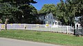
 Gate 19-10-12 043.jpg 3,456 × 4,608; 4 MB
-
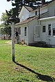
 Information 19-10-12 021.jpg 4,608 × 3,072; 3.62 MB
-
 Interior door 19-10-12 056.jpg 3,072 × 4,608; 2.85 MB
-
 Kitchen 19-10-12 028.jpg 4,608 × 3,072; 2.85 MB
-
 Living Room 19-10-12 031.jpg 4,608 × 3,072; 3.53 MB
-
 Living Room 19-10-12 032.jpg 4,608 × 3,072; 3.56 MB
-
 Main facade 19-10-12 014.jpg 3,050 × 2,654; 1.19 MB
-
 North facade 19-10-12 025.jpg 4,608 × 3,072; 5.83 MB
-
 Side door 19-10-12 008.jpg 3,072 × 4,608; 3.93 MB
-
 South & east facades 19-10-12 011.jpg 4,608 × 3,072; 4.24 MB
-
 South facade 19-10-12 017.jpg 3,072 × 4,608; 4.84 MB
-
 Stairway 19-10-12 033.jpg 3,072 × 4,608; 3.56 MB
-
 Yard 19-10-12 004.jpg 4,608 × 3,072; 4.72 MB
-
 Yard 19-10-12 039.jpg 4,608 × 2,592; 3.87 MB
-
 Yard bell 19-10-12 027.jpg 3,072 × 4,608; 4.86 MB
-
 Yard, Hse & Garage 19-10-12 015.jpg 4,608 × 3,072; 4.27 MB


