Category:Fareham
Jump to navigation
Jump to search
market town on Portsmouth Harbour, England  | |||||
| Upload media | |||||
| Instance of | |||||
|---|---|---|---|---|---|
| Location | Fareham, Hampshire, South East England, England | ||||
| Population |
| ||||
| Different from | |||||
 | |||||
Subcategories
This category has the following 13 subcategories, out of 13 total.
Media in category "Fareham"
The following 200 files are in this category, out of 357 total.
(previous page) (next page)-
 "The Miniatures", Gordon Road - geograph.org.uk - 615971.jpg 640 × 480; 51 KB
-

-
-

-
-

-

-

-

-
 A lot of allotments in Fareham - geograph.org.uk - 1226623.jpg 640 × 480; 70 KB
-
 A pleasant view. - panoramio.jpg 3,907 × 2,137; 2.63 MB
-
 A Tower Crane.jpeg 1,024 × 768; 472 KB
-
 AFC Portchester's Wicor Recreation Ground 2018.jpg 3,648 × 2,736; 2.2 MB
-
 Albany Business Centre on the A32 - geograph.org.uk - 458299.jpg 640 × 427; 126 KB
-
 Aldi car park just off West Street - geograph.org.uk - 1496544.jpg 640 × 480; 42 KB
-
 All Time Grate Main Stage at Wickham Festival.jpg 3,264 × 1,840; 1.72 MB
-
 Alley leading to Osborn Road - geograph.org.uk - 615941.jpg 640 × 480; 81 KB
-
 Ancient Brick Wall - Fareham - geograph.org.uk - 1092577.jpg 640 × 480; 95 KB
-
 Anjou Crescent, Fareham - geograph.org.uk - 1202284.jpg 640 × 360; 66 KB
-
 Anjou Crescent, Fareham - geograph.org.uk - 1202291.jpg 640 × 360; 74 KB
-
 Antonio's in Fareham town centre - geograph.org.uk - 1511310.jpg 480 × 640; 75 KB
-

-
-

-
 Avenue of trees - near Ridge Farm - geograph.org.uk - 89643.jpg 480 × 640; 167 KB
-

-
 Bench by public garden in Gordon Road - geograph.org.uk - 615938.jpg 640 × 480; 89 KB
-
 Block of Flats, Greyshott Ave - Fareham - geograph.org.uk - 756853.jpg 640 × 514; 118 KB
-
 Bowling alley in Fareham - geograph.org.uk - 1476418.jpg 640 × 480; 55 KB
-
 Bridge over A road near High Street - geograph.org.uk - 616512.jpg 640 × 480; 66 KB
-
 Burpham House Fareham.jpg 5,489 × 3,659; 11.62 MB
-
 Burridge, the post office - geograph.org.uk - 625919.jpg 640 × 480; 104 KB
-
 Bus shelter in West Street - geograph.org.uk - 1503505.jpg 480 × 640; 66 KB
-
 Bus stop in Wet Street - geograph.org.uk - 616639.jpg 640 × 480; 65 KB
-
 Café Sorento in West Street - geograph.org.uk - 1504949.jpg 480 × 640; 71 KB
-
 Cams Bay - geograph.org.uk - 464817.jpg 640 × 480; 125 KB
-
 Cams Hall North Front.jpg 4,096 × 3,072; 1.26 MB
-
 Cams Hall South Front.jpg 4,096 × 3,072; 1.91 MB
-
 Canton Express in West Street - geograph.org.uk - 1503514.jpg 480 × 640; 85 KB
-
-
 Cedar Court - geograph.org.uk - 616613.jpg 640 × 480; 64 KB
-
 Chicago Rock Café behind West Street - geograph.org.uk - 1504941.jpg 640 × 480; 86 KB
-
 Church Path- Fareham - geograph.org.uk - 1365328.jpg 640 × 592; 122 KB
-
 Clinic in West Street - geograph.org.uk - 1496553.jpg 480 × 640; 54 KB
-
 Clock in Portchester Precinct - geograph.org.uk - 731412.jpg 640 × 480; 88 KB
-

-
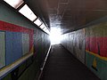
 Colourful subway in Bath Lane (1) - geograph.org.uk - 1216430.jpg 640 × 480; 72 KB
-
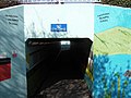
 Colourful subway in Bath Lane (2) - geograph.org.uk - 1216450.jpg 640 × 480; 58 KB
-
 Colourful subway in Bath Lane (3) - geograph.org.uk - 1216476.jpg 640 × 480; 62 KB
-
 Colourful subway in Bath Lane (4) - geograph.org.uk - 1216499.jpg 640 × 480; 96 KB
-
 Colourful subway in Bath Lane (5) - geograph.org.uk - 1216518.jpg 640 × 480; 81 KB
-
-
 Community Hospital - Locks Heath (geograph 2358579).jpg 640 × 427; 68 KB
-
 Connexions in West Street - geograph.org.uk - 1503378.jpg 480 × 640; 68 KB
-
 Contrasting homes in the High Street - geograph.org.uk - 616499.jpg 640 × 480; 55 KB
-
 Converted Maltings - Wallington - geograph.org.uk - 763963.jpg 640 × 480; 94 KB
-
 Court Building - Fareham - geograph.org.uk - 789237.jpg 640 × 398; 48 KB
-
 David winter in West Street - geograph.org.uk - 1496503.jpg 640 × 480; 97 KB
-
 Dead End - Fareham - geograph.org.uk - 838249.jpg 640 × 480; 70 KB
-
 Dead trees, Bunny Meadows, Warsash - geograph.org.uk - 710552.jpg 640 × 480; 109 KB
-
 Delme place.JPG 2,560 × 1,920; 2.32 MB
-
 Demolition of Car Park-FAREHAM - geograph.org.uk - 690250.jpg 640 × 374; 91 KB
-
 Demolition of Pub - Fareham - geograph.org.uk - 873589.jpg 640 × 480; 70 KB
-
 Dentists in West Street - geograph.org.uk - 1504851.jpg 480 × 640; 67 KB
-
 Derelict Cottage at Park Lane, Fareham (May 2019).jpg 3,000 × 1,800; 2.82 MB
-
-
 Echinocorys Scutata Shell Fossils, Cumberland House Natural History Museum.jpg 3,614 × 2,409; 7.44 MB
-
-
 Electronic sign in Gosport Road - geograph.org.uk - 1590576.jpg 640 × 480; 63 KB
-

-
 Ernest Jones in Fareham town centre - geograph.org.uk - 1504946.jpg 480 × 640; 60 KB
-
 Eye Sore at Wallington Village - geograph.org.uk - 747842.jpg 640 × 480; 60 KB
-
 Falklands Arch - geograph.org.uk - 616667.jpg 640 × 480; 75 KB
-
 Fareham - 168, Castle Street - 20220916134236.jpg 4,395 × 2,930; 9.96 MB
-
 Fareham - Dovercroft - 20220916134143.jpg 3,288 × 4,603; 10.93 MB
-
 Fareham - First 53505 (14928744839).jpg 3,888 × 2,592; 3.9 MB
-
 Fareham - Hampshire dot.png 417 × 599; 122 KB
-
 Fareham - Myrtle Cottage - 20220916133242.jpg 3,366 × 3,366; 8.39 MB
-
 Fareham - Wisteria Cottage - 20220916133429.jpg 4,712 × 3,366; 16.19 MB
-
-
 Fareham 2006 election map.png 680 × 480; 56 KB
-
 Fareham 2008 election map.png 680 × 480; 54 KB
-

-
 Fareham Bowling Club - geograph.org.uk - 734801.jpg 640 × 334; 64 KB
-
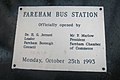
 Fareham Bus Station - geograph.org.uk - 616718.jpg 640 × 480; 52 KB
-
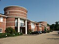
 Fareham Civic Centre, Civic Way, Fareham (May 2019).JPG 1,600 × 1,800; 1.08 MB
-
 Fareham Civic Offices - geograph.org.uk - 616701.jpg 640 × 480; 66 KB
-
 Fareham College - geograph.org.uk - 863178.jpg 640 × 487; 78 KB
-
 Fareham Common beside the M27 - geograph.org.uk - 973241.jpg 640 × 480; 146 KB
-
-
 Fareham Creek - geograph.org.uk - 1236324.jpg 640 × 428; 112 KB
-
 Fareham Fire Station - geograph.org.uk - 430744.jpg 640 × 427; 176 KB
-
 Fareham Fire Station, Station Approach, Fareham (May 2019).JPG 2,000 × 1,600; 1.06 MB
-

-
 Fareham Hand Car Wash, Queens Road, Fareham (May 2019).JPG 2,800 × 1,600; 1.59 MB
-
 Fareham Leisure Centre - geograph.org.uk - 615968.jpg 640 × 480; 44 KB
-
 Fareham Library - geograph.org.uk - 616696.jpg 640 × 480; 78 KB
-
 Fareham Library, off Osborn Road, Fareham (May 2019).JPG 3,000 × 2,000; 1.75 MB
-
 Fareham lines 1841.png 1,036 × 1,034; 76 KB
-
 Fareham lines 1848.png 1,036 × 1,034; 89 KB
-
 Fareham lines 1866.png 1,036 × 1,034; 99 KB
-
 Fareham lines 1894.png 1,036 × 1,034; 110 KB
-
 Fareham lines 1904.png 1,036 × 1,034; 117 KB
-
 Fareham Magistrates Court - geograph.org.uk - 617971.jpg 640 × 480; 50 KB
-
 Fareham Museum and garden - geograph.org.uk - 466202.jpg 640 × 480; 142 KB
-
 Fareham Police Station - geograph.org.uk - 616671.jpg 640 × 480; 49 KB
-
 Fareham Post Office - geograph.org.uk - 616684.jpg 640 × 480; 64 KB
-
 Fareham Register Office - geograph.org.uk - 615913.jpg 640 × 480; 63 KB
-
 Fareham Registry Office, Osborn Road South, Fareham (May 2019).JPG 2,800 × 1,600; 1.48 MB
-
 Fareham Road - geograph.org.uk - 1273816.jpg 640 × 480; 76 KB
-
 Fareham Road Dental Practice - geograph.org.uk - 1762677.jpg 640 × 428; 67 KB
-
-
 Fareham UK local election 2006 map.svg 1,385 × 1,226; 373 KB
-
 Fareham UK local election 2008 map.svg 1,385 × 1,226; 373 KB
-
 Fareham Youth Centre - geograph.org.uk - 617979.jpg 640 × 480; 63 KB
-
 Fareham's Monday Market - geograph.org.uk - 615894.jpg 640 × 480; 72 KB
-
 FarehamConstituency.svg 300 × 270; 103 KB
-
 FarehamShoppingCentre2Dec2006.jpg 2,272 × 1,704; 2.12 MB
-
 Farmers Market-Fareham - geograph.org.uk - 708207.jpg 640 × 399; 79 KB
-
 Farmland, South of Fareham - geograph.org.uk - 297940.jpg 640 × 480; 289 KB
-
 Fast Food Outlet - Fareham - geograph.org.uk - 1094014.jpg 640 × 480; 67 KB
-
 Fastway in West Street - geograph.org.uk - 1503318.jpg 480 × 640; 45 KB
-

-
 Fire Station - Fareham - geograph.org.uk - 863213.jpg 640 × 480; 64 KB
-
 Firework display at Cams Alders(1) - geograph.org.uk - 1072043.jpg 7,198 × 4,577; 1.99 MB
-
 Firework display at Cams Alders(2) - geograph.org.uk - 1072051.jpg 640 × 409; 35 KB
-
 Firework display at Cams Alders(3) - geograph.org.uk - 1072065.jpg 7,198 × 4,494; 2.94 MB
-
 Firework display at Cams Alders(4) - geograph.org.uk - 1072074.jpg 640 × 409; 45 KB
-
 Fish and Chip Shop in West Street - geograph.org.uk - 615957.jpg 640 × 480; 71 KB
-
 Football Club - Fareham - geograph.org.uk - 927076.jpg 640 × 480; 71 KB
-

-
 Footbridge in Wallington - geograph.org.uk - 1607290.jpg 640 × 480; 84 KB
-

-

-
 Footpath to NatWest Call Centre - geograph.org.uk - 616529.jpg 640 × 480; 101 KB
-
 Fort Wallington 1 - geograph.org.uk - 763968.jpg 640 × 480; 88 KB
-
 Fort Wallington 2 - geograph.org.uk - 763970.jpg 640 × 480; 61 KB
-
 GMK Ltd, Bear House.JPG 3,008 × 2,000; 2.46 MB
-
 Gordon Road. - Fareham - geograph.org.uk - 863230.jpg 640 × 480; 83 KB
-
 Grove Care Group in West Street - geograph.org.uk - 1503340.jpg 469 × 640; 70 KB
-

-
 Helicopter passing over Wicor Rec - geograph.org.uk - 2691912.jpg 640 × 480; 41 KB
-
 High St. - Fareham - geograph.org.uk - 1092554.jpg 640 × 480; 88 KB
-
 High Street- FAREHAM - geograph.org.uk - 690237.jpg 640 × 412; 57 KB
-
 HMS Daedalus (RNAS Lee-on-Solent) 781 Sq, SAR Flight Building (34832590094).jpg 2,815 × 1,877; 3.75 MB
-
 HMS Daedalus (RNAS Lee-on-Solent) 781 Sq, SAR ramp and hangars (35633891846).jpg 2,776 × 1,851; 5.72 MB
-
 Holy Trinity Car Park - geograph.org.uk - 617947.jpg 640 × 480; 57 KB
-
 Houses in Western Road - geograph.org.uk - 1511592.jpg 640 × 480; 76 KB
-
 Industrial Units at 280 and 282 West Street, Fareham (May 2019).JPG 2,800 × 1,400; 1.44 MB
-
 Lamp Outside 13 High St Fareham.jpg 3,086 × 6,000; 8.21 MB
-
 Lamp outside 44 High Street Fareham.jpg 2,027 × 5,434; 6.1 MB
-
 Lamp Outside 65 and 66 High Street Fareham.jpg 2,955 × 5,665; 6.26 MB
-
 Leisure Centre-Fareham - geograph.org.uk - 734794.jpg 640 × 373; 43 KB
-
 Locks Heath Ladies FC.jpg 720 × 482; 97 KB
-
 Looking at Fareham from Whitedell Lane - geograph.org.uk - 1282372.jpg 640 × 427; 165 KB
-

-

-

-

-

-

-
 Lovely brick house in Western Road - geograph.org.uk - 616734.jpg 640 × 480; 85 KB
-
 Lower Brownwich Farm, Fareham - geograph.org.uk - 814343.jpg 640 × 480; 99 KB
-
 Lysses House Hotel - Fareham - geograph.org.uk - 760191.jpg 640 × 480; 69 KB
-

-
 Masonic Hall, Queens Road, Fareham (May 2019).JPG 3,000 × 1,500; 1.71 MB
-
 Meon valley rly.png 848 × 1,519; 81 KB
-
 Mid November 2011- Wicor Rec (6) - geograph.org.uk - 2690315.jpg 640 × 480; 73 KB
-

-
 Mitre Court - Fareham - geograph.org.uk - 927117.jpg 640 × 480; 71 KB
-
 Mobile Libraries - Fareham - geograph.org.uk - 845097.jpg 640 × 480; 90 KB
-
 MOD Lambretta.jpg 375 × 500; 214 KB
-

-
 More recent housing - geograph.org.uk - 230142.jpg 640 × 480; 52 KB
-
 Multi-storey car-park in Osborn Road - geograph.org.uk - 616690.jpg 640 × 480; 60 KB
-
 Multistorey Car park - Fareham - geograph.org.uk - 845092.jpg 640 × 480; 79 KB
-
 Nando's in West Street - geograph.org.uk - 1504928.jpg 640 × 480; 88 KB
-
 Naz in West Street - geograph.org.uk - 1504788.jpg 480 × 640; 62 KB
-
 New Accommodation - Fareham - geograph.org.uk - 1094008.jpg 640 × 480; 72 KB
-
 New Apartments - Fareham - geograph.org.uk - 760241.jpg 640 × 460; 87 KB
-

-
 New Housing - geograph.org.uk - 230612.jpg 640 × 480; 57 KB
-
 NHS Dental Access Centre - Fareham - geograph.org.uk - 1092584.jpg 640 × 480; 95 KB
-
 NHS dentists at Church Place - geograph.org.uk - 616531.jpg 640 × 480; 87 KB
-
 Nightclub near Bus Station - geograph.org.uk - 616705.jpg 640 × 480; 86 KB
-
 Oasis of calm in Fareham - geograph.org.uk - 615926.jpg 640 × 480; 77 KB
-
 Offices of Fareham Community Action - geograph.org.uk - 617974.jpg 640 × 480; 52 KB
-
 Old Bridge-wallington - geograph.org.uk - 748008.jpg 640 × 480; 109 KB
-
 Old cottages-Wallington, near Fareham - geograph.org.uk - 747834.jpg 640 × 480; 82 KB
-

-
 Park Gate Primary School - geograph.org.uk - 610169.jpg 640 × 480; 48 KB
-
 Path to Town Centre - Fareham - geograph.org.uk - 863232.jpg 640 × 480; 85 KB
-

-
 Path towards North Fareham Farm - geograph.org.uk - 973309.jpg 640 × 480; 181 KB
-
 Patriotic flats in Trinity Street - geograph.org.uk - 617962.jpg 640 × 480; 76 KB
-
 Peel Common Mill, Fareham.jpg 896 × 1,464; 183 KB
-
 Perfect Pizza in West Street - geograph.org.uk - 1503387.jpg 640 × 480; 89 KB
-
 Phonebox outside Shopping Mall - geograph.org.uk - 615908.jpg 640 × 480; 87 KB
-

-
 Places to eat in Fareham town centre - geograph.org.uk - 1504950.jpg 483 × 640; 73 KB


_-_geograph.org.uk_-_2690829.jpg)
_-_geograph.org.uk_-_2690831.jpg)
_-_geograph.org.uk_-_2691809.jpg)
_-_geograph.org.uk_-_2691898.jpg)
_-_geograph.org.uk_-_2691900.jpg)
_-_geograph.org.uk_-_2691949.jpg)


_-_geograph.org.uk_-_1216430.jpg)
_-_geograph.org.uk_-_1216450.jpg)
_-_geograph.org.uk_-_1216476.jpg)
_-_geograph.org.uk_-_1216499.jpg)
_-_geograph.org.uk_-_1216518.jpg)

.jpg)


.jpg)


.jpg)


.JPG)


.JPG)

.JPG)


.JPG)


.JPG)


_-_geograph.org.uk_-_1633978.jpg)


_-_geograph.org.uk_-_1072043.jpg)
_-_geograph.org.uk_-_1072051.jpg)
_-_geograph.org.uk_-_1072065.jpg)
_-_geograph.org.uk_-_1072074.jpg)


_781_Sq,_SAR_Flight_Building_(34832590094).jpg)
_781_Sq,_SAR_ramp_and_hangars_(35633891846).jpg)


.JPG)


_-_geograph.org.uk_-_1341881.jpg)
_-_geograph.org.uk_-_1341889.jpg)


.JPG)
.JPG)

_-_geograph.org.uk_-_2690315.jpg)


_Industrial_Estate_-_geograph.org.uk_-_459664.jpg)


