Category:Faraid Head
Jump to navigation
Jump to search
peninsula in Highland, Scotland, UK  | |||||
| Upload media | |||||
| Instance of | |||||
|---|---|---|---|---|---|
| Location | Highland, Scottish Highlands, Scotland | ||||
 | |||||
Subcategories
This category has only the following subcategory.
C
Media in category "Faraid Head"
The following 55 files are in this category, out of 55 total.
-
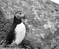 A puffin on Faraid Head - geograph.org.uk - 733047.jpg 640 × 531; 70 KB
-
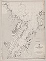 Admiralty Chart No 2076 Scotland north coast Loch Eriboll, Published 1851.jpg 5,875 × 7,764; 5.19 MB
-
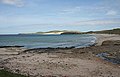
 Balnakeil Bay and Faraid Head - geograph.org.uk - 821831.jpg 640 × 212; 101 KB
-
 Balnakeil Bay and Faraid Head - geograph.org.uk - 834070.jpg 640 × 411; 206 KB
-
 Bay on Faraid Head - geograph.org.uk - 54129.jpg 640 × 480; 144 KB
-
 Boulder in the Stormy Sea - geograph.org.uk - 2199677.jpg 640 × 466; 38 KB
-
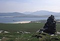 Cairn at Faraid Head - geograph.org.uk - 878484.jpg 640 × 438; 51 KB
-
 Cairn near Faraid Head - geograph.org.uk - 94663.jpg 640 × 480; 88 KB
-

-
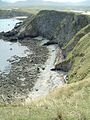
 Cliffs and rocks at Cuarnagaig - geograph.org.uk - 5042239.jpg 2,543 × 1,889; 1.18 MB
-
 Coastline at Poll a' Gheodha Bhain - geograph.org.uk - 3990322.jpg 1,024 × 678; 213 KB
-
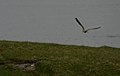 Curlew in flight at Faraid Head - geograph.org.uk - 437411.jpg 640 × 406; 34 KB
-
 Durness Golf club - geograph.org.uk - 1110479.jpg 640 × 480; 64 KB
-
 East coast of An Fharaid - geograph.org.uk - 3577469.jpg 640 × 480; 83 KB
-
 Extreme westerly part of Faraid Head - geograph.org.uk - 234511.jpg 640 × 480; 83 KB
-
 Faraid head - east side - geograph.org.uk - 782884.jpg 640 × 426; 80 KB
-
 Faraid Head - west side - geograph.org.uk - 782891.jpg 640 × 428; 68 KB
-
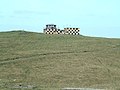 Faraid Head control tower - geograph.org.uk - 94661.jpg 640 × 480; 81 KB
-

-
 Faraid Head Rocks - panoramio.jpg 2,640 × 1,760; 3.02 MB
-
 Faraid Head towards Durness - panoramio.jpg 2,640 × 1,760; 2.94 MB
-
 Faraid Head.jpg 8,726 × 736; 1.33 MB
-
 Fishing station on Faraid Head - geograph.org.uk - 437404.jpg 640 × 427; 94 KB
-

-
 Gentian on Faraid Head - geograph.org.uk - 742732.jpg 425 × 640; 42 KB
-
 Gob nan Leac - geograph.org.uk - 3818014.jpg 1,600 × 1,067; 391 KB
-
 Gob nan Leac, Faraid Head - geograph.org.uk - 3990386.jpg 1,024 × 678; 207 KB
-
 Kyle of Durness and Faraid Head - geograph.org.uk - 821858.jpg 640 × 336; 163 KB
-
 North coast of Faraid Head - geograph.org.uk - 5304786.jpg 1,600 × 1,203; 671 KB
-
 Oi^^ Are you lookin' at my bird^ - geograph.org.uk - 742762.jpg 543 × 640; 65 KB
-
 Puffin colony on Faraid Head - geograph.org.uk - 743016.jpg 640 × 404; 95 KB
-
 Rough Weather at Faraid Head - geograph.org.uk - 2202524.jpg 640 × 480; 42 KB
-

-
 Sea and coast line to south east of Port Obhar - geograph.org.uk - 5757759.jpg 1,152 × 864; 861 KB
-
 Sea from Meall a' Bhuic on Faraid Head - geograph.org.uk - 5757776.jpg 1,152 × 864; 833 KB
-

-
 Sea stacks at Poll a' Gheodha Bhain - geograph.org.uk - 3990327.jpg 1,024 × 678; 263 KB
-
 Sea stacks east of Faraid Head (2) - geograph.org.uk - 3990392.jpg 1,024 × 678; 192 KB
-
 Sea stacks east of Faraid Head - geograph.org.uk - 3990378.jpg 1,024 × 678; 160 KB
-
 Sheepfold on Faraid Head - geograph.org.uk - 437398.jpg 640 × 427; 66 KB
-

-
 The Faraid Stacks - geograph.org.uk - 2199455.jpg 640 × 480; 34 KB
-
 View over Geodh' a' Lochaidh - geograph.org.uk - 2199426.jpg 640 × 399; 28 KB
-
 View south-east from Faraid Head - geograph.org.uk - 878478.jpg 640 × 435; 67 KB
-
 View to A'Chleit at High Tide - geograph.org.uk - 2182105.jpg 640 × 480; 26 KB
-
 An Faraid cliffs - geograph.org.uk - 94656.jpg 480 × 640; 128 KB
-
 Cliff at the western end of Faraid Head - geograph.org.uk - 417826.jpg 640 × 480; 134 KB
-
 Cuarnagaig - geograph.org.uk - 437420.jpg 640 × 427; 90 KB
-
 Curlew on Faraid Head peninsula - geograph.org.uk - 437408.jpg 640 × 397; 57 KB
-
 Faraid Head - geograph.org.uk - 437416.jpg 640 × 427; 85 KB
-
 Faraid Head - geograph.org.uk - 703316.jpg 640 × 480; 106 KB
-
 Faraid Head - geograph.org.uk - 93244.jpg 640 × 479; 63 KB
-
-
 Sand sculpture - geograph.org.uk - 437406.jpg 640 × 427; 58 KB
-


_-_geograph.org.uk_-_3990392.jpg)


