Category:Exe Estuary
Jump to navigation
Jump to search
estuary in Devon, UK  | |||||
| Upload media | |||||
| Instance of | |||||
|---|---|---|---|---|---|
| Location |
| ||||
| Located in or next to body of water | |||||
| Heritage designation |
| ||||
| Area |
| ||||
 | |||||
Subcategories
This category has the following 9 subcategories, out of 9 total.
C
- Cockwood Harbour (65 F)
- Cockwood Steps (16 F)
E
- Exminster viaduct (35 F)
- Exmouth to Starcross Ferry (23 F)
L
- Lympstone riverfront (41 F)
R
S
T
- The Goat Walk, Topsham (45 F)
W
- Wotton Brook at Lympstone (11 F)
Media in category "Exe Estuary"
The following 200 files are in this category, out of 454 total.
(previous page) (next page)-
 'The Ridge' at Low Tide - geograph.org.uk - 1048663.jpg 640 × 480; 60 KB
-
 2015 at Exton station - beside the Exe.JPG 1,366 × 820; 380 KB
-

-
 43023 Starcross.jpg 2,000 × 1,500; 800 KB
-
 A grey day on the Exe Estuary - geograph.org.uk - 5712825.jpg 640 × 464; 50 KB
-

-

-
 Abandoned lock, at Topsham - geograph.org.uk - 1158779.jpg 640 × 480; 78 KB
-
 Across to Powderham - geograph.org.uk - 1137854.jpg 640 × 428; 171 KB
-
 Anchor House in The Strand - geograph.org.uk - 1182228.jpg 640 × 427; 56 KB
-

-
-
-
 Avocet at Tresillian in Topsham - geograph.org.uk - 1182168.jpg 640 × 427; 66 KB
-
 Avocet Line 142068 near Lympstone.jpg 1,004 × 768; 310 KB
-
 Avocet Line 150239 near Exmouth.jpg 1,024 × 768; 228 KB
-
 Avocet on the Exe at Topsham - geograph.org.uk - 1182153.jpg 640 × 427; 72 KB
-
 Avocet over Greenland - geograph.org.uk - 1182239.jpg 640 × 427; 63 KB
-
 Avocets at Topsham - geograph.org.uk - 1034159.jpg 501 × 640; 89 KB
-

-
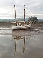 Boat and reflection, Turf, Exe Estuary - geograph.org.uk - 82394.jpg 478 × 640; 152 KB
-
 Boat in the mud, River Exe - geograph.org.uk - 1623651.jpg 640 × 383; 70 KB
-
 Boat off Exmouth beach.jpg 3,303 × 2,231; 2.82 MB
-
 Boats at Starcross - geograph.org.uk - 773165.jpg 480 × 640; 43 KB
-
 Boats at Topsham - geograph.org.uk - 264491.jpg 480 × 640; 121 KB
-

-
 Boats in the mud, Topsham - geograph.org.uk - 1109171.jpg 640 × 430; 64 KB
-

-
 Boats moored by the River Exe - geograph.org.uk - 1309104.jpg 640 × 480; 135 KB
-

-
 Boats on the mud at Cockwood harbour - geograph.org.uk - 994590.jpg 640 × 391; 64 KB
-
 Boats speed away from the Turf Lock - geograph.org.uk - 1285706.jpg 640 × 480; 66 KB
-

-
 Breakwater, Lympstone Boat Shelter - geograph.org.uk - 1114256.jpg 640 × 430; 89 KB
-
 Breakwater, Starcross - geograph.org.uk - 1418273.jpg 640 × 480; 57 KB
-
 Brent Geese feeding - geograph.org.uk - 1137867.jpg 640 × 427; 201 KB
-
 Brent Geese on the River Exe Estuary - geograph.org.uk - 1181339.jpg 640 × 427; 92 KB
-
 Brent Geese, on the Exe Estuary - geograph.org.uk - 1170722.jpg 640 × 480; 56 KB
-

-
 Causeway, Topsham - geograph.org.uk - 264801.jpg 480 × 640; 96 KB
-
 Channel marker buoy, Exe estuary - geograph.org.uk - 188032.jpg 640 × 480; 75 KB
-
 Channel marker buoy, Exe estuary - geograph.org.uk - 188047.jpg 640 × 480; 78 KB
-
 Chilly view - geograph.org.uk - 1137845.jpg 640 × 426; 191 KB
-
 Coastal defence, Exton - geograph.org.uk - 1059792.jpg 640 × 480; 115 KB
-
 Cockle Sand, Exe estuary - geograph.org.uk - 188052.jpg 640 × 480; 67 KB
-
 Cockle Sands - geograph.org.uk - 1114790.jpg 640 × 430; 68 KB
-
 Cockles Sands, Exe Estuary - geograph.org.uk - 1075790.jpg 640 × 480; 98 KB
-
 Cocklesand - geograph.org.uk - 1137862.jpg 640 × 426; 185 KB
-
 Cocklesand Exmouth - geograph.org.uk - 1119841.jpg 640 × 451; 42 KB
-
 Cocklesand the Exe estuary - geograph.org.uk - 1119819.jpg 640 × 480; 75 KB
-
 Cockwood (2021-07-31) 04.jpg 5,568 × 3,712; 13.1 MB
-
 Cockwood (2021-07-31) 09.jpg 5,568 × 3,712; 15.81 MB
-
 Cockwood - FGW 143611+143619 up train.JPG 1,366 × 910; 456 KB
-
 Cockwood - FGW 43070 up Royal Duchy.JPG 1,366 × 910; 364 KB
-
 Cockwood and the Haldon Hills - geograph.org.uk - 1181296.jpg 640 × 427; 52 KB
-

-
-
 Countess Wear Bridge - geograph.org.uk - 1452080.jpg 640 × 480; 258 KB
-
 Countess Wear Bridge - geograph.org.uk - 1452083.jpg 640 × 480; 263 KB
-
 Countess Wear Bridge and river Exe - geograph.org.uk - 1560849.jpg 640 × 480; 235 KB
-
 Countess Wear Bridge over the Exe - geograph.org.uk - 200859.jpg 640 × 480; 133 KB
-
 Countess Weir Exeter England.jpg 1,075 × 832; 160 KB
-

-
 Crossing Berry Brook - geograph.org.uk - 1223852.jpg 640 × 480; 98 KB
-
-
 Cyclist, near Powderham - geograph.org.uk - 1062234.jpg 640 × 480; 74 KB
-
 Darling's Rock Lympstone - geograph.org.uk - 1117427.jpg 640 × 446; 64 KB
-
 Darling's Rock, Lympstone - geograph.org.uk - 1114254.jpg 640 × 430; 44 KB
-

-
-

-

-
-
 Dawlish Warren , Sandy Spit - geograph.org.uk - 1345347.jpg 640 × 239; 46 KB
-
 Dawlish Warren , Sandy Spit - geograph.org.uk - 1345361.jpg 640 × 210; 27 KB
-

-

-

-

-
 Dawlish Warren from the estuary - geograph.org.uk - 78349.jpg 640 × 480; 58 KB
-

-
 Dos Ailithrr and Pieter in the mud - geograph.org.uk - 1109176.jpg 640 × 430; 84 KB
-

-

-

-

-
 East Devon , The River Exe - geograph.org.uk - 1445566.jpg 640 × 480; 33 KB
-
 East Devon Way along the Exe Estuary - geograph.org.uk - 1114107.jpg 640 × 430; 57 KB
-
 East Devon Way along the River Exe - geograph.org.uk - 1114719.jpg 640 × 430; 54 KB
-

-

-
 Entrance to Exmouth Marina - geograph.org.uk - 1301806.jpg 640 × 480; 109 KB
-
 Estuary - panoramio.jpg 578 × 432; 101 KB
-
 Estuary and footpath near Turf lock - geograph.org.uk - 866564.jpg 640 × 480; 79 KB
-
 Estuary Evening - panoramio.jpg 2,848 × 2,139; 1.94 MB
-
 Estuary of the River Exe - geograph.org.uk - 43739.jpg 640 × 427; 45 KB
-
 Estuary of the River Exe, Exmouth - geograph.org.uk - 221516.jpg 640 × 480; 84 KB
-
 Estuary shore at Topsham - geograph.org.uk - 1113434.jpg 640 × 480; 59 KB
-
 Estuary View - panoramio.jpg 2,848 × 2,136; 1.71 MB
-
 Exe at Cockwood - geograph.org.uk - 772910.jpg 640 × 466; 115 KB
-
 Exe Estuary - geograph.org.uk - 1223796.jpg 480 × 640; 85 KB
-
 Exe estuary - geograph.org.uk - 1251995.jpg 640 × 461; 45 KB
-
 Exe Estuary - geograph.org.uk - 282141.jpg 640 × 480; 30 KB
-
 Exe Estuary - geograph.org.uk - 282146.jpg 480 × 640; 23 KB
-
 Exe estuary - geograph.org.uk - 387381.jpg 480 × 640; 42 KB
-
 Exe Estuary - geograph.org.uk - 4906440.jpg 640 × 385; 25 KB
-
 Exe Estuary - geograph.org.uk - 708638.jpg 640 × 480; 84 KB
-
 Exe Estuary alongside the Avocet Line.jpg 3,547 × 1,999; 1.04 MB
-
 Exe estuary and station footbridge - geograph.org.uk - 1078247.jpg 640 × 429; 54 KB
-
 Exe estuary at low tide - geograph.org.uk - 917222.jpg 640 × 480; 73 KB
-
 Exe Estuary at Turf.jpg 4,120 × 2,848; 3.47 MB
-
 Exe estuary cliffs, near Lympstone - geograph.org.uk - 1028901.jpg 640 × 480; 113 KB
-
 Exe estuary from balloon.jpg 631 × 469; 72 KB
-
 Exe Estuary from near Turf Lock - geograph.org.uk - 237891.jpg 640 × 480; 135 KB
-

-
 Exe Estuary Nature Reserve - geograph.org.uk - 1170714.jpg 640 × 464; 70 KB
-
 Exe Estuary.jpg 4,272 × 2,848; 4.92 MB
-
 Exe Estury at high tide - panoramio.jpg 2,048 × 1,536; 896 KB
-
 Exe mud - geograph.org.uk - 1114716.jpg 640 × 430; 51 KB
-

-
-
 Exe Slipway by Riversmeet House - geograph.org.uk - 956412.jpg 640 × 480; 90 KB
-
 ExeEstuaryAtPowderham.jpg 2,816 × 2,112; 1 MB
-
-
 Exeter Ship Canal meets the Exe.jpg 3,843 × 2,693; 2.58 MB
-
 A fishing trawler returns to Exmouth - geograph.org.uk - 542187.jpg 640 × 482; 98 KB
-

-
 Exmouth - FGW 153305+150232 Exeter to Exmouth train.JPG 1,366 × 820; 601 KB
-
 Exmouth - fGWR 143618+143620 Paignton train.JPG 1,366 × 910; 782 KB
-
 Exmouth - fGWR 150101+153370 approaching from Paignton.JPG 1,366 × 910; 501 KB
-
 Exmouth - fGWR 150243+153325 Barnstaple train.JPG 1,366 × 910; 574 KB
-
 Exmouth - geograph.org.uk - 518563.jpg 640 × 480; 85 KB
-
 Exmouth - geograph.org.uk - 518582.jpg 640 × 480; 89 KB
-
 Exmouth - geograph.org.uk - 97819.jpg 640 × 480; 98 KB
-
 Exmouth - panoramio.jpg 3,072 × 2,304; 3.07 MB
-
 Exmouth Beach - geograph.org.uk - 1091457.jpg 640 × 480; 83 KB
-
 Exmouth Dock - geograph.org.uk - 917219.jpg 640 × 480; 86 KB
-
 Exmouth Estuary - panoramio (1).jpg 3,072 × 2,304; 2.74 MB
-
 Exmouth Estuary - panoramio (2).jpg 3,072 × 2,304; 2.77 MB
-
 Exmouth Estuary - panoramio.jpg 3,072 × 2,304; 2.74 MB
-
 Exmouth from the Exe Estuary - geograph.org.uk - 1048656.jpg 640 × 480; 45 KB
-
 Exmouth lifeboat 12-21 Margaret Jean moored in the Exe.jpg 1,024 × 768; 226 KB
-
 Exmouth lifeboat passes Pole Sand - geograph.org.uk - 1094047.jpg 640 × 480; 59 KB
-
 Exmouth Lifeboat. - geograph.org.uk - 420766.jpg 640 × 480; 98 KB
-

-

-
 Exmouth, Mamhead Slipway - geograph.org.uk - 1038848.jpg 640 × 480; 68 KB
-
 Exmouth, River Exe estuary - geograph.org.uk - 1038800.jpg 640 × 480; 100 KB
-
 Exmouth, view across the Exe - geograph.org.uk - 1476993.jpg 640 × 480; 103 KB
-
 Exton - FGW 143618+153361.JPG 1,366 × 910; 481 KB
-
 Exton railway station, Devon.jpg 4,000 × 3,000; 3.88 MB
-
 Exton village with a flock of Dunlin - geograph.org.uk - 1181354.jpg 640 × 427; 78 KB
-
 Fence, Dawlish Warren - geograph.org.uk - 1252017.jpg 640 × 480; 82 KB
-
 Ferry slips at Topsham.jpg 3,907 × 2,672; 3.91 MB
-
 First Great Western - geograph.org.uk - 997666.jpg 640 × 480; 82 KB
-

-
 Fishing boat in the Exe estuary - geograph.org.uk - 1306377.jpg 640 × 480; 87 KB
-
 Flood protection wall, Exe estuary - geograph.org.uk - 1223598.jpg 640 × 461; 87 KB
-
 Foot Ferry to Topsham - geograph.org.uk - 957949.jpg 640 × 480; 73 KB
-

-
 Foreshore at Cocklesand - geograph.org.uk - 1137869.jpg 640 × 427; 204 KB
-
 Geese on the road - geograph.org.uk - 1033981.jpg 640 × 480; 97 KB
-
 Goat Walk, Topsham - geograph.org.uk - 1313999.jpg 640 × 480; 105 KB
-
 Great Bull Hill - geograph.org.uk - 1253547.jpg 640 × 400; 46 KB
-
 Harbour, Cockwood - geograph.org.uk - 772973.jpg 640 × 480; 105 KB
-
 Herring Gull - geograph.org.uk - 1235354.jpg 640 × 480; 94 KB
-
 High tide, on the Exe estuary - geograph.org.uk - 1280602.jpg 640 × 480; 46 KB
-
 Ice, near the Goat Walk, Topsham - geograph.org.uk - 1653996.jpg 640 × 480; 85 KB
-

-

-
 Kite Surfers (8440895093) (2).jpg 3,550 × 1,248; 2.68 MB
-
 Kitesurfing in the Exe estuary - geograph.org.uk - 1285648.jpg 640 × 480; 58 KB
-
 Landing stage at Powderham - geograph.org.uk - 78342.jpg 640 × 480; 113 KB
-

-

-
 Landing stage, Turf Hotel - geograph.org.uk - 1003691.jpg 640 × 480; 77 KB
-
 Lifeboat off Lympstone.JPG 1,366 × 910; 453 KB
-
 Lonesome pine - geograph.org.uk - 1078242.jpg 640 × 429; 53 KB
-

-
-
 Low tide - Cockwood Harbour - geograph.org.uk - 1570045.jpg 640 × 480; 65 KB
-
 Low Tide at Cockwood - geograph.org.uk - 990163.jpg 640 × 480; 76 KB
-
 Low Tide at Exmouth - geograph.org.uk - 1091454.jpg 640 × 353; 48 KB
-
 Low tide at Exmouth - geograph.org.uk - 675977.jpg 500 × 400; 100 KB
-
 Low tide at Starcross - geograph.org.uk - 1048113.jpg 640 × 480; 87 KB
-
 Low Tide exposes the Maer Rocks - geograph.org.uk - 931997.jpg 640 × 480; 74 KB
-
 Low Tide in the Exe Estuary - geograph.org.uk - 1048643.jpg 640 × 480; 91 KB
-
 Low tide on the Exe - geograph.org.uk - 560547.jpg 640 × 480; 69 KB
-
 Low tide on the Exe Estuary - geograph.org.uk - 1114713.jpg 640 × 430; 55 KB
-
 Low tide on the River Exe, Starcross - geograph.org.uk - 1117262.jpg 640 × 430; 53 KB
-
 Lympstone (8440898249).jpg 3,648 × 1,635; 2.39 MB
-
 Lympstone - FGW 150233 by the river.JPG 1,366 × 820; 655 KB
-
 Lympstone - fGWR 150123 Exmouth train.JPG 1,366 × 910; 649 KB
-
 Lympstone - GWR 150261 Exeter train.JPG 1,366 × 910; 525 KB
-
 Lympstone allotments - geograph.org.uk - 760565.jpg 640 × 480; 103 KB
-
 Lympstone at low tide - geograph.org.uk - 1137840.jpg 640 × 427; 197 KB
-
 Lympstone Boat Shelter - geograph.org.uk - 1114250.jpg 640 × 430; 76 KB
-
 Lympstone Commando - FGW 150233 down train.JPG 1,366 × 910; 483 KB
-
 Lympstone Devon - geograph.org.uk - 1117861.jpg 640 × 480; 69 KB
-
 Lympstone from the Exe - geograph.org.uk - 1285658.jpg 640 × 480; 68 KB


_04.jpg)
_09.jpg)


.jpg)
.jpg)


.jpg)


_(2).jpg)