Category:Ewes, Dumfries and Galloway
Jump to navigation
Jump to search
Scottish parish in Dumfries and Galloway, Scotland, UK | |||||
| Upload media | |||||
| Instance of | |||||
|---|---|---|---|---|---|
| Location |
| ||||
| Population |
| ||||
| Area |
| ||||
 | |||||
CIVIL PARISH MAP of Dumfriesshire to be used as a guide. Ref: http://maps.nls.uk/atlas/thomson/555.html
CIVIL PARISH HISTORICAL TAX ROLLS for the Civil Parish of Ewes, Dumfries and Galloway, (Volumes 1-5) refer http://www.scotlandsplaces.gov.uk/digital_volumes/book.php?book_id=555&place_id=10&p_name=Dumfriesshire
Subcategories
This category has the following 5 subcategories, out of 5 total.
A
- Arkleton (8 F)
B
- Burnfoot, Dumfries and Galloway (14 F)
E
- Ewes Parish Church (13 F)
M
- Meikledale Burn (7 F)
U
Media in category "Ewes, Dumfries and Galloway"
The following 200 files are in this category, out of 288 total.
(previous page) (next page)-
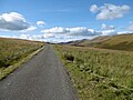
 A country road - geograph.org.uk - 341907.jpg 640 × 480; 125 KB
-
 A drystane dyke near Little Tarras Water - geograph.org.uk - 683021.jpg 640 × 480; 111 KB
-
 A drystone dyke and electric fence - geograph.org.uk - 634711.jpg 640 × 480; 133 KB
-
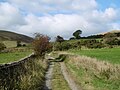
 A farm track in Unthank Hope - geograph.org.uk - 736329.jpg 480 × 640; 126 KB
-
 A farm track on Auldshiels Hill - geograph.org.uk - 634704.jpg 640 × 480; 122 KB
-
 A fence and gate on Wether Law - geograph.org.uk - 3250855.jpg 640 × 480; 265 KB
-
 A fence on Broad Head - geograph.org.uk - 1074306.jpg 427 × 640; 135 KB
-
 A fence on Broad Head - geograph.org.uk - 571811.jpg 640 × 480; 116 KB
-
 A fence on The Pikes - geograph.org.uk - 1975123.jpg 640 × 480; 194 KB
-
 A fence running up to Stibbiegill Head - geograph.org.uk - 571793.jpg 631 × 470; 119 KB
-
 A gate on Broom Hill - geograph.org.uk - 683133.jpg 640 × 480; 116 KB
-
 A grass track on Sole Hill - geograph.org.uk - 556645.jpg 640 × 480; 103 KB
-
 A grass track on Stibbiegill Knowe - geograph.org.uk - 571790.jpg 640 × 480; 106 KB
-

-
 A minor road in Eskdale - geograph.org.uk - 344512.jpg 640 × 480; 94 KB
-
 A minor road near Tarras Lodge - geograph.org.uk - 520622.jpg 640 × 480; 120 KB
-
 A minor road off the A7 - geograph.org.uk - 5369189.jpg 2,000 × 1,333; 2 MB
-
 A plaque on Unthank Bridge - geograph.org.uk - 2151709.jpg 640 × 452; 142 KB
-
 A pond on Loch Hill - geograph.org.uk - 683143.jpg 640 × 480; 133 KB
-
 A sign by the track at Burngrains - geograph.org.uk - 1078167.jpg 640 × 427; 142 KB
-
 A small burn on Stake Hill - geograph.org.uk - 558729.jpg 480 × 640; 140 KB
-
 A small enclosure on Hareshaw Hill - geograph.org.uk - 574143.jpg 640 × 480; 121 KB
-
 A small plantation on Castlewink - geograph.org.uk - 3248562.jpg 635 × 471; 213 KB
-
 A small plantation on Castlewink - geograph.org.uk - 4918552.jpg 1,024 × 768; 309 KB
-
 A track at Jock's Hope - geograph.org.uk - 1071130.jpg 640 × 427; 121 KB
-
 A track at Rigfoot - geograph.org.uk - 1078175.jpg 427 × 640; 137 KB
-
 A track at Swingill - geograph.org.uk - 556654.jpg 640 × 480; 97 KB
-
 A track leading up to Roughbank Height - geograph.org.uk - 1074312.jpg 427 × 640; 157 KB
-
 A track on Wether Law - geograph.org.uk - 3269357.jpg 640 × 480; 255 KB
-
 A Viewback Towards Mosspeeble - geograph.org.uk - 4340120.jpg 2,560 × 1,920; 3.05 MB
-
 A7 heading north past Fiddleton - geograph.org.uk - 1815302.jpg 640 × 480; 99 KB
-
 A7 heading south near Hoghill - geograph.org.uk - 1816370.jpg 640 × 430; 41 KB
-
 A7 layby - geograph.org.uk - 4919416.jpg 1,024 × 768; 385 KB
-
 A7, Ewes Water - geograph.org.uk - 4918920.jpg 1,024 × 768; 363 KB
-
 A7, Ewes Water - geograph.org.uk - 4918938.jpg 1,024 × 768; 297 KB
-
 A7, Ewesdale - geograph.org.uk - 4919449.jpg 1,024 × 768; 249 KB
-
 Above Little Tudhope Hill - geograph.org.uk - 5169242.jpg 1,920 × 1,280; 540 KB
-
 Access road to Middlemoss - geograph.org.uk - 1250929.jpg 640 × 480; 98 KB
-
 Access track and walking route - geograph.org.uk - 556607.jpg 480 × 640; 127 KB
-
 Adder Gill - geograph.org.uk - 350832.jpg 640 × 480; 155 KB
-
 An access road on Crude Hill - geograph.org.uk - 2343014.jpg 640 × 427; 161 KB
-
 An electric fence on Faw Side - geograph.org.uk - 556635.jpg 640 × 480; 111 KB
-
 An unnamed sike - geograph.org.uk - 636278.jpg 640 × 480; 131 KB
-
 Arkleton and the Ewes Water valley - geograph.org.uk - 3517596.jpg 3,264 × 2,448; 3.6 MB
-
 Arkleton Burn - geograph.org.uk - 636280.jpg 640 × 480; 175 KB
-
 Arkleton Cottage Ford - geograph.org.uk - 5850619.jpg 1,500 × 1,000; 2.61 MB
-
 Arkleton Hill - geograph.org.uk - 3363607.jpg 640 × 460; 201 KB
-
 Arkleton Hill - geograph.org.uk - 4339495.jpg 2,560 × 1,920; 2.68 MB
-
 Ashy Sike - geograph.org.uk - 2216558.jpg 2,592 × 1,944; 2.27 MB
-

-
 Bauchle Hill - geograph.org.uk - 350812.jpg 640 × 480; 139 KB
-
 Bauchle Hill - geograph.org.uk - 350823.jpg 640 × 480; 130 KB
-
 Billhope Hass - geograph.org.uk - 4918489.jpg 768 × 1,024; 427 KB
-
 Billhope Hass - geograph.org.uk - 4918494.jpg 1,024 × 768; 368 KB
-
 Billhope Hass - geograph.org.uk - 4918498.jpg 1,024 × 768; 413 KB
-
 Black Cove - geograph.org.uk - 4919000.jpg 1,024 × 768; 232 KB
-
 Border Hill countryside - geograph.org.uk - 871860.jpg 640 × 427; 122 KB
-
 Breaking Camp, Ellson Fell - geograph.org.uk - 5169343.jpg 1,920 × 1,280; 515 KB
-
 Bridge Over Ewes Water at Fiddleton - geograph.org.uk - 4191891.jpg 4,000 × 3,000; 4.19 MB
-
 Bridge Over Ewes Water at Mosspeeble - geograph.org.uk - 4191884.jpg 4,000 × 3,000; 3.51 MB
-
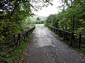
 Bridge over Jock's Hope Burn - geograph.org.uk - 263061.jpg 640 × 445; 104 KB
-
 Bridge over the Tarras Water - geograph.org.uk - 4920612.jpg 1,024 × 768; 315 KB
-
 Bridge over the Tarras Water - geograph.org.uk - 574165.jpg 640 × 480; 108 KB
-
 Bridge, Back Burn - geograph.org.uk - 4918538.jpg 1,024 × 768; 299 KB
-
 Bridge, Hoghill - geograph.org.uk - 4919439.jpg 1,024 × 768; 465 KB
-
 Briery Bank - geograph.org.uk - 4919410.jpg 1,024 × 768; 325 KB
-
 Burnfoot Farm in Ewesdale - geograph.org.uk - 2124188.jpg 640 × 382; 121 KB
-
 Burnsgrains Cottage, Ewes - geograph.org.uk - 263057.jpg 640 × 439; 125 KB
-
 Butter Hill - geograph.org.uk - 3250857.jpg 640 × 480; 226 KB
-
 Carehoperig - geograph.org.uk - 4918531.jpg 1,024 × 768; 326 KB
-
 Carewood Rig - geograph.org.uk - 3258922.jpg 640 × 480; 234 KB
-
 Carewood Rig - geograph.org.uk - 4918518.jpg 1,024 × 768; 295 KB
-
 Carewoodrig - geograph.org.uk - 1251162.jpg 640 × 480; 77 KB
-
 Carewoodrig Burn - geograph.org.uk - 4918554.jpg 1,024 × 768; 356 KB
-
 Carewoodrig Burn - geograph.org.uk - 5531242.jpg 640 × 480; 84 KB
-
 Carewoodrig Farm - geograph.org.uk - 2216563.jpg 2,592 × 1,944; 1.32 MB
-
 Carlin Tooth from Ellson Fell - geograph.org.uk - 2216545.jpg 2,592 × 1,944; 1.5 MB
-
 Castlewink - geograph.org.uk - 4918566.jpg 1,024 × 768; 330 KB
-
 Cattle feeders on Crude Hill - geograph.org.uk - 2341170.jpg 640 × 427; 180 KB
-
 Cattle near Burnfoot - geograph.org.uk - 827020.jpg 640 × 480; 117 KB
-
 Clear fell area on Auldshiels Hill - geograph.org.uk - 634697.jpg 640 × 480; 129 KB
-
 Copse on Castlewink - geograph.org.uk - 5531234.jpg 640 × 480; 56 KB
-
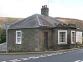
 Cottage at the side of the A7 - geograph.org.uk - 1815406.jpg 640 × 496; 84 KB
-
 Covered Reservoir On Bauchle Hill - geograph.org.uk - 1410616.jpg 480 × 640; 123 KB
-
 Cows, Carewoodrigg - geograph.org.uk - 5169387.jpg 1,857 × 1,239; 445 KB
-
 Crags, Wrae Hill - geograph.org.uk - 4919427.jpg 1,024 × 768; 271 KB
-
 Descending Castlewink - geograph.org.uk - 5169351.jpg 1,920 × 1,280; 535 KB
-
 Descending Tudhope Hill - geograph.org.uk - 5169240.jpg 1,920 × 1,280; 503 KB
-
 Detail on the Lady Florance Stone - geograph.org.uk - 557937.jpg 480 × 640; 145 KB
-
 Dyke, Wrae Hill - geograph.org.uk - 4919431.jpg 1,024 × 768; 293 KB
-
 Ellson Fell - geograph.org.uk - 3347822.jpg 1,600 × 1,200; 829 KB
-
 Ellson Fell - geograph.org.uk - 4918521.jpg 1,024 × 768; 345 KB
-
 Ellson Fell from Carlin Tooth - geograph.org.uk - 2216534.jpg 2,592 × 1,944; 1.62 MB
-
 Ellson Fell South West Top - geograph.org.uk - 3347829.jpg 1,600 × 1,200; 923 KB
-
 Ellson Fell South West Top - geograph.org.uk - 5169348.jpg 1,920 × 1,280; 535 KB
-
 Ellson Fell, south-west ridge - geograph.org.uk - 2216551.jpg 2,592 × 1,944; 1.37 MB
-
 En Route To Potholme Hill - geograph.org.uk - 4339450.jpg 2,560 × 1,920; 2.4 MB
-
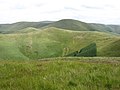
 Ewe Hill - geograph.org.uk - 379176.jpg 640 × 480; 142 KB
-
 Ewes Hall - geograph.org.uk - 1250695.jpg 640 × 480; 60 KB
-
 Ewes Hall - geograph.org.uk - 1815451.jpg 640 × 480; 69 KB
-
 Ewes Hall - geograph.org.uk - 4919395.jpg 1,024 × 768; 290 KB
-
 Ewes Hall and Post Box near Bush - geograph.org.uk - 363465.jpg 640 × 480; 108 KB
-
 Ewes Parish Church - geograph.org.uk - 3924397.jpg 640 × 480; 274 KB
-
 Ewes Parish Church - geograph.org.uk - 4191869.jpg 4,000 × 3,000; 3.06 MB
-
 Ewes Parish Church - geograph.org.uk - 565565.jpg 640 × 480; 111 KB
-
 Ewes School House - geograph.org.uk - 4191876.jpg 4,000 × 3,000; 3.26 MB
-
 Ewes Water - geograph.org.uk - 4919440.jpg 1,024 × 768; 460 KB
-
 Ewes Water and Mosspeeble - geograph.org.uk - 1250737.jpg 640 × 480; 84 KB
-
 Ewesdale - geograph.org.uk - 4919451.jpg 1,024 × 768; 359 KB
-
 Eweshaugh-Sandyhaugh road - geograph.org.uk - 4919408.jpg 1,024 × 768; 374 KB
-
 Farm road, Brieryshaw - geograph.org.uk - 4919421.jpg 1,024 × 768; 341 KB
-
 Farmland at Ewes - geograph.org.uk - 1126567.jpg 640 × 427; 132 KB
-
 Farmland at Eweslees - geograph.org.uk - 1035352.jpg 640 × 427; 163 KB
-
 Farmland at the head of Ewesdale - geograph.org.uk - 2146378.jpg 427 × 640; 145 KB
-
 Fiddleton - geograph.org.uk - 4918581.jpg 1,024 × 768; 441 KB
-
 Fiddleton Brae - geograph.org.uk - 4918971.jpg 1,024 × 768; 409 KB
-
 Field, Fiddleton - geograph.org.uk - 4918919.jpg 1,024 × 768; 405 KB
-
 Forestry on Ellson Fell - geograph.org.uk - 2737343.jpg 640 × 427; 230 KB
-
 Forestry road on Auldshiels Hill - geograph.org.uk - 636271.jpg 640 × 480; 131 KB
-
 Former Tollhouse by the A7, Fiddleton - geograph.org.uk - 6114509.jpg 1,024 × 766; 153 KB
-
 Glendivan Farm - geograph.org.uk - 1812282.jpg 640 × 419; 167 KB
-
 Glendivan Farm - geograph.org.uk - 680063.jpg 635 × 469; 134 KB
-
 Glenrief - geograph.org.uk - 4918559.jpg 1,024 × 768; 359 KB
-
 Glenrief and Crude Hill - geograph.org.uk - 1250920.jpg 640 × 480; 80 KB
-
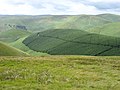
 Good sheep country - geograph.org.uk - 5369194.jpg 2,000 × 1,333; 1.92 MB
-
 Grassland, Ewes - geograph.org.uk - 2472243.jpg 640 × 480; 276 KB
-
 Grazing in the Valley - geograph.org.uk - 1816378.jpg 640 × 480; 60 KB
-

-
 Hathorn scrub - geograph.org.uk - 1250967.jpg 640 × 480; 93 KB
-
 Haugh, Unthank - geograph.org.uk - 4918977.jpg 1,024 × 768; 323 KB
-
 Haughs, Ewes Water - geograph.org.uk - 4918937.jpg 1,024 × 768; 324 KB
-
 Head of the Bauchie Sike - geograph.org.uk - 1250668.jpg 640 × 480; 93 KB
-
 Heading down hill to the settlement of Sorbie and the A7 - geograph.org.uk - 3936817.jpg 3,264 × 2,448; 3.69 MB
-
 Hermitage road - geograph.org.uk - 4918529.jpg 1,024 × 768; 340 KB
-
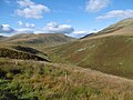
 Hill countryside in the Ewes Valley - geograph.org.uk - 683047.jpg 640 × 480; 121 KB
-
 Hill countryside near Roughbank Height - geograph.org.uk - 1078183.jpg 640 × 427; 131 KB
-
 Hill farmland - geograph.org.uk - 634745.jpg 640 × 480; 116 KB
-
 Hillside and moors - geograph.org.uk - 263059.jpg 640 × 440; 84 KB
-
 Hillside near Tarras Lodge - geograph.org.uk - 574171.jpg 640 × 480; 117 KB
-
 Hog Hill - geograph.org.uk - 683087.jpg 640 × 480; 116 KB
-
 Icicles by a hill track - geograph.org.uk - 3250850.jpg 640 × 489; 229 KB
-
 Kew Sike - geograph.org.uk - 1192456.jpg 640 × 480; 73 KB
-
 Kew Sike - geograph.org.uk - 4918509.jpg 1,024 × 768; 349 KB
-
 Langholm Moor - geograph.org.uk - 4920551.jpg 1,024 × 768; 355 KB
-
 Langholm Moor - geograph.org.uk - 4920554.jpg 1,024 × 768; 324 KB
-
 Langholm to Newcastleton road - geograph.org.uk - 4920621.jpg 1,024 × 768; 264 KB
-
 Lay-by at Brieryshaw - geograph.org.uk - 1815847.jpg 640 × 480; 92 KB
-
 Lay-by near Arkleton - geograph.org.uk - 1816358.jpg 640 × 480; 93 KB
-

-
 Little Tarras Water - geograph.org.uk - 4920585.jpg 1,024 × 768; 316 KB
-
 Little Tudhope Hill - geograph.org.uk - 2216525.jpg 2,592 × 1,944; 1.72 MB
-
 Little Tudhope Hill and Tudhope Hill - geograph.org.uk - 2693595.jpg 640 × 259; 204 KB
-
 Livestock pens - geograph.org.uk - 1250945.jpg 640 × 480; 109 KB
-
 Loch Hill - geograph.org.uk - 4919419.jpg 1,024 × 768; 296 KB
-
 Longgrain Head - geograph.org.uk - 349454.jpg 640 × 480; 140 KB
-
 Longgrain Head - geograph.org.uk - 349458.jpg 640 × 480; 142 KB
-
 Lowland Pasture At Fiddleton - geograph.org.uk - 1707309.jpg 640 × 480; 67 KB
-
 March Sike - geograph.org.uk - 5169378.jpg 1,920 × 1,280; 495 KB
-
 Minor road approaching Billhope Hass - geograph.org.uk - 2216561.jpg 2,592 × 1,944; 1.19 MB
-
 Moorland grazing - geograph.org.uk - 520624.jpg 640 × 480; 104 KB
-
 Moorland on Broad Head - geograph.org.uk - 574139.jpg 640 × 480; 100 KB
-

-

-
 No, I'm not the farmer. - geograph.org.uk - 1152045.jpg 639 × 449; 145 KB
-

-
 On Ellson Fell - geograph.org.uk - 5169344.jpg 1,920 × 1,280; 505 KB
-
 On Little Tudhope Hill - geograph.org.uk - 5169243.jpg 1,920 × 1,280; 507 KB
-
 On Little Tudhope Hill - geograph.org.uk - 5169328.jpg 1,920 × 1,280; 514 KB
-
 On Tudhope Hill - geograph.org.uk - 5169237.jpg 1,920 × 1,280; 525 KB
-
 Ordnance Survey Cut Mark - geograph.org.uk - 4263583.jpg 4,000 × 3,000; 4.4 MB
-
 Ordnance Survey Flush Bracket 11966 - geograph.org.uk - 4264018.jpg 4,000 × 3,000; 2.97 MB
-
 Ordnance Survey Flush Bracket 12085 - geograph.org.uk - 4264044.jpg 4,000 × 3,000; 4.25 MB
-
 Ordnance Survey Flush Bracket S7372 - geograph.org.uk - 4263576.jpg 4,000 × 3,000; 4.86 MB
-
 Ordnance Survey Flush Bracket S7373 - geograph.org.uk - 4263569.jpg 4,000 × 3,000; 3.23 MB
-
 Ordnance Survey Flush Bracket S7374 - geograph.org.uk - 4263561.jpg 4,000 × 3,000; 4.31 MB
-
 Ordnance Survey Flush Bracket S7375 - geograph.org.uk - 4263547.jpg 4,000 × 3,000; 3.6 MB
-
 Pasture - geograph.org.uk - 341930.jpg 640 × 480; 99 KB
-
 Pasture field near Ewes Hall - geograph.org.uk - 573030.jpg 640 × 480; 103 KB
-
 Pasture land below Upper Hill - geograph.org.uk - 1815342.jpg 640 × 480; 69 KB
-
 Peat cutting at Tarras Rig - geograph.org.uk - 1930131.jpg 640 × 427; 141 KB
-
 Picnic area adjacent to Ewes Hall - geograph.org.uk - 1815527.jpg 640 × 480; 75 KB
-
 Pike Fell - geograph.org.uk - 4339491.jpg 2,560 × 1,920; 2.66 MB
-
 Pikethaw Hill - geograph.org.uk - 4701290.jpg 2,560 × 1,920; 2.84 MB
-
 Plantation on Glenrief Rig - geograph.org.uk - 2216553.jpg 2,592 × 1,944; 1.72 MB
-
 Potholme Hill - geograph.org.uk - 4339455.jpg 2,560 × 1,920; 2.9 MB
-
 Pylons by the A7 - geograph.org.uk - 6335168.jpg 709 × 1,024; 467 KB
-
 Pylons near Hoghill - geograph.org.uk - 2253009.jpg 427 × 640; 207 KB
-
 Pylons off A7 - geograph.org.uk - 363443.jpg 640 × 480; 89 KB
-
 Riggfoot - geograph.org.uk - 592592.jpg 640 × 426; 41 KB
-
 Road and Barn at Carewoodrig - geograph.org.uk - 4191897.jpg 4,000 × 3,000; 2.97 MB
-
 Road at Carewood Rigg - geograph.org.uk - 5169393.jpg 1,920 × 1,280; 542 KB
-
 Road Bridge at Tarras Lodge - geograph.org.uk - 5448252.jpg 640 × 480; 92 KB
-
 Road to A7 at Fiddleton - geograph.org.uk - 4191894.jpg 4,000 × 3,000; 4.05 MB
-
 Road to Carewood - geograph.org.uk - 5531226.jpg 640 × 422; 39 KB
-
 Road to Carewoodrig - geograph.org.uk - 2888744.jpg 816 × 612; 158 KB
-
 Road to Hermitage Castle - geograph.org.uk - 2888765.jpg 816 × 612; 154 KB
-
 Road under Tup Knowe - geograph.org.uk - 5169383.jpg 1,920 × 1,280; 558 KB
-
 Road, west side of Bill Hope Hass - geograph.org.uk - 4918516.jpg 1,024 × 768; 341 KB
-
 Roadside memorial - geograph.org.uk - 813335.jpg 640 × 427; 115 KB
-
 Rough Grazing at Pyat Knowe - geograph.org.uk - 4302934.jpg 640 × 468; 188 KB


