Category:Evangelisch-Lutherisches Pfarramt Rothenburg ob der Tauber
Jump to navigation
Jump to search
| Object location | | View all coordinates using: OpenStreetMap |
|---|
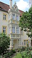
This is the category of the Bavarian Baudenkmal (cultural heritage monument) with the ID D-5-71-193-352 (Wikidata)
|
 | |||||
| Upload media | |||||
| Instance of | |||||
|---|---|---|---|---|---|
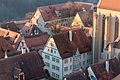
| Location | Rothenburg ob der Tauber, Ansbach, Middle Franconia, Bavaria, Germany | ||||
| Street address |
| ||||
| Heritage designation | |||||
 | |||||
Media in category "Evangelisch-Lutherisches Pfarramt Rothenburg ob der Tauber"
The following 45 files are in this category, out of 45 total.
-
 Bayern Rothenburg 13.jpg 6,016 × 4,016; 6.92 MB
-
 GER Rothenburg ob der Tauber, Klostergasse 001.jpg 3,024 × 4,032; 2.1 MB
-
 GER Rothenburg ob der Tauber, Klostergasse 003.jpg 3,024 × 4,032; 1.2 MB
-
 Rothenburg ob der Tauber 27.07.2016 Parish Office in Rothenburg (28275795694).jpg 5,184 × 3,456; 4.69 MB
-
 Rothenburg ob der Tauber Dekanat 001.jpg 3,264 × 4,928; 5.94 MB
-
 Rothenburg ob der Tauber Dekanat 002.jpg 4,928 × 3,264; 7.03 MB
-
 Rothenburg ob der Tauber Dekanat 003.jpg 4,928 × 3,264; 6.87 MB
-
 Rothenburg ob der Tauber Dekanat 004.jpg 3,264 × 4,928; 6.92 MB
-
 Rothenburg ob der Tauber Dekanat 006.jpg 3,264 × 4,928; 7.3 MB
-
 Rothenburg ob der Tauber Klostergasse 13, 15-001.jpg 3,264 × 4,928; 7.37 MB
-
 Rothenburg ob der Tauber Klostergasse 15-001.jpg 4,928 × 3,264; 7.3 MB
-
 Rothenburg ob der Tauber Klostergasse 15-002.jpg 3,264 × 4,928; 7.82 MB
-
 Rothenburg ob der Tauber Klostergasse 15-003.jpg 4,928 × 3,264; 6.74 MB
-
 Rothenburg ob der Tauber Klostergasse 15-004.jpg 3,264 × 4,928; 6.39 MB
-
 Rothenburg ob der Tauber Klostergasse 15-005.jpg 3,264 × 4,928; 5.62 MB
-
 Rothenburg ob der Tauber Klostergasse 15-006.JPG 3,264 × 4,928; 7.22 MB
-
 Rothenburg ob der Tauber May 2022 KW 19.jpg 4,032 × 3,024; 9.44 MB
-
-
 Rothenburg ob der Tauber, 91541 Rothenburg ob der Tauber, Germany - panoramio (8).jpg 1,150 × 2,048; 626 KB
-
 Rothenburg ob der Tauber, Ev. Dekanat, 08-2014-001.jpg 4,928 × 3,264; 10.57 MB
-
 Rothenburg ob der Tauber, Ev. Dekanat, vom Rathausturm 20170526 001.jpg 5,996 × 4,003; 13.91 MB
-
 Rothenburg ob der Tauber, Ev. Dekanatsamt, vom Rathausturm 20170526 001.jpg 5,995 × 4,002; 11.13 MB
-
 Rothenburg ob der Tauber, Klostergasse 15 20161203-001.jpg 5,996 × 4,003; 11.04 MB
-
 Rothenburg ob der Tauber, Klostergasse 15, Ansicht von Osten-20160108-001.jpg 6,016 × 4,016; 13.72 MB
-
 Rothenburg ob der Tauber, Klostergasse 15, Evang.-Luth. Dekanat-001.jpg 3,264 × 4,928; 7.66 MB
-
 Rothenburg ob der Tauber, Klostergasse 15, Evang.-Luth. Dekanat-002.jpg 4,928 × 3,264; 7.8 MB
-
 Rothenburg ob der Tauber, Klostergasse 15, Evang.-Luth. Dekanat-003.jpg 3,264 × 4,928; 6.33 MB
-
 Rothenburg ob der Tauber, Klostergasse 15, Evang.-Luth. Dekanat-004.jpg 3,264 × 4,928; 5.95 MB
-
 Rothenburg ob der Tauber, Klostergasse 15, Evang.-Luth. Dekanat-005.jpg 3,264 × 4,928; 7.74 MB
-
 Rothenburg ob der Tauber, Klostergasse 15, Evang.-Luth. Dekanat-006.jpg 3,264 × 4,928; 7.03 MB
-
 Rothenburg ob der Tauber, Klostergasse 15, Evang.-Luth. Dekanat-007.jpg 3,264 × 4,928; 7.23 MB
-
 Rothenburg ob der Tauber, Klostergasse 15-20140819-001.jpg 6,056 × 4,011; 10.5 MB
-
 Rothenburg ob der Tauber, Klostergasse 15-20140819-002.jpg 4,012 × 6,057; 8.67 MB
-
 Rothenburg ob der Tauber, Klostergasse 15-20140819-003.jpg 4,012 × 6,057; 7.84 MB
-
 Rothenburg ob der Tauber, Klostergasse 15-20140819-004.jpg 4,012 × 6,057; 10.91 MB
-
 Rothenburg ob der Tauber, Klostergasse 15-20140819-005.jpg 4,012 × 6,057; 9.91 MB
-
 Rothenburg ob der Tauber, Klostergasse 15-20140819-006.jpg 4,011 × 6,056; 9.98 MB
-
 Rothenburg ob der Tauber, Klostergasse 15-20151230-001.jpg 6,033 × 4,027; 11.2 MB
-
 Rothenburg ob der Tauber, Klostergasse 15-20151230-002.jpg 4,027 × 6,033; 11.82 MB
-
 Rothenburg ob der Tauber, Klostergasse 15-20151230-003.jpg 4,027 × 6,032; 10.21 MB
-
 Rothenburg ob der Tauber, Klostergasse 15-20151230-004.jpg 4,027 × 6,033; 10.6 MB
-
 Rothenburg ob der Tauber, Klostergasse, vom Rathausturm gesehen-001.jpg 4,928 × 3,264; 10.75 MB
-
 Rothenburg ob der Tauber, lutherisches Pfarramt, Erker, 5.jpeg 4,000 × 5,200; 7.58 MB
-
 Rothenburg ob der Tauber, Reichstadtmuseum, Ev. Dekant, vom Rathausturm 20161203-001.jpg 5,996 × 4,003; 13.91 MB
-
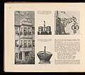 Unterfranken - Eine Streife auf Volkskunst und malerische Winkel 031.jpg 3,000 × 2,645; 1.1 MB


.jpg)


.jpg)
.jpg)


