Category:Euonymus europaeus in Ruhland
Jump to navigation
Jump to search
| Object location | | View all coordinates using: OpenStreetMap |
|---|
Pfaffenhütchen (Euonymus europaeus) in Ruhland[edit]
Deutsch: Diese Kategorie erfasst Pfaffenhütchen oder Gewöhnlicher Spindelstrauch (Euonymus europaeus) in Ruhland mit Ortsteil Arnsdorf.
English: This category contains Euonymus europaeus or European spindle tree in Ruhland with urban district Arnsdorf.
Subcategories
This category has only the following subcategory.
Pages in category "Euonymus europaeus in Ruhland"
This category contains only the following page.
Media in category "Euonymus europaeus in Ruhland"
The following 37 files are in this category, out of 37 total.
-

-
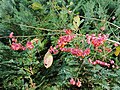
 Ruhland, Berliner Str. 29a, Pfaffenhütchen im Garten, Früchte, Herbst, 01.jpg 2,736 × 3,648; 4.13 MB
-
 Ruhland, Berliner Str. 29a, Pfaffenhütchen im Garten, Früchte, Herbst, 02.jpg 2,736 × 3,648; 4.33 MB
-
 Ruhland, Berliner Str. 29a, Pfaffenhütchen im Garten, Früchte, Herbst, 03.jpg 2,736 × 3,648; 2.54 MB
-
 Ruhland, Berliner Str. 29a, Pfaffenhütchen im Garten, Früchte, Herbst, 04.jpg 3,648 × 2,736; 4.15 MB
-
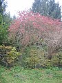
 Ruhland, Berliner Str. 29a, Pfaffenhütchen im Garten, Herbst, 01.jpg 3,648 × 2,736; 8.52 MB
-
 Ruhland, Berliner Str. 29a, Pfaffenhütchen im Garten, Herbst, 02.jpg 3,648 × 2,736; 8.18 MB
-
 Ruhland, Berliner Str. 29a, Pfaffenhütchen im Garten, Herbst, 03.jpg 2,736 × 3,648; 7.76 MB
-
 Ruhland, Berliner Str. 29a, Pfaffenhütchen im Garten, Herbst, 04.jpg 2,736 × 3,648; 8.39 MB
-
 Ruhland, Forsthaus 1, Pfaffenhütchen, Strauch fruchtend, Vorwinter, 01.jpg 2,736 × 3,648; 6.45 MB
-
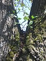 Ruhland, Goethestr. gegenüber Hausnr. 11, Pfaffenhütchen auf Winterlinde, Frühling, 01.jpg 2,736 × 3,648; 2.82 MB
-

-
 Ruhland, Goethestr. gegenüber Hausnr. 11, Pfaffenhütchen auf Winterlinde, Frühling, 03.jpg 3,000 × 4,000; 7.97 MB
-
 Ruhland, Goethestr. gegenüber Hausnr. 11, Pfaffenhütchen auf Winterlinde, Frühling, 04.jpg 3,000 × 4,000; 6.21 MB
-
 Ruhland, Goethestr. gegenüber Hausnr. 11, Pfaffenhütchen auf Winterlinde, Herbst, 01.jpg 3,000 × 4,000; 3.57 MB
-

-

-

-

-

-
-

-

-

-

-

-

-
 Ruhland, Grenzstr. 3, Pfaffenhütchen-Zweig fruchttragend, Herbst, 01.jpg 4,000 × 3,000; 5.19 MB
-
 Ruhland, Grenzstr. 3, Pfaffenhütchen-Zweig fruchttragend, Herbst, 02.jpg 3,000 × 4,000; 3.44 MB
-
 Ruhland, Grenzstr. 3, Pfaffenhütchen-Zweig fruchttragend, Herbst, 03.jpg 3,000 × 4,000; 2.36 MB
-
 Ruhland, Grenzstr. 3, Pfaffenhütchen-Zweig fruchttragend, Herbst, 04.jpg 3,000 × 4,000; 1.67 MB
-
 Ruhland, Grenzstr. 3, Pfaffenhütchen-Zweig fruchttragend, Herbst, 05.jpg 1,676 × 2,717; 304 KB
-
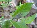
 Ruhland, Grenzstr. 3, Sämling eines Pfaffenhütchen, 01.jpg 1,182 × 3,407; 807 KB
-
 Ruhland, Ortrander Straße 3, Pfaffenhütchen am Schützenhausplatz, Herbst.jpg 1,704 × 2,272; 963 KB
-
 Ruhland, Parkstr. 27, Pfaffenhütchen, Nordnordostansicht, Herbst, 01.jpg 1,704 × 2,272; 878 KB
-
 Ruhland, Parkstr. 27, Pfaffenhütchen, Nordnordostansicht, Herbst, 02.jpg 2,272 × 1,704; 594 KB
-
 Ruhland, Parkstr., Pfaffenhütchen gegenüber Hausnr. 2 - 3, Herbst, 01.jpg 1,704 × 2,272; 937 KB


