Category:Esperanto-language SVG maps
Jump to navigation
Jump to search
Subcategories
This category has the following 2 subcategories, out of 2 total.
- SVG-veturmapoj Esperante (9 F)
Media in category "Esperanto-language SVG maps"
The following 68 files are in this category, out of 68 total.
-
 African continent-eo.svg 1,525 × 1,440; 783 KB
-
 Alps-Mediterranean Euroregion map-eo.svg 1,465 × 1,126; 344 KB
-
 Altimetria Italia eo.svg 700 × 700; 29 KB
-
 Anaximander world map-eo.svg 1,063 × 1,063; 14 KB
-
 Angola Ethnic map 1970-eo.svg 640 × 786; 71 KB
-
 Arabian Peninsula Map.svg 1,854 × 1,546; 19 KB
-
 Map of the Arabic peninsula - eo.svg 520 × 415; 146 KB
-
 BaffinIsland eo.svg 668 × 536; 1.16 MB
-
 Banks Islands-eo.svg 1,002 × 1,508; 323 KB
-
 Basque dialects-eo.svg 678 × 486; 79 KB
-
 Bay-of-Piran maritime-boundary-dispute-eo.svg 789 × 735; 36 KB
-
 Canal du Midi map-eo.svg 1,048 × 582; 289 KB
-
 Caucasic languages eo.svg 840 × 500; 232 KB
-
 Caucasus-ethnic eo.svg 984 × 1,144; 371 KB
-
 Curzon-linio.svg 563 × 513; 310 KB
-
 Czechia-geographic map-eo.svg 1,949 × 1,200; 14.56 MB
-
 Dist of hu lang europe-eo.svg 688 × 438; 145 KB
-
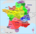
 Départements et régions de France eo.svg 588 × 550; 465 KB
-
 Early Dynastic-eo.svg 196 × 206; 39 KB
-
 Europe eo.svg 504 × 668; 447 KB
-
 Fergana Valo.svg 840 × 629; 2.44 MB
-
 Finnugroj en 1000 (eo).svg 963 × 987; 927 KB
-
 Gdansk Bay Borderlines 1939 Esperanto.svg 1,339 × 866; 161 KB
-
 Geografiaj subregionoj laŭ Unuiĝintaj Nacioj eo.svg 940 × 477; 1.67 MB
-
 Ĝermanaj Lingvoj.svg 823 × 910; 59 KB
-
 Granda Rifta Valo.svg 1,403 × 1,808; 1.05 MB
-
 Hecataeus world map-eo.svg 825 × 803; 70 KB
-
 Iranian tongues eo.svg 838 × 619; 179 KB
-
 Jemeno en la jaro -100.svg 1,500 × 1,400; 177 KB
-
 Kamaishi-Linio eo.svg 500 × 812; 38 KB
-
 Keltisch Sprachen eo.svg 352 × 519; 164 KB
-
 Kradaja-eo.svg 433 × 540; 112 KB
-
 Landkreise Sachsen 2012 eo.svg 738 × 572; 70 KB
-
 Languages of Europe eo.svg 3,070 × 1,990; 2.49 MB
-
 Languages-Europe eo.svg 886 × 793; 624 KB
-
 Langues de la France eo.svg 2,000 × 1,898; 1.2 MB
-
 Lincoln Sea map-eo.svg 1,000 × 913; 195 KB
-
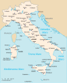 Map of Italy-eo.svg 3,245 × 3,948; 818 KB
-
 Map of sinitic languages-eo.svg 441 × 940; 1.03 MB
-
 Map of USA with state names eo.svg 959 × 593; 717 KB
-
 Mapo de Gondoro.svg 1,282 × 881; 427 KB
-
 Mapo de la Malnova Urbo de Jerusalemo.svg 1,600 × 1,600; 45 KB
-
 Mapo de La Provinco.svg 741 × 439; 497 KB
-
 Mariánské Lázně, tramo.svg 403 × 724; 12 KB
-
 Montbard Semur.svg 447 × 507; 1.76 MB
-
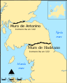 Muroj de Hadriano kaj de Antonino.svg 800 × 995; 217 KB
-
 Märket Island Political Map-eo.svg 590 × 430; 50 KB
-
 Nepala mapo (2013).svg 254 × 253; 1.39 MB
-
 North Macedonia, administrative divisions - eo - colored.svg 1,368 × 1,133; 228 KB
-
 Portugala kolonia milito.png 661 × 738; 107 KB
-
 Portuguese colonial war-eo.svg 635 × 709; 516 KB
-
 Provincoj de Pollando.svg 2,061 × 1,925; 372 KB
-
 Pyrenees topographic map-eo.svg 3,200 × 1,900; 6.01 MB
-
 Regen (skiza mapo).svg 4,230 × 2,419; 28 KB
-
 Regionoj de Turkio.svg 1,031 × 514; 953 KB
-
 Regions and Prefectures of Japan (eo).svg 2,480 × 3,175; 191 KB
-
 Rumanio-Bulgario.svg 338 × 365; 29 KB
-
 Simplified Languages of Europe map-eo.svg 1,486 × 1,215; 1.12 MB
-
 Slavaj lingvoj mapo eo.svg 675 × 622; 651 KB
-
 Tchernobyl radiation 1996 eo.svg 1,398 × 1,476; 563 KB
-
 Torres Islands-eo.svg 938 × 1,235; 170 KB
-
 UEFA Euro 2012 eo.svg 1,000 × 639; 143 KB
-
 UEFA Euro 2012 eo2.svg 1,000 × 639; 143 KB
-
 Volcae-eo.svg 2,052 × 955; 334 KB
-
 World ecozones eo.svg 1,500 × 775; 592 KB
-
 Ĉeĉenio.svg 345 × 394; 36 KB
-
 ĈinioGeografio.svg 960 × 719; 249 KB
-
 Ŝtatoj de Barato (numerigitaj).svg 1,594 × 1,868; 306 KB


.svg)


.svg)


.svg)

.svg)


.svg)