Category:Environs of Rockland St Mary
Jump to navigation
Jump to search
Media in category "Environs of Rockland St Mary"
The following 15 files are in this category, out of 15 total.
-
 Fallen tree in peat by Short Dyke - geograph.org.uk - 812376.jpg 640 × 426; 115 KB
-
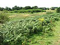
 Fields beside the path - geograph.org.uk - 1440676.jpg 640 × 480; 110 KB
-
 Hellington Beck - geograph.org.uk - 1334557.jpg 480 × 640; 111 KB
-
 Machinery at Broad Hall Farm - geograph.org.uk - 1413209.jpg 576 × 580; 103 KB
-
 Poppies growing on field edge - geograph.org.uk - 1433356.jpg 640 × 480; 134 KB
-
 Potato field beside footpath - geograph.org.uk - 1413271.jpg 640 × 480; 121 KB
-
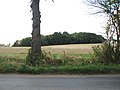
 Private road leading east - geograph.org.uk - 1413213.jpg 640 × 480; 95 KB
-
 Shed in pasture - geograph.org.uk - 1440687.jpg 640 × 480; 114 KB
-
 Sugar beet crop beside the path - geograph.org.uk - 1433361.jpg 640 × 480; 110 KB
-
 The northern edge of Low Common - geograph.org.uk - 1433363.jpg 640 × 480; 116 KB
-
 Triangular owl box in the trees - geograph.org.uk - 1733318.jpg 800 × 531; 112 KB
-
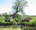 View across Hellington Beck - geograph.org.uk - 1334564.jpg 640 × 541; 128 KB
-
 View across Low Common - geograph.org.uk - 1433371.jpg 640 × 480; 128 KB
-
 View south along the Beck - geograph.org.uk - 1493382.jpg 480 × 640; 139 KB
-
 Woodland west of Low Road - geograph.org.uk - 1493366.jpg 640 × 480; 79 KB


