Category:English-language maps of New Zealand
Jump to navigation
Jump to search
Media in category "English-language maps of New Zealand"
The following 9 files are in this category, out of 9 total.
-
 2011 general election provisional electorates (partial).svg 778 × 778; 1,012 KB
-
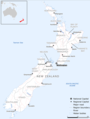
 Auckland Islands Location.jpg 565 × 798; 49 KB
-
 Map of New Zealand showing railway, steamer and coach routes - btv1b531534229.jpg 5,342 × 6,966; 3.88 MB
-
 New Zealand Base Map.png 752 × 998; 274 KB
-
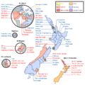
 NewZealandElectorates1853-Labeled.png 596 × 604; 22 KB
-
 NZ electorates 2011 election night empty.png 778 × 778; 163 KB
-
 NZ electorates 2011 election night empty.svg 778 × 778; 180 KB
-
 NZ electorates 2011 election night.png 778 × 778; 199 KB
-
 NZ electorates 2011 election night.svg 778 × 778; 183 KB
.svg)


