Category:English-language SVG maps of Europe
Jump to navigation
Jump to search
Subcategories
This category has the following 6 subcategories, out of 6 total.
D
F
H
P
Media in category "English-language SVG maps of Europe"
The following 200 files are in this category, out of 206 total.
(previous page) (next page)-
 1570 borders of the Principality of Transylvania.svg 970 × 970; 42 KB
-
 2008 Channel Fire (1) en.svg 474 × 389; 30 KB
-
 2008 Channel Tunnel fire en.svg 472 × 387; 29 KB
-
 2014 European Men's Handball Championship.svg 680 × 520; 363 KB
-
 2014 European Men-s Handball Championship Result.png 1,329 × 1,000; 342 KB
-
 2015 Critérium du Dauphiné map.svg 553 × 653; 182 KB
-
 2022 French Presidential Election Second Round Map.svg 2,500 × 1,900; 924 KB
-
 2022 Russian invasion of Ukraine.svg 2,199 × 1,478; 3.7 MB
-
 2022 Russian invasion of Ukraine; 31 December 2023.svg 2,199 × 1,478; 3.68 MB
-
 888 CE, Europe.svg 512 × 438; 1.74 MB
-
 Albania map of Köppen climate classification.svg 1,900 × 1,900; 70 KB
-
 Albania map-en.svg 1,880 × 3,850; 6.17 MB
-
 Alps-Mediterranean Euroregion map-en.svg 1,465 × 1,126; 344 KB
-
 Ancient Epirus & Modern Borders.svg 688 × 1,002; 200 KB
-
 Andorra map.svg 329 × 354; 44 KB
-
 Andorra topographic map-en.svg 1,625 × 1,300; 1.56 MB
-
 Armenia map of Köppen climate classification.svg 1,900 × 1,900; 89 KB
-
 Arquipélago das Berlengas-en.svg 1,643 × 2,743; 209 KB
-
 Austria Hungary ethnic.svg 1,360 × 1,052; 1.56 MB
-
 Austria map of Köppen climate classification.svg 1,900 × 1,290; 94 KB
-
 Azerbaijan map of Köppen climate classification.svg 1,900 × 1,900; 115 KB
-
 Azerbaijan map Sumqayit-en.svg 577 × 389; 57 KB
-
 Baanvaksnelheden.svg 744 × 1,052; 135 KB
-
 Balkans.svg 841 × 731; 491 KB
-
 Baltic History 5000-BC.svg 961 × 1,306; 721 KB
-
 Baltic History 5500-BC.svg 961 × 1,306; 814 KB
-
 Baltic History 7500-BC-ar.svg 961 × 1,306; 876 KB
-
 Baltic History 7500-BC.svg 961 × 1,306; 652 KB
-
 Basque dialects-en.svg 678 × 486; 79 KB
-
 Bay-of-Piran maritime-boundary-dispute.svg 789 × 735; 35 KB
-
 Bjørnøya map-en.svg 2,195 × 2,653; 1.73 MB
-
 Bosnia and Herzegovina map of Köppen climate classification.svg 1,900 × 1,900; 95 KB
-
 Bulgaria geographic map borders of Balkan Mountains bg.svg 7,554 × 2,600; 5.49 MB
-
 Bulgaria geographic map Stara Planina bg.svg 7,551 × 3,075; 20.48 MB
-
 Bulgaria map of Köppen climate classification.svg 1,900 × 1,630; 199 KB
-
 Bulgarian motorway network en.svg 676 × 453; 264 KB
-
 Caucasus topographic map with border colors-en.svg 1,155 × 898; 5.55 MB
-
 Caucasus topographic map-en.svg 1,155 × 898; 5.56 MB
-
 Caucasus-ethnic en.svg 977 × 1,111; 327 KB
-
 Caucasus-political en.svg 972 × 922; 370 KB
-
 Ceewikigroupmap.svg 1,417 × 1,856; 410 KB
-
 Curzon line en.svg 563 × 513; 243 KB
-
 Czech Republic map of Köppen climate classification.svg 1,900 × 1,100; 86 KB
-
 Czechoslovakia.svg 1,187 × 638; 84 KB
-
 Democratic Republic of Georgia (en).svg 1,724 × 1,198; 928 KB
-
 Denmark map of Köppen climate classification.svg 1,900 × 1,395; 114 KB
-
 Dioceses of the Macedonian Orthodox Church en (2013-2023).svg 744 × 581; 499 KB
-
 Dist of hu lang europe.svg 688 × 438; 127 KB
-
 Distribution of immigrants by regions of Georgia.svg 770 × 480; 720 KB
-
 Christ Church Cathedral Dublin - Plan Park en.svg 1,600 × 2,500; 620 KB
-
 Départements de France English.svg 588 × 550; 341 KB
-
 Eastern statistical region en.svg 1,400 × 1,052; 179 KB
-
 Ethnic groups in Skopje en.svg 580 × 600; 577 KB
-
 Ethnic groups in Skopje Region of North Macedonia en.svg 700 × 510; 483 KB
-
 Ethnic groups in the Eastern Region of North Macedonia en.svg 744 × 581; 238 KB
-
 Ethnic groups in the Northeastern Region of North Macedonia en.svg 660 × 270; 165 KB
-
 Ethnic groups in the Pelagonia Region of North Macedonia en.svg 744 × 440; 282 KB
-
 Ethnic groups in the Polog Region of North Macedonia en.svg 600 × 540; 326 KB
-
 Ethnic groups in the Southeastern Region of North Macedonia en.svg 620 × 520; 500 KB
-
 Ethnic groups in the Southwestern Region of North Macedonia en.svg 630 × 581; 307 KB
-
 Ethnic groups in the Vardar Region of North Macedonia en.svg 590 × 581; 275 KB
-
 Ethnic map of Montenegro by municipality.svg 1,063 × 1,285; 220 KB
-
 EUgivetake2013.svg 600 × 768; 747 KB
-
 Eurobasket 2011 participants - en.svg 680 × 520; 532 KB
-
 Eurobasket 2013 participants - en.svg 680 × 520; 529 KB
-
 Eurobasket 2015 participants - en.svg 680 × 520; 373 KB
-
 Europe HSR density1.svg 1,150 × 800; 729 KB
-
 Europe map of Köppen climate classification.svg 1,900 × 1,900; 1.05 MB
-
 Europe-Isle of Man.svg 2,045 × 1,720; 2.24 MB
-
-
 European Water Polo Championship 2010 participants - en.svg 680 × 520; 522 KB
-
 Expulsion judios-en selection.svg 8,960 × 6,672; 318 KB
-
 Expulsion judios-en.svg 8,960 × 6,672; 326 KB
-
 France map of Köppen climate classification.svg 1,900 × 1,900; 225 KB
-
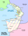 Free Territory of Trieste Map.svg 612 × 792; 829 KB
-
 French Ways of St. James.svg 1,010 × 850; 121 KB
-
 GE-AB-gagra-en.svg 550 × 450; 582 KB
-
 GE-AB-sokhumi-en.svg 550 × 450; 582 KB
-
 Generalplan Ost-en.svg 746 × 1,052; 292 KB
-
 Geographic map of Balkan Peninsula.svg 3,118 × 2,600; 13.82 MB
-
 Georgia map of Köppen climate classification.svg 1,900 × 1,130; 109 KB
-
 Georgia regions map.svg 744 × 1,052; 234 KB
-
 Georgia, Ossetia, Russia and Abkhazia (en).svg 676 × 400; 114 KB
-
 Georgian Railway Network.svg 1,715 × 913; 331 KB
-
 German unified 1815 1871.svg 708 × 1,074; 737 KB
-
 Germany map of Köppen climate classification.svg 1,900 × 1,900; 159 KB
-
 Gibraltar location.svg 510 × 501; 91 KB
-
 Gibraltar map-en-edit1.svg 2,020 × 3,140; 553 KB
-
 Gibraltar map-en-edit2.svg 1,000 × 1,558; 1.46 MB
-
 Gibraltar map-en.svg 2,020 × 3,140; 289 KB
-
 Greece map of Köppen climate classification (new).svg 1,165 × 1,127; 2.87 MB
-
 Greece map of Köppen climate classification.svg 1,900 × 1,900; 288 KB
-
 Greecemap-en.svg 983 × 751; 585 KB
-
 Greek railway network.svg 620 × 620; 524 KB
-
 Handball European Championship 2012 - en.svg 680 × 520; 525 KB
-
 Iberia 300BC-en.svg 924 × 762; 772 KB
-
 Iberia Late Bronze.svg 924 × 762; 136 KB
-
 Iberian Cenozoic sedimentary basins.svg 542 × 406; 83 KB
-
 Iberian Tectonic EN.svg 382 × 485; 695 KB
-
 Iceland map of Köppen climate classification.svg 1,900 × 950; 73 KB
-
 Isle of Man constituencies-en.svg 1,200 × 1,100; 315 KB
-
 Isle of Man map-en.svg 1,200 × 1,100; 686 KB
-
 Isle of Man topographic map-en.svg 1,200 × 1,100; 642 KB
-
 IsleOfMan LocAuths and Sheadings2020.svg 1,200 × 1,100; 191 KB
-
 IsleOfMan SheadingsAndParishes-en.svg 1,200 × 1,100; 222 KB
-
 Istanbul canal map.svg 1,536 × 1,043; 1.6 MB
-
 Italy Köppen.svg 765 × 1,215; 1.34 MB
-
 Italy map of Köppen climate classification.svg 1,900 × 1,900; 199 KB
-
 Izbiračka edinica 3 - en.svg 744 × 581; 414 KB
-
 Izbiračka edinica 4 - en.svg 744 × 581; 394 KB
-
 Izbiračka edinica 5 - en.svg 744 × 581; 349 KB
-
 Izbiračka edinica 6 - en.svg 744 × 581; 287 KB
-
 Kartvelian languages.svg 790 × 550; 3.89 MB
-
 Kaszubians in Poland.svg 2,750 × 2,600; 24 KB
-
 Köppen climate classification map of Georgia.svg 1,716 × 913; 182 KB
-
 Languages of Europe (BW).svg 560 × 425; 1.29 MB
-
 Languages of Europe.svg 3,070 × 1,990; 746 KB
-
 Linguistic map of Montenegro by municipality.svg 1,063 × 1,285; 237 KB
-
 Low Franconian.svg 845 × 1,071; 155 KB
-
 Macedonia (Greece) map of Köppen climate classification.svg 748 × 514; 1.89 MB
-
 Macedonia (Greece) map of mean yearly temperatures.svg 748 × 514; 1.53 MB
-
 Macedonia-disambiguation.svg 425 × 496; 135 KB
-
 Major railway lines in Finland en.svg 600 × 773; 52 KB
-
 Map Battle of Stalingrad-en.svg 1,699 × 1,806; 597 KB
-
 Map City of Skopje en.svg 1,550 × 910; 215 KB
-
 Map Europe alliances 1914-en.svg 1,002 × 593; 97 KB
-
 Map Greco-Persian Wars-en.svg 992 × 793; 3.57 MB
-
 Map Greece expansion 1832-1947-en.svg 730 × 959; 469 KB
-
 Map greek sanctuaries-en.svg 993 × 793; 3.26 MB
-
 Map Gulf of Finland-en.svg 1,400 × 800; 373 KB
-
 Map Iberian Peninsula 1037-en.svg 827 × 574; 252 KB
-
 Map Londinium 400 AD-en.svg 996 × 998; 742 KB
-
 Map Macedonia 336 BC-en.svg 992 × 794; 3.74 MB
-
 Map Minoan Crete-en.svg 1,001 × 601; 246 KB
-
 Map of Akrotiri-en.svg 1,035 × 886; 189 KB
-
 Map of Bismarcks alliances-en.svg 998 × 593; 191 KB
-
 Map of Sweden Cities (polar stereographic).svg 1,000 × 2,387; 694 KB
-
 Map of the cities of Macedonia-en.svg 1,052 × 744; 6.18 MB
-
 Map of the main lakes and rivers of North Macedonia-en.svg 1,052 × 744; 5.98 MB
-
 Map of the majority ethnic groups of Macedonia by municipality.svg 744 × 581; 729 KB
-
 Map of the municipalities of Eastern Statistical Region en.svg 744 × 581; 473 KB
-
 Map of the municipalities of Pelagonia Statistical Region en.svg 744 × 581; 477 KB
-
 Map of the municipalities of Skopje Statistical Region en.svg 744 × 581; 457 KB
-
 Map of the municipalities of the Northeastern Statistical Region en.svg 744 × 581; 454 KB
-
 Map of the municipalities of the Polog Statistical Region en.svg 744 × 581; 476 KB
-
 Map of the municipalities of the Southeastern Statistical Region en.svg 744 × 581; 462 KB
-
 Map of the municipalities of the Southwestern Statistical Region en.svg 744 × 581; 466 KB
-
 Map of the municipalities of the Vardar Statistical Region en.svg 744 × 581; 433 KB
-
 Map of the quays of Dublin city Ireland 2023 linear.svg 4,001 × 391; 103 KB
-
 Map of the quays of Dublin city Ireland 2023 stacked.svg 1,013 × 1,694; 183 KB
-
 MontesBalcanes (en).svg 2,483 × 1,642; 4.7 MB
-
 Mormaerdoms.svg 744 × 1,052; 40 KB
-
 Municipalities of Georgia by Population’s Predominant Gender (2014).svg 1,500 × 891; 1.27 MB
-
 Municipalities of Montenegro.svg 1,063 × 1,285; 242 KB
-
 NATO AB in France map-en.svg 1,025 × 1,030; 494 KB
-
 North Macedonia, administrative divisions - en - monochrome.svg 1,400 × 1,130; 177 KB
-
 Northeast Caucasus languages map en.svg 1,133 × 1,183; 255 KB
-
 Northeastern statistical region en.svg 1,400 × 1,052; 178 KB
-
 Northern Russia and the Arctic Ocean.svg 855 × 557; 1.88 MB
-
 Norway map of Köppen climate classification.svg 1,900 × 1,108; 238 KB
-
 Orient-Express Historic Routes (en).svg 738 × 570; 381 KB
-
 Oulu-Kontiomaki railway map-en.svg 1,371 × 2,007; 230 KB
-
 Pelagonia statistical region en.svg 1,400 × 1,052; 185 KB
-
 Percentage of ethnic Georgians by municipality.svg 680 × 400; 943 KB
-
 Poland airports 2015.svg 1,053 × 1,131; 179 KB
-
 Poland airports 2016.svg 1,053 × 1,131; 73 KB
-
 Polog statistical region en.svg 1,400 × 1,052; 175 KB
-
 Population densities in Spain (2007).svg 568 × 387; 1.5 MB
-
 Portugal map of Köppen climate classification.svg 1,900 × 1,900; 65 KB
-
 Portugal topographic map-en.svg 1,738 × 3,070; 11.35 MB
-
 Provinces of Belgium with CoA-en.svg 1,000 × 819; 995 KB
-
 Pyrenees topographic map-en.svg 3,200 × 1,900; 6.3 MB
-
 Reino de los visigodos-en.svg 653 × 670; 38 KB
-
 Religious map of Montenegro by municipality.svg 1,063 × 1,285; 233 KB
-
 Resultats Eleccions al Parlament de Catalunya 2017 en.svg 1,250 × 640; 280 KB
-
 Romania map of Köppen climate classification.svg 1,900 × 1,586; 131 KB
-
 Route Punic army messana.svg 1,290 × 908; 52 KB
-
 Serbia map of Köppen climate classification.svg 1,900 × 1,900; 116 KB
-
 Slovakia map of Köppen climate classification.svg 1,900 × 1,233; 96 KB
-
 South Slavic dialect continuum.svg 512 × 441; 883 KB
-
 Southeastern statistical region en.svg 1,400 × 1,052; 177 KB
-
 Southwestern statistical region en.svg 1,400 × 1,052; 180 KB
-
 Spain map of Köppen climate classification.svg 1,900 × 1,900; 228 KB
-
 Sweden map of Köppen climate classification.svg 1,900 × 1,900; 128 KB
-
 Switzerland map of Köppen climate classification.svg 1,900 × 1,900; 138 KB
-
 Tour de France 1954 map.svg 600 × 650; 373 KB
-
 Tour de France 1955 map.svg 600 × 600; 368 KB
-
 Tour de France 1956 map.svg 600 × 600; 368 KB
-
 Tour de France 1957 map.svg 600 × 600; 369 KB
-
 Tour de France 1958 map.svg 600 × 600; 375 KB
-
 Tour de France 1959 map.svg 600 × 600; 373 KB
-
 Tour de France 1960 map.svg 600 × 600; 370 KB
-
 Tour de France 1961 map.svg 600 × 600; 374 KB
-
 Tour de France 1962 map.svg 600 × 600; 381 KB
-
 Turkey Köppen.svg 1,152 × 792; 1.48 MB
-
 Turkey map of Köppen climate classification.svg 1,900 × 1,419; 266 KB
-
 Ukraine map of Köppen climate classification.svg 1,900 × 1,375; 146 KB
-
 Un-croatia v1.svg 900 × 666; 881 KB
-
 United Kingdom EU membership referendum 2016 map.svg 512 × 918; 3.27 MB
-
 United Kingdom EU referendum 2016 area results.svg 871 × 1,289; 4.84 MB
_en.svg)


.svg)

.svg)


.svg)


.svg)


.svg)


_map_of_K%C3%B6ppen_climate_classification.svg)
_map_of_mean_yearly_temperatures.svg)


.svg)


.svg)

.svg)


.svg)


.svg)


