Category:England
Jump to navigation
Jump to search
Constituent countries of the United Kingdom: England · Northern Ireland · Scotland · Wales – British Crown dependencies: Bailiwick of Guernsey · Isle of Man · Jersey
British overseas territories: Akrotiri and Dhekelia · Anguilla · Bermuda · British Antarctic Territory · British Indian Ocean Territory · British Virgin Islands · Cayman Islands · Falkland Islands · Gibraltar · Pitcairn Islands · Saint Helena, Ascension and Tristan da Cunha · South Georgia and the South Sandwich Islands · Turks and Caicos Islands
British overseas territories: Akrotiri and Dhekelia · Anguilla · Bermuda · British Antarctic Territory · British Indian Ocean Territory · British Virgin Islands · Cayman Islands · Falkland Islands · Gibraltar · Pitcairn Islands · Saint Helena, Ascension and Tristan da Cunha · South Georgia and the South Sandwich Islands · Turks and Caicos Islands
country in north-west Europe, part of the United Kingdom  someja satełitar in avril      | |||||
| Upload media | |||||
| Spoken text audio | |||||
|---|---|---|---|---|---|
| Pronunciation audio | |||||
| Instance of | |||||
| Name in native language |
| ||||
| Named after | |||||
| Patron saint | |||||
| Location |
| ||||
| Capital | |||||
| Basic form of government |
| ||||
| Official language | |||||
| Anthem |
| ||||
| Currency | |||||
| Head of state |
| ||||
| Head of government |
| ||||
| Highest point | |||||
| Population |
| ||||
| Area |
| ||||
| Replaces |
| ||||
| Different from | |||||
| official website | |||||
 | |||||

Subcategories
This category has the following 47 subcategories, out of 47 total.
Media in category "England"
The following 46 files are in this category, out of 46 total.
-
 A few of the many turbines at the Gunfleet Sands wind farm - geograph.org.uk - 6280355.jpg 5,010 × 3,579; 5.72 MB
-
 Bar Lightship - geograph.org.uk - 6293533.jpg 502 × 393; 33 KB
-
 Beach End - geograph.org.uk - 6284152.jpg 800 × 600; 156 KB
-
 Bottlenose dolphins at St John’s Haven - geograph.org.uk - 6289430.jpg 1,024 × 697; 180 KB
-
 Brean , Steep Holm - geograph.org.uk - 6287297.jpg 6,000 × 4,000; 4.03 MB
-
 Brean , Steep Holm - geograph.org.uk - 6287352.jpg 6,000 × 4,000; 3.79 MB
-
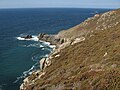
 Chalk cliffs near Handfast Point - geograph.org.uk - 6292782.jpg 4,288 × 2,848; 2.22 MB
-
 Cliffs, Carn Gowla - geograph.org.uk - 6295062.jpg 800 × 600; 109 KB
-
 Coast path at Muxham Point - geograph.org.uk - 6288574.jpg 4,288 × 2,848; 1.83 MB
-
 Coves Haven from Nessend - geograph.org.uk - 6295744.jpg 3,648 × 2,736; 4 MB
-
 Eastern Black Rock - geograph.org.uk - 6298344.jpg 1,024 × 768; 176 KB
-
 End View - geograph.org.uk - 6284178.jpg 800 × 600; 183 KB
-
 English whisky distilleries (chart).png 1,200 × 800; 42 KB
-
 North Pinnacle - geograph.org.uk - 6292852.jpg 3,324 × 2,287; 1.08 MB
-
 Pinnacle and cliff south of Handfast Point - geograph.org.uk - 6292817.jpg 2,651 × 3,730; 1.12 MB
-
 Pinnacle by Old Nick's Ground - geograph.org.uk - 6292825.jpg 2,966 × 2,086; 833 KB
-
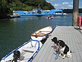 Pontoon by King Harry Ferry - geograph.org.uk - 6290418.jpg 800 × 600; 104 KB
-
 Redcliff Point - geograph.org.uk - 6298976.jpg 2,048 × 1,536; 489 KB
-
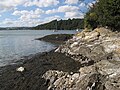 River Fal shore - geograph.org.uk - 6290395.jpg 800 × 600; 137 KB
-
 Rock and fishing boat - geograph.org.uk - 6298690.jpg 768 × 1,024; 226 KB
-
 Rock climbing at Pier Quarry near Spittal - geograph.org.uk - 6281502.jpg 1,024 × 683; 586 KB
-
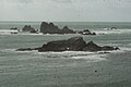
 Rocks off Outer Froward Point - geograph.org.uk - 6297547.jpg 1,024 × 768; 188 KB
-
 Rugged features, Outer Froward Point - geograph.org.uk - 6298254.jpg 1,024 × 768; 354 KB
-
 Seashore at Hemsby - geograph.org.uk - 6288158.jpg 3,909 × 2,933; 2.06 MB
-
 Tidal observatory, Newlyn - geograph.org.uk - 6296346.jpg 768 × 1,024; 141 KB
-

-
 View of Shag Rock and Men Par from Lizard Point - geograph.org.uk - 6284786.jpg 3,872 × 2,592; 2.1 MB
-
 View of Shag Rock from Lizard Point - geograph.org.uk - 6284766.jpg 3,729 × 2,497; 1.06 MB
-
 View of The Brisons from Porth Nanven ^2 - geograph.org.uk - 6284334.jpg 3,872 × 2,592; 1.55 MB
-

-
 View of the sunset at Botallack - geograph.org.uk - 6285520.jpg 3,872 × 2,592; 1.39 MB
-
 View of the sunset at Botallack ^2 - geograph.org.uk - 6285523.jpg 3,872 × 2,592; 1.19 MB
-
 View of the sunset at Botallack ^3 - geograph.org.uk - 6285525.jpg 3,603 × 2,592; 1.09 MB
-
 View of waves crashing onto rocks at Botallack - geograph.org.uk - 6285499.jpg 3,872 × 2,592; 3.02 MB
-
 View of waves crashing onto the rocks at Botallack - geograph.org.uk - 6285503.jpg 3,872 × 2,592; 1.91 MB
-
 View of waves crashing onto the rocks at Lizard Point ^3 - geograph.org.uk - 6285284.jpg 3,872 × 2,592; 2.17 MB
-
 View of waves crashing onto the rocks at Lizard Point ^4 - geograph.org.uk - 6285431.jpg 3,872 × 2,592; 2.54 MB
-
 View of waves crashing onto the rocks at Lizard Point ^5 - geograph.org.uk - 6285438.jpg 3,872 × 2,592; 2.49 MB
-
 View of waves crashing onto the rocks at Lizard Point ^6 - geograph.org.uk - 6285440.jpg 3,872 × 2,592; 2.03 MB
-
 View of waves crashing onto the rocks at Lizard Point ^7 - geograph.org.uk - 6285442.jpg 3,872 × 2,592; 1.94 MB
-
 View of waves crashing onto the rocks at Lizard Point ^9 - geograph.org.uk - 6285455.jpg 3,872 × 2,592; 2.38 MB
-
 View of waves crashing up against the cliff at Botallack ^2 - geograph.org.uk - 6285498.jpg 3,872 × 2,592; 2.67 MB
-
 View of waves crashing up against the cliff at Botallack ^3 - geograph.org.uk - 6285500.jpg 3,872 × 2,592; 2.99 MB
-

-
 View of waves crashing up against the cliff at Botallack ^6 - geograph.org.uk - 6285513.jpg 3,872 × 2,592; 2.79 MB
-
 View towards West Rock buoy - geograph.org.uk - 6297599.jpg 768 × 1,024; 301 KB


.png)


