Category:Emneth
Jump to navigation
Jump to search
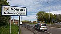
English: Emneth is a village and a civil parish in the English county of Norfolk. The village is north-north-west of the village. The Village lies to the south-west of the route of the A47 between Peterborough and King's Lynn. The nearest railway station is at Downham Market for the Fen Line which runs between King's Lynn and Cambridge. The nearest airport is Norwich International Airport. The parish of Emneth in the 2001 census, has a population of 2,466. For the purposes of local government, the parish falls within the district of King's Lynn and West Norfolk.
village and civil parish in Norfolk, United Kingdom  | |||||
| Upload media | |||||
| Instance of | |||||
|---|---|---|---|---|---|
| Location | King's Lynn and West Norfolk, Norfolk, East of England, England | ||||
| Said to be the same as | Emneth (Wikimedia duplicated page, civil parish) | ||||
 | |||||
Subcategories
This category has the following 2 subcategories, out of 2 total.
E
- Elmbridge railway station (2 F)
Media in category "Emneth"
The following 200 files are in this category, out of 202 total.
(previous page) (next page)-
 "The Map of the marshland in Norfolk".jpg 4,686 × 4,018; 12.91 MB
-
 175 Outwell Road sign - geograph.org.uk - 5803061.jpg 2,604 × 3,921; 4.5 MB
-
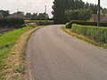
 A bend in Church Road, Emneth - geograph.org.uk - 4103546.jpg 640 × 394; 49 KB
-
 A1101 at Collett's Bridge - geograph.org.uk - 3641562.jpg 640 × 481; 47 KB
-
 A1101 Elm High Road, Elm - geograph.org.uk - 6184356.jpg 4,608 × 3,456; 4.11 MB
-
 A1101 Elm High Road, Elm - geograph.org.uk - 6184405.jpg 4,608 × 3,456; 4.38 MB
-
 A1101 Elm High Road, Elm - geograph.org.uk - 6184662.jpg 4,000 × 2,632; 3.65 MB
-
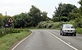
 A1101 enters Norfolk - geograph.org.uk - 3555186.jpg 1,600 × 990; 296 KB
-
 A1101 near Inglethorpe Manor - geograph.org.uk - 3641572.jpg 640 × 481; 60 KB
-
 A1101 nears B1101 junction - geograph.org.uk - 3641586.jpg 640 × 481; 67 KB
-
 A1101 Outwell Road, Emneth - geograph.org.uk - 5803040.jpg 4,608 × 3,072; 1.75 MB
-
 A1101 Outwell Road, Emneth - geograph.org.uk - 5803047.jpg 4,608 × 3,072; 1.81 MB
-
 A1101 Outwell Road, Emneth - geograph.org.uk - 6186128.jpg 3,595 × 2,616; 2.33 MB
-
 A1101 Outwell Road, Emneth - geograph.org.uk - 6188187.jpg 4,608 × 3,456; 4.31 MB
-
 A1101 Outwell Road, Emneth - geograph.org.uk - 6188190.jpg 4,608 × 3,456; 3.72 MB
-
 A1101 Outwell Road, Holly End, Emneth - geograph.org.uk - 6184664.jpg 4,608 × 3,456; 4.02 MB
-
 An old barn - geograph.org.uk - 1847038.jpg 2,848 × 2,136; 3.13 MB
-
 Basin Villa - geograph.org.uk - 1261425.jpg 640 × 486; 79 KB
-
 Boyces Bridge Postbox - geograph.org.uk - 6184164.jpg 4,608 × 3,456; 3.83 MB
-
 Boyces Bridge Postbox - geograph.org.uk - 6185023.jpg 2,917 × 3,890; 3.11 MB
-
 Bungalow in Emneth - geograph.org.uk - 1820097.jpg 640 × 480; 148 KB
-
 Bungalow on Hollycroft Road - geograph.org.uk - 4715670.jpg 640 × 480; 69 KB
-
-
 Bus stop on Well Road, Boyces Bridge - geograph.org.uk - 4715668.jpg 640 × 480; 74 KB
-
 Chapels in Emneth - geograph.org.uk - 1984648.jpg 2,848 × 2,136; 2.95 MB
-
 China Rose restaurant, Elm - geograph.org.uk - 5982877.jpg 1,600 × 1,141; 720 KB
-
 Church Cottage, Emneth - geograph.org.uk - 1820105.jpg 640 × 480; 147 KB
-
 Church Road sign - geograph.org.uk - 6185036.jpg 4,608 × 3,456; 3.86 MB
-
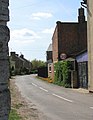
 Church Road, Emneth - geograph.org.uk - 1984623.jpg 2,848 × 2,136; 3.09 MB
-
 Church Road, Emneth - geograph.org.uk - 6185033.jpg 4,608 × 3,456; 3.76 MB
-
 Church Road, Emneth - geograph.org.uk - 6185038.jpg 4,608 × 3,456; 3.88 MB
-
 Church Road, Emneth - geograph.org.uk - 6185070.jpg 4,000 × 3,000; 4.81 MB
-
 Church Road, Emneth - geograph.org.uk - 6185293.jpg 3,495 × 2,732; 2.52 MB
-
 Church Road, Emneth - geograph.org.uk - 6185308.jpg 4,608 × 3,456; 4.03 MB
-
 Cottages in Chapel Lane - geograph.org.uk - 1267554.jpg 640 × 480; 88 KB
-
 Crop field off Lady's Drove - geograph.org.uk - 4103540.jpg 640 × 480; 102 KB
-
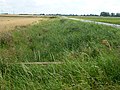
 Dike full of reeds off Edge bank, Outwell - geograph.org.uk - 3095437.jpg 4,320 × 3,240; 5.4 MB
-
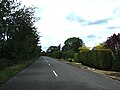
 Elm High Road (A1101) - geograph.org.uk - 3558453.jpg 1,912 × 1,156; 1.35 MB
-
 Elm High Road - geograph.org.uk - 5586291.jpg 640 × 480; 54 KB
-
 Elm Road Pumping Station - geograph.org.uk - 2361485.jpg 800 × 600; 159 KB
-
 Elme Hall Hotel - geograph.org.uk - 4791039.jpg 1,920 × 1,140; 624 KB
-
 Emneth Academy, Emneth - geograph.org.uk - 6183901.jpg 4,608 × 3,456; 4.18 MB
-
 Emneth Central Hall - geograph.org.uk - 6182556.jpg 4,608 × 3,456; 3.94 MB
-
 Emneth Central Hall - geograph.org.uk - 6185013.jpg 3,918 × 2,939; 5.3 MB
-
 Emneth Methodist Church - geograph.org.uk - 6183876.jpg 4,608 × 3,456; 4.18 MB
-
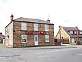
 Emneth Post Office - geograph.org.uk - 4103549.jpg 640 × 415; 57 KB
-
 Emneth Post Office Postbox - geograph.org.uk - 6183838.jpg 2,094 × 3,738; 1.83 MB
-
 Emneth Post Office Postbox - geograph.org.uk - 6185020.jpg 2,905 × 3,873; 3.74 MB
-
 Emneth Post Office ^ Store - geograph.org.uk - 6183831.jpg 4,608 × 3,456; 3.59 MB
-
 Emneth Post Office ^ Store - geograph.org.uk - 6185016.jpg 4,608 × 3,456; 4.16 MB
-
 Emneth St. Edmund's church - geograph.org.uk - 4339108.jpg 640 × 480; 94 KB
-
 Emneth Village Notice Board - geograph.org.uk - 6182569.jpg 3,918 × 2,939; 4.22 MB
-
 Emneth village sign - geograph.org.uk - 1820100.jpg 480 × 640; 125 KB
-
 Emneth Village sign - geograph.org.uk - 6185042.jpg 2,917 × 3,890; 6.27 MB
-
 Emneth Village sign - geograph.org.uk - 6185045.jpg 2,958 × 3,944; 3.9 MB
-
 Emneth Village sign - geograph.org.uk - 6186632.jpg 4,608 × 3,456; 4.08 MB
-
 Emneth Village sign - geograph.org.uk - 6186707.jpg 4,608 × 3,456; 4.06 MB
-
 Emneth War Memorial - geograph.org.uk - 5603080.jpg 3,456 × 2,592; 3.86 MB
-
 Emneth, church and village sign - geograph.org.uk - 1984560.jpg 2,848 × 2,136; 2.96 MB
-
 Emneth, St Edmund - geograph.org.uk - 6363007.jpg 3,456 × 4,608; 5.31 MB
-
 Emneth, village sign and parish church. - geograph.org.uk - 70409.jpg 640 × 420; 112 KB
-
 Entrance off Outwell Road - geograph.org.uk - 6188192.jpg 4,608 × 3,456; 4.04 MB
-
 Entrance to 175 Outwell Road - geograph.org.uk - 5803057.jpg 4,608 × 3,072; 1.85 MB
-
 Excelsior House - geograph.org.uk - 1261431.jpg 640 × 480; 78 KB
-
 Farm track off Hungate Road, Emneth - geograph.org.uk - 1984680.jpg 2,848 × 2,136; 3.07 MB
-
 Farmhouse south of St Edmund's church - geograph.org.uk - 1820107.jpg 640 × 480; 152 KB
-
 Farmland off Smeeth Road near Emneth, Wisbech - geograph.org.uk - 1984738.jpg 2,848 × 2,136; 3.13 MB
-
 Fendike Road, Holly End, Emneth - geograph.org.uk - 3073589.jpg 4,320 × 3,240; 5.98 MB
-
 Fendyke Road - geograph.org.uk - 4715680.jpg 640 × 480; 53 KB
-
 Flat farmland off Fendyke Road - geograph.org.uk - 4715675.jpg 640 × 480; 79 KB
-
 Flowering trees - geograph.org.uk - 1261500.jpg 506 × 640; 126 KB
-
 Footpath to Meadowgate Lane, Wisbech - geograph.org.uk - 1975667.jpg 2,848 × 2,136; 3.14 MB
-
 Former AHF - geograph.org.uk - 2526267.jpg 800 × 600; 121 KB
-
 Former Co-Op. - geograph.org.uk - 2526281.jpg 800 × 600; 109 KB
-
 Gaultree playground, Hungate Road. - geograph.org.uk - 70319.jpg 640 × 278; 64 KB
-
 Gaultree Square sign - geograph.org.uk - 6182576.jpg 4,608 × 3,456; 3.92 MB
-
 Gaultree Square, Emneth - geograph.org.uk - 6182380.jpg 4,608 × 3,456; 3.63 MB
-
 Gaultree Square, Emneth - geograph.org.uk - 6182381.jpg 4,000 × 2,884; 2.44 MB
-
 Gaultree Square, Emneth - geograph.org.uk - 6182548.jpg 4,608 × 3,456; 4.05 MB
-
 Gaultree Square, Emneth - geograph.org.uk - 6182911.jpg 4,000 × 2,830; 3.52 MB
-
 Gaultree Square, Emneth - geograph.org.uk - 6183109.jpg 4,608 × 3,456; 4.19 MB
-
 Gaultree Square, Emneth - geograph.org.uk - 6183882.jpg 4,608 × 3,456; 4.41 MB
-
 Gosmoor Bridge, Collett's Bridge, Emneth - geograph.org.uk - 6188186.jpg 4,608 × 3,456; 4.16 MB
-
 Hanging sign for The Gaultree Inn - geograph.org.uk - 5660164.jpg 2,592 × 3,456; 2.99 MB
-
 Harvesting on The Edge - geograph.org.uk - 3095418.jpg 4,320 × 3,240; 5.37 MB
-
 Holly Mount - geograph.org.uk - 1261498.jpg 640 × 500; 97 KB
-
 Hollycroft Road - geograph.org.uk - 4715671.jpg 640 × 480; 41 KB
-
 Hollycroft Road sign - geograph.org.uk - 6182041.jpg 3,840 × 2,880; 4.13 MB
-
 Hollycroft Road, Holly End - geograph.org.uk - 6182373.jpg 4,000 × 3,000; 3.44 MB
-
 Hollycroft Road, Holly End, Emneth - geograph.org.uk - 6181943.jpg 4,608 × 3,456; 3.84 MB
-
 Hollycroft Road, Holly End, Emneth - geograph.org.uk - 6182375.jpg 4,608 × 3,456; 4.3 MB
-
 Hollycroft Road, Holly End, Emneth - geograph.org.uk - 6182376.jpg 4,608 × 3,456; 4.08 MB
-
 Hollycroft Road, Holly End, Emneth - geograph.org.uk - 6184133.jpg 3,746 × 2,761; 2.61 MB
-
 House on Well Road, Boyces Bridge - geograph.org.uk - 4715667.jpg 640 × 480; 66 KB
-

-
 Houses on Hungate Road - geograph.org.uk - 4715689.jpg 640 × 480; 55 KB
-
 Houses on the old Outwell Road - geograph.org.uk - 1261428.jpg 640 × 480; 77 KB
-
 Houses on the old Outwell Road - geograph.org.uk - 1261534.jpg 640 × 480; 68 KB
-
 Humgate Road, Emneth - geograph.org.uk - 6182954.jpg 4,608 × 3,456; 4.04 MB
-
 Hungate Road - geograph.org.uk - 4715691.jpg 640 × 480; 50 KB
-
 Hungate Road, Emneth near Wisbech - geograph.org.uk - 1984691.jpg 2,848 × 2,136; 3.14 MB
-
 Lady's Drove - geograph.org.uk - 4103542.jpg 640 × 480; 75 KB
-
 Lady's Drove - geograph.org.uk - 4716244.jpg 640 × 480; 65 KB
-
 Lady's Drove sign - geograph.org.uk - 6183071.jpg 4,608 × 3,456; 3.86 MB
-
 Lady's Drove, Emneth - geograph.org.uk - 6182960.jpg 4,000 × 3,000; 5.21 MB
-
 Large shed on Fendike Road near Outwell - geograph.org.uk - 3073604.jpg 4,320 × 3,240; 5.81 MB
-
 Meadowgate Lane near Oxburgh Hall - geograph.org.uk - 1975652.jpg 2,848 × 2,136; 3.07 MB
-
 Methodist Church, Gaultree. - geograph.org.uk - 70410.jpg 572 × 640; 118 KB
-
 Mill Road - geograph.org.uk - 513907.jpg 640 × 480; 106 KB
-
 Mobile pea viners near Emneth Hungate - geograph.org.uk - 3073599.jpg 4,320 × 3,240; 5.5 MB
-
 New housing in Elmfield Drive - geograph.org.uk - 1267602.jpg 640 × 480; 78 KB
-
 New planting north of The Wroe - geograph.org.uk - 513916.jpg 640 × 480; 113 KB
-
 No More Jet. - geograph.org.uk - 2526290.jpg 800 × 600; 106 KB
-
 Norfolk boundary.jpg 4,160 × 2,340; 2.09 MB
-
 Norfolk County.jpg 1,184 × 796; 169 KB
-
 Old shed near Emneth - geograph.org.uk - 2885432.jpg 4,320 × 3,240; 5.48 MB
-
 On the edge of Edge Bank, Emneth Hungate - geograph.org.uk - 3073414.jpg 4,320 × 3,240; 5.53 MB
-
 Ordnance Survey Cut Mark - geograph.org.uk - 4294188.jpg 4,000 × 3,000; 4.7 MB
-
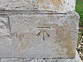
 Ordnance Survey Flush Bracket G2942 - geograph.org.uk - 4294190.jpg 4,000 × 3,000; 3.51 MB
-
 Ordnance Survey Flush Bracket G2943 - geograph.org.uk - 4294182.jpg 4,000 × 3,000; 3.94 MB
-
 Outwell Road (A1101) - geograph.org.uk - 3558462.jpg 1,935 × 1,170; 1.71 MB
-
 Outwell Road Road, Holly End, Emneth - geograph.org.uk - 6188191.jpg 4,608 × 3,456; 3.89 MB
-
 Outwell Road, Holly End, Emneth - geograph.org.uk - 6180988.jpg 3,890 × 2,853; 4.52 MB
-
 Outwell Road, Holly End, Emneth - geograph.org.uk - 6181022.jpg 4,000 × 3,000; 3.62 MB
-
 Outwell Road, Holly End, Emneth - geograph.org.uk - 6181030.jpg 3,832 × 2,748; 2.9 MB
-
 Outwell Road, Holly End, Emneth - geograph.org.uk - 6181038.jpg 4,000 × 3,000; 2.9 MB
-
 Outwell Road, Holly End, Emneth - geograph.org.uk - 6181927.jpg 4,608 × 3,456; 4.12 MB
-
 Outwell Road, Holly End, Emneth - geograph.org.uk - 6184149.jpg 4,608 × 3,456; 3.76 MB
-
 Outwell Road, Holly End, Emneth - geograph.org.uk - 6184152.jpg 4,608 × 3,456; 3.35 MB
-
 Outwell Road, Holly End, Emneth - geograph.org.uk - 6184184.jpg 4,608 × 3,456; 3.92 MB
-
 Poplar trees and drain, Emneth Hungate - geograph.org.uk - 6235893.jpg 1,024 × 768; 191 KB
-
 Post box in a garden wall - geograph.org.uk - 1984614.jpg 2,848 × 2,136; 3.02 MB
-
 Pumpkins at Collett's Bridge - geograph.org.uk - 5982916.jpg 1,600 × 640; 411 KB
-
-
 Road Name signs on Outwell Road - geograph.org.uk - 6185728.jpg 4,608 × 3,456; 3.88 MB
-
 Roadsign on Outwell Road - geograph.org.uk - 6181932.jpg 3,016 × 2,554; 2.78 MB
-
 Roadsign on the A1101 Elm High Road - geograph.org.uk - 6184388.jpg 3,817 × 2,863; 4.86 MB
-
 Roadsigns on Colletts Bridge - geograph.org.uk - 6188188.jpg 3,918 × 2,939; 4.39 MB
-
 Roadsigns on Outwell Road - geograph.org.uk - 6184143.jpg 4,608 × 3,456; 4.38 MB
-
 Shallow lay-by beside A47 south of Wisbech - geograph.org.uk - 5982874.jpg 1,600 × 799; 482 KB
-
 Shampers grooming parlour at The Wroe, Emneth - geograph.org.uk - 5660163.jpg 3,456 × 2,592; 4.77 MB
-
 Shops in Emneth near Wisbech - geograph.org.uk - 1984660.jpg 2,848 × 2,136; 2.98 MB
-
 Sign for the Queens Head, Emneth - geograph.org.uk - 4715687.jpg 486 × 640; 65 KB
-
 Small Bridge - geograph.org.uk - 3398541.jpg 800 × 600; 243 KB
-
 Smeeth Road near Popenhoe Farm - geograph.org.uk - 283583.jpg 640 × 427; 76 KB
-
 Sports fields off Hungate Road - geograph.org.uk - 4715690.jpg 640 × 480; 59 KB
-
 Spraying a wheatfield on Edge Bank - geograph.org.uk - 3073433.jpg 4,320 × 3,240; 5.38 MB
-
 St Edmund's church, Emneth - geograph.org.uk - 4444642.jpg 4,004 × 2,835; 4.63 MB
-
 St. Edmund Church Notice Board - geograph.org.uk - 6185299.jpg 4,608 × 3,456; 4.07 MB
-
 St. Edmund Church, Emneth - geograph.org.uk - 6185050.jpg 4,608 × 3,456; 3.99 MB
-
 St. Edmund Church, Emneth - geograph.org.uk - 6185316.jpg 3,456 × 4,608; 3.77 MB
-
 St. Edmund Church, Emneth - geograph.org.uk - 6186705.jpg 4,608 × 3,456; 3.79 MB
-
 Sugar beet, Hall Dike, Outwell - geograph.org.uk - 3073571.jpg 4,320 × 3,240; 5.45 MB
-
 The Church of St Edmund at Emneth - geograph.org.uk - 4254783.jpg 3,000 × 4,000; 2.44 MB
-

-

-

-

-

-

-

-

-
 The church of St Edmund in Emneth - geograph.org.uk - 1820106.jpg 480 × 640; 93 KB
-
 The church of St Edmund in Emneth - geograph.org.uk - 1820115.jpg 480 × 640; 132 KB
-
 The church of St Edmund in Emneth - geograph.org.uk - 1820117.jpg 640 × 480; 171 KB
-
 The church of St Edmund in Emneth - geograph.org.uk - 1820118.jpg 640 × 480; 173 KB
-
 The church of St Edmund in Emneth - geograph.org.uk - 1820120.jpg 640 × 480; 118 KB
-
 The church of St Edmund in Emneth - geograph.org.uk - 1820125.jpg 480 × 640; 119 KB
-

-

-

-

-

-

-

-
-

-

-

-

-

-
 The Church of St Edmund, Emneth - geograph.org.uk - 4103544.jpg 640 × 480; 76 KB
-
 The former Queens Head Public House, Emneth - geograph.org.uk - 6182379.jpg 4,608 × 3,456; 3.97 MB
-
 The Gaultree Inn - geograph.org.uk - 4103550.jpg 640 × 396; 52 KB
-
 The Gaultree Inn Public House, Emneth - geograph.org.uk - 6182382.jpg 4,608 × 3,456; 3.64 MB
-
 The Gaultree Inn Public House, Emneth - geograph.org.uk - 6183893.jpg 4,608 × 3,456; 3.6 MB
-
 The Gaultree Inn Public House, Emneth - geograph.org.uk - 6185024.jpg 4,608 × 3,456; 3.67 MB
-
 The Gaultree Inn, Emneth - geograph.org.uk - 5660165.jpg 3,456 × 2,592; 3.48 MB
-
 The Queens Head, Emneth - geograph.org.uk - 4715685.jpg 640 × 480; 44 KB
-
 The road through Emneth - geograph.org.uk - 1820094.jpg 640 × 480; 151 KB
-
 The sky over Little Fendyke Field. - geograph.org.uk - 71521.jpg 640 × 396; 78 KB
-
 The vicarage in Emneth - geograph.org.uk - 1820101.jpg 640 × 480; 138 KB
-
 The Wroe - geograph.org.uk - 4103552.jpg 640 × 480; 85 KB
-
 The Wroe - geograph.org.uk - 4103597.jpg 640 × 480; 67 KB
-
 The Wroe at Collett's Bridge - geograph.org.uk - 5982912.jpg 1,600 × 1,067; 837 KB
-
 The Wroe, Emneth - geograph.org.uk - 6183673.jpg 4,608 × 3,456; 3.85 MB
-
 Titkill Bridge - geograph.org.uk - 1003544.jpg 640 × 480; 75 KB
-
 Truck washing business by A47, south of Wisbech - geograph.org.uk - 5982875.jpg 1,600 × 800; 551 KB
-
 View along Chapel Lane - geograph.org.uk - 1267635.jpg 497 × 640; 73 KB
-
 Wisbech - Meadowgate Lane, looking north - geograph.org.uk - 1818194.jpg 640 × 480; 185 KB


_-_geograph.org.uk_-_3558453.jpg)


_-_geograph.org.uk_-_3558462.jpg)


_-_geograph.org.uk_-_1833520.jpg)


