Category:Ellistown and Battleflat
Jump to navigation
Jump to search
civil parish in Leicestershire, United Kingdom | |||||
| Upload media | |||||
| Instance of | |||||
|---|---|---|---|---|---|
| Location | North West Leicestershire, Leicestershire, East Midlands, England | ||||
 | |||||
Main Wikipedia article: Ellistown and Battleflat.
Media in category "Ellistown and Battleflat"
The following 49 files are in this category, out of 49 total.
-
 Allotment gardens, Ellistown - geograph.org.uk - 4921446.jpg 1,920 × 1,080; 641 KB
-
 Allotments, Ellistown - geograph.org.uk - 5046184.jpg 640 × 480; 94 KB
-
 Beaconsfield Villas - geograph.org.uk - 3946289.jpg 3,156 × 2,827; 3.47 MB
-
 Beveridge Lane on the Bardon Industrial Park - geograph.org.uk - 3737842.jpg 1,600 × 1,256; 684 KB
-
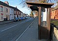 Bus shelter along Ellistown Terrace Road - geograph.org.uk - 4348093.jpg 1,600 × 1,131; 502 KB
-

-
 Construction work on Berridge Lane - geograph.org.uk - 5180840.jpg 640 × 461; 68 KB
-
 Diane's Food Emporium by A511 - geograph.org.uk - 4541577.jpg 1,600 × 1,198; 1.42 MB
-
 East Lane - geograph.org.uk - 2182913.jpg 1,024 × 770; 222 KB
-

-
 Ellistown Post Office - geograph.org.uk - 5047466.jpg 640 × 480; 63 KB
-
 Farmland between Hugglescote and Ellistown - geograph.org.uk - 4347800.jpg 1,600 × 995; 452 KB
-
 Ferneyhough & Co. Bookbinders.jpg 2,448 × 3,264; 1.41 MB
-
 Footpath from the A511 to the B585 - geograph.org.uk - 5886466.jpg 4,000 × 3,000; 3.46 MB
-
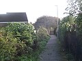 Footpath through Ellistown - geograph.org.uk - 5946138.jpg 4,000 × 3,000; 3.04 MB
-
 Footpath to Blackberry Lane - geograph.org.uk - 4158533.jpg 1,600 × 1,068; 743 KB
-
 Freight railway from Leicester to Burton upon Trent - geograph.org.uk - 5946238.jpg 4,000 × 3,000; 2.81 MB
-
 Grazing land near the A511 - geograph.org.uk - 2182930.jpg 1,024 × 748; 297 KB
-
 Hanging baskets along West Lane - geograph.org.uk - 3737855.jpg 1,600 × 1,184; 522 KB
-
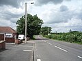
 Heading east along the A511 Bardon Road - geograph.org.uk - 3737626.jpg 1,600 × 1,198; 470 KB
-
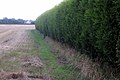 Hedge round the house in a field - geograph.org.uk - 4147512.jpg 1,600 × 1,070; 499 KB
-
 Houses on Midland Road, Ellistown - geograph.org.uk - 5046186.jpg 640 × 480; 50 KB
-
 Houses on Whitehill Road, Ellistown - geograph.org.uk - 5046167.jpg 640 × 480; 70 KB
-
 Houses on Whitehill Road, Ellistown - geograph.org.uk - 5046177.jpg 640 × 480; 68 KB
-
 Houses on Whitehill Road, Ellistown - geograph.org.uk - 5046178.jpg 640 × 480; 65 KB
-
 Interlink Way West - geograph.org.uk - 6333967.jpg 1,024 × 768; 170 KB
-
 Midland Road in Ellistown - geograph.org.uk - 4347951.jpg 1,600 × 1,099; 445 KB
-
 Midland Road, Ellistown - geograph.org.uk - 5046197.jpg 640 × 480; 63 KB
-
 Mini roundabout and village green, Ellistown - geograph.org.uk - 3384757.jpg 1,024 × 768; 111 KB
-
 Overgrown pond, Ellistown - geograph.org.uk - 4921454.jpg 1,920 × 1,080; 635 KB
-
 Path into Donington le Heath - geograph.org.uk - 4147599.jpg 1,600 × 1,067; 428 KB
-
 Power poles in stubble field - geograph.org.uk - 4147617.jpg 1,200 × 1,600; 559 KB
-
 Pylons in the farm - geograph.org.uk - 4147531.jpg 1,600 × 1,069; 186 KB
-
 Regs Way on the Bardon Industrial Park - geograph.org.uk - 3737833.jpg 1,600 × 1,200; 539 KB
-
 Regs Way towards Bardon Industrial Park - geograph.org.uk - 3737737.jpg 1,600 × 1,203; 658 KB
-
 Roca Group building - geograph.org.uk - 6333966.jpg 1,024 × 768; 144 KB
-
 Roundabout on the B585 Beveridge Lane - geograph.org.uk - 3737849.jpg 1,600 × 1,200; 518 KB
-
 Saint Christopher's church - geograph.org.uk - 5946137.jpg 4,000 × 3,000; 2.89 MB
-
 South end of Moore Road, Ellistown - geograph.org.uk - 3384766.jpg 1,024 × 768; 111 KB
-
 St Christopher's Church, Ellistown - geograph.org.uk - 3384769.jpg 1,024 × 768; 237 KB
-
 St Peter's Church in Bardon - geograph.org.uk - 3737782.jpg 1,600 × 1,413; 682 KB
-
 St. Christopher's Church in Ellistown - geograph.org.uk - 4348083.jpg 1,600 × 1,143; 792 KB
-
 Start of dual carriageway on A511 Bardon Road - geograph.org.uk - 4541575.jpg 1,600 × 1,199; 1.14 MB
-
 The A511 Bardon Road - geograph.org.uk - 3737717.jpg 1,600 × 1,153; 540 KB
-
 The New Ellistown Public House - geograph.org.uk - 3946256.jpg 3,130 × 2,662; 3.65 MB
-
 Wesleyan Reform Chapel - Ellistown - geograph.org.uk - 3946250.jpg 1,542 × 2,706; 1.97 MB
-
 Whitehill Road, Ellistown - geograph.org.uk - 3384774.jpg 1,024 × 768; 203 KB
-
 Whitehill Road, Ellistown - geograph.org.uk - 5046180.jpg 640 × 480; 62 KB
-
 Zebra crossing on Midland Road in Ellistown - geograph.org.uk - 4348024.jpg 1,600 × 1,058; 311 KB


