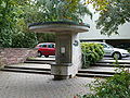
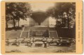
Category:Elisabethenbrunnen (Bad Homburg vor der Höhe)
Jump to navigation
Jump to search
| Object location | | View all coordinates using: OpenStreetMap |
|---|
water well in Bad Homburg vor der Höhe, Hesse, Germany  | |||||
| Upload media | |||||
| Instance of | |||||
|---|---|---|---|---|---|
| Part of | |||||
| Location | Bad Homburg vor der Höhe, Hochtaunuskreis, Darmstadt Government Region, Hesse, Germany | ||||
| Heritage designation | |||||
 | |||||
Media in category "Elisabethenbrunnen (Bad Homburg vor der Höhe)"
The following 19 files are in this category, out of 19 total.
-
 (GASPEY) p39 ELISABETHBRUNNEN, COLONADE UND NEUES GEWÄCHSHAUS.jpg 2,037 × 1,347; 1.84 MB
-
 Bad Homburg Elisabethenbrunnen 0749-dfh.jpg 1,619 × 1,206; 583 KB
-
 Bad Homburg tempio.jpg 2,000 × 1,334; 873 KB
-
 Bad Homburg – Elisabethenbrunnen - panoramio (1).jpg 7,649 × 3,022; 5.71 MB
-
 Bad Homburg – Elisabethenbrunnen - panoramio (2).jpg 4,320 × 3,240; 4.53 MB
-
 Bad Homburg – Elisabethenbrunnen - panoramio.jpg 5,424 × 2,712; 3.24 MB
-
 Bad Homburg – Kurpark - panoramio (10).jpg 4,320 × 3,240; 4.57 MB
-
 Bad-homburg-elisabethen-quelle-007.jpg 3,648 × 2,736; 2.86 MB
-
 Bad-homburg-kurpark-elisabethen-quelle-012.jpg 3,648 × 2,736; 3.37 MB
-
 Bad-homburg-kurpark-elisabethen-quelle-014.jpg 2,736 × 3,648; 2.64 MB
-
 Der Kurpark Bad Homburg 4.jpg 3,264 × 2,448; 2.91 MB
-
 Elisabethenbrunnen-Bad-Homburg-JR-G6-1793-2007-08-06.jpg 3,072 × 2,304; 2.25 MB
-
 Germany - Bad Homburg – Elisabethenbrunnen - panoramio.jpg 4,320 × 3,240; 4.8 MB
-
 Kurpark Bad Homburg.jpg 2,816 × 2,112; 2.68 MB
-
 Kurpark-hg-elisabethen-brunnen-002.jpg 2,848 × 2,136; 1.97 MB
-
 Kurpark-hg-elisabethen-brunnen-003.jpg 2,848 × 2,136; 1.84 MB
-

-
 Zonder titel PK-F-MM.4934.tiff 2,008 × 1,320; 7.62 MB
-
 Zonder titel PK-F-MM.5129.tiff 2,007 × 1,311; 7.56 MB
_p39_ELISABETHBRUNNEN,_COLONADE_UND_NEUES_GEW%C3%84CHSHAUS.jpg)


.jpg)

.jpg)


,_RP-F-F06024.jpg)
.jpg)