Category:Elend (Harz)
Jump to navigation
Jump to search
district of the town of Oberharz am Brocken in the Harz District, in Saxony-Anhalt, Germany    | |||||
| Upload media | |||||
| Instance of |
| ||||
|---|---|---|---|---|---|
| Location | Oberharz am Brocken, Harz District, Saxony-Anhalt, Germany | ||||
| Population |
| ||||
| Area |
| ||||
| Elevation above sea level |
| ||||
| official website | |||||
 | |||||
Subcategories
This category has the following 10 subcategories, out of 10 total.
B
- Bahnhof Elend (10 F)
E
G
- Grenzübergang Elend (5 F)
K
- Kriegerdenkmal (Elend/Harz) (2 F)
M
N
R
S
- Scherstorklippen (8 F)
Media in category "Elend (Harz)"
The following 30 files are in this category, out of 30 total.
-
 DE-ST 15-0-85-228 Elend COA.svg 401 × 460; 104 KB
-
 99 5906 at Elend in the Harz Mountains. - panoramio.jpg 3,278 × 2,174; 4.89 MB
-
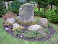
 B 27 Grenz-Denkmal.JPG 2,048 × 1,536; 666 KB
-
 Barenberg-Klippen 1.jpg 4,492 × 2,749; 5.65 MB
-
 Barenberg-Klippen 2.jpg 4,098 × 2,749; 5.31 MB
-
 Blick auf Elend.jpg 3,072 × 2,304; 956 KB
-
 Brücke vermutlich bei Elend.jpg 996 × 639; 151 KB
-
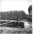 Bundesarchiv Bild 183-32472-0029, Waldfreibad in Elend-Harz.jpg 783 × 800; 108 KB
-
 Die ersten Schwalben.JPG 2,048 × 1,536; 1.39 MB
-
 Die Kalte Bode.JPG 3,264 × 2,448; 4.15 MB
-
 Elbingerode – Schirke – Tanne (4).png 1,663 × 769; 2.55 MB
-
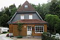
 Elend (Harz) KURFILM-BÜHNE (1994) (52062362299).jpg 7,700 × 5,198; 8.18 MB
-
 Elend (Harz) KURFILM-BÜHNE (1994) 2 (52062124361).jpg 8,816 × 5,998; 8.68 MB
-
 Elend (Harz), Sachsen-Anhalt - Bode (Zeno Ansichtskarten).jpg 2,166 × 1,383; 437 KB
-
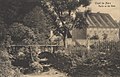
 Elend (Harz), Sachsen-Anhalt - Erholungsheim Waldmühle (Zeno Ansichtskarten).jpg 2,208 × 1,395; 297 KB
-
 Elend (Harz), Sachsen-Anhalt - Hotel Waldhöhe (Zeno Ansichtskarten).jpg 2,150 × 1,389; 465 KB
-
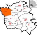 Elend in Oberharz am Brocken.svg 492 × 464; 116 KB
-
 Elend Karte 1912.JPG 602 × 548; 76 KB
-
 Elend Wald.JPG 2,448 × 3,264; 5.05 MB
-
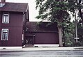
 Elend, Bodeweg 1, Kulturdenkmal.jpg 1,622 × 2,432; 1.05 MB
-
 Elend, Bodeweg 2, Kulturdenkmal.jpg 2,384 × 3,576; 2.48 MB
-
 Elend, Bodeweg 5, Kulturdenkmal.jpg 2,430 × 1,620; 1.21 MB
-
 Elend, Bodeweg 6, Kulturdenkmal.jpg 2,409 × 1,606; 918 KB
-
 Elend.JPG 3,264 × 2,448; 3.03 MB
-
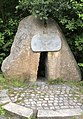
 Elendsburg.jpg 2,258 × 1,429; 737 KB
-
 Garten in Elend.JPG 3,264 × 2,448; 4.38 MB
-
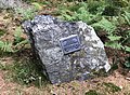
 Grenzdenkmal Elend 2020.jpg 1,536 × 2,206; 1.41 MB
-
 Kalte Bode in Elend.JPG 3,264 × 2,448; 3.91 MB
-
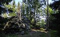
 Wildererstein bei Elend 01.jpg 2,102 × 1,536; 1.57 MB
-
 Wildererstein bei Elend 02.jpg 2,378 × 1,536; 1.63 MB


.png)
_KURFILM-B%C3%9CHNE_(1994)_(52062362299).jpg)
_KURFILM-B%C3%9CHNE_(1994)_2_(52062124361).jpg)
,_Sachsen-Anhalt_-_Bode_(Zeno_Ansichtskarten).jpg)
,_Sachsen-Anhalt_-_Erholungsheim_Waldm%C3%BChle_(Zeno_Ansichtskarten).jpg)
,_Sachsen-Anhalt_-_Hotel_Waldh%C3%B6he_(Zeno_Ansichtskarten).jpg)


