Category:Election maps of Tyrol (state)
Jump to navigation
Jump to search
States of Austria: Burgenland · Carinthia · Lower Austria · Salzburg · Styria · Tyrol · Upper Austria · Vienna · Vorarlberg
Deutsch: Karten von Tirol (Nord und Ost) mit Wahlergebnissen.
English: Maps of Tyrol (North and East) showing election results.
Media in category "Election maps of Tyrol (state)"
The following 8 files are in this category, out of 8 total.
-
 Landtagswahl in Tirol 2008 Gemeindemehrheiten.png 454 × 289; 122 KB
-
 Landtagswahl in Tirol 2008 Gemeinden.png 1,513 × 997; 381 KB
-
 Landtagswahl Tirol 2022 Stimmenateile der Siegerpartei.svg 2,364 × 1,316; 554 KB
-
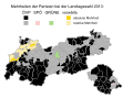 Landtagswahlkarte Tirol 2013.svg 1,000 × 735; 131 KB
-
 Landtagswahlkarte Tirol 2018.svg 950 × 690; 386 KB
-
 Landtagswahlkarte Tirol 2022.svg 950 × 690; 408 KB
-
 Landtagswahlkreise Tirol.svg 454 × 289; 28 KB
-
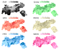 Parteien Landtagswahl Tirol 2018.svg 850 × 700; 1.28 MB


