Category:Election maps of Indonesia
Jump to navigation
Jump to search
Countries of Asia: Afghanistan · Armenia‡ · Azerbaijan‡ · Bangladesh · Bhutan · Cambodia · People's Republic of China · Cyprus‡ · East Timor · Egypt‡ · Georgia‡ · India · Indonesia‡ · Iran · Iraq · Israel · Japan · Kazakhstan‡ · Kyrgyzstan · Lebanon · Malaysia · Maldives · Mongolia · Myanmar · Nepal · North Korea · Pakistan · Philippines · Russia‡ · Singapore · South Korea · Sri Lanka · Syria · Tajikistan · Thailand · Turkey‡ · Turkmenistan · Uzbekistan · Yemen
Limited recognition: Taiwan · Northern Cyprus‡ · State of Palestine – Other territories: Hong Kong
‡: partly located in Asia
Limited recognition: Taiwan · Northern Cyprus‡ · State of Palestine – Other territories: Hong Kong
‡: partly located in Asia
Countries of Oceania: Australia · Fiji · Nauru · New Zealand · Papua New Guinea · Samoa · Solomon Islands · Tuvalu · Vanuatu
Other areas: American Samoa · Cook Islands · French Polynesia · Guam · Hawaii · New Caledonia · Northern Mariana Islands · Wallis and Futuna – Partly: British overseas territories · Indonesia
Other areas: American Samoa · Cook Islands · French Polynesia · Guam · Hawaii · New Caledonia · Northern Mariana Islands · Wallis and Futuna – Partly: British overseas territories · Indonesia
Subcategories
This category has the following 5 subcategories, out of 5 total.
Media in category "Election maps of Indonesia"
The following 30 files are in this category, out of 30 total.
-
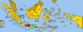
 1955 Indonesian Electoral Regions.png 1,500 × 590; 182 KB
-
 1955 Indonesian legislative election results map by electoral district.svg 1,605 × 836; 1.38 MB
-
 2004ElectionsIndonesia.png 1,500 × 590; 142 KB
-
 2009 ElectionsIndonesia.png 1,500 × 590; 130 KB
-
 2009 Indonesian General Election Electoral College.png 1,582 × 656; 233 KB
-
 2009 PresElectionsIndonesia.png 1,500 × 590; 135 KB
-
 2014 Indonesian legislative election results map by electoral district.svg 1,748 × 1,169; 1.55 MB
-
 2020 Indonesian local elections mayoral regency map.png 1,462 × 545; 145 KB
-
 Election 1999.png 1,500 × 590; 150 KB
-
 Electoral District of Indonesia (seat distribution).svg 1,123 × 600; 3.13 MB
-
 Indonesia Election 1999.png 1,500 × 590; 150 KB
-
 Indonesia local elections provinces.png 2,000 × 938; 297 KB
-
 Indonesian 2019 General Election Electoral College.png 1,580 × 656; 225 KB
-
 IndonesianElections.gif 720 × 283; 333 KB
-
 Map of 1955 Constituent Assembly Election - Provinces.svg 1,200 × 460; 384 KB
-
 Map of 1955 Indonesian Legislative Election - Cities and Regencies.svg 1,631 × 600; 1.1 MB
-
 Map of 1955 Indonesian Legislative Election - Electoral Districts.svg 1,200 × 460; 384 KB
-

-
 Map of 1971 Indonesian Legislative Election - Cities and Regencies.svg 1,631 × 600; 670 KB
-
 Map of 1971 Indonesian Legislative Election - Overseas Elections.svg 940 × 477; 849 KB
-
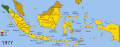
 Map of 1977 Indonesian Legislative Election - Cities and Regencies.svg 1,631 × 600; 676 KB
-
 Map of 1982 Indonesian Legislative Election - Cities and Regencies.svg 1,631 × 600; 670 KB
-
 Map of 1982 Indonesian Legislative Election - Overseas Elections.svg 940 × 477; 1.59 MB
-
 Map of 1987 Indonesian Legislative Election - Cities and Regencies.svg 1,631 × 600; 670 KB
-
 Map of 1987 Indonesian Legislative Election - Overseas Elections.svg 940 × 477; 834 KB
-
 Map of 1992 Indonesian Legislative Election - Cities and Regencies.svg 1,631 × 600; 670 KB
-
 Map of 1999 Indonesian Legislative Election - Provinces.png 5,000 × 2,000; 646 KB
-
 Map of 2004 Indonesian Presidential Election (1st Round) - Overseas Elections.svg 2,754 × 1,398; 1.14 MB
-
 Map of 2004 Indonesian Presidential Election (1st Round) - Provinces.svg 1,322 × 620; 714 KB
-
 Map of 2004 Indonesian Presidential Election (2nd Round) - Provinces.svg 1,322 × 620; 693 KB


.svg)


_-_Overseas_Elections.svg)
_-_Provinces.svg)
_-_Provinces.svg)
.svg)