Category:Eisenbahnbrücke Kehl/Straßburg
Jump to navigation
Jump to search
Pour l'histoire du pont, voir http://www.archi-strasbourg.org/Pont-Rail de l'Europe
| Object location | | View all coordinates using: OpenStreetMap |
|---|
bridge in France and Kehl, Germany  | |||||
| Upload media | |||||
| Instance of | |||||
|---|---|---|---|---|---|
| Part of | |||||
| Made from material | |||||
| Location | Baden-Württemberg, Germany | ||||
| Crosses | |||||
| Carries | |||||
| Inception |
| ||||
| Date of official opening |
| ||||
| Length |
| ||||
| Next crossing upstream | |||||
 | |||||
Subcategories
This category has only the following subcategory.
E
Media in category "Eisenbahnbrücke Kehl/Straßburg"
The following 35 files are in this category, out of 35 total.
-
 20170430-kehl-tram-d-opening-rhine-trambrueke-tgv-tram-ship.jpg 3,456 × 2,304; 3.79 MB
-
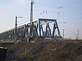
 20180915Eisenbahnbrücke Kehl Straßburg 01.jpg 6,032 × 4,032; 2.81 MB
-
 20180915Eisenbahnbrücke Kehl Straßburg 02.jpg 6,032 × 4,032; 2.57 MB
-
 Alte EIsenbahnbrücke bei Kehl 2.JPG 2,288 × 1,712; 690 KB
-
 Alte Eisenbahnbrücke bei Kehl.JPG 2,288 × 1,712; 791 KB
-
 Baubeginn neue Eisenbahnbrücke in Kehl.JPG 2,288 × 1,712; 701 KB
-
 Bundesarchiv Bild 195-1769, Rheinbefliegung, Kehl.jpg 796 × 800; 130 KB
-
 Eisenbahnbrücke bei Kehl.JPG 2,288 × 1,712; 849 KB
-
 Eisenbahnbrücke Kehl.jpg 2,582 × 1,452; 2.41 MB
-
 Freedom of Panorama, Germany 2017.jpg 4,644 × 3,084; 1.61 MB
-
 Future passerelle sur le Rhin Pont de l'Europe 28022015.JPG 2,592 × 1,944; 1.38 MB
-
 July 2007, Rhine between Strasbourg and Kehl 8.jpg 3,072 × 2,304; 1.43 MB
-
 July 2007, Rhine between Strasbourg and Kehl 9.jpg 3,072 × 2,304; 1.41 MB
-
 Le pont du tramway et le pont de chemin de fer vus depuis le pont de l'Europe.jpg 2,816 × 2,112; 1.77 MB
-
 Les trois ponts de Strasbourg vus depuis la passerelle des Deux-Rives.jpg 2,816 × 2,112; 1,022 KB
-
 Neubau Eisenbahnbrücke Kehl1.JPG 2,288 × 1,712; 720 KB
-
 Neubau Eisenbahnbrücke Kehl2.JPG 2,288 × 1,712; 747 KB
-
 Neubau Eisenbahnbrücke Kehl3.JPG 2,288 × 1,712; 700 KB
-
 Neubau Eisenbahnbrücke Kehl4.JPG 2,288 × 1,712; 689 KB
-
 Neue Eisenbahnbrücke fertig errichtet.jpg 3,264 × 1,836; 696 KB
-
 Neue Rheinbrücke Kehl 2009 01.JPG 2,122 × 1,365; 903 KB
-
 Neue Rheinbrücke Kehl 2009 02.JPG 2,088 × 1,371; 584 KB
-
 Neue Rheinbrücke Kehl 2009 03.JPG 1,984 × 1,323; 637 KB
-
 Neue Rheinbrücke Kehl 2009 04.JPG 2,055 × 1,370; 647 KB
-
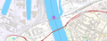 Pont ferroviare de kehl.png 1,146 × 439; 501 KB
-
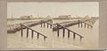 Pontonbrücke und Eisenbahnbrücke Kehl 1859 Etikett.jpg 1,373 × 659; 101 KB
-
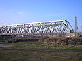
 Railway border bridge Strasbourg-Kehl.jpg 3,648 × 2,736; 4.08 MB
-
 Rejno ĉe Strasburgo-Kehl, piliero de la tramponto, 1.jpeg 4,350 × 2,600; 3.63 MB
-
 Station Kehl 2017 1.jpg 3,648 × 2,736; 4.88 MB
-
 Station Kehl 2017 5.jpg 3,648 × 2,736; 4.89 MB
-
 Station Kehl 2019 2.jpg 3,648 × 2,736; 4.61 MB
-
 Train bridge @ Rhine river @ Pont Beatus-Rhenanus @ Kehl (44822625754).jpg 5,472 × 3,648; 5.32 MB
-
 Trambrücke Kehl bau pfleiler D.jpg 2,304 × 1,728; 900 KB
-
 Trambrücke von Kehl nach Strasbourg, im Hintergrund die Eisenbahnbrücke.jpg 4,000 × 2,717; 3.19 MB
-
 Trambrücke von Kehl nach Strasbourg, rechts die Eisenbahnbrücke.jpg 3,146 × 1,563; 1.68 MB


.jpg)


Categories:
- Grenzübergang Kehl/Straßburg
- Bridges over the Rhine in Strasbourg
- Iron truss railway bridges in Baden-Württemberg
- Iron truss beam railway bridges in Germany
- Railway bridges over the Rhine in Germany
- Bridges in Kehl
- France-Germany bridges over the Rhine
- Iron truss railway bridges in France
- Bahnstrecke Appenweier–Strasbourg
- Rail transport in Strasbourg
- 21st-century bridges in Alsace
- 2010s bridges in France
- Built in Strasbourg in 2010
- Railway bridges in Alsace
- Buildings built by Max Bögl