Category:Eccles, Scottish Borders (civil parish)
Jump to navigation
Jump to search
Scottish parish in Scottish Borders, Scotland, UK | |||||
| Upload media | |||||
| Instance of | |||||
|---|---|---|---|---|---|
| Part of |
| ||||
| Named after | |||||
| Location |
| ||||
| Population |
| ||||
| Area |
| ||||
 | |||||
Subcategories
This category has the following 3 subcategories, out of 3 total.
Media in category "Eccles, Scottish Borders (civil parish)"
The following 200 files are in this category, out of 506 total.
(previous page) (next page)-
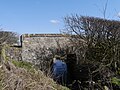
 A 'cundy' near Hunthall in the Scottish Borders - geograph.org.uk - 6250480.jpg 3,128 × 2,346; 2.93 MB
-
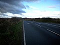
 A bend in the A698 - geograph.org.uk - 5009334.jpg 640 × 480; 65 KB
-
 A Burn Near Earnslaw - geograph.org.uk - 3065817.jpg 3,448 × 4,592; 3.77 MB
-
 A country road at Printonan Hill - geograph.org.uk - 1292122.jpg 640 × 427; 120 KB
-

-
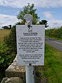 A Fly-covered Sign At Earnslaw - geograph.org.uk - 3065801.jpg 3,448 × 4,592; 2.91 MB
-

-
 A gate in to the field - geograph.org.uk - 1926044.jpg 640 × 480; 75 KB
-
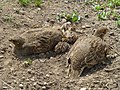 A Grey Partridge Family - geograph.org.uk - 4059009.jpg 4,320 × 3,240; 5.66 MB
-
 A healthy crop at Pittlesheugh - geograph.org.uk - 1926222.jpg 640 × 480; 78 KB
-
 A Hint Of Autumn - geograph.org.uk - 4162498.jpg 4,592 × 3,448; 3.91 MB
-
 A junction of minor roads at the entrance to Belchester - geograph.org.uk - 5999026.jpg 4,000 × 3,000; 4.16 MB
-
 A Lister Bale Elevator - geograph.org.uk - 3394422.jpg 3,448 × 4,592; 3.29 MB
-
 A mounting block with steps, Eccles - geograph.org.uk - 3636118.jpg 1,789 × 1,247; 931 KB
-
 A part of Wylie Cleugh near Leitholm in the Scottish Borders - geograph.org.uk - 6254678.jpg 5,184 × 3,888; 5.97 MB
-
 A rapeseed field at Lochton - geograph.org.uk - 3972484.jpg 640 × 480; 173 KB
-
 A rapeseed field at Lochton - geograph.org.uk - 3972485.jpg 640 × 469; 183 KB
-
 A road junction in Birgham - geograph.org.uk - 3636181.jpg 3,648 × 2,736; 1.76 MB
-
 A road sign in Birgham - geograph.org.uk - 4590192.jpg 640 × 487; 196 KB
-
 A Roadside Rest Near Eccles - geograph.org.uk - 3079231.jpg 4,592 × 3,448; 4.16 MB
-
 A Small Bridge In The Merse - geograph.org.uk - 4417999.jpg 4,592 × 3,448; 4.25 MB
-
 A Small Stream Through The Merse - geograph.org.uk - 4059084.jpg 3,240 × 4,320; 4.78 MB
-
 A Track Near Eccles - geograph.org.uk - 4059020.jpg 3,240 × 4,320; 5.09 MB
-
 A View Towards Charterhall Airfield - geograph.org.uk - 2754863.jpg 4,592 × 3,448; 4.35 MB
-

-
 A697 northbound - geograph.org.uk - 3394940.jpg 640 × 457; 30 KB
-
 A697 northbound - geograph.org.uk - 3394946.jpg 640 × 441; 38 KB
-
 A697 northbound - geograph.org.uk - 3394948.jpg 640 × 480; 42 KB
-
 A697 northbound - geograph.org.uk - 3394953.jpg 640 × 463; 49 KB
-
 A697 northbound - geograph.org.uk - 3394955.jpg 640 × 480; 36 KB
-
 A697 northbound - geograph.org.uk - 3394959.jpg 640 × 480; 35 KB
-
 A698 at Birgham village boundary - geograph.org.uk - 5842489.jpg 1,024 × 761; 99 KB
-
 A698 at Homebank Farm - geograph.org.uk - 5842487.jpg 1,024 × 762; 69 KB
-
 A698 east of Homebank Farm - geograph.org.uk - 5842484.jpg 1,024 × 760; 142 KB
-
 A698 near Springhill - geograph.org.uk - 5842491.jpg 1,024 × 768; 167 KB
-
 A698 roadworks next to the River Tweed - geograph.org.uk - 5842492.jpg 1,024 × 706; 210 KB
-
 A698 towards Coldstream - geograph.org.uk - 5009340.jpg 640 × 480; 69 KB
-
 A698 towards Coldstream - geograph.org.uk - 5009354.jpg 640 × 480; 88 KB
-
 A698 towards Coldstream - geograph.org.uk - 5009361.jpg 640 × 480; 69 KB
-
 Access to Saint Foin left - geograph.org.uk - 3636161.jpg 1,824 × 1,368; 678 KB
-
 After The Hail - geograph.org.uk - 3596136.jpg 3,448 × 4,592; 1.53 MB
-
 Agricultural dealers, Orange Lane - geograph.org.uk - 4963222.jpg 640 × 396; 45 KB
-

-
 Ancient cross near Crosshall Farm - geograph.org.uk - 1925626.jpg 640 × 480; 69 KB
-
 Arable Land At Eccles Hill - geograph.org.uk - 3945297.jpg 3,448 × 4,592; 4.04 MB
-
 Arable land near Bankhead - geograph.org.uk - 1925432.jpg 640 × 480; 58 KB
-
 Arable land, Crosshall - geograph.org.uk - 1950195.jpg 640 × 480; 84 KB
-
 Arable land, Crosshall - geograph.org.uk - 1950197.jpg 640 × 480; 93 KB
-
 Arable land, Eccles - geograph.org.uk - 2332623.jpg 640 × 359; 184 KB
-
 Autumn Hues - geograph.org.uk - 4217041.jpg 3,448 × 4,592; 3.95 MB
-
 Autumn-sown cereal at Eccles Tofts - geograph.org.uk - 1042466.jpg 640 × 480; 86 KB
-
 B6461 approaching the A697 - geograph.org.uk - 4963217.jpg 640 × 429; 59 KB
-
 B6461 near Langrig - geograph.org.uk - 4958445.jpg 640 × 480; 64 KB
-
 B6461 near Langrig - geograph.org.uk - 4961801.jpg 640 × 480; 70 KB
-
 B6461 towards Berwick - geograph.org.uk - 4958380.jpg 640 × 480; 69 KB
-
 B6461 towards Berwick - geograph.org.uk - 4958430.jpg 640 × 480; 66 KB
-
 B6461 towards Swinton - geograph.org.uk - 4963188.jpg 640 × 480; 59 KB
-
 B6461 towards Swinton - geograph.org.uk - 4963211.jpg 640 × 480; 47 KB
-
 B6461, Eccles - geograph.org.uk - 4963180.jpg 640 × 480; 68 KB
-
 B6461, Leitholm - geograph.org.uk - 4968455.jpg 3,648 × 2,736; 1.5 MB
-
 B6461, Stainrigg - geograph.org.uk - 4958385.jpg 640 × 480; 54 KB
-
 B6461, Stainrigg - geograph.org.uk - 4958394.jpg 640 × 480; 81 KB
-
 B6461, Stainrigg Mains - geograph.org.uk - 4958377.jpg 640 × 480; 58 KB
-
 B6461, Wormerlaw - geograph.org.uk - 4963142.jpg 640 × 480; 48 KB
-
 Barley By Eccles - geograph.org.uk - 4059046.jpg 3,240 × 4,320; 4.73 MB
-
 Barley field - geograph.org.uk - 1948654.jpg 640 × 359; 63 KB
-
 Barley Near The Bastle - geograph.org.uk - 3014000.jpg 4,592 × 3,448; 4.2 MB
-
 Barley on Whitrig Hill - geograph.org.uk - 1948871.jpg 640 × 359; 87 KB
-
 Barley, Fernyrig - geograph.org.uk - 1948927.jpg 640 × 359; 99 KB
-
 Bartlehill - geograph.org.uk - 3079139.jpg 3,448 × 4,592; 2.87 MB
-

-
 Beans Near The Bastle - geograph.org.uk - 3014008.jpg 4,592 × 3,448; 4.15 MB
-
 Beeches at Birgham - geograph.org.uk - 6083015.jpg 1,200 × 1,600; 833 KB
-
 Beer Garden - geograph.org.uk - 3991162.jpg 2,560 × 1,920; 2.17 MB
-
 Below Dub Cottage - geograph.org.uk - 3353464.jpg 800 × 600; 134 KB
-
 Bend in the B6461 near Eccles - geograph.org.uk - 4963149.jpg 640 × 480; 105 KB
-

-
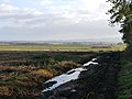
 Big ploughed field near Printonan in the Scottish Borders - geograph.org.uk - 6255253.jpg 5,184 × 3,888; 4.93 MB
-
 Birgham - geograph.org.uk - 1950188.jpg 640 × 359; 82 KB
-
 Birgham Millennium War Memorial Cairn - geograph.org.uk - 5009462.jpg 640 × 480; 104 KB
-
 Birgham Wood - geograph.org.uk - 1948950.jpg 640 × 359; 112 KB
-
 Blue Houses - geograph.org.uk - 5565577.jpg 640 × 411; 39 KB
-
 Bowmakers Hill near Printonan in the Scottish Borders - geograph.org.uk - 6265717.jpg 5,184 × 3,888; 6.85 MB
-
 Bowmakers Hill on Printonan in the Scottish Borders - geograph.org.uk - 6266495.jpg 5,184 × 3,888; 4.4 MB
-
 Bridge Over The Lambden Burn - geograph.org.uk - 4417944.jpg 3,447 × 4,481; 5.2 MB
-
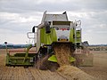 Bringing In The Wheat - geograph.org.uk - 3079209.jpg 4,592 × 3,448; 2.84 MB
-
 Bungalow, Stainrigg Mains - geograph.org.uk - 4958379.jpg 640 × 480; 47 KB
-
 Bus stop and shelter, Birgham - geograph.org.uk - 5009371.jpg 640 × 480; 87 KB
-
 By Birgham Wood - geograph.org.uk - 1948962.jpg 640 × 359; 119 KB
-
 Carham Church - geograph.org.uk - 3353553.jpg 800 × 600; 92 KB
-
 Carham Church in Silhouette - geograph.org.uk - 3353810.jpg 800 × 600; 116 KB
-
 Cattle, Harlaw - geograph.org.uk - 5559040.jpg 640 × 435; 93 KB
-
 Cereal crop at Lochton Farm - geograph.org.uk - 1852151.jpg 640 × 480; 72 KB
-
 Charterhall Airfield - geograph.org.uk - 2762687.jpg 4,592 × 3,448; 4.08 MB
-
 Charterhall Met Office Weather Station - Image ^1 - geograph.org.uk - 2754908.jpg 4,592 × 3,448; 4.48 MB
-
 Charterhall Met Office Weather Station - Image ^2 - geograph.org.uk - 2754912.jpg 4,592 × 3,448; 4.52 MB
-
 Charterhall Met Office Weather Station - Image ^3 - geograph.org.uk - 2754917.jpg 4,592 × 3,448; 2.57 MB
-

-
 Charterhall Runway - geograph.org.uk - 2756097.jpg 4,592 × 3,448; 3.5 MB
-
 Charterhall West Hangar - geograph.org.uk - 2895677.jpg 4,592 × 3,448; 3.84 MB
-
 Close up, Elizabeth II postbox on Eccles Main Street - geograph.org.uk - 4968378.jpg 1,866 × 3,082; 1.1 MB
-
 Coldstream to Greenlaw road - geograph.org.uk - 1042919.jpg 640 × 480; 49 KB
-
 Cotchet Ridge - geograph.org.uk - 4075505.jpg 640 × 480; 457 KB
-

-
 Cottage in Birgham - geograph.org.uk - 5009366.jpg 640 × 480; 71 KB
-
 Cottages near Belmont Farm - geograph.org.uk - 1926115.jpg 640 × 383; 65 KB
-
 Cottages, Leitholm - geograph.org.uk - 4958407.jpg 640 × 480; 68 KB
-
 Cottages, Wormerlaw - geograph.org.uk - 4963144.jpg 640 × 480; 48 KB
-
 Course of Leet Water near Leitholm in the Scottish Borders - geograph.org.uk - 6255415.jpg 5,184 × 3,888; 7.77 MB
-
 Crop field and hedgerow - geograph.org.uk - 4963204.jpg 640 × 480; 80 KB
-
 Crop field and hedgerow - geograph.org.uk - 5009770.jpg 640 × 480; 89 KB
-
 Crop field and pylons - geograph.org.uk - 4963206.jpg 640 × 480; 37 KB
-
 Crop field and pylons near Langrig - geograph.org.uk - 4958434.jpg 640 × 480; 45 KB
-
 Crop field beside woodland, Eccles - geograph.org.uk - 4963147.jpg 640 × 480; 84 KB
-
 Crop field near Bartlehill - geograph.org.uk - 5009471.jpg 640 × 480; 56 KB
-
 Crop field near Homebank - geograph.org.uk - 5009764.jpg 640 × 480; 74 KB
-
 Crop field near Langrig - geograph.org.uk - 4958440.jpg 640 × 480; 51 KB
-
 Crop field near Lochton - geograph.org.uk - 5009333.jpg 640 × 480; 71 KB
-

-

-
 Crop field off the B6461 - geograph.org.uk - 4963210.jpg 640 × 480; 41 KB
-
 Crop field, Bishop's Bog - geograph.org.uk - 5009478.jpg 640 × 480; 85 KB
-
 Crop field, Eccles - geograph.org.uk - 4963167.jpg 640 × 480; 59 KB
-
 Crop Spraying At Bartlehill - geograph.org.uk - 3079167.jpg 4,592 × 3,448; 2.82 MB
-
 Cropped Grassland - geograph.org.uk - 4017755.jpg 3,448 × 4,592; 3.89 MB
-
 Crosshall Cross - geograph.org.uk - 3945284.jpg 3,448 × 4,592; 3.31 MB
-
 Crosshall Farm - geograph.org.uk - 4075239.jpg 640 × 480; 498 KB
-

-
 Culvert under the A698 - geograph.org.uk - 1950180.jpg 640 × 359; 121 KB
-
 Cutting OSR Stubble - geograph.org.uk - 2573133.jpg 1,600 × 1,200; 448 KB
-
 Demolished farm, Eccles - geograph.org.uk - 1947929.jpg 640 × 359; 78 KB
-
 Drainage ditch - geograph.org.uk - 5759618.jpg 1,600 × 1,067; 501 KB
-
 Drainage ditch near Bankhead - geograph.org.uk - 5759648.jpg 1,600 × 1,067; 401 KB
-
 Ducks on a peaceful River Tweed - geograph.org.uk - 5245481.jpg 1,600 × 1,147; 196 KB
-
 Dung heap beside Mayfield Wood - geograph.org.uk - 5245512.jpg 1,600 × 1,144; 194 KB
-
 Dusk At RAF Charterhall - geograph.org.uk - 2745699.jpg 4,592 × 3,448; 2.29 MB
-
 Eccles - geograph.org.uk - 1947932.jpg 640 × 359; 92 KB
-
 Eccles Hill - geograph.org.uk - 1947921.jpg 640 × 359; 83 KB
-
 Eccles House, boundary wall and outbuildings - geograph.org.uk - 3636132.jpg 1,824 × 1,368; 882 KB
-
 Eccles parish church - geograph.org.uk - 3636109.jpg 1,824 × 1,368; 630 KB
-
 Eccles Parish Church - geograph.org.uk - 4590195.jpg 640 × 427; 173 KB
-
 Eccles Parish Church - geograph.org.uk - 4963174.jpg 640 × 480; 51 KB
-
 Eccles Tofts - geograph.org.uk - 2754815.jpg 3,448 × 4,592; 3.91 MB
-
 Edge of Birgham - geograph.org.uk - 2613779.jpg 640 × 480; 312 KB
-

-
 Elizabeth II postbox and phonebox on Main Street, Leitholm - geograph.org.uk - 4968460.jpg 2,595 × 2,292; 1.21 MB
-
 Entering Birgham - geograph.org.uk - 5009364.jpg 640 × 480; 68 KB
-
 Entering Eccles - geograph.org.uk - 4963165.jpg 640 × 480; 69 KB
-
 Entering Leitholm - geograph.org.uk - 4958397.jpg 640 × 480; 76 KB
-
 Entrance to Belchester - geograph.org.uk - 1925546.jpg 640 × 480; 136 KB
-
 Entrance to Eccles electric sub station - geograph.org.uk - 1923251.jpg 4,000 × 3,000; 2.48 MB
-
 Entrance to Eccles House - geograph.org.uk - 3636125.jpg 1,824 × 1,368; 673 KB
-
 Entrance to Eccles Parish Church - geograph.org.uk - 3636120.jpg 1,247 × 1,775; 647 KB
-
 Entrance to Leitholm - geograph.org.uk - 2685227.jpg 640 × 462; 69 KB
-
 Entry to Birgham - geograph.org.uk - 3636166.jpg 1,789 × 961; 511 KB
-
 Farm building, Langrig - geograph.org.uk - 4961803.jpg 640 × 480; 47 KB
-
 Farm buildings, Loanknowe - geograph.org.uk - 5559041.jpg 640 × 480; 44 KB
-
 Farm road leading to Hardacres - geograph.org.uk - 5998981.jpg 4,000 × 3,000; 3.19 MB
-
 Farm road leading to Pittlesheugh - geograph.org.uk - 5998990.jpg 4,000 × 3,000; 3.43 MB
-
 Farm road near Langrig - geograph.org.uk - 4958501.jpg 640 × 480; 53 KB
-
 Farm road to Belville - geograph.org.uk - 5999036.jpg 4,000 × 3,000; 3.18 MB
-
 Farm road, Lochton - geograph.org.uk - 2613774.jpg 640 × 480; 294 KB
-
 Farm track off the B6461 near Eccles - geograph.org.uk - 4963154.jpg 640 × 480; 95 KB
-
 Farmhouse, Springwells - geograph.org.uk - 5565610.jpg 640 × 480; 48 KB
-
 Farmland and pylons - geograph.org.uk - 1459285.jpg 640 × 480; 53 KB
-
 Farmland at Birgham - geograph.org.uk - 1145119.jpg 640 × 427; 137 KB
-

-
 Farmland near Pittlesheugh - geograph.org.uk - 4007038.jpg 1,600 × 1,200; 435 KB
-
 Farmland to the southeast of Eccles - geograph.org.uk - 1286614.jpg 640 × 427; 142 KB
-
 Farmlands at Stainrigg Mains - geograph.org.uk - 1926234.jpg 640 × 480; 64 KB
-

-
 Fenn Trap Near Eccles Tofts - geograph.org.uk - 2754826.jpg 3,448 × 4,592; 3.8 MB
-
 Field Access - geograph.org.uk - 3945307.jpg 3,448 × 4,592; 3.67 MB
-

-
 Field Corner Near Lambden - geograph.org.uk - 3079251.jpg 4,592 × 3,448; 4.13 MB
-

-
 Field Edge Near The A697 - geograph.org.uk - 3006739.jpg 3,448 × 4,592; 3.32 MB
-

-

-
 Field entrance off the A698 - geograph.org.uk - 5009337.jpg 640 × 480; 85 KB
-
 Field near Dub Cottage - geograph.org.uk - 5009358.jpg 640 × 480; 67 KB
-
 Field near Loanknowe - geograph.org.uk - 5565585.jpg 640 × 436; 71 KB
-
 Field of barley at Bartlehill Farm - geograph.org.uk - 4075508.jpg 640 × 480; 464 KB
-
 Field of wheat at Bartlehill Farm - geograph.org.uk - 4075509.jpg 640 × 480; 449 KB
-
 Field of wheat at Bartlehill Farm - geograph.org.uk - 4075510.jpg 640 × 480; 463 KB
-
-
 Field under crop near Eccles - geograph.org.uk - 2382224.jpg 640 × 496; 99 KB
-
 Fields at Angelrow Farm - geograph.org.uk - 1041730.jpg 640 × 480; 62 KB
-
 Ford Through The Leet Water - geograph.org.uk - 4604099.jpg 1,198 × 1,600; 856 KB
-

-

-
 Garage on B6461, Eccles - geograph.org.uk - 3636101.jpg 3,648 × 2,736; 1.9 MB
-

-
 Gateway by Leet Water near Leitholm in the Scottish Borders - geograph.org.uk - 6255439.jpg 5,184 × 3,888; 7.03 MB
-
 Grassland and woodland, Bishop's Bog - geograph.org.uk - 5009482.jpg 640 × 480; 92 KB
-
 Grassland, Hassington West Mains - geograph.org.uk - 1947908.jpg 640 × 480; 99 KB
-
 Grazing and woodland near Leitholm - geograph.org.uk - 4958428.jpg 640 × 480; 72 KB
-
 Grazing and woodland, Pittlesheugh - geograph.org.uk - 5565606.jpg 640 × 414; 39 KB
-
 Grazing land at Bankhead - geograph.org.uk - 1925441.jpg 640 × 480; 55 KB
-
 Hardwood Strip woodland - geograph.org.uk - 5009468.jpg 640 × 480; 66 KB


&filefrom=Harlaw+-+geograph.org.uk+-+1947912.jpg#mw-category-media)