Category:East Portlemouth
Jump to navigation
Jump to search
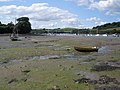
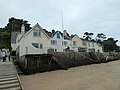
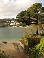
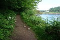
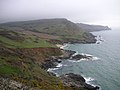
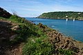
English: East Portlemouth is a small Devon village situated at the southern end of the Kingsbridge Estuary. The village is sited on a hill giving views to the north to Kingsbridge and on a clear day as far as Dartmoor. There is a small ferry that runs to Salcombe and a beach that is popular with holiday makers.
village in the United Kingdom  | |||||
| Upload media | |||||
| Instance of | |||||
|---|---|---|---|---|---|
| Location | South Hams, Devon, South West England, England | ||||
 | |||||
Subcategories
This category has the following 2 subcategories, out of 2 total.
E
M
- Mill Bay, East Portlemouth (15 F)
Media in category "East Portlemouth"
The following 200 files are in this category, out of 282 total.
(previous page) (next page)-
 A grassy meadow - geograph.org.uk - 3147873.jpg 640 × 374; 36 KB
-
 A path above Salcombe Harbour - geograph.org.uk - 2537656.jpg 3,872 × 2,592; 7.07 MB
-
 Above Leek Cove-geograph-2460378-by-Philip-Halling.jpg 1,024 × 768; 256 KB
-
 Across Southpool Creek - geograph.org.uk - 2185197.jpg 640 × 480; 79 KB
-
 Across Southpool Creek to Westerncombe - geograph.org.uk - 3855808.jpg 3,648 × 2,736; 1.89 MB
-
 Across the creek - geograph.org.uk - 3920665.jpg 1,704 × 2,304; 1.46 MB
-
 Bar Lodge from suny cove.jpg 563 × 427; 47 KB
-
 Beside Southpool Creek - geograph.org.uk - 2184975.jpg 640 × 480; 134 KB
-
 Biddlehead Point - geograph.org.uk - 5976865.jpg 1,600 × 1,166; 227 KB
-
 Biddlehead Point, Salcombe - geograph.org.uk - 2232371.jpg 640 × 480; 82 KB
-

-

-
 Bridleway from Mill Bay - geograph.org.uk - 2185804.jpg 640 × 480; 159 KB
-
 Bridleway near Newhouse Cottages - geograph.org.uk - 3147929.jpg 640 × 430; 28 KB
-
 Buildings at Goodshelter - geograph.org.uk - 2184949.jpg 640 × 480; 95 KB
-
 Busy day on Batson Creek - geograph.org.uk - 3920670.jpg 2,304 × 1,704; 1.73 MB
-
 Cafe over looking Salcombe - panoramio.jpg 4,000 × 3,000; 3.73 MB
-
 Coast at Portlemouth Down - geograph.org.uk - 2186249.jpg 640 × 480; 125 KB
-
 Coast path - geograph.org.uk - 4015913.jpg 640 × 425; 130 KB
-
 Coast path - geograph.org.uk - 4017228.jpg 640 × 425; 101 KB
-
 Coast path - geograph.org.uk - 4017319.jpg 640 × 425; 99 KB
-
 Coast path - geograph.org.uk - 4017340.jpg 640 × 425; 97 KB
-
 Coast path above Rickham Sand - geograph.org.uk - 4017285.jpg 640 × 425; 89 KB
-
 Coast path above Seacombe Sand - geograph.org.uk - 2745460.jpg 1,024 × 768; 230 KB
-
 Coast path at Gara Rock - geograph.org.uk - 2186531.jpg 640 × 480; 96 KB
-
 Coast Path below Deckler's Cliff - geograph.org.uk - 2745457.jpg 1,024 × 768; 291 KB
-
 Coast path below Portlemouth Down - geograph.org.uk - 2745440.jpg 1,024 × 768; 255 KB
-
 Coast path heading towards Gara Rock - geograph.org.uk - 4017243.jpg 640 × 425; 89 KB
-
 Coast path, Portlemouth Down - geograph.org.uk - 2186260.jpg 640 × 480; 120 KB
-
 Coast path, Portlemouth Down - geograph.org.uk - 2186349.jpg 640 × 480; 137 KB
-
 Coast path, Portlemouth Down - geograph.org.uk - 2745448.jpg 1,024 × 768; 296 KB
-
 Converted barn, High House Farm - geograph.org.uk - 2187319.jpg 640 × 428; 58 KB
-
 Cottages near West Prawle - geograph.org.uk - 2187343.jpg 640 × 436; 58 KB
-

-
 Coveside beside the Horsepool - geograph.org.uk - 3855286.jpg 3,563 × 2,605; 1.33 MB
-
 Cows on a hillside near Rickham - geograph.org.uk - 2537680.jpg 3,872 × 2,592; 6.08 MB
-
 Ditch End seen from Salcombe - geograph.org.uk - 4884681.jpg 640 × 427; 77 KB
-
 Ditchend Cove - geograph.org.uk - 1434554.jpg 640 × 480; 109 KB
-
 Ditchend Cove - geograph.org.uk - 1434568.jpg 640 × 480; 81 KB
-
 East from Portlemouth Down.jpg 3,865 × 2,755; 4.56 MB
-
 East Portlemouth - geograph.org.uk - 3142184.jpg 640 × 430; 54 KB
-
 East Portlemouth - geograph.org.uk - 3142230.jpg 640 × 451; 45 KB
-
 East Portlemouth, a flock on the move - geograph.org.uk - 951884.jpg 640 × 427; 204 KB
-
 East Portlemouth, by Portlemouth Down - geograph.org.uk - 567842.jpg 640 × 427; 197 KB
-
 East Portlemouth, church of St Winwalloe-Onolaus, 1995 - geograph.org.uk - 4997419.jpg 2,317 × 1,328; 3.21 MB
-
 East Portlemouth, ferry from Salcombe - geograph.org.uk - 1733982.jpg 3,072 × 2,304; 2.74 MB
-
 East Portlemouth, from Salcombe - geograph.org.uk - 1733975.jpg 3,072 × 2,304; 2.57 MB
-
 East Portlemouth, Gara Rock lookout - geograph.org.uk - 567831.jpg 640 × 427; 166 KB
-
 East Portlemouth, towards Deckler's Cliff - geograph.org.uk - 567836.jpg 640 × 427; 197 KB
-
 East Portlemouth, UK - panoramio.jpg 4,000 × 3,000; 4.72 MB
-
 Edge of woodland by Wood Lane - geograph.org.uk - 2188572.jpg 640 × 480; 146 KB
-
 Entering East Portlemouth - geograph.org.uk - 3147875.jpg 640 × 430; 63 KB
-
 Entrance to Salcombe Harbour - geograph.org.uk - 2460382.jpg 1,024 × 768; 245 KB
-
 Farm buildings - geograph.org.uk - 408200.jpg 640 × 480; 79 KB
-
 Farm land above Gara Rock - geograph.org.uk - 408167.jpg 640 × 480; 89 KB
-
 Farmland looking towards West Prawle - geograph.org.uk - 408190.jpg 640 × 480; 86 KB
-
 Farmland near Newhouse Cottages - geograph.org.uk - 3147918.jpg 640 × 430; 33 KB
-
 Farmland near Rickham Cross - geograph.org.uk - 3147893.jpg 640 × 430; 46 KB
-
 Ferry Side Cottages - geograph.org.uk - 2212546.jpg 640 × 426; 124 KB
-
 Ferry to Salcombe - geograph.org.uk - 2457053.jpg 1,024 × 768; 184 KB
-
 Field track near Moor Farm - geograph.org.uk - 3150717.jpg 640 × 430; 50 KB
-
 Footbridge on the coast path - geograph.org.uk - 4017299.jpg 640 × 425; 114 KB
-
 Footbridge on the coastal path by the remains of a house - geograph.org.uk - 2537537.jpg 3,872 × 2,592; 6.3 MB
-
 Footpath on Rickham Common - geograph.org.uk - 2185901.jpg 640 × 480; 132 KB
-
 Footpath on Rickham Common - geograph.org.uk - 2185930.jpg 640 × 480; 138 KB
-
 Footpath on Rickham Common - geograph.org.uk - 2186204.jpg 640 × 480; 99 KB
-
 Ford at Yalton Kiln - geograph.org.uk - 3855783.jpg 3,648 × 2,736; 1.97 MB
-
 Gara Beach - geograph.org.uk - 1475081.jpg 640 × 426; 96 KB
-
 Gara Rock - geograph.org.uk - 2745452.jpg 1,024 × 768; 302 KB
-
 Gara Rock - geograph.org.uk - 372414.jpg 640 × 480; 163 KB
-
 Gara Rock and beach - geograph.org.uk - 2537523.jpg 3,872 × 2,592; 4.69 MB
-
 Gara Rock Lookout - geograph.org.uk - 2186861.jpg 640 × 478; 88 KB
-
 Gara Rock Lookout - geograph.org.uk - 372409.jpg 640 × 480; 121 KB
-
 Gara Rock lookout.jpg 3,734 × 2,666; 3.22 MB
-
 Gate on Rickham Common - geograph.org.uk - 2186236.jpg 640 × 480; 107 KB
-
 Gate, Wood Lane - geograph.org.uk - 2187520.jpg 640 × 419; 87 KB
-
 Gateway on Wood Lane - geograph.org.uk - 2187420.jpg 510 × 640; 100 KB
-
 Gateway on Wood Lane - geograph.org.uk - 2187431.jpg 640 × 447; 80 KB
-
 Goodshelter - geograph.org.uk - 124633.jpg 640 × 480; 71 KB
-
 Goodshelter - geograph.org.uk - 2212502.jpg 640 × 426; 135 KB
-
 Goodshelter tidal ford - geograph.org.uk - 3855995.jpg 3,579 × 2,692; 2.12 MB
-
 Goodshelter Tidal Road - geograph.org.uk - 3149007.jpg 3,264 × 2,448; 3.54 MB
-
 Goodshelter Tidal Road - geograph.org.uk - 3686507.jpg 3,872 × 2,592; 1.24 MB
-
 Goodshelter, Devon - geograph.org.uk - 4734641.jpg 800 × 533; 193 KB
-

-
 Hairpin bend, East Portlemouth - geograph.org.uk - 3142206.jpg 640 × 430; 56 KB
-

-
 High House Farm - geograph.org.uk - 1476119.jpg 640 × 426; 68 KB
-
 High House Farm - geograph.org.uk - 2187161.jpg 640 × 406; 70 KB
-
 High House Farm - geograph.org.uk - 2187180.jpg 640 × 404; 72 KB
-
 High House Farm - geograph.org.uk - 3147911.jpg 640 × 430; 51 KB
-
 High House Farm - geograph.org.uk - 3147914.jpg 640 × 430; 40 KB
-
 Holset Cross - geograph.org.uk - 1475977.jpg 640 × 426; 69 KB
-
 Holset Cross - geograph.org.uk - 2899285.jpg 4,000 × 2,343; 3.39 MB
-

-
 Houses by the ferry ramp - geograph.org.uk - 4884679.jpg 640 × 427; 79 KB
-
-
 Impressive tree, East Portlemouth - geograph.org.uk - 3142226.jpg 640 × 430; 61 KB
-
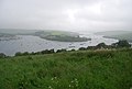
 Kingsbridge estuary - geograph.org.uk - 2282043.jpg 1,024 × 680; 148 KB
-
 Kingsbridge Estuary - geograph.org.uk - 3142160.jpg 640 × 430; 38 KB
-
 Kingsbridge Estuary - geograph.org.uk - 3142174.jpg 640 × 430; 53 KB
-
 Kingsbridge Estuary from Salcombe - geograph.org.uk - 5976880.jpg 1,600 × 1,200; 290 KB
-

-
 Lane at Horsepool Cove - geograph.org.uk - 2185226.jpg 640 × 480; 106 KB
-
 Lane at Yalton - geograph.org.uk - 2185162.jpg 480 × 640; 141 KB
-
 Lane at Yalton - geograph.org.uk - 2185164.jpg 640 × 480; 130 KB
-
 Lane from Gara Rock - geograph.org.uk - 2187112.jpg 640 × 458; 113 KB
-
 Lane in East Portlemouth - geograph.org.uk - 3142198.jpg 640 × 392; 48 KB
-
 Lane in East Portlemouth - geograph.org.uk - 3142219.jpg 640 × 483; 53 KB
-
 Lane near Vinivers Cross - geograph.org.uk - 5793669.jpg 4,271 × 2,462; 2.02 MB
-
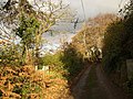
 Lane to East Portlemouth - geograph.org.uk - 3150720.jpg 640 × 430; 32 KB
-

-
 Lane to East Prawle - geograph.org.uk - 3147926.jpg 640 × 430; 33 KB
-
 Lane to East Prawle - geograph.org.uk - 3147950.jpg 640 × 430; 59 KB
-
 Lane to East Prawle - geograph.org.uk - 3150734.jpg 640 × 430; 49 KB
-
 Lane to Gara Rock, Rickham Cross - geograph.org.uk - 3147908.jpg 640 × 430; 43 KB
-
 Lane to Holset, Holset Cross - geograph.org.uk - 3147889.jpg 640 × 430; 44 KB
-
 Lane to Rickham Cross - geograph.org.uk - 3147897.jpg 640 × 430; 49 KB
-
 Lane to Vinivers Cross - geograph.org.uk - 3150721.jpg 640 × 430; 40 KB
-
 Leek Cove from Sharp Tor - geograph.org.uk - 2749231.jpg 600 × 800; 334 KB
-
 Lime kiln, Goodshelter - geograph.org.uk - 2212507.jpg 640 × 426; 141 KB
-

-
 Moor Sands, a closer look - geograph.org.uk - 1179362.jpg 640 × 480; 97 KB
-
 Moor Sands-Venerick's Cove - geograph.org.uk - 1179345.jpg 640 × 480; 98 KB
-
 Mouth of Salcombe Estuary - geograph.org.uk - 4016282.jpg 640 × 425; 99 KB
-
 Muddy track near West Prawle - geograph.org.uk - 3150714.jpg 640 × 430; 37 KB
-
 Narrow lane at Passageway - geograph.org.uk - 3140121.jpg 640 × 430; 74 KB
-
 Near Scoble - geograph.org.uk - 310148.jpg 640 × 480; 85 KB
-
 Newhouse Cottages - geograph.org.uk - 1476135.jpg 640 × 426; 79 KB
-
 Newhouse Cottages - geograph.org.uk - 2537736.jpg 3,872 × 2,592; 4.33 MB
-
 Newhouse Cottages - geograph.org.uk - 2899129.jpg 3,784 × 2,154; 2.62 MB
-
 Newhouse Cottages - geograph.org.uk - 3147924.jpg 640 × 385; 35 KB
-
 North end of Mill Bay - geograph.org.uk - 2185556.jpg 490 × 640; 90 KB
-

-
 On the coastal path below Portlemouth Down - geograph.org.uk - 2737245.jpg 1,024 × 768; 242 KB
-
 Ordnance Survey Cut Mark - geograph.org.uk - 6101870.jpg 1,024 × 930; 415 KB
-
 Ordnance Survey Cut Mark - geograph.org.uk - 6101871.jpg 980 × 1,024; 301 KB
-
 Ordnance Survey Cut Mark - geograph.org.uk - 6101872.jpg 1,024 × 429; 145 KB
-
 Pasture north of Portlemouth Down - geograph.org.uk - 3851977.jpg 3,648 × 2,736; 1.05 MB
-
 Path heading towards Rickham Common - geograph.org.uk - 4015891.jpg 640 × 425; 107 KB
-
 Path junction - geograph.org.uk - 4015885.jpg 640 × 425; 88 KB
-
 Path junction - geograph.org.uk - 4015905.jpg 640 × 425; 127 KB
-
 Path junction - geograph.org.uk - 4017263.jpg 640 × 425; 98 KB
-
 Path junction - geograph.org.uk - 4017280.jpg 640 × 425; 133 KB
-
 Path on Portlemouth Down - geograph.org.uk - 2186221.jpg 640 × 480; 110 KB
-
 Path past Gara Rock - geograph.org.uk - 5976937.jpg 1,600 × 1,200; 411 KB
-
 Path to East Portlemouth - geograph.org.uk - 3142155.jpg 640 × 430; 117 KB
-
 Pig's Nose - geograph.org.uk - 2537436.jpg 3,872 × 2,592; 5.2 MB
-
 Pining for a sit down - geograph.org.uk - 3851979.jpg 3,648 × 2,736; 1.28 MB
-
 Pond near West Prawle - geograph.org.uk - 2187368.jpg 640 × 480; 72 KB
-
 Portlemouth Down - geograph.org.uk - 172073.jpg 640 × 480; 155 KB
-
 Portlemouth Down - geograph.org.uk - 2186370.jpg 640 × 480; 104 KB
-
 Portlemouth Down - geograph.org.uk - 413548.jpg 640 × 480; 72 KB
-
 Portlemouth Down with a rainbow - geograph.org.uk - 5299851.jpg 1,600 × 1,200; 690 KB
-
 Puddle, Wood Lane - geograph.org.uk - 2187503.jpg 640 × 480; 90 KB
-
 Rebuilding Gara Rock - geograph.org.uk - 2187044.jpg 640 × 454; 82 KB
-
 Ria - panoramio (1).jpg 3,244 × 1,773; 993 KB
-
 Rickham and Seaham Sands.jpg 4,112 × 2,848; 5.79 MB
-
 Rickham Common - geograph.org.uk - 2186097.jpg 640 × 480; 122 KB
-
 Rickham Cross - geograph.org.uk - 2187125.jpg 640 × 471; 76 KB
-
 Rickham Farm - geograph.org.uk - 2537688.jpg 3,872 × 2,592; 4.63 MB
-
 Rickham Farm - geograph.org.uk - 2537713.jpg 3,872 × 2,592; 5.04 MB
-
 Rivulet at Mill Bay - geograph.org.uk - 3851980.jpg 3,648 × 2,736; 2.06 MB
-
 Rivulets in the sand - geograph.org.uk - 5247053.jpg 1,200 × 804; 366 KB
-
 Road closure and diversion at Rickham Cross - geograph.org.uk - 2537721.jpg 3,872 × 2,592; 4.25 MB
-
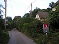
 Road sign, East Portlemouth - geograph.org.uk - 3142244.jpg 640 × 430; 53 KB
-

-
 Road, East Portlemouth - geograph.org.uk - 2185337.jpg 640 × 480; 86 KB
-
 Roadsign, Holsett Cross - geograph.org.uk - 3147883.jpg 640 × 430; 32 KB
-
 Roadsign, Rickham Cross - geograph.org.uk - 3147903.jpg 640 × 430; 48 KB
-
 Rocks at Moor Sands - geograph.org.uk - 1179282.jpg 640 × 480; 61 KB
-
 Rocky coast below Deckler's Cliff - geograph.org.uk - 4918111.jpg 768 × 1,024; 239 KB
-
 Rocky coastline - geograph.org.uk - 408152.jpg 640 × 480; 139 KB
-
 Ruins of a building by Gara Beach - geograph.org.uk - 1935494.jpg 640 × 480; 118 KB
-
 Salcombe - geograph.org.uk - 4917916.jpg 800 × 600; 115 KB
-
 Salcombe across the Estuary - geograph.org.uk - 3140114.jpg 640 × 430; 35 KB
-
 Salcombe across the Estuary - geograph.org.uk - 3140115.jpg 640 × 402; 49 KB
-
 Salcombe and Mill Bay beach - geograph.org.uk - 413508.jpg 640 × 480; 63 KB
-
 Salcombe and Mill Bay.jpg 8,645 × 2,650; 8.97 MB
-
 Salcombe and the Kingsbridge Estuary - geograph.org.uk - 6193152.jpg 3,599 × 2,399; 1.29 MB
-
 Salcombe Estuary - geograph.org.uk - 3142157.jpg 640 × 430; 31 KB
-
 Salcombe Estuary - geograph.org.uk - 4015922.jpg 640 × 425; 88 KB
-
 Salcombe Estuary - geograph.org.uk - 4016250.jpg 640 × 425; 87 KB
-
 Salcombe ferry - geograph.org.uk - 2457030.jpg 1,024 × 768; 196 KB
-
 Salcombe Harbour - geograph.org.uk - 4402360.jpg 2,324 × 1,473; 595 KB
-
 Salcombe Harbour - geograph.org.uk - 4917908.jpg 800 × 600; 153 KB
-
 Salcombe Harbour Entrance - geograph.org.uk - 306821.jpg 640 × 428; 58 KB
-

-
 Sand by the Salcombe Estuary - geograph.org.uk - 2519844.jpg 3,872 × 2,592; 3.76 MB
-
 Sandy beach at Seacombe - geograph.org.uk - 4918113.jpg 600 × 800; 110 KB
-
 Seacombe - geograph.org.uk - 4017293.jpg 640 × 425; 71 KB
-
 Seacombe - geograph.org.uk - 4918118.jpg 800 × 600; 138 KB
-

-
 Sheep on the coastal path - geograph.org.uk - 4016290.jpg 640 × 425; 75 KB
-
 Sign to West Prawle - geograph.org.uk - 3150711.jpg 640 × 430; 24 KB
-
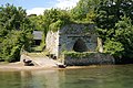
 Slade's Mill - geograph.org.uk - 2184916.jpg 640 × 480; 117 KB
-
 Small valley, Seacombe - geograph.org.uk - 4017310.jpg 640 × 425; 104 KB
-

-
 Small's Cove, Salcombe Harbour - geograph.org.uk - 910996.jpg 640 × 427; 79 KB
-
 Snapes Point - geograph.org.uk - 3142162.jpg 640 × 430; 32 KB


.jpg)


