Category:East Meon
Jump to navigation
Jump to search
village in United Kingdom  | |||||
| Upload media | |||||
| Instance of | |||||
|---|---|---|---|---|---|
| Location | East Hampshire, Hampshire, South East England, England | ||||
 | |||||
English: East Meon is a village and civil parish in the East Hampshire district of Hampshire, England. It is 4.4 miles (7 km) west of Petersfield.
Subcategories
This category has the following 10 subcategories, out of 10 total.
C
- Court House, East Meon (2 F)
E
I
- Izaak Walton pub, East Meon (5 F)
M
O
- Oasts in East Meon (2 F)
W
Media in category "East Meon"
The following 200 files are in this category, out of 935 total.
(previous page) (next page)-
 "The Cathedral of the South Downs" - geograph.org.uk - 3003600.jpg 4,288 × 3,216; 3.65 MB
-
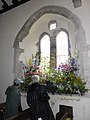
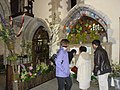
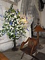
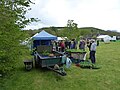
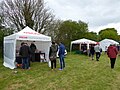
 2012 East Meon Flower Festival (a) - geograph.org.uk - 3005707.jpg 480 × 640; 89 KB
-
 2012 East Meon Flower Festival (b) - geograph.org.uk - 3005708.jpg 640 × 480; 125 KB
-
 2012 East Meon Flower Festival (c) - geograph.org.uk - 3005710.jpg 640 × 480; 60 KB
-
 2012 East Meon Flower Festival (d) - geograph.org.uk - 3005711.jpg 480 × 640; 61 KB
-
 2012 East Meon Flower Festival (e) - geograph.org.uk - 3005714.jpg 480 × 640; 51 KB
-
 2012 East Meon Flower Festival (f) - geograph.org.uk - 3005716.jpg 480 × 640; 72 KB
-
 2012 East Meon Flower Festival (g) - geograph.org.uk - 3005717.jpg 480 × 640; 82 KB
-
 2012 East Meon Flower Festival (h) - geograph.org.uk - 3005718.jpg 640 × 480; 99 KB
-
 2012 East Meon Flower Festival (i) - geograph.org.uk - 3005721.jpg 640 × 480; 93 KB
-
 2012 East Meon Flower Festival (j) - geograph.org.uk - 3005723.jpg 640 × 480; 99 KB
-
 2012 East Meon Flower Festival (k) - geograph.org.uk - 3006252.jpg 640 × 480; 74 KB
-
 2012 East Meon Flower Festival (l) - geograph.org.uk - 3005725.jpg 640 × 480; 87 KB
-
 2012 East Meon Flower Festival (m) - geograph.org.uk - 3005727.jpg 480 × 640; 82 KB
-
 2012 East Meon Flower Festival (n) - geograph.org.uk - 3005729.jpg 640 × 480; 86 KB
-
 2012 East Meon Flower Festival (o) - geograph.org.uk - 3005731.jpg 480 × 640; 101 KB
-
 2012 East Meon Flower Festival (p) - geograph.org.uk - 3005733.jpg 480 × 640; 96 KB
-
 2012 East Meon Flower Festival (q) - geograph.org.uk - 3005735.jpg 480 × 640; 68 KB
-
 2012 East Meon Flower Festival (r) - geograph.org.uk - 3005737.jpg 480 × 640; 55 KB
-
 2012 East Meon Flower Festival (s) - geograph.org.uk - 3005738.jpg 480 × 640; 53 KB
-
 2012 East Meon Flower Festival (t) - geograph.org.uk - 3005739.jpg 480 × 640; 97 KB
-
 2012 East Meon Flower Festival (u) - geograph.org.uk - 3005742.jpg 480 × 640; 88 KB
-
 2012 East Meon Flower Festival (v) - geograph.org.uk - 3005743.jpg 480 × 640; 82 KB
-
 2012 East Meon Flower Festival (w) - geograph.org.uk - 3005745.jpg 480 × 640; 84 KB
-
 2012 East Meon Flower Festival (x) - geograph.org.uk - 3005746.jpg 480 × 640; 82 KB
-
 2012 East Meon Flower Festival (y) - geograph.org.uk - 3005747.jpg 640 × 480; 40 KB
-
 2012 East Meon Flower Festival (z) - geograph.org.uk - 3005748.jpg 640 × 480; 91 KB
-
 2016, a year on Geograph (Day 144) - geograph.org.uk - 4966090.jpg 640 × 480; 98 KB
-
 2016, a year on Geograph (Day 146) - geograph.org.uk - 4966096.jpg 640 × 480; 37 KB
-
 A lush growth of wild flowers, A272 south of Privett - geograph.org.uk - 6220592.jpg 1,600 × 1,057; 862 KB
-
 A yurt at the Sustainability Centre - geograph.org.uk - 4431656.jpg 800 × 600; 179 KB
-
 A272 entering Hanger Copse - geograph.org.uk - 6220584.jpg 1,600 × 1,142; 738 KB
-

-
 A272 rounds War Hill - geograph.org.uk - 3248243.jpg 3,339 × 2,265; 957 KB
-
 A272 south of Stock Farm - geograph.org.uk - 3248270.jpg 3,219 × 2,292; 1.25 MB
-
 A272 southwest of Petersfield Lodge - geograph.org.uk - 3248267.jpg 3,648 × 2,432; 1.74 MB
-
 A272, eastbound - geograph.org.uk - 5219058.jpg 640 × 544; 58 KB
-
 A272, Hanger Copse - geograph.org.uk - 5219057.jpg 640 × 411; 106 KB
-
 A273 through Martin's Wood - geograph.org.uk - 5219055.jpg 640 × 409; 101 KB
-
 Aboard the 67 - geograph.org.uk - 5614665.jpg 1,280 × 851; 339 KB
-

-
 All Ears - geograph.org.uk - 3003858.jpg 4,288 × 3,216; 3.9 MB
-
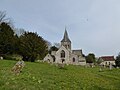
 All Saints Church, East Meon - geograph.org.uk - 6259643.jpg 1,024 × 683; 187 KB
-
 All Saints' Church, East Meon - geograph.org.uk - 5805270.jpg 1,024 × 683; 177 KB
-
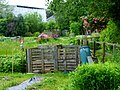
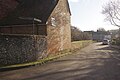
 Allotments off High Street, East Meon - geograph.org.uk - 2509973.jpg 640 × 427; 206 KB
-
 Allotments on Workhouse Lane, East Meon - geograph.org.uk - 2509965.jpg 640 × 427; 224 KB
-
 Allotments with scarecrow and lupins - geograph.org.uk - 4006212.jpg 640 × 480; 130 KB
-
 Along Limekiln Lane... - geograph.org.uk - 4194043.jpg 800 × 586; 154 KB
-
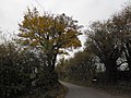 An autumnal scene in Oxenbourne Lane - geograph.org.uk - 3768592.jpg 640 × 480; 106 KB
-
 Approaching East Meon - geograph.org.uk - 5614996.jpg 1,280 × 851; 488 KB
-
-
 Attractive access road - geograph.org.uk - 4005568.jpg 800 × 600; 204 KB
-
 Autumn Beech trees in Hen Wood - geograph.org.uk - 604401.jpg 438 × 640; 213 KB
-

-
 Autumn road - geograph.org.uk - 3750266.jpg 640 × 480; 204 KB
-
 Barley Field by Duncoombe Farm - geograph.org.uk - 3003868.jpg 4,288 × 3,216; 3.73 MB
-

-
 Barn and silos, Whitewool Farm - geograph.org.uk - 3769370.jpg 640 × 480; 86 KB
-
 Barn at Frogmore - geograph.org.uk - 2510016.jpg 640 × 427; 169 KB
-
 Barns near Park Cottages - geograph.org.uk - 3750020.jpg 640 × 480; 95 KB
-
 Belmont Farm - geograph.org.uk - 3003899.jpg 4,288 × 3,216; 3.63 MB
-
 Belmont Farm, East Meon - geograph.org.uk - 3003909.jpg 4,288 × 3,216; 3.3 MB
-
 Bench on Small Down - geograph.org.uk - 3003697.jpg 4,288 × 3,216; 3.63 MB
-

-
 Bend on Limekiln Lane - geograph.org.uk - 4194088.jpg 600 × 800; 232 KB
-
 Bend on the A272 - geograph.org.uk - 5219056.jpg 640 × 405; 38 KB
-

-
 Beside the track to Hyden Cottage - geograph.org.uk - 6085821.jpg 1,024 × 683; 270 KB
-
 Bridge Cottage, Frogmore - geograph.org.uk - 2450574.jpg 640 × 480; 77 KB
-
 Bridge over Whitewool Pond - geograph.org.uk - 4026250.jpg 800 × 600; 161 KB
-
 Bridleway to Tigwell Farm - geograph.org.uk - 3750027.jpg 640 × 480; 141 KB
-
 Bridleway to Tigwell Farm - geograph.org.uk - 3869479.jpg 800 × 600; 150 KB
-
 Brook Cottages, East Meon (geograph 4577344).jpg 1,205 × 1,000; 997 KB
-
 Brook Cottages, East Meon - geograph.org.uk - 5617899.jpg 1,280 × 851; 483 KB
-

-
 Brookside Lane, East Meon - geograph.org.uk - 3003983.jpg 4,288 × 3,216; 3.74 MB
-
 Building at the Sustainability Centre - geograph.org.uk - 4280551.jpg 800 × 600; 186 KB
-
 Building site on Droxford Road - geograph.org.uk - 4431662.jpg 800 × 600; 119 KB
-
 Buildings and road at Lower Farm - geograph.org.uk - 4005794.jpg 800 × 600; 145 KB
-
 Buildings at Tigwell Farm - geograph.org.uk - 3869325.jpg 800 × 600; 130 KB
-
 Buildings at Upper Parsonage Farm - geograph.org.uk - 4194081.jpg 800 × 600; 169 KB
-
 Buildings on South side of High Street, East Meon (July 2019).JPG 2,800 × 2,000; 2.73 MB
-
 Butser Hill from the south west - geograph.org.uk - 2930751.jpg 3,968 × 2,976; 2.78 MB
-
 Butser Hill portrait view - geograph.org.uk - 4577435.jpg 1,000 × 1,333; 1.26 MB
-

-

-
 Byway approaches Leydene Gardens Farm - geograph.org.uk - 4280544.jpg 480 × 640; 140 KB
-
-
 Byway on Drayton Down looking northwards - geograph.org.uk - 4005598.jpg 800 × 600; 203 KB
-
 Byway on Hyden Hill - geograph.org.uk - 3908179.jpg 640 × 480; 205 KB
-
 Byway Open to All Traffic - geograph.org.uk - 5616554.jpg 928 × 1,280; 290 KB
-
 Byway reaches Oxenbourne Lane - geograph.org.uk - 4006000.jpg 800 × 600; 193 KB
-
 Byway to Old Down Farm from Peak farm - geograph.org.uk - 3869817.jpg 800 × 600; 218 KB
-
 Byway towards Hyden Cross - geograph.org.uk - 6041624.jpg 1,024 × 768; 414 KB
-
 Byway up Hyden Hill - geograph.org.uk - 6039047.jpg 1,024 × 768; 385 KB
-
 Byway, Hyden Hill - geograph.org.uk - 6041676.jpg 1,024 × 768; 466 KB
-
-
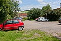 Car Park on Coombe Road, East Meon - geograph.org.uk - 2509931.jpg 640 × 427; 198 KB
-
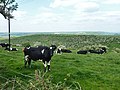 Cattle on Salt Hill - geograph.org.uk - 3979941.jpg 640 × 480; 112 KB
-
 Chalk Dell - geograph.org.uk - 3001299.jpg 4,288 × 3,216; 3.67 MB
-
 Chickens at the Sustainability Centre - geograph.org.uk - 4280548.jpg 800 × 600; 228 KB
-
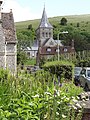 Church from Church Street - geograph.org.uk - 3001201.jpg 3,216 × 4,288; 3.48 MB
-
 Church of All Saints - geograph.org.uk - 3248072.jpg 3,648 × 2,432; 1.62 MB
-
 Church Street - geograph.org.uk - 3004069.jpg 4,288 × 3,216; 3.82 MB
-
 Church Street, East Meon - geograph.org.uk - 5615336.jpg 1,280 × 851; 380 KB
-
 Church Street, East Meon - geograph.org.uk - 5615708.jpg 1,280 × 851; 427 KB
-
 Church Street, East Meon ca 1975 - geograph.org.uk - 3826067.jpg 518 × 800; 606 KB
-
 Clearing in Hyden Wood - geograph.org.uk - 6041655.jpg 1,024 × 768; 441 KB
-
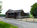 Club house at East Meon - geograph.org.uk - 4005450.jpg 800 × 600; 116 KB
-
-
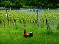 Cockerel by vineyard - geograph.org.uk - 4006235.jpg 800 × 600; 210 KB
-
 Coombe - geograph.org.uk - 3002743.jpg 4,288 × 3,216; 3.61 MB
-
 Coombe Road - geograph.org.uk - 3003885.jpg 4,288 × 3,216; 3.55 MB
-
 Coombe Road, East Meon - geograph.org.uk - 5615650.jpg 1,280 × 851; 665 KB
-
 Coombe Wood, Hampshire - geograph.org.uk - 2865476.jpg 3,504 × 2,336; 970 KB
-
 Cottages at Frogmore - geograph.org.uk - 2510011.jpg 640 × 427; 217 KB
-
 Cottages beside the river in Frogmore - geograph.org.uk - 4006142.jpg 800 × 600; 166 KB
-
 Cottages in High Street, East Meon - geograph.org.uk - 3956451.jpg 2,048 × 1,536; 485 KB
-
 Cottages in The Cross, East Meon - geograph.org.uk - 5805266.jpg 1,024 × 683; 263 KB
-
 Country lane on Tegdown Hill, part of the South Downs Way - geograph.org.uk - 2930755.jpg 3,968 × 2,976; 3.08 MB
-
 Cross Cottages, East Meon - geograph.org.uk - 3956519.jpg 2,048 × 1,536; 747 KB
-
 Crossroads and Cross - geograph.org.uk - 3004054.jpg 4,288 × 3,216; 3.47 MB
-

-
 Cyclists on Tegdown Hill - geograph.org.uk - 4580991.jpg 1,142 × 857; 444 KB
-
 Date stone, Bridge Cottage - geograph.org.uk - 2450592.jpg 640 × 480; 68 KB
-
 Descending Limekiln Lane northwards - geograph.org.uk - 4194052.jpg 600 × 800; 184 KB
-
 Distant view of Ramsdean Down to the east - geograph.org.uk - 2930781.jpg 3,968 × 2,976; 3.08 MB
-
 Disused building by Mare Pond - geograph.org.uk - 3869880.jpg 800 × 600; 163 KB
-
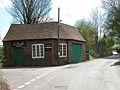
 Disused Forge, East Meon - geograph.org.uk - 2510068.jpg 640 × 427; 179 KB
-
 Disused railway bridge over the A272 - geograph.org.uk - 3869299.jpg 800 × 600; 171 KB
-
 Ditch south of Frogmore Mill - geograph.org.uk - 2510046.jpg 640 × 427; 216 KB
-
 Downland Below Wether Down - geograph.org.uk - 3002873.jpg 4,288 × 3,216; 3.63 MB
-
 Downland by East Meon - geograph.org.uk - 3001336.jpg 4,288 × 3,216; 3.63 MB
-
 Downland by Lower Farm - geograph.org.uk - 3003810.jpg 4,288 × 3,216; 3.63 MB
-
 Downland Near Coombe Cross - geograph.org.uk - 3002710.jpg 4,288 × 3,216; 3.45 MB
-
 Downland towards East Meon - geograph.org.uk - 2757606.jpg 1,800 × 1,185; 1.69 MB
-
 Drayton Cottages - geograph.org.uk - 3001378.jpg 4,288 × 3,216; 3.55 MB
-
 Drayton Down - geograph.org.uk - 3002541.jpg 4,288 × 3,216; 3.6 MB
-
 Drayton Farm - geograph.org.uk - 3001354.jpg 4,288 × 3,216; 3.7 MB
-
 Drayton Farm from the South - geograph.org.uk - 3001392.jpg 4,288 × 3,216; 3.59 MB
-
 Drayton Mill - geograph.org.uk - 3001367.jpg 4,288 × 3,216; 3.81 MB
-
 Drayton, nr East Meon - geograph.org.uk - 604370.jpg 640 × 434; 63 KB
-

-
 Droxford Road - geograph.org.uk - 1890569.jpg 2,816 × 2,112; 1.87 MB
-
 Droxford Road looking east - geograph.org.uk - 4431679.jpg 800 × 600; 158 KB
-
 Droxford Road looking west - geograph.org.uk - 4280566.jpg 800 × 600; 165 KB
-
 Dry Valley Below Salt Hill - geograph.org.uk - 3002981.jpg 4,288 × 3,216; 3.51 MB
-
 Dry valley, S of Long Down, Leydene Park - geograph.org.uk - 6005684.jpg 5,184 × 2,920; 4.24 MB
-
 East End, Hampshire - geograph.org.uk - 2229174.jpg 1,800 × 1,200; 500 KB
-
 East End, Hampshire - geograph.org.uk - 2229193.jpg 3,504 × 2,336; 496 KB
-
 East Hampshire , Park Road - geograph.org.uk - 5739213.jpg 6,000 × 4,000; 7 MB
-
 East Hampshire , Road - geograph.org.uk - 5739223.jpg 6,000 × 4,000; 7.47 MB
-
 East Hampshire , The A272 - geograph.org.uk - 5739216.jpg 6,000 × 4,000; 7.9 MB
-
 East Hampshire , The A272 - geograph.org.uk - 5739217.jpg 6,000 × 4,000; 5.89 MB
-
 East Hampshire , The A272 - geograph.org.uk - 5739224.jpg 6,000 × 4,000; 5.94 MB
-
 East Hampshire , The A272 - geograph.org.uk - 5739225.jpg 6,000 × 4,000; 6.07 MB
-
 East Hampshire , The A272 - geograph.org.uk - 5739226.jpg 6,000 × 4,000; 7.57 MB
-
 East Hampshire , The A272 - geograph.org.uk - 5739228.jpg 6,000 × 4,000; 6.01 MB
-
 East Hampshire , The A272 - geograph.org.uk - 5739229.jpg 6,000 × 4,000; 6.69 MB
-
 A splendid house in Church Street - geograph.org.uk - 1499939.jpg 640 × 480; 64 KB
-
 South Farm, East Meon - geograph.org.uk - 2631.jpg 640 × 480; 106 KB
-
 East Meon - geograph.org.uk - 3001143.jpg 4,288 × 3,216; 3.54 MB
-
 East Meon - geograph.org.uk - 5617151.jpg 1,280 × 851; 392 KB
-
 East Meon - High Street and Izaak Walton PH - geograph.org.uk - 4577323.jpg 1,244 × 1,000; 1.03 MB
-

-
-

-

-
 East Meon and Downland - geograph.org.uk - 3003879.jpg 4,288 × 3,216; 3.61 MB
-
 East Meon Baptist Church - geograph.org.uk - 3139284.jpg 3,608 × 2,734; 1.3 MB
-
 East Meon Baptist Church - geograph.org.uk - 3139296.jpg 3,296 × 2,645; 1.58 MB
-
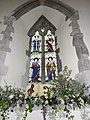
 East Meon church - geograph.org.uk - 3751449.jpg 640 × 480; 107 KB
-
 East Meon Church - geograph.org.uk - 5618625.jpg 851 × 1,280; 417 KB
-
-
 East Meon Church, mid April 2019 - geograph.org.uk - 6120810.jpg 640 × 480; 59 KB
-
 East Meon Flower Festival (Z) - geograph.org.uk - 3006640.jpg 480 × 640; 94 KB
-
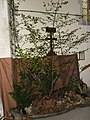
 East Meon Flower Festival - geograph.org.uk - 3001281.jpg 4,288 × 3,216; 3.42 MB
-
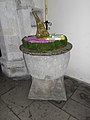
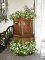
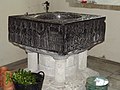 East Meon Font - geograph.org.uk - 3001232.jpg 4,288 × 3,216; 2.31 MB
-
 East Meon Font - geograph.org.uk - 6258815.jpg 1,024 × 683; 165 KB
-
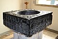 East Meon Font - geograph.org.uk - 6263283.jpg 1,024 × 686; 157 KB
-
 East Meon forge - geograph.org.uk - 2633.jpg 640 × 480; 100 KB
-
 East Meon from Small Down - geograph.org.uk - 3003588.jpg 4,288 × 3,216; 3.59 MB
-
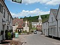
 East Meon High Street - geograph.org.uk - 3260027.jpg 1,600 × 1,066; 361 KB
-
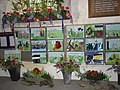
 East Meon in Bloom - geograph.org.uk - 3004033.jpg 3,216 × 4,288; 3.54 MB
-
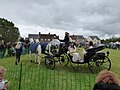
 East Meon May Day Celebrations (1) - geograph.org.uk - 5371998.jpg 640 × 480; 72 KB
-
 East Meon May Day Celebrations (10) - geograph.org.uk - 5372161.jpg 640 × 480; 84 KB
-
 East Meon May Day Celebrations (11) - geograph.org.uk - 5372165.jpg 640 × 480; 73 KB
-
 East Meon May Day Celebrations (12) - geograph.org.uk - 5372167.jpg 640 × 480; 70 KB
-
 East Meon May Day Celebrations (13) - geograph.org.uk - 5372169.jpg 640 × 480; 72 KB
-
 East Meon May Day Celebrations (14) - geograph.org.uk - 5372172.jpg 640 × 480; 70 KB
-
 East Meon May Day Celebrations (15) - geograph.org.uk - 5372174.jpg 640 × 480; 88 KB
-
 East Meon May Day Celebrations (16) - geograph.org.uk - 5372177.jpg 640 × 480; 100 KB
-
 East Meon May Day Celebrations (17) - geograph.org.uk - 5372179.jpg 640 × 480; 80 KB
-
 East Meon May Day Celebrations (18) - geograph.org.uk - 5372181.jpg 640 × 480; 77 KB
-
 East Meon May Day Celebrations (19) - geograph.org.uk - 5372183.jpg 640 × 480; 77 KB
-
 East Meon May Day Celebrations (2) - geograph.org.uk - 5372141.jpg 640 × 480; 66 KB
-
 East Meon May Day Celebrations (20) - geograph.org.uk - 5372186.jpg 640 × 480; 66 KB
-
 East Meon May Day Celebrations (21) - geograph.org.uk - 5372187.jpg 640 × 480; 91 KB
-
 East Meon May Day Celebrations (22) - geograph.org.uk - 5372188.jpg 640 × 480; 79 KB
-
 East Meon May Day Celebrations (3) - geograph.org.uk - 5372146.jpg 640 × 480; 93 KB

_-_geograph.org.uk_-_3005707.jpg)
_-_geograph.org.uk_-_3005708.jpg)
_-_geograph.org.uk_-_3005710.jpg)
_-_geograph.org.uk_-_3005711.jpg)
_-_geograph.org.uk_-_3005714.jpg)
_-_geograph.org.uk_-_3005716.jpg)
_-_geograph.org.uk_-_3005717.jpg)
_-_geograph.org.uk_-_3005718.jpg)
_-_geograph.org.uk_-_3005721.jpg)
_-_geograph.org.uk_-_3005723.jpg)
_-_geograph.org.uk_-_3006252.jpg)
_-_geograph.org.uk_-_3005725.jpg)
_-_geograph.org.uk_-_3005727.jpg)
_-_geograph.org.uk_-_3005729.jpg)
_-_geograph.org.uk_-_3005731.jpg)
_-_geograph.org.uk_-_3005733.jpg)
_-_geograph.org.uk_-_3005735.jpg)
_-_geograph.org.uk_-_3005737.jpg)
_-_geograph.org.uk_-_3005738.jpg)
_-_geograph.org.uk_-_3005739.jpg)
_-_geograph.org.uk_-_3005742.jpg)
_-_geograph.org.uk_-_3005743.jpg)
_-_geograph.org.uk_-_3005745.jpg)
_-_geograph.org.uk_-_3005746.jpg)
_-_geograph.org.uk_-_3005747.jpg)
_-_geograph.org.uk_-_3005748.jpg)
_-_geograph.org.uk_-_4966090.jpg)
_-_geograph.org.uk_-_4966096.jpg)


.jpg)


.JPG)


_-_geograph.org.uk_-_1455302.jpg)
_-_geograph.org.uk_-_1455319.jpg)
_-_geograph.org.uk_-_1455339.jpg)
_-_geograph.org.uk_-_1455522.jpg)


_-_geograph.org.uk_-_2634.jpg)

_-_geograph.org.uk_-_3006640.jpg)


_-_geograph.org.uk_-_5371998.jpg)
_-_geograph.org.uk_-_5372161.jpg)
_-_geograph.org.uk_-_5372165.jpg)
_-_geograph.org.uk_-_5372167.jpg)
_-_geograph.org.uk_-_5372169.jpg)
_-_geograph.org.uk_-_5372172.jpg)
_-_geograph.org.uk_-_5372174.jpg)
_-_geograph.org.uk_-_5372177.jpg)
_-_geograph.org.uk_-_5372179.jpg)
_-_geograph.org.uk_-_5372181.jpg)
_-_geograph.org.uk_-_5372183.jpg)
_-_geograph.org.uk_-_5372141.jpg)
_-_geograph.org.uk_-_5372186.jpg)
_-_geograph.org.uk_-_5372187.jpg)
_-_geograph.org.uk_-_5372188.jpg)
_-_geograph.org.uk_-_5372146.jpg)