Category:Easington, East Riding of Yorkshire
Jump to navigation
Jump to search
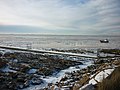
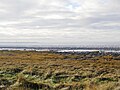
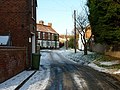
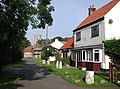
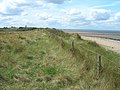
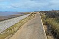
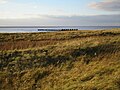
English: Easington is a small village and civil parish in the East Riding of Yorkshire, England in the area known as Holderness. It is situated between the Humber estuary and the North Sea at the south-eastern corner of the county at the end of the B1445 road from Patrington.
village and civil parish in East Riding of Yorkshire, UK  | |||||
| Upload media | |||||
| Instance of | |||||
|---|---|---|---|---|---|
| Location | East Riding of Yorkshire, Yorkshire and the Humber, England | ||||
| Said to be the same as | Easington (Wikimedia duplicated page, civil parish) | ||||
 | |||||
Subcategories
This category has the following 11 subcategories, out of 11 total.
B
- Beacon Lagoons (9 F)
- Bull Sand Fort (21 F)
C
D
- Dimlington Water Tower (1 F)
K
M
O
S
W
- The White Horse, Easington (4 F)
Media in category "Easington, East Riding of Yorkshire"
The following 200 files are in this category, out of 905 total.
(previous page) (next page)-
 6 deer grazing near Easington - geograph.org.uk - 2293323.jpg 800 × 600; 175 KB
-
 A barn at Dimlington - geograph.org.uk - 2200548.jpg 800 × 600; 266 KB
-
 A bird hide over looking the lagoon - geograph.org.uk - 2200729.jpg 800 × 600; 231 KB
-
 A bleak scene at Warren Head - geograph.org.uk - 5590689.jpg 640 × 480; 44 KB
-
 A Bungalow on the Kilnsea Road - geograph.org.uk - 1990155.jpg 800 × 600; 156 KB
-
 A drain near Marsh Cott, Easington - geograph.org.uk - 2293327.jpg 800 × 600; 259 KB
-
 A footpath to the south of Easington - geograph.org.uk - 2293317.jpg 800 × 600; 312 KB
-
 A jetty into the Humber - geograph.org.uk - 2200766.jpg 800 × 600; 280 KB
-
 A lost cause - geograph.org.uk - 3434427.jpg 640 × 427; 259 KB
-
 A Man, a Woman and their Dog - geograph.org.uk - 2670192.jpg 3,486 × 2,616; 684 KB
-
 A Square of wheat - geograph.org.uk - 28404.jpg 640 × 480; 104 KB
-
 A unknown farm on Peter Lane, Easington - geograph.org.uk - 2201533.jpg 800 × 600; 253 KB
-
 A very icy River Humber - geograph.org.uk - 2200759.jpg 800 × 600; 257 KB
-
 A view from Warren Head - geograph.org.uk - 6010912.jpg 1,600 × 1,196; 502 KB
-
 A Well Battered Battery - geograph.org.uk - 6113077.jpg 5,184 × 3,456; 2.56 MB
-
 ABP VTS Humber tower at Spurn Head - geograph.org.uk - 5785405.jpg 1,600 × 1,200; 288 KB
-
 Access to the beach - geograph.org.uk - 3434434.jpg 640 × 427; 308 KB
-
 Across the Humber - geograph.org.uk - 6011014.jpg 1,600 × 1,200; 113 KB
-
 All Saints church, Easington - geograph.org.uk - 5784962.jpg 2,592 × 1,944; 2.25 MB
-
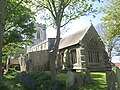 All Saints Church, Easington - geograph.org.uk - 5785643.jpg 1,600 × 1,200; 913 KB
-
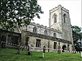 All Saints Church, Easington - geograph.org.uk - 5889009.jpg 1,024 × 768; 264 KB
-
 All washed up - geograph.org.uk - 4559797.jpg 3,046 × 1,682; 3.12 MB
-
 Ammunition room, gun emplacements - geograph.org.uk - 3050192.jpg 1,600 × 1,200; 450 KB
-
 An ice bound boat at Easington Clays - geograph.org.uk - 2200771.jpg 800 × 600; 277 KB
-
 An Out Newton Wind Turbine - geograph.org.uk - 3413346.jpg 2,588 × 1,860; 674 KB
-
 Anglers' path, Spurn Point - geograph.org.uk - 2734456.jpg 1,600 × 1,200; 738 KB
-
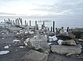
 Anti-tank blocks, Easington Beach, Holderness - geograph.org.uk - 3847443.jpg 1,200 × 798; 345 KB
-
 Anti-tank blocks, Easington Beach, Holderness - geograph.org.uk - 3847452.jpg 1,200 × 798; 221 KB
-
 Anti-tank blocks, Easington Beach, Holderness - geograph.org.uk - 3847456.jpg 1,200 × 798; 358 KB
-
 Anti-tank blocks, Easington Beach, Holderness - geograph.org.uk - 3847460.jpg 1,200 × 798; 263 KB
-
 Anti-tank blocks, Easington Beach, Holderness - geograph.org.uk - 3847462.jpg 1,200 × 798; 194 KB
-
 Anti-tank blocks, Easington Beach, Holderness - geograph.org.uk - 3847474.jpg 1,200 × 798; 266 KB
-
 Anti-tank blocks, Easington Beach, Holderness - geograph.org.uk - 3847476.jpg 1,200 × 798; 275 KB
-
 Anti-tank blocks, Easington Beach, Holderness - geograph.org.uk - 3847477.jpg 1,200 × 798; 373 KB
-
 Anti-tank blocks, Easington Beach, Holderness - geograph.org.uk - 3847478.jpg 1,200 × 798; 324 KB
-
 Anti-tank wall, Spurn - geograph.org.uk - 6010983.jpg 1,600 × 1,205; 600 KB
-
 Associated British Ports Vessel Tracking Station, Humber - geograph.org.uk - 4559930.jpg 3,064 × 1,714; 3.03 MB
-

-
 B1445 at Easington village boundary - geograph.org.uk - 5255497.jpg 640 × 513; 51 KB
-
 B1445 Easington - geograph.org.uk - 30587.jpg 480 × 640; 98 KB
-

-
 Back Street, Easington - geograph.org.uk - 2201489.jpg 800 × 600; 261 KB
-

-
-

-
 Beach access, Easington - geograph.org.uk - 5546515.jpg 1,024 × 768; 202 KB
-
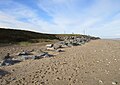
 Beach and sea defences - geograph.org.uk - 5406178.jpg 800 × 600; 187 KB
-
 Beach and soft cliffs, Kilnsea Warren - geograph.org.uk - 2407553.jpg 1,600 × 1,200; 460 KB
-
 Beach and Spurn Jetty - geograph.org.uk - 2407607.jpg 1,600 × 1,073; 282 KB
-
 Beach and wartime defences near Easington - geograph.org.uk - 2407527.jpg 1,600 × 1,200; 308 KB
-
 Beach and wartime defences near Easington - geograph.org.uk - 2407533.jpg 1,600 × 1,200; 280 KB
-
 Beach at north end of Spurn Head - geograph.org.uk - 6055074.jpg 1,600 × 1,200; 356 KB
-
 Beach at Spurn Point - geograph.org.uk - 6055057.jpg 1,600 × 1,200; 322 KB
-

-
 Beach near Dimlington - geograph.org.uk - 2407462.jpg 1,600 × 1,200; 377 KB
-
 Beach near Easington looking South - geograph.org.uk - 2407535.jpg 1,600 × 1,200; 502 KB
-
 Beach near Kilnsea - geograph.org.uk - 2407544.jpg 1,600 × 1,200; 528 KB
-
 Beach near Long Bank - geograph.org.uk - 5546520.jpg 1,024 × 768; 220 KB
-
 Beach north of Kilnsea - geograph.org.uk - 3145167.jpg 2,428 × 2,867; 2.83 MB
-
 Beach on Spurn Point - geograph.org.uk - 6055058.jpg 1,600 × 1,200; 336 KB
-
 Beach on the Spurn Peninsula - geograph.org.uk - 5889396.jpg 1,024 × 768; 184 KB
-
 Beach patrol - geograph.org.uk - 4498725.jpg 1,280 × 727; 599 KB
-
 Beach south of Easington - geograph.org.uk - 5546532.jpg 1,024 × 768; 165 KB
-

-
 Beach, Humber Estuary - geograph.org.uk - 2407593.jpg 1,600 × 1,200; 483 KB
-
 Beach, Humber Estuary - geograph.org.uk - 2407600.jpg 1,600 × 1,200; 314 KB
-
 Beach, Spurn Peninsula - geograph.org.uk - 2407597.jpg 1,600 × 1,200; 281 KB
-
 Beacon Lagoons Nature Reserve - geograph.org.uk - 2069040.jpg 2,816 × 2,112; 2.51 MB
-
 Beacon Lagoons, Kilnsea - geograph.org.uk - 5720278.jpg 1,024 × 683; 161 KB
-
 Beacon Lane at Kilnsea - geograph.org.uk - 2399967.jpg 3,648 × 2,736; 2.7 MB
-
 Beck Lane, Easington - geograph.org.uk - 2201475.jpg 800 × 600; 319 KB
-
 Beck Street, Easington - geograph.org.uk - 981853.jpg 640 × 477; 99 KB
-
 Below Dimlington Cliff - geograph.org.uk - 5603590.jpg 1,024 × 768; 79 KB
-
 Below Dimlington Cliff - geograph.org.uk - 5603601.jpg 1,024 × 768; 100 KB
-
 Bench and marker at Spurn Point - geograph.org.uk - 5299333.jpg 1,024 × 682; 141 KB
-
 Bench by the Shore - geograph.org.uk - 6115928.jpg 1,600 × 1,200; 783 KB
-
 Benches on the Concrete - geograph.org.uk - 6113978.jpg 5,152 × 3,301; 1.87 MB
-
 Bend in Out Newton Road - geograph.org.uk - 5546503.jpg 1,024 × 768; 214 KB
-
 Beneath the ammunition store - geograph.org.uk - 5636189.jpg 1,024 × 768; 155 KB
-
 Bird trapping area at Warren Cottage - geograph.org.uk - 2068984.jpg 2,816 × 2,112; 2.82 MB
-
 Bird watchers and River Traffic - geograph.org.uk - 2061579.jpg 2,560 × 1,920; 2.03 MB
-
 Birdwatching hide at Chalk Bank, Spurn - geograph.org.uk - 5299241.jpg 1,024 × 682; 162 KB
-
 Black Sheep on Warren Head - geograph.org.uk - 6111815.jpg 4,124 × 2,284; 846 KB
-
 Blacksmiths cottage - geograph.org.uk - 1990125.jpg 800 × 600; 323 KB
-
 Bladeless Wind Turbines^ - geograph.org.uk - 3777495.jpg 3,041 × 2,412; 1.4 MB
-
 Blowing soil at Out Newton - geograph.org.uk - 6055013.jpg 1,600 × 1,302; 147 KB
-
 Blue Bell Cafe gets ever closer to the sea - geograph.org.uk - 4498716.jpg 1,024 × 627; 334 KB
-
 Blue Bell Cottage - geograph.org.uk - 3050224.jpg 1,600 × 1,200; 503 KB
-
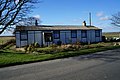
 Blue Bell information centre - geograph.org.uk - 3050228.jpg 1,600 × 1,114; 303 KB
-
 Blue Bell information centre - geograph.org.uk - 3050240.jpg 1,600 × 1,200; 397 KB
-
 Bluebell Cottage ^ on Spurn Road - geograph.org.uk - 5255538.jpg 640 × 511; 69 KB
-
 Boiler on the beach - geograph.org.uk - 6011039.jpg 1,600 × 1,194; 351 KB
-
 Boulder alongside Warmer Lane - geograph.org.uk - 3145395.jpg 2,438 × 2,649; 3.04 MB
-
 Breached area at Kilnsea Warren - geograph.org.uk - 5796345.jpg 1,600 × 1,200; 503 KB
-
-
 Brent Geese (Branta bernicla), Kilnsea - geograph.org.uk - 5720309.jpg 1,024 × 684; 185 KB
-
 Brent Geese beside Kilnsea Grange - geograph.org.uk - 5720297.jpg 1,024 × 684; 158 KB
-
 Bricks on the Beach - geograph.org.uk - 3534865.jpg 3,282 × 2,421; 3.1 MB
-
 Bridleway at Chalk Bank, Spurn Point - geograph.org.uk - 3848384.jpg 1,200 × 798; 398 KB
-
 Bridleway to Spurn Point - geograph.org.uk - 5635556.jpg 1,024 × 768; 216 KB
-
 Broken up temporary road - geograph.org.uk - 3050026.jpg 1,600 × 1,200; 764 KB
-
 BT Radio Mast, Easington - geograph.org.uk - 3844827.jpg 2,304 × 3,072; 1.69 MB
-
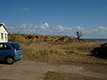
 Building in the dunes - geograph.org.uk - 2698982.jpg 1,600 × 1,200; 656 KB
-

-
 Buildings at the Yorkshire Wildlife Centre - geograph.org.uk - 3847585.jpg 1,200 × 798; 322 KB
-
 Bushes behind Canal Scrape - geograph.org.uk - 2697520.jpg 1,600 × 1,200; 792 KB
-
 By the Humber at Warren Head - geograph.org.uk - 5635551.jpg 1,024 × 749; 195 KB
-
 Canal Hedge, Spurn - geograph.org.uk - 2697541.jpg 1,600 × 1,200; 732 KB
-
 Canal Scrape - geograph.org.uk - 2697536.jpg 1,600 × 1,200; 783 KB
-
 Canal Scrape Pillbox - geograph.org.uk - 2886201.jpg 4,592 × 3,448; 4.39 MB
-
 Canal zone, Spurn - geograph.org.uk - 2697498.jpg 1,600 × 1,200; 835 KB
-
 Canine wonder - geograph.org.uk - 5635508.jpg 768 × 1,024; 140 KB
-
 Capstan at Warren Head, Spurn - geograph.org.uk - 3847641.jpg 1,200 × 798; 489 KB
-
 Car park and toilets at Kilnsea Beach - geograph.org.uk - 3145176.jpg 3,083 × 2,201; 2.69 MB
-
 Car park at Canal Scrape - geograph.org.uk - 3805726.jpg 1,024 × 768; 236 KB
-
 Car Park at the Spurn Discovery Centre - geograph.org.uk - 5889040.jpg 1,024 × 768; 248 KB
-
 Car Park off Dimlington Road - geograph.org.uk - 3013235.jpg 640 × 480; 71 KB
-
 Caravans and mud, Kilnsea - geograph.org.uk - 5635712.jpg 1,024 × 768; 190 KB
-
 Chalk Bank at Spurn Head - geograph.org.uk - 4985939.jpg 4,865 × 3,649; 5.31 MB
-
 Chalk Bank beside Greedy Gut - geograph.org.uk - 4559854.jpg 3,046 × 1,682; 2.54 MB
-
 Chalk Bank North hide - geograph.org.uk - 2878510.jpg 4,000 × 3,000; 2.49 MB
-
 Chalk Bank North Hide, Spurn Point - geograph.org.uk - 3848374.jpg 1,200 × 798; 363 KB
-
 Chalk Bank on the Spurn Head Spit - geograph.org.uk - 5555472.jpg 800 × 506; 137 KB
-
 Chalk Bank, Spurn Point - geograph.org.uk - 2734465.jpg 1,600 × 1,200; 710 KB
-
 Chalk, rock and road - geograph.org.uk - 6011064.jpg 1,600 × 1,177; 439 KB
-
 Christmas Eve at Spurn - geograph.org.uk - 6010993.jpg 1,600 × 1,246; 397 KB
-
 Clearing the previous road - geograph.org.uk - 3727765.jpg 1,600 × 1,200; 648 KB
-
 Clearing the road, Spurn Head - geograph.org.uk - 3727273.jpg 1,600 × 1,060; 583 KB
-
 Clearing the sand - geograph.org.uk - 3727268.jpg 1,600 × 1,200; 579 KB
-
 Cliff and beach south of Kilnsea - geograph.org.uk - 2068794.jpg 2,816 × 2,112; 2.66 MB
-
 Cliff edge at Old Hive - geograph.org.uk - 5523956.jpg 1,024 × 747; 196 KB
-
 Cliff Erosion - geograph.org.uk - 2481685.jpg 3,648 × 2,736; 2.3 MB
-
 Cliff erosion at Kilnsea - geograph.org.uk - 5636185.jpg 1,024 × 768; 120 KB
-
 Cliff Farm near Holmton - geograph.org.uk - 2201432.jpg 800 × 600; 200 KB
-
 Cliff Farm, Out Newton - geograph.org.uk - 2407456.jpg 1,600 × 1,200; 326 KB
-
 Cliff Farm, Out Newton seen from Balk Hill - geograph.org.uk - 4986049.jpg 4,998 × 3,748; 2.92 MB
-
 Cliff protection - geograph.org.uk - 5603617.jpg 1,024 × 724; 142 KB
-
 Cliff top looking towards Balk Hill - geograph.org.uk - 5524013.jpg 1,024 × 768; 245 KB
-
 Cliff View, Easington Road, Kilnsea - geograph.org.uk - 3852896.jpg 1,200 × 798; 434 KB
-
 Cliffs at Easington - geograph.org.uk - 5603608.jpg 1,024 × 768; 159 KB
-
 Coal on the tideline - geograph.org.uk - 3713051.jpg 1,600 × 1,200; 597 KB
-
 Coast by the Warren - geograph.org.uk - 2669803.jpg 1,600 × 1,200; 516 KB
-

-
 Coast north of Kilnsea, aerial 2018 - geograph.org.uk - 5718998.jpg 640 × 427; 52 KB
-
 Coastal Erosion, Dimlington - geograph.org.uk - 51708.jpg 640 × 480; 121 KB
-
 Coastal pillbox - geograph.org.uk - 2698995.jpg 1,600 × 1,200; 593 KB
-
 Coastal Ruin - geograph.org.uk - 6113990.jpg 5,152 × 3,864; 2.54 MB
-
 Coastal scene, Spurn Peninsula - geograph.org.uk - 2407594.jpg 1,600 × 1,200; 587 KB
-
 Coastguard Cottages, Easington - geograph.org.uk - 5294786.jpg 1,600 × 900; 330 KB
-
 Coastline at Sammy's Point, Easington - geograph.org.uk - 5300081.jpg 1,024 × 682; 127 KB
-
 Coastline by gas terminal - geograph.org.uk - 6055027.jpg 1,600 × 1,200; 309 KB
-
 Coastline just north of Kilnsea - geograph.org.uk - 5720295.jpg 1,024 × 683; 204 KB
-
 Coastline near Kilnsea - geograph.org.uk - 6113783.jpg 4,602 × 3,083; 2.16 MB
-
 Cocoons of Brown-tail moth - geograph.org.uk - 2878554.jpg 4,000 × 3,000; 2.58 MB
-
 Collapsed Road by the Shore - geograph.org.uk - 6111935.jpg 1,600 × 1,069; 579 KB
-
 Communications mast and field of oilseed arpe - geograph.org.uk - 5603635.jpg 1,024 × 768; 136 KB
-
 Concrete blocks at Kilnsea Warren - geograph.org.uk - 3805689.jpg 1,024 × 768; 326 KB
-

-
 Concrete gun emplacement base - geograph.org.uk - 3145127.jpg 3,264 × 2,448; 3.33 MB
-
 Concrete Old ^ New - geograph.org.uk - 6113087.jpg 5,152 × 3,361; 2.08 MB
-
 Concrete road to Spurn Point - geograph.org.uk - 5800975.jpg 640 × 480; 55 KB
-
 Condemned buildings - geograph.org.uk - 3727309.jpg 1,600 × 1,126; 580 KB
-
 Cottages on Easington Road, Kilnsea - geograph.org.uk - 2407687.jpg 1,600 × 1,200; 442 KB
-
 Crown and Anchor, Kilnsea - geograph.org.uk - 5800953.jpg 640 × 480; 52 KB
-
 Crumbling military remains - geograph.org.uk - 6010989.jpg 1,600 × 1,210; 463 KB
-
 Damaged road on the Spurn Head Spit - geograph.org.uk - 5555078.jpg 800 × 583; 131 KB
-
 Damaged road, Spurn Head - geograph.org.uk - 3727279.jpg 1,600 × 1,200; 556 KB
-

-
 Debris on the road - geograph.org.uk - 3727299.jpg 1,600 × 1,200; 560 KB
-
 Deep Tracks in the Sand - geograph.org.uk - 5369064.jpg 4,277 × 3,208; 2.96 MB
-
 Deer on the run, near Kilnsea Grange - geograph.org.uk - 2200738.jpg 800 × 600; 165 KB
-
 Defences in the River Humber - geograph.org.uk - 5635566.jpg 1,024 × 768; 239 KB
-
 Dimlington Beach - geograph.org.uk - 2407502.jpg 1,600 × 1,200; 477 KB
-
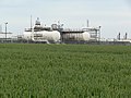 Dimlington Natural Gas Terminal - geograph.org.uk - 3145344.jpg 3,264 × 2,448; 2.94 MB
-
 Disused bus stop at Canal Scrape - geograph.org.uk - 3805722.jpg 1,024 × 768; 142 KB
-
 Ditch by the Humber bank - geograph.org.uk - 6055008.jpg 1,600 × 1,200; 335 KB
-
 Do Not Cross, Uneven Surface - geograph.org.uk - 6111943.jpg 1,600 × 1,046; 630 KB
-
 Don't believe the Sat Nav^ - geograph.org.uk - 817570.jpg 640 × 443; 88 KB
-
 Down the beach on a dull day - geograph.org.uk - 2069056.jpg 2,816 × 2,112; 2.64 MB
-
 Drain at Kilnsea Grange - geograph.org.uk - 5558877.jpg 800 × 600; 146 KB
-
 Drain entering the beach - geograph.org.uk - 5635545.jpg 1,024 × 768; 155 KB
-
 Drain next to Humber Side Lane - geograph.org.uk - 2407712.jpg 1,600 × 1,200; 495 KB
-
 Drainage ditch beside Out Newton Road - geograph.org.uk - 2407479.jpg 1,600 × 1,200; 798 KB
-
 Drift wood - geograph.org.uk - 4559978.jpg 3,072 × 1,728; 4.27 MB
-
 Dunes and beach at the Spurn Head Spit - geograph.org.uk - 5555306.jpg 693 × 800; 113 KB
-
-
 Dunes ^ beach at Spurn Head - geograph.org.uk - 2034203.jpg 640 × 480; 122 KB
-
 Dunes, beach ^ North Sea - geograph.org.uk - 2034224.jpg 631 × 469; 130 KB
-
 Dunnock (Prunella modularis) in song, Kilnsea - geograph.org.uk - 5720307.jpg 1,024 × 684; 128 KB
-
 Dusk at Spurn Road, Kilnsea - geograph.org.uk - 5298215.jpg 1,024 × 684; 87 KB
-
 Easington - geograph.org.uk - 30586.jpg 640 × 480; 85 KB
-
 Easington Bank - geograph.org.uk - 305520.jpg 640 × 475; 109 KB
-
 Easington Bank - geograph.org.uk - 5748868.jpg 640 × 480; 70 KB
-
 Easington Beach - geograph.org.uk - 304802.jpg 640 × 480; 81 KB
-
 Easington beach - geograph.org.uk - 5720266.jpg 1,024 × 683; 152 KB
-
 Easington beach - geograph.org.uk - 5720270.jpg 1,024 × 683; 118 KB
-
 Easington Beach Caravan Site on Seaside Road - geograph.org.uk - 3847379.jpg 1,200 × 798; 358 KB
-
 Easington Beach Caravan Site on Seaside Road - geograph.org.uk - 3847381.jpg 1,200 × 729; 345 KB
-
 Easington Beach from Seaside Road - geograph.org.uk - 3847384.jpg 1,200 × 798; 381 KB
-
 Easington Beach, Holderness Coast, Yorkshire - geograph.org.uk - 3847425.jpg 1,200 × 798; 456 KB


_on_Long_Bank_Marsh,_Kilnsea_-_geograph.org.uk_-_5300062.jpg)
,_Kilnsea_-_geograph.org.uk_-_5720309.jpg)


_-_geograph.org.uk_-_5719007.jpg)


_in_song,_Kilnsea_-_geograph.org.uk_-_5720307.jpg)


,_Beacon_Lagoons,_Kilnsea_-_geograph.org.uk_-_5720289.jpg)
,_Beacon_Lagoons,_Kilnsea_-_geograph.org.uk_-_5720279.jpg)