Category:Eardisley
Jump to navigation
Jump to search
village in Herefordshire, England, UK  | |||||
| Upload media | |||||
| Instance of | |||||
|---|---|---|---|---|---|
| Location | Herefordshire, West Midlands, England | ||||
| official website | |||||
 | |||||
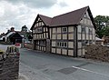
Cymraeg: Pentref yn Swydd Henffordd, Gorllewin Canolbarth Lloegr, Lloegr ydy Eardisley, 4.5 milltir i'r de o ganol Kington ac yn agor i'r ffin gyda Chymru. Ceir nifer o dai du-a-gwyn yn y pentref, rhai'n dyddio yn ôl i'r 14 ganrif. Mae yma ddwy dafarn: y Tram Inn a'r New Strand. (→Eardisley)
English: Eardisley is a village and civil parish in Herefordshire about south of the centre of Kington. Eardisley is in the Wye valley in the northwest of the county, close to the border with Wales. (→Eardisley)

Subcategories
This category has the following 10 subcategories, out of 10 total.
B
- Baskerville arms (9 F)
E
- Eardisley Methodist Chapel (2 F)
- Eardisley railway station (2 F)
- Eardisley School (3 F)
- Eardisley Village Pound (3 F)
M
N
- New Strand, Eardisley (7 F)
O
- Old Crow Cottage (8 F)
T
- The Tram Inn, Eardisley (10 F)
W
- Woods Eaves (6 F)
Media in category "Eardisley"
The following 200 files are in this category, out of 269 total.
(previous page) (next page)-
 1-4 Castle Close, Eardisley - geograph.org.uk - 3529410.jpg 800 × 639; 170 KB
-
 15th century house, Eardisley - geograph.org.uk - 1826137.jpg 3,015 × 2,216; 4.73 MB
-

-

-
 5-8 Castle Close, Eardisley - geograph.org.uk - 3529396.jpg 800 × 494; 127 KB
-
 A Crop in Bloom - geograph.org.uk - 5860311.jpg 5,184 × 3,456; 2.76 MB
-
 A handbag^ - geograph.org.uk - 5695438.jpg 1,024 × 685; 318 KB
-
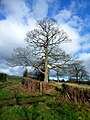
 A once mighty oak - geograph.org.uk - 2782251.jpg 1,024 × 680; 211 KB
-
 A4111 - geograph.org.uk - 6145130.jpg 1,024 × 683; 117 KB
-
 A4111 looking towards Kington - geograph.org.uk - 4826398.jpg 1,600 × 901; 663 KB
-
 A4111 South of Eardisley - geograph.org.uk - 5863028.jpg 1,600 × 1,146; 768 KB
-
 A4111-A4112 junction - geograph.org.uk - 4822960.jpg 1,600 × 901; 676 KB
-
 A438 east of Willersley - geograph.org.uk - 2788274.jpg 1,024 × 577; 327 KB
-
 Almeley Road at Gypsy Hall Bridge - geograph.org.uk - 4825186.jpg 1,600 × 901; 696 KB
-
 Almeley Road, Eardisley - geograph.org.uk - 3529293.jpg 800 × 715; 126 KB
-
 Apple Tree in the Park - geograph.org.uk - 5863035.jpg 1,600 × 1,200; 776 KB
-
 Arboyne House, Eardisley - geograph.org.uk - 3529558.jpg 800 × 525; 107 KB
-
 Armorial Bearings of the BASKERVILLE family of Eardisley Castle, Herefordshire.png 1,200 × 1,200; 345 KB
-
 Back to basics - geograph.org.uk - 2785288.jpg 1,024 × 680; 225 KB
-
 Bargeboards on cottage, Eardisley - geograph.org.uk - 1826149.jpg 1,313 × 1,074; 1.08 MB
-
 Barn conversion, Lower Welson - geograph.org.uk - 2930425.jpg 1,024 × 680; 228 KB
-
 Barrier at a field entrance - geograph.org.uk - 5694746.jpg 1,024 × 680; 298 KB
-
 Black and White in Eardisley - geograph.org.uk - 1827051.jpg 3,452 × 2,344; 7.57 MB
-
 Bollingham to Lyonshall road - geograph.org.uk - 4318649.jpg 800 × 600; 432 KB
-
 Bower Lane - geograph.org.uk - 4826433.jpg 1,600 × 901; 713 KB
-
 Bridge House, Eardisley - geograph.org.uk - 3943182.jpg 4,320 × 3,240; 2.9 MB
-
 Bridleway near Red Gates - geograph.org.uk - 2782164.jpg 680 × 1,024; 265 KB
-
 Brook and Lady Arbour Farm - geograph.org.uk - 4822938.jpg 1,600 × 901; 709 KB
-
 Brook beside a pasture at Queest Moor - geograph.org.uk - 4826465.jpg 1,600 × 901; 672 KB
-
 Castle Barns, Eardisley - geograph.org.uk - 1822822.jpg 3,774 × 2,149; 5.52 MB
-
 Castle Close (Eardisley) - geograph.org.uk - 6310939.jpg 3,648 × 2,736; 3.24 MB
-
 Castle Farm (Eardisley) - geograph.org.uk - 6310914.jpg 3,648 × 2,736; 3.51 MB
-
 Castle House, Eardisley - geograph.org.uk - 1825257.jpg 3,456 × 2,314; 6.9 MB
-
 Chennel's Gate Nursery - geograph.org.uk - 2549263.jpg 800 × 600; 427 KB
-
 Church Road cottages, Eardisley - geograph.org.uk - 3529337.jpg 800 × 540; 138 KB
-
-
 Clematis Cottage, Woodseaves Road - geograph.org.uk - 6010013.jpg 4,708 × 3,208; 3.25 MB
-

-
 Cottages in Woodseaves Road, Eardisley - geograph.org.uk - 4120533.jpg 1,024 × 681; 181 KB
-
 Cover crop or green manure - geograph.org.uk - 4826386.jpg 1,600 × 901; 736 KB
-
 Crop in Field 12 - geograph.org.uk - 5860191.jpg 5,184 × 3,456; 2.5 MB
-
 Crushing Wheel for cider production, Parton Farm, Eardisley - geograph.org.uk - 2653810.jpg 3,488 × 2,616; 2.11 MB
-
 Derelict cottage in Willersley - geograph.org.uk - 2912985.jpg 640 × 480; 73 KB
-
 Derelict hut in woodland - geograph.org.uk - 943521.jpg 640 × 480; 124 KB
-

-

-
 Eardisley black-and-white - geograph.org.uk - 2549247.jpg 800 × 450; 311 KB
-
 Eardisley Castle (Motte) - geograph.org.uk - 6310920.jpg 3,648 × 2,736; 3.79 MB
-
 Eardisley Castle - geograph.org.uk - 6310910.jpg 3,648 × 2,736; 4.69 MB
-
 Eardisley Castle - geograph.org.uk - 6310924.jpg 3,648 × 2,736; 4.45 MB
-
 Eardisley Church of England Primary School - geograph.org.uk - 6310806.jpg 3,648 × 2,736; 2.49 MB
-
 Eardisley Fire Station - geograph.org.uk - 3894013.jpg 800 × 664; 132 KB
-
 Eardisley Fire Station - geograph.org.uk - 460739.jpg 640 × 427; 184 KB
-
 Eardisley Millennium Castle Green - geograph.org.uk - 6309311.jpg 3,648 × 2,056; 3.22 MB
-
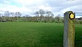
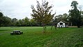
 Eardisley Park - geograph.org.uk - 2782198.jpg 1,024 × 680; 245 KB
-
 Eardisley Telephone Exchange - geograph.org.uk - 4041374.jpg 800 × 688; 118 KB
-
 Eardisley Wootton - geograph.org.uk - 6145128.jpg 1,024 × 683; 122 KB
-
 Eardisley, A4111 from crossroads - geograph.org.uk - 2011126.jpg 640 × 480; 72 KB
-
 Eardisley, Church Road - geograph.org.uk - 4639109.jpg 3,678 × 2,455; 4 MB
-
 Eardisley, Church Road, "The Tardis" - geograph.org.uk - 4623241.jpg 5,478 × 3,614; 7.44 MB
-
 Eardisley, Church Road, Hawthorn Cottage - geograph.org.uk - 4639072.jpg 3,678 × 2,455; 3.92 MB
-
 Eardisley, Church Road, Hawthorn Cottage - geograph.org.uk - 4639086.jpg 4,390 × 2,793; 5.68 MB
-
 Eardisley, Church Road, Pilgrim Cottage - geograph.org.uk - 4639115.jpg 4,248 × 2,977; 6.74 MB
-

-
 Eardisley, Church Road, Small terrace of mock Tudor houses - geograph.org.uk - 4623228.jpg 3,678 × 2,455; 5.37 MB
-
 Eardisley, Church Road, Small terrace of mock Tudor houses - geograph.org.uk - 4623231.jpg 3,678 × 2,456; 3.71 MB
-
 Eardisley, Church Road, The old post office - geograph.org.uk - 4639094.jpg 3,678 × 2,456; 4.5 MB
-
 Eardisley, Church Road, The old post office - geograph.org.uk - 4639105.jpg 4,472 × 2,944; 5.95 MB
-
 End of the 30 zone through Eardisley - geograph.org.uk - 4041905.jpg 800 × 756; 168 KB
-

-
 Entrance to Lady Arbour Farm - geograph.org.uk - 2784164.jpg 1,024 × 680; 167 KB
-
 Entrance to Lady Arbour Farm - geograph.org.uk - 4822948.jpg 1,600 × 901; 618 KB
-
 Entrance to Lemore Manor, Eardisley - geograph.org.uk - 4120957.jpg 1,024 × 682; 291 KB
-
 Farm road - geograph.org.uk - 4822942.jpg 1,600 × 901; 658 KB
-
 Farmland at Eardisley - geograph.org.uk - 6310917.jpg 3,648 × 2,736; 3.59 MB
-
 Farmland at Eardisley - geograph.org.uk - 6310925.jpg 3,648 × 2,736; 2.97 MB
-
 Farmland at Eardisley - geograph.org.uk - 6310934.jpg 3,648 × 2,056; 2.3 MB
-
 Farmland at Field - geograph.org.uk - 5860139.jpg 4,663 × 2,904; 3.7 MB
-
 Farmland at Lower Welson - geograph.org.uk - 5860181.jpg 5,184 × 3,456; 3.32 MB
-
 Farmland at Willersley - geograph.org.uk - 2784160.jpg 1,024 × 680; 202 KB
-
 Farmland near Eardisley - geograph.org.uk - 2782285.jpg 1,024 × 680; 221 KB
-
 Farmland near Willersley - geograph.org.uk - 2785303.jpg 1,024 × 680; 205 KB
-
 Field off Bower Lane - geograph.org.uk - 6144166.jpg 1,024 × 683; 221 KB
-
 Field, Bollingham - geograph.org.uk - 4056717.jpg 640 × 480; 302 KB
-
 Field, Yewtree - geograph.org.uk - 4318645.jpg 800 × 600; 436 KB
-
 Fields near Lemore Manor, Eardisley - geograph.org.uk - 4116985.jpg 1,024 × 682; 151 KB
-
 Floral Pump along Field Lane - geograph.org.uk - 5860150.jpg 3,867 × 3,136; 4.44 MB
-
 Fly tipping beside the B4111 - geograph.org.uk - 5694749.jpg 1,024 × 680; 289 KB
-
 Footbridge at Eardisley - geograph.org.uk - 2786853.jpg 1,024 × 680; 285 KB
-
 Footpath at Castle Farm - geograph.org.uk - 5863439.jpg 5,152 × 3,864; 4.13 MB
-
 Footpath leaves the Herefordshire Trail - geograph.org.uk - 5861138.jpg 4,649 × 3,571; 2.67 MB
-
 Footpath north from the Almeley Road - geograph.org.uk - 4825192.jpg 1,600 × 903; 723 KB
-
 Footpath signs near Bower Cottage - geograph.org.uk - 4826427.jpg 1,600 × 901; 700 KB
-
 Footpath through Holywell Dingle, Eardisley - geograph.org.uk - 4117257.jpg 1,024 × 682; 372 KB
-
 Footpath to Bower Brook Farm - geograph.org.uk - 4826417.jpg 1,600 × 901; 710 KB
-
 Footpath to Eardisley church - geograph.org.uk - 2785296.jpg 1,024 × 680; 243 KB
-
 Footpath to Holywell Cottage, Eardisley - geograph.org.uk - 4120543.jpg 1,024 × 681; 273 KB
-
 Forge Framing ^ Gallery, Eardisley - geograph.org.uk - 3529546.jpg 800 × 561; 110 KB
-
 Former Police House, Eardisley - geograph.org.uk - 1826218.jpg 3,452 × 2,353; 5.96 MB
-
 Former railway bridge in Eardisley - geograph.org.uk - 3894148.jpg 800 × 492; 104 KB
-
 Former shop, Eardisley - geograph.org.uk - 1825443.jpg 3,382 × 2,295; 4.91 MB
-
 Former tramway, Eardisley - geograph.org.uk - 2782303.jpg 1,024 × 680; 299 KB
-
 Gate off Bower Lane - geograph.org.uk - 6144168.jpg 1,024 × 683; 262 KB
-
 Graveyard, Eardisley - geograph.org.uk - 3529497.jpg 800 × 600; 234 KB
-
 Great Parton Farm - geograph.org.uk - 2912949.jpg 640 × 480; 65 KB
-
-
 Hawthorn Cottage, Eardisley - geograph.org.uk - 3529343.jpg 800 × 603; 140 KB
-
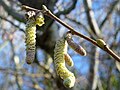 Hazel catkins by the Holywell Brook - geograph.org.uk - 4825183.jpg 1,600 × 1,199; 1,009 KB
-
 Hedge beside the A4111, Eardisley - geograph.org.uk - 4120550.jpg 1,024 × 681; 295 KB
-
 Herefordshire Trail approaching Eardisley - geograph.org.uk - 2786873.jpg 1,024 × 680; 236 KB
-
 Herefordshire Trail near Eardisley - geograph.org.uk - 5861150.jpg 5,152 × 3,864; 3.42 MB
-
 Herefordshire Trail near Eardisley Park - geograph.org.uk - 5861126.jpg 4,507 × 2,672; 2.12 MB
-
 Holywell Brook - geograph.org.uk - 4825178.jpg 1,600 × 901; 769 KB
-

-
 House under restoration - geograph.org.uk - 1826225.jpg 3,411 × 2,108; 4.43 MB
-
 House undergoing restoration, Eardisley - geograph.org.uk - 1826847.jpg 3,426 × 2,195; 4.74 MB
-
 Houses at Field - geograph.org.uk - 5860136.jpg 4,757 × 3,197; 3.61 MB
-
 JDC Car Sales, Eardisley - geograph.org.uk - 2789216.jpg 1,024 × 680; 177 KB
-

-

-
 Jumbled Facades - geograph.org.uk - 413108.jpg 600 × 450; 111 KB
-
 Junction in Eardisley - geograph.org.uk - 946259.jpg 640 × 480; 62 KB
-
 Kington Tramway - geograph.org.uk - 4585680.jpg 960 × 1,280; 496 KB
-
 Lady Gardens, Eardisley - geograph.org.uk - 3894021.jpg 800 × 654; 126 KB
-
 Lane at Questmoor Farm - geograph.org.uk - 4826458.jpg 1,600 × 901; 671 KB
-
 Lawn Coppice - geograph.org.uk - 2930368.jpg 1,024 × 680; 253 KB
-
 Lemore Manor, Eardisley - geograph.org.uk - 4116769.jpg 1,024 × 682; 182 KB
-
 Lemore Manor, Eardisley - geograph.org.uk - 4116776.jpg 1,024 × 680; 234 KB
-
 Little Quebb Farmhouse - geograph.org.uk - 1126172.jpg 640 × 480; 106 KB
-
 LPG compound, Eardisley - geograph.org.uk - 4041749.jpg 800 × 596; 151 KB
-
 Lychgate at St. Mary Magdalene Church (Eardisley) - geograph.org.uk - 6310853.jpg 3,648 × 2,736; 3.31 MB
-
 Millstream Gardens, Eardisley - geograph.org.uk - 2782272.jpg 1,024 × 680; 183 KB
-
 Narrow road, Lower Welson - geograph.org.uk - 4319424.jpg 800 × 600; 516 KB
-
 New Housing Completed (Eardisley) - geograph.org.uk - 6310930.jpg 3,648 × 2,736; 2.74 MB
-
 New2You, Eardisley - geograph.org.uk - 3529319.jpg 800 × 443; 97 KB
-
 Oak tree - geograph.org.uk - 2782292.jpg 1,024 × 680; 212 KB
-
 Old barrow wheel - geograph.org.uk - 2549279.jpg 800 × 763; 579 KB
-
 Old House on Woodseaves Road - geograph.org.uk - 5863550.jpg 4,510 × 3,030; 1.82 MB
-
 Old Houses on Church Road - geograph.org.uk - 5863435.jpg 5,152 × 3,864; 2.77 MB
-
 Old road, Bollingham - geograph.org.uk - 4056837.jpg 640 × 480; 343 KB
-
 Olde-worlde facades, Eardisley, Herefordshire.jpg 600 × 450; 156 KB
-
 Orchard Close, Eardisley - geograph.org.uk - 4041753.jpg 800 × 483; 96 KB
-
 Ordnance Survey 1GL Bolt - geograph.org.uk - 5329251.jpg 640 × 326; 91 KB
-
 Ordnance Survey Cut Mark - geograph.org.uk - 5329252.jpg 640 × 366; 85 KB
-
 Overgrown mill stream, Eardisley - geograph.org.uk - 3529375.jpg 800 × 600; 214 KB
-
 Overhanging building, Eardisley - geograph.org.uk - 3529329.jpg 800 × 646; 140 KB
-
 Overlarge chimney stack, Eardisley - geograph.org.uk - 3529524.jpg 800 × 612; 142 KB
-
 Oxygen Shoes, Eardisley - geograph.org.uk - 3894070.jpg 800 × 528; 122 KB
-
 Parish pump, Eardisley - geograph.org.uk - 1827058.jpg 3,343 × 2,212; 4.23 MB
-
 Park Road (Eardisley) - geograph.org.uk - 6310898.jpg 3,648 × 2,736; 4.09 MB
-

-
 Pentre Coed Dingle - view downstream - geograph.org.uk - 486498.jpg 640 × 480; 160 KB
-
 Playground at Castle Green (Eardisley) - geograph.org.uk - 6309306.jpg 3,648 × 2,056; 3.35 MB
-
 Playground at Castle Green (Eardisley) - geograph.org.uk - 6310945.jpg 3,648 × 2,736; 2.82 MB
-
 Please do not feed - geograph.org.uk - 2785278.jpg 1,024 × 680; 172 KB
-
 Pond at Lemore Manor, Eardisley - geograph.org.uk - 4116767.jpg 1,024 × 682; 309 KB
-
 Pond at Lemore Manor, Eardisley - geograph.org.uk - 4116998.jpg 1,024 × 682; 207 KB
-
 Post office - geograph.org.uk - 946262.jpg 640 × 480; 70 KB
-
 Post Office and tea room - geograph.org.uk - 946254.jpg 640 × 480; 83 KB
-

-
 Postbox and phonebox in Eardisley - geograph.org.uk - 4041297.jpg 800 × 547; 113 KB
-
 Pump House, Woodseaves Road - geograph.org.uk - 5867162.jpg 1,600 × 1,185; 663 KB
-
 Questmoor Farm - geograph.org.uk - 4826445.jpg 1,600 × 901; 695 KB
-
 Rambling Rose after a summer shower - geograph.org.uk - 2549276.jpg 800 × 600; 388 KB
-
 Rebuild underway - geograph.org.uk - 5563167.jpg 640 × 480; 72 KB
-

-
 Restoration of Oakwood Lodge, Eardisley - geograph.org.uk - 3529332.jpg 800 × 590; 128 KB
-
 Road and brook - geograph.org.uk - 4320021.jpg 800 × 600; 574 KB
-
 Road and brook - geograph.org.uk - 4320026.jpg 800 × 600; 446 KB
-
 Road entering Eardisley - geograph.org.uk - 2785299.jpg 1,024 × 680; 201 KB
-
 Road Junction at Pound Farm, Lower Welson - geograph.org.uk - 5860183.jpg 4,771 × 3,090; 2.42 MB
-
 Road out of Eardisley - geograph.org.uk - 946256.jpg 640 × 480; 64 KB
-
 Road to Upper Welson - geograph.org.uk - 2930433.jpg 1,024 × 680; 304 KB
-

-
 Specimen oak at The Parks - geograph.org.uk - 4826478.jpg 1,200 × 1,600; 1.11 MB
-
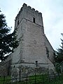
 St. Mary Magdalene Church (Bell Tower ^ Eardisley) - geograph.org.uk - 6310046.jpg 3,648 × 2,736; 4.08 MB
-
 St. Mary Magdalene Church (Bell Tower ^ Eardisley) - geograph.org.uk - 6310895.jpg 2,736 × 3,648; 2.97 MB
-
 St. Mary Magdalene Church (Bell Tower ^ Eardisley) - geograph.org.uk - 6310932.jpg 3,648 × 2,736; 3.02 MB
-
 St. Mary Magdalene Church (Bell Tower ^ Eardisley) - geograph.org.uk - 6310943.jpg 2,736 × 3,648; 2.95 MB
-
 St. Mary Magdalene Church (Chancel ^ Eardisley) - geograph.org.uk - 6310784.jpg 3,648 × 2,736; 1.02 MB
-
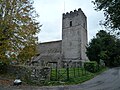
 St. Mary Magdalene Church (Eardisley) - geograph.org.uk - 6310084.jpg 3,648 × 2,056; 1.48 MB
-
 St. Mary Magdalene Church (Eardisley) - geograph.org.uk - 6310827.jpg 3,648 × 2,736; 3.22 MB
-
 St. Mary Magdalene Church (Eardisley) - geograph.org.uk - 6310902.jpg 3,648 × 2,736; 3.76 MB
-
 St. Mary Magdalene Church (Font ^ Eardisley) - geograph.org.uk - 6310057.jpg 3,648 × 2,736; 3.1 MB
-
 St. Mary Magdalene Church (Font ^ Eardisley) - geograph.org.uk - 6310077.jpg 3,648 × 2,736; 3.03 MB
-
 St. Mary Magdalene Church (Nave ^ Eardisley) - geograph.org.uk - 6310791.jpg 3,648 × 2,736; 984 KB
-
 St. Mary Magdalene Church (North Aisle ^ Eardisley) - geograph.org.uk - 6310780.jpg 3,648 × 2,736; 1.8 MB
-
 St. Mary Magdalene Church (North Aisle ^ Eardisley) - geograph.org.uk - 6310792.jpg 3,648 × 2,736; 1.03 MB
-
 St. Mary Magdalene Church (Organ ^ Eardisley) - geograph.org.uk - 6310125.jpg 2,736 × 3,648; 1.83 MB
-
 St. Mary Magdalene Church (Porch ^ Eardisley) - geograph.org.uk - 6310040.jpg 3,648 × 2,736; 4.18 MB
-
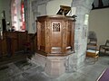 St. Mary Magdalene Church (Pulpit ^ Eardisley) - geograph.org.uk - 6310115.jpg 3,648 × 2,736; 1.63 MB
-
 St. Mary Magdalene Church (War Memorial ^ Eardisley) - geograph.org.uk - 6309352.jpg 3,648 × 2,736; 4.21 MB
-
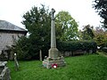 St. Mary Magdalene Church (War Memorial ^ Eardisley) - geograph.org.uk - 6310050.jpg 3,648 × 2,736; 3.4 MB
-
 Stream in Holywell Dingle, Eardisley - geograph.org.uk - 4117263.jpg 1,024 × 682; 374 KB
-
 Stream near Eardisley - geograph.org.uk - 2786850.jpg 1,024 × 680; 249 KB
-
 Stream passing through a stubble field - geograph.org.uk - 2784173.jpg 1,024 × 680; 251 KB
-
 Street scene, Eardisley - geograph.org.uk - 1825438.jpg 3,812 × 2,210; 4.88 MB
-
 Stubble field near Eardisley - geograph.org.uk - 2784170.jpg 1,024 × 680; 192 KB
-

-


.jpg)


_-_geograph.org.uk_-_6310939.jpg)
_-_geograph.org.uk_-_6310914.jpg)


,_Lemore_Manor,_Eardisley_-_geograph.org.uk_-_4118410.jpg)


_-_geograph.org.uk_-_6310772.jpg)
_-_geograph.org.uk_-_6310775.jpg)

_-_geograph.org.uk_-_6310920.jpg)


_-_geograph.org.uk_-_6310803.jpg)


_on_globe_thistle_(Echinops),_Lemore_Manor,_Eardisley_-_geograph.org.uk_-_4116989.jpg)


_-_geograph.org.uk_-_6310853.jpg)


_-_geograph.org.uk_-_6310930.jpg)


_-_geograph.org.uk_-_6310898.jpg)


_-_geograph.org.uk_-_6309306.jpg)
_-_geograph.org.uk_-_6310945.jpg)


,_Lemore_Manor,_Eardisley_-_geograph.org.uk_-_4117268.jpg)


,_Lemore_Manor,_Eardisley_-_geograph.org.uk_-_4117374.jpg)

_-_geograph.org.uk_-_6310046.jpg)
_-_geograph.org.uk_-_6310895.jpg)
_-_geograph.org.uk_-_6310932.jpg)
_-_geograph.org.uk_-_6310943.jpg)
_-_geograph.org.uk_-_6310784.jpg)
_-_geograph.org.uk_-_6310084.jpg)
_-_geograph.org.uk_-_6310827.jpg)
_-_geograph.org.uk_-_6310902.jpg)
_-_geograph.org.uk_-_6310057.jpg)
_-_geograph.org.uk_-_6310077.jpg)
_-_geograph.org.uk_-_6310791.jpg)
_-_geograph.org.uk_-_6310780.jpg)
_-_geograph.org.uk_-_6310792.jpg)
_-_geograph.org.uk_-_6310125.jpg)
_-_geograph.org.uk_-_6310040.jpg)
_-_geograph.org.uk_-_6310115.jpg)
_-_geograph.org.uk_-_6309352.jpg)
_-_geograph.org.uk_-_6310050.jpg)


