Category:Dumont Dunes
Jump to navigation
Jump to search
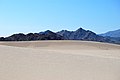
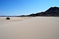
English: The Dumont Dunes — a sand dunes formation in the Mojave Desert, in northern San Bernardino County, California.
- It is bordered by the Amargosa River and volcanic hills, about 31 miles north of Baker. Competition Hill is the tallest of the dunes.
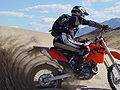
- A portion of the Dumont Dunes are in the Dumont Dunes Off-Highway Vehicle Area, managed by the Bureau of Land Management.
| Object location | | View all coordinates using: OpenStreetMap |
|---|
area of sand dunes in the Mojave Desert  | |||||
| Upload media | |||||
| Instance of | |||||
|---|---|---|---|---|---|
| Part of | |||||
| Location | California, Pacific States Region | ||||
| Maintained by | |||||
 | |||||
Media in category "Dumont Dunes"
The following 36 files are in this category, out of 36 total.
-

-

-
 Amargosa River at Dumont Dunes 1.jpg 2,400 × 1,600; 718 KB
-
 Amargosa River at Dumont Dunes 2.jpg 2,400 × 1,600; 877 KB
-
 Amargosa River at Dumont Dunes 3.jpg 2,400 × 1,600; 917 KB
-
 Amargosa River at Dumont Dunes 4.jpg 2,400 × 1,600; 699 KB
-
 Amargosa River at Dumont Dunes 5.jpg 2,400 × 1,600; 625 KB
-
 ATHLETE rovers at Dumont Dunes.jpg 2,000 × 1,309; 357 KB
-
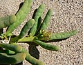
 Cistanthe ambigua 1.jpg 1,200 × 866; 494 KB
-
 Cistanthe ambigua 2.jpg 1,800 × 1,425; 728 KB
-
 Cistanthe ambigua 3.jpg 1,800 × 1,460; 491 KB
-
 Cistanthe ambigua 4.jpg 1,800 × 1,554; 879 KB
-
 Cistanthe ambigua 5.jpg 2,400 × 1,800; 1.02 MB
-
 Dumont Dunes - nedaleko Údolí smrti - panoramio.jpg 3,872 × 2,592; 2.46 MB
-
 Dumont Dunes - panoramio (1).jpg 3,872 × 2,592; 2.98 MB
-
 Dumont Dunes - panoramio (2).jpg 3,872 × 2,592; 3.16 MB
-
 Dumont Dunes - panoramio.jpg 3,872 × 2,592; 2.96 MB
-
 Dumont Dunes 1.jpg 2,400 × 1,600; 487 KB
-
 Dumont Dunes at Sunrise.jpg 5,579 × 2,233; 7.02 MB
-
 Dumont Dunes East.jpg 3,160 × 1,266; 1.36 MB
-
 DumontDunes 2005-04-25 paddle-tire.jpg 2,048 × 1,536; 1.3 MB
-
 DumontDunes.jpg 1,600 × 1,066; 2.61 MB
-
 Eremalche rotundifolia 6.jpg 1,600 × 1,549; 342 KB
-
 Golden Dunes-2.jpg (13843421095).jpg 2,647 × 1,133; 2.93 MB
-
 Last Light on The Dunes-2.jpg (13843785364).jpg 2,611 × 1,148; 2.01 MB
-
 Phacelia calthifolia 5.jpg 1,600 × 1,521; 627 KB
-
 Phacelia calthifolia 6.jpg 1,200 × 1,197; 248 KB
-
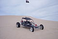 Sandrail at Dumont Dunes CA 2011.jpg 1,600 × 1,072; 551 KB
-
 Scout SSII small.png 185 × 135; 140 KB
-
 Scout-SSII-big.png 800 × 505; 144 KB
-
 Sundown on the Dumont Dunes from the SW - near Shoshone, California (13843431043).jpg 2,121 × 1,414; 2.3 MB
-
 Sundown on the Dumont Dunes from the SW - near Shoshone, California (13843435423).jpg 2,121 × 1,414; 1.91 MB
-
 Sundown on the Dumont Dunes from the SW - near Shoshone, California (13843454183).jpg 2,121 × 1,414; 1.65 MB
-

-
 Sunrise on the N side of the Dumont Dunes, California (13843440075).jpg 2,121 × 1,414; 1.34 MB
-
 TheDumontDunes.JPG 640 × 480; 89 KB
_(16464391067).jpg)
_(16671690585).jpg)


.jpg)
.jpg)


.jpg)
.jpg)


.jpg)
.jpg)
.jpg)
.jpg)
.jpg)
