Category:Dullatur
Jump to navigation
Jump to search
village in North Lanarkshire, Scotland, UK  | |||||
| Upload media | |||||
| Instance of | |||||
|---|---|---|---|---|---|
| Location |
| ||||
| Population |
| ||||
 | |||||
English: Dullatur is a village (population 520 (2004)) within the vicinity of Cumbernauld, Scotland. Its name is anglicised from the Gaelic "Dubh Leitir", which means dark slope. The route of the Antonine Wall passes just to the north of Dullatur, and a Roman camp was sited on the line of the wall at nearby Croy Hill.
Subcategories
This category has the following 3 subcategories, out of 3 total.
Media in category "Dullatur"
The following 19 files are in this category, out of 19 total.
-
 Beside the Forth and Clyde Canal - geograph.org.uk - 706443.jpg 640 × 480; 139 KB
-
 Canal Basin near Dullatur - geograph.org.uk - 1454810.jpg 640 × 480; 53 KB
-

-
 Craigmarloch Bridge, Forth and Clyde Canal - geograph.org.uk - 5812401.jpg 1,600 × 1,067; 511 KB
-
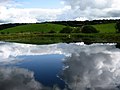
 Dullatur Marsh - geograph.org.uk - 1763514.jpg 908 × 681; 133 KB
-
 Forth and Clyde Canal towpath - geograph.org.uk - 1006198.jpg 640 × 480; 65 KB
-
 Glen Road at Dullatur - geograph.org.uk - 1523387.jpg 480 × 640; 135 KB
-
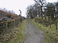 Old Parish Road - geograph.org.uk - 1763481.jpg 778 × 584; 136 KB
-
 Prospect Road, Dullatur - geograph.org.uk - 1311090.jpg 640 × 480; 120 KB
-

-
 Roman themed feature, Dullatur. - geograph.org.uk - 128452.jpg 640 × 480; 307 KB
-

-
 Standing Stone at Wester Dullatur - geograph.org.uk - 1523274.jpg 640 × 480; 115 KB
-
 Swans on the Forth and Clyde Canal - geograph.org.uk - 1006205.jpg 640 × 480; 84 KB
-
 The Antonine Wall at Dullatur - geograph.org.uk - 1522990.jpg 480 × 640; 136 KB
-
 To Cumbernauld - geograph.org.uk - 1311105.jpg 640 × 480; 126 KB
-
 Towpath by the Forth and Clyde Canal - geograph.org.uk - 1006210.jpg 640 × 480; 77 KB
-
 Tramway route to Dullatur Sand Quarry - geograph.org.uk - 1523000.jpg 480 × 640; 160 KB
-
 Wester Dullatur farm - geograph.org.uk - 128440.jpg 640 × 480; 275 KB


